
After taking Spanish class all February, we decided to pause at the beginning of March. Firstly, Crystal didn’t have a class to take, as all the people in her A1 class ended after four weeks, and there wasn’t an A2 class scheduled for a couple weeks. Secondly, we wanted to have some time without class, so we could have more free time to do other things around the island, such as hiking. Because of its varied topography and great weather, Tenerife has some really great hiking, but with class every day, that limited our options.
 |
 |
So as soon as we didn’t have class to go to, we took advantage. On March 3 we decided to go out west, to Parque de Teno, the hilly part of the west side with no highway, between Buenavista del Norte (on the north coast) and Santiago del Teide (the north end of the touristy area of the west coast). The most famous part of the Teno area is Masca, which has deep green peaks and valleys, but we weren’t going quite that far south today. Instead, we were taking the Callejón de Teno hike that started and ended in the El Palmar area.
Like when we went to Punta de Teno a few weeks prior, we took the 363 bus west from Puerto to Buenavista del Norte. Being a weekday this time, there were many more commuters and people out doing chores, and way fewer tourists. We seemingly stopped at every single possible stop, and each stop was more excruciating than the last. Near the end I was worried we were going to miss our connection in Buenavista del Norte, and that was going to be the end of that. But by that time, the only people left on the bus were us and 6-8 obvious hikers, and maybe the bus driver called ahead, because when we got to Buenavista del Norte a small bus was still there waiting for us.
 |
 |
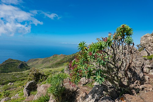
On the small bus we went up TF-436, which zig zags up into the mountains. Crystal wasn’t feeling well, and I just hoped we’d get to our stop (Las Canales) before she had to puke. Thankfully we did, in the tiny town of El Palmar. We got off the bus and put on our socks, boots, etc. We looked to see where the other hikers had gone to, and followed them. We started right near a restaurant, Restaurante El Rincon la Abu, and went through an open area, with the vibe being ruined by people using weed-eaters to cut back weeds near a road off to our right. Eventually we crossed over that small road, and once we did that, we went from walking a little uphill to walking nearly straight uphill. We could see a ridge with some power lines in front of us, and figured that was the top, and sure enough it was. [After the fact, I determined the ridge was over 2500 feet (around 800 meters) in elevation.]
 |
 |
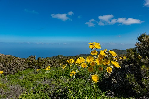
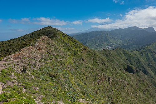
At this point the hike flattened out, and we alternated between having sweeping views to the northeast coast and being enveloped in tree tunnels. This alternation continued until we got to the small town of Teno Alto, where all of a sudden we were on a paved street with some small stores and a bar nearby. There were some parked cars, and we saw some hikers getting into one of them – they’d apparently parked in two different spots so they had to walk only one way. It took us about 5 minutes to figure out where our hike continued onto, as Teno Alto was the intersection of many hiking trails in the Parque Teno area. Eventually, using the Alltrails app on our phones, we found the trail and just followed along until we realized we were on the correct path.
 |
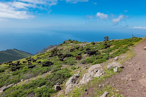 |
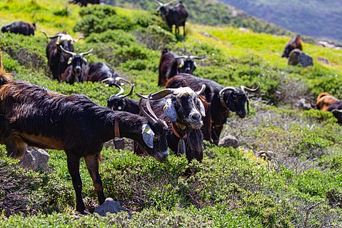
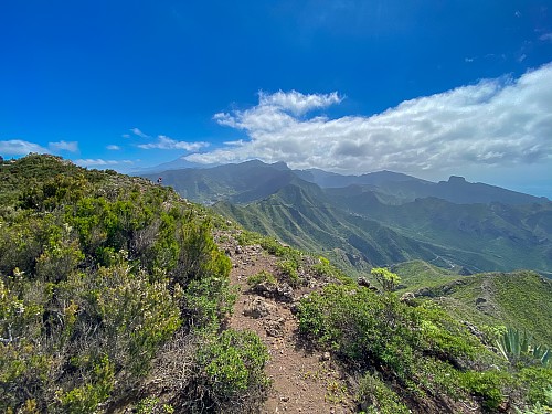
From Teno Alto we were walking south, and then southeast. None of the people we’d seen on the first part of the trail were going this way, apparently. They were missing out, as this part of the hike was even better than the first part. There were sweeping views to the southwest, including of the nearby island of La Gomera, which we hadn’t seen on the first part of the hike [probably because our view was to the northwest, not southwest]. We also encountered a big group of goats, who had an almost hypnotic sound coming from their cacophony of bells.
 |
 |
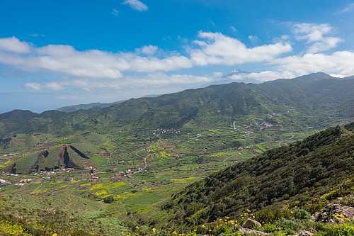
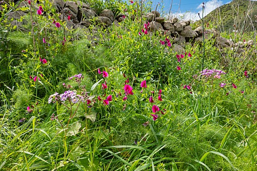
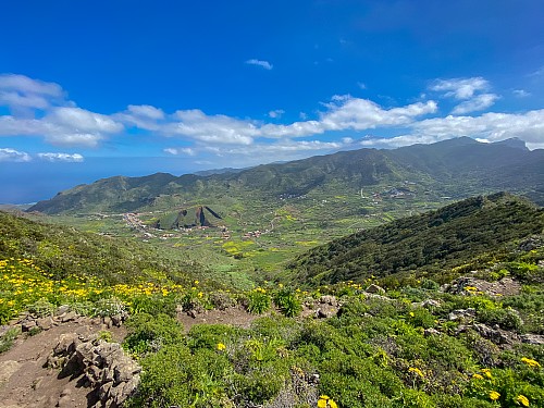
Shortly after coming upon the goats we briefly ran into civilization again, as we went right by Mirador Altos de Baracán, which I saw on Google Maps was along the TF-436 if we’d stayed on the bus. It was easy to see – literally – why there was a viewpoint here. So if you’re not interested in doing the hike, but getting the view, just drive yourself here. From the viewpoint we turned north, basically walking down a hill on a slope that the highway had purposefully avoided. We could see the end of the hike, on the highway, in front of us, and there were no more sweeping views (although the view of the El Palmar area was nice in its own right), so we just wanted the hike to be done, but it took longer than we would have cared for. Our plan was to end at the El Badén bus stop and head south for a bit to get lunch at a restaurant really highly related (Restaurante Mesón del Norte), but when we got to the bus stop, it occurred to me that while I’d checked the timetables for getting from and to home, I hadn’t checked for buses that might be able to take us to lunch. I checked the TITSA app, and sure enough, there wasn’t anything that was going to work for us. So we were going to have to do a little bit more walking, back to where we’d gotten off the bus in the morning, and choose another place for lunch.
 |
 |
 |
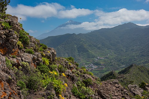
We decided to get lunch at the restaurant right next to the bus stop, Restaurante El Rincon la Abu. Not only was it pretty well rated in its own right, it was literally across the street from the bus stop, so we’d presumably see the bus coming without having to leave our table. From the timetable, we were going to have about 2 hours for lunch, which seemed more than long enough. We decided to make the most of it. We ordered the house red wine, and actually got an appetizer for once, a plate with some fancy cold cuts (I didn't catch the official name). I can’t remember what Crystal ordered, but I ordered a steak, and they brought it out seared on the outside, but still rare on the inside, and it was sliced such that I could cook individual pieces as much or as little as I wanted on a portable grill they also brought out. Finally they brought out some steak fries as well as a bunch of salt crystals for me to drizzle on either or both. We ordered a second liter of wine about halfway through the meal. As it turned out, we had to hurry a tiny bit at the end to make the bus, not because it took too long to drink the wine, but because the wine made us lose track of time. We got back on the bus for the ride down the hill to Buenavista del Norte, and then the connection to the 363 bus back to town, with good views of snowcapped Mt Teide along the way.
 |
 |
A day like today is pretty much exactly what I had in mind when deciding whether to retire and move abroad. We had a lovely hike, gorgeous weather, incredible food, great wine, and all told we probably spent less than $100. Most importantly, however, I was still young enough to actually do everything. One of the reasons we've gone on so many adventures at such a young age is that my grandparents had plans to do all sorts of things after they retired, but never got to because they each were diagnosed with different types of cancer. Along the same lines, we'd see people on cruise ships enjoying the cruise, but not really able to do anything active on the shore excursions, and that always bummed me out. So I wanted to make sure that if I was able to retire early, I actually did it, and did it at a time where I could do pretty much whatever I wanted to do. Well today, for one day at least, I did exactly that.
| Previous Entry |