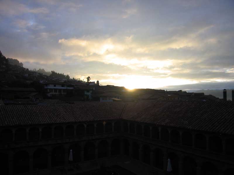
We got up at around 5am so that we could get ready and eat breakfast in advance of getting on the train. We actually didn't get on the train in Cusco – we drove from Cusco to Poroy, a little outside Cusco. The reason for this is that the train goes very slowly from Cusco to Poroy, and we could drive much faster. If we had actually gotten on the train in Cusco, we would have had to wake up even earlier.

We waited for about 15 minutes at the train station, then boarded. There are assigned seats on the train, which had three cars only. The train has lots of windows on the side, plus several large skylights on the roof. Gilmar was across the aisle from us. We were facing forward, and across the table from us was a young guy with an FBI hat – "Female Body Inspector." He must have bought it in the 1980s.

The countryside around Poroy was very nice. The sun was out and there were an endless supply of rolling green hills and small towns with dogs that liked to bark at the train as we went by. One dog ran with us for about 45 seconds, going at about 95% the speed of the train, jumping large puddles and short walls and getting oohs and aahs from the passengers. We slowly descended, and at some point started paralleling the Urabamba river. The Urabamba is one of a whole host of rivers that collects rain and snow runoff from the Andes and filters its way down (up?) to the Amazon.
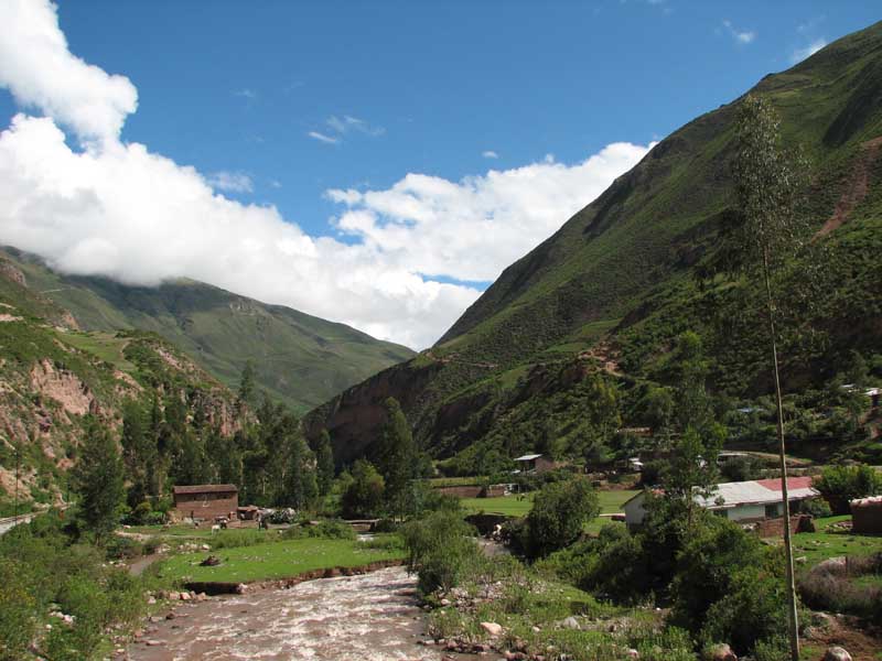
After awhile, we started to recognize the scenery – we were approaching Ollantaytambo. The road to Ollantaytambo takes a circuitous route – the one that we had taken two days earlier. The train is much more direct. Right at Ollantaytambo, they briefly parallel one another, then the road veers off to the north while the train track continues to the west. We started to see some snow-capped peaks as we headed on. Gilmar told us how the Andes got their name. The Incas basically dominated all the groups they came across, with the exception of the people in the Amazon basin. The Incas referred to these groups collectively as the " Andes." So now the 20,000 foot mountain range is named after the people living near sea level to the east of the mountains.

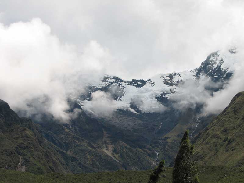
When we dropped below roughly 7000 feet, there was a noticeable change in the vegetation. The grass hills and Eucalyptus trees were quickly replaced with ferns, aroids, heliconias, bromeliads, and thick groves of trees. Neither of us expected Machu Picchu to be in the "jungle" – we always envisioned it in some sort of an alpine cloud forest. All the pictures you see in travel brochures and postcards show Machu Picchu shrouded in clouds, up in the mountains.

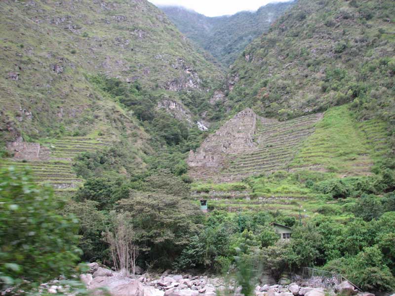
We passed some Incan ruins as we continued on. The Spanish, for whatever reason, thought that Ollantaytambo was the end of the line, and never continued on. Luckily, for everyone but the Spanish, they did not find the Inca trail, which would have led them right to these ruins (which presumably weren't ruins at the time) and Machu Picchu. When Hiram Bingham 'discovered' Machu Picchu in 1911, he found the Inca trail and walked back to Ollantaytambo.

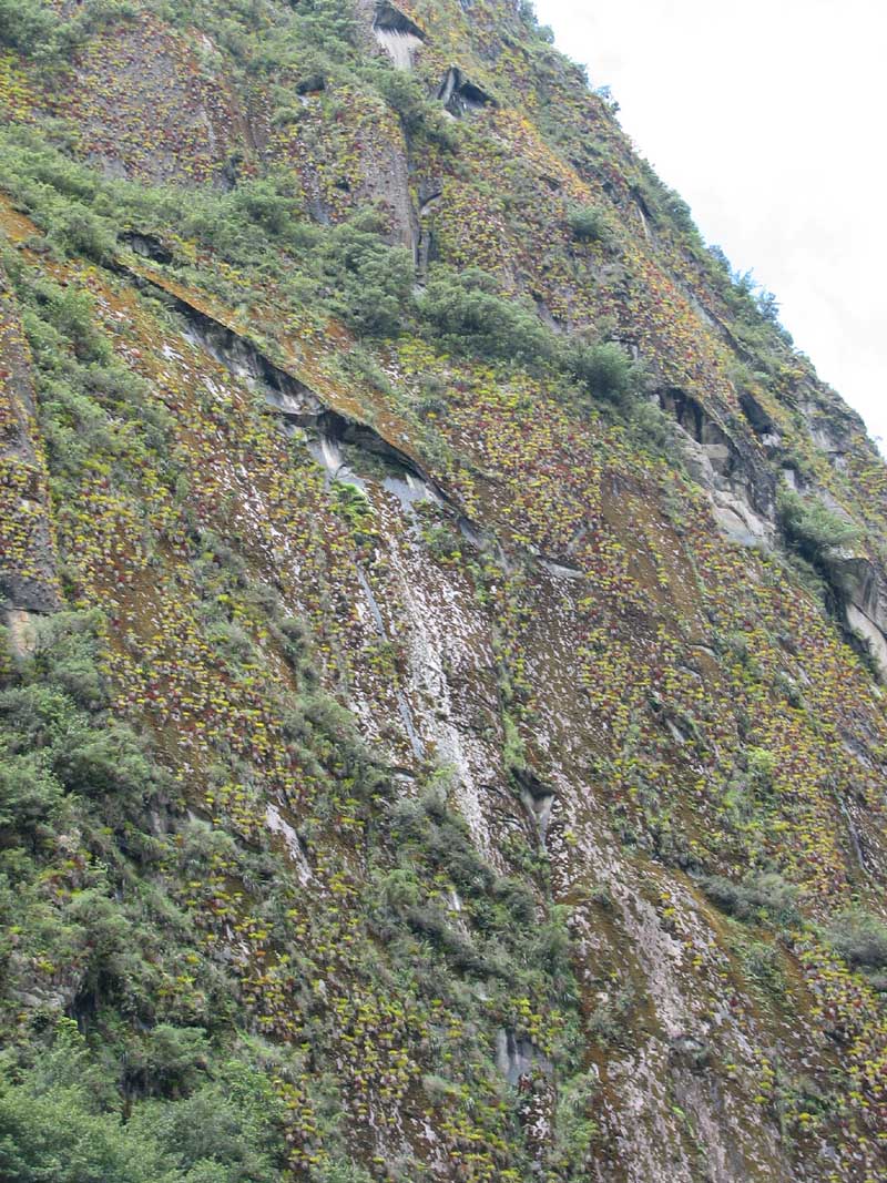
Everyone got off the train at Aguas Calientes, which is where you get on a bus to go up to Machu Picchu . The second we got off the train, there were people everywhere trying to sell us stuff. Gilmar navigated us through the crowd so that we could get to the bus stop before the masses. We got on a bus and started up the mountain. The base, where the river is, lies at about 6300 feet above sea level. Machu Picchu is at about 7500 feet. This is something else that we did not know about Machu Picchu – we knew it was in the mountains, but had no idea it was above a river, far above a river. We thought it was kind of in a valley around other mountains, kind of like Cusco. There were no valleys of any sort in sight, however. We went up 1200 feet via 14 switchbacks, losing sight of the river in the process.
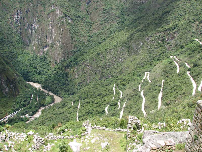
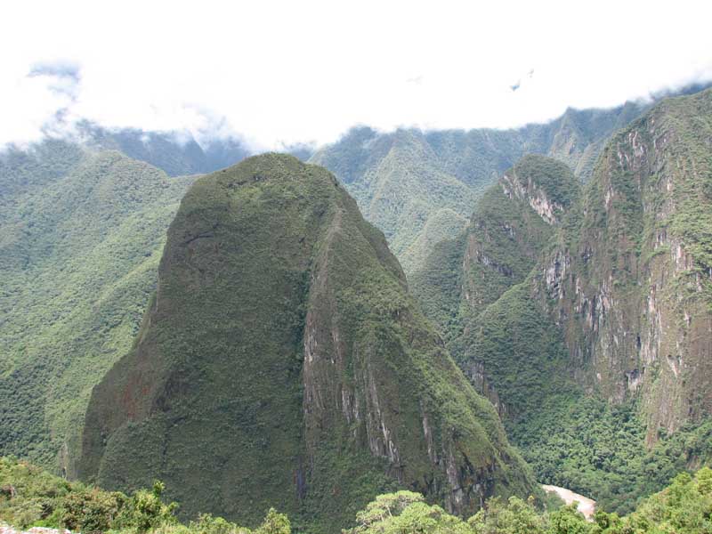
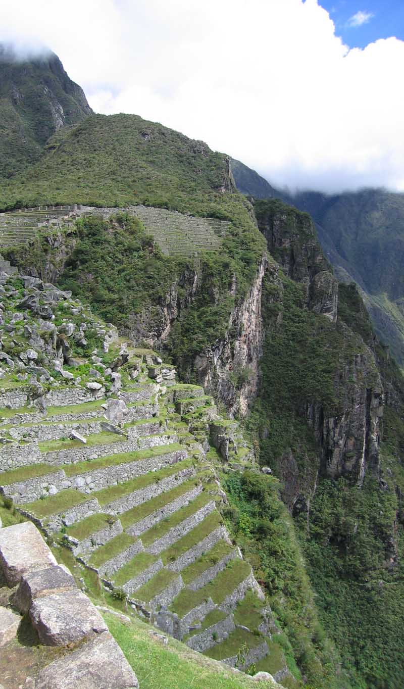
Accordingly, it's not that surprising that no one found Machu Picchu for so long. No one in their right mind would have picked this location for a place to live. The hillside is very steep, meaning that numerous terraces were necessary to grow anything. Moreover, any soil for the terraces needed to be dragged up the hill from the riverbanks below. So the thought of their being large city at the top of the hill certainly did not cross anyone's mind. Additionally, the vegetation is more jungle-like, and when Hiram Bingham found Machu Picchu everything was covered by a thick jungle.
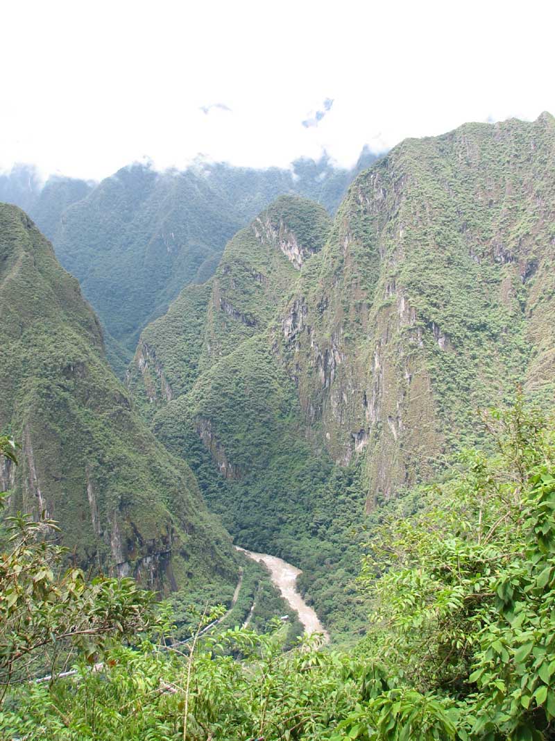
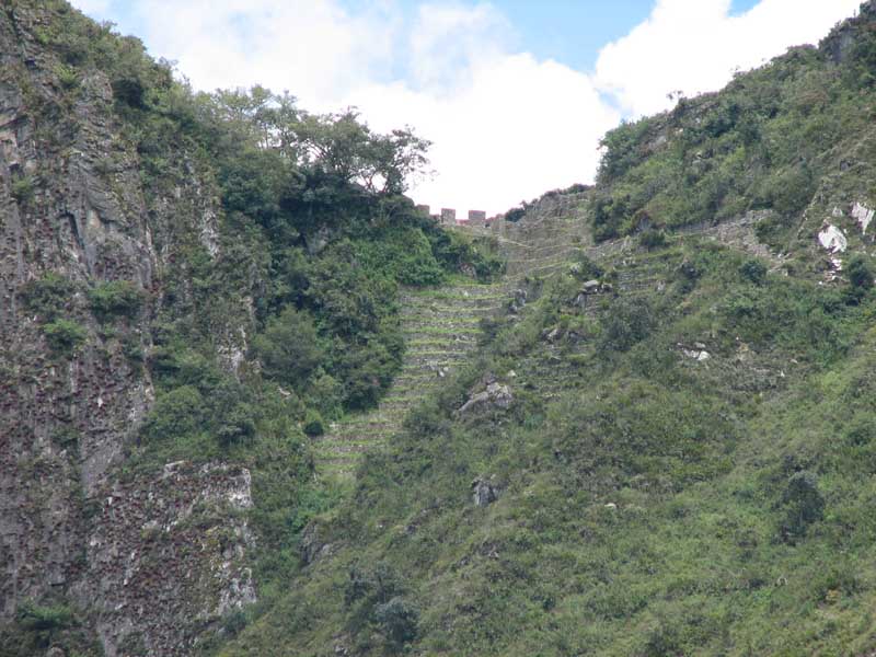
He was down near the river, going about his merry way trying to find the alleged Lost City of Gold, when a local family told them that they were living up on top of the hill in some Incan ruins. They had been living there for 8 years, so they actually "discovered" Machu Picchu. Hiram Bingham reluctantly climbed up the side of the mountain, and wasn't sure what we had actually found when he got to the top. Much of the stonework at Machu Picchu is "ordinary," and he thought he had just found some small ruins. He kept digging around though, and kept finding more and more ruins, and then he found what he called the " Temple of the Sun," replete with exquisite stonework and an eye towards the solstices. At this point, he knew he had found something important.

Most of the names of the areas within Machu Picchu, including the name itself (translated it means "Old Mountain") came from Hiram Bingham. He tried his best to guess what certain areas were used for, based on appearance, what was found in the area, resemblance to buildings in other Incan areas such as Ollantaytambo and Cusco, etc. The truth is, however, that no one actually knows what any of these areas were used for, what their names were, when they were built, when they were abandoned – anything. It's all educated guesses. Gilmar was very emphatic about this – some guides simply give tours as if the guesses were facts, and the tourists don't think about questioning the authority.
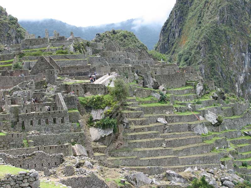
We arrived at the Sanctuary just as the one hotel within the Sanctuary, the Sanctuary Lodge, was opening its lunch buffet. The Sanctuary Lodge is where we were supposed to have stayed the night before. It was a very nice looking hotel, and was smaller than we thought. Given the price, though, it's not that surprising. After lunch, Gilmar noted that most of the tour groups had gone up from the entry area, so we went down. Some groups are as large as 30 people, and the guides have colored flags that they carry around so that the tourists can follow. Some groups even had tour guides with wireless microphones so that they could talk over everyone else in the area. Not exactly the serenity that shows up in the postcards.
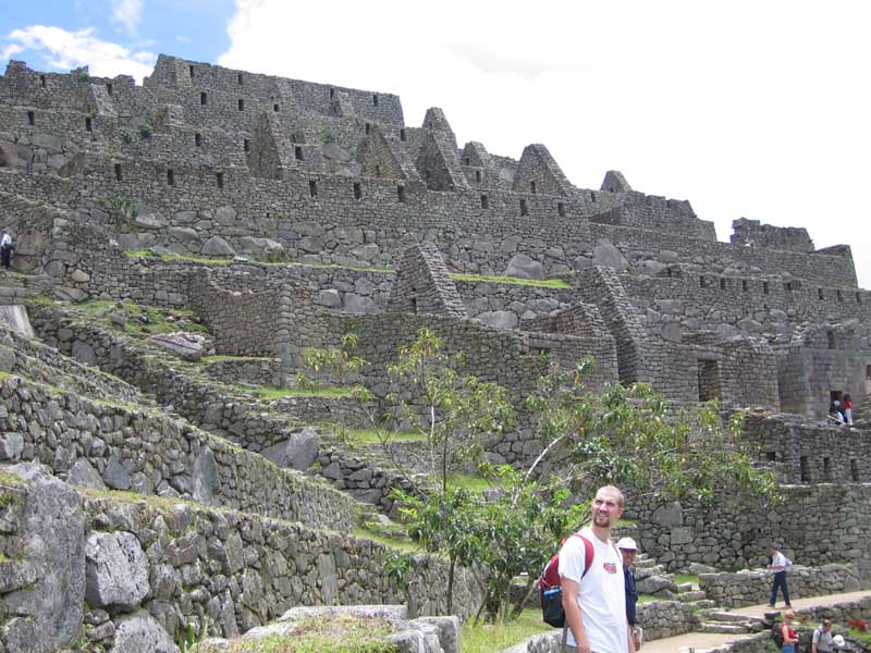
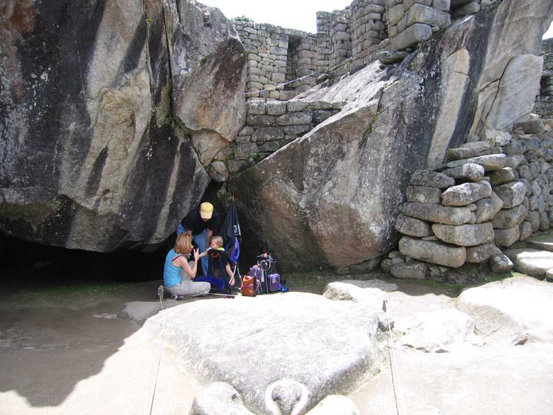
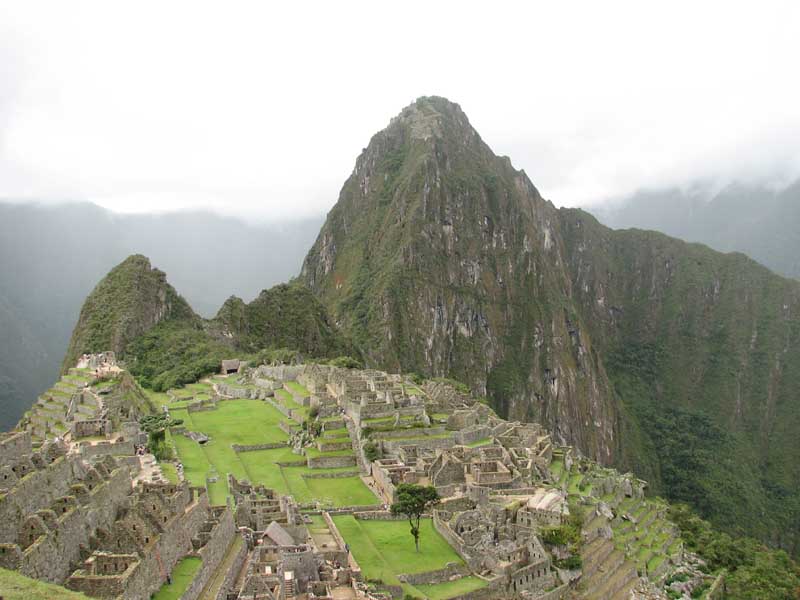
Machu Picchu is split into two parts, the agricultural area and the city. The agricultural area is terraced, and the theory is that the soil was brought from the riverbanks down below. The city contains working areas, religious areas, open areas, and living quarters. One of the firs things we saw was a large condor "statue." There were two large boulders that resembled wings, and on the ground in front of the boulders was a mostly flat rock in which the Incas carved the head of a condor. One current theory is that Machu Picchu was a religious area, worshipping the condor, and thus that very few people knew about it, keeping its existence a secret from the Spanish. Given the grandeur and magnitude of the area, however, thousands of people had to at least be there to build it.

After the Temple of the Condor, we walked through some common working areas. We then walked by the river-side of a large open area that was presumably used for ceremonies. There are buildings on both sides of the open area, and when quiet, people on one side can hear people talking – not loudly, just regular voice – without any problems. The distance between the two sides has to be at least a few hundred meters. We tried to listen, but there were a couple of crying and screaming kids near us that did not let this happen.

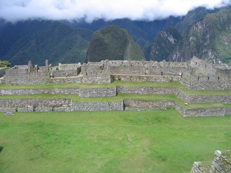
The diamond-shaped peak that stands above the city, Huayna Picchu, is closed in February for restoration and cleaning. We walked by the entry gate for the peak – people need to sign in (and out) so that the staff can tell if people have fallen off the mountain, as happened a couple of months ago. Also during February, the Inca Trail is restored and cleaned. We're not sure if we would have scheduled our trip for a different time of year had we known this information, but it would have been nice to go up Huayna Picchu at least a little bit so that we could get some panoramic views of the city.

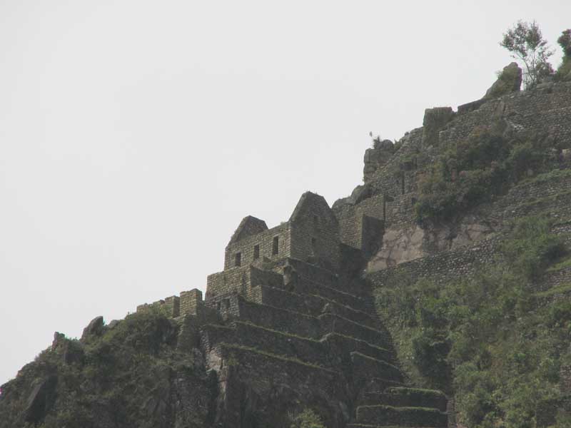
After walking up to the top portion of the city, we took a short break and Gilmar pointed out where Hiram Bingham had started his ascent up the mountain. It was a long way down, and looked very steep. He must have really wanted to find that Lost City of Gold (which Machu Picchu is not, by the way, only one piece of gold was found in the entire area). He also told us that there may well be other ruins in the area, but none of the locals are apt to say anything. The family that told Bingham about Machu Picchu lost their land when the ruins were found – the government paid them for it, and then sent them on their way. The remaining locals presumably want to avoid a similar fate, so if there are more hidden ruins, they'll probably stay that way.

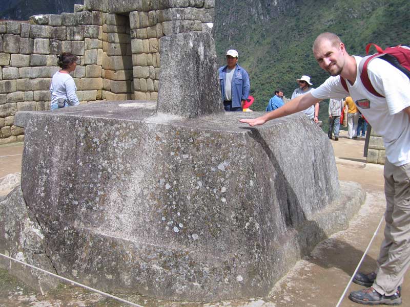
There was a large rock at the top, and legend has it that the rock is a source of energy for those that touch it (or at least put their hands close). The more likely alternative is that the rock is dark granite and gets hot during the day, so when you put your hands close you feel the radiated heat. Nonetheless, in search of some psychosomatic energy if nothing else, Justin tried it out. We kept walking near the top, and saw the "Andean Cross." On June 21, and June 21 only, the way the sun hits the carved stone makes a perfect reflected shadow that makes the cross.
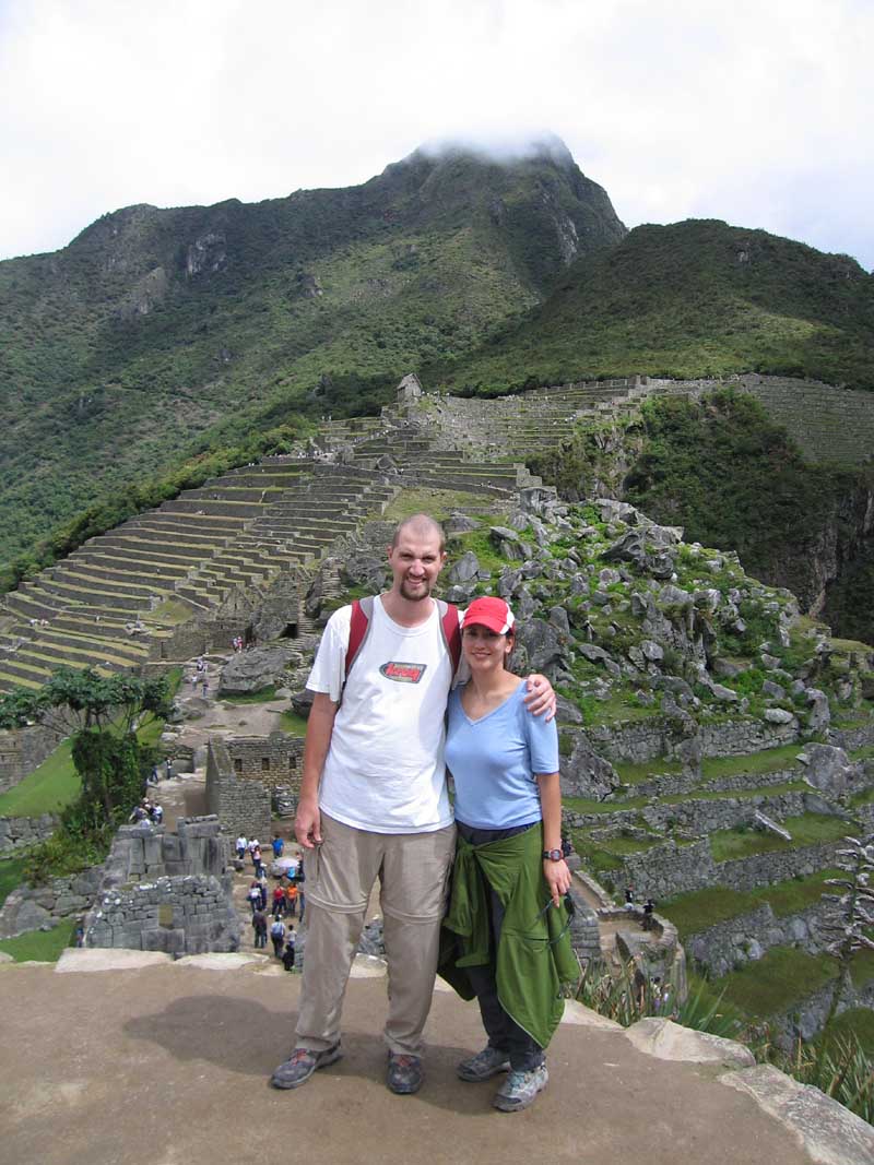
We then walked around the leader's quarters, whoever the leader was – again, no one knows for sure. It had the closest thing to a bed of any of the dwellings, a small piece of stone that separated a sleeping area. It also had a bathroom – a hole in the ground that led outside the dwelling. There was also something akin to an entry closet near the front of the house – it had an area for him to put his staff and take off his headdress, so whenever he went out he could be back in character.

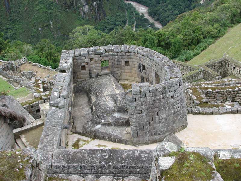
Next was the so-called "temple of the sun" which had two large windows that let light into the circular room. One window got direct light on December 22, the other on June 21. We went down a level, to a mausoleum at the base of the temple of the sun. We patiently waited for other groups to clear out, and once they did we moved in. Within 30 seconds, however, the entire area was overtaken by a massive group of Asian tourists, including their guide with a guide with a wireless microphone. Justin almost didn't make it out of the mob.

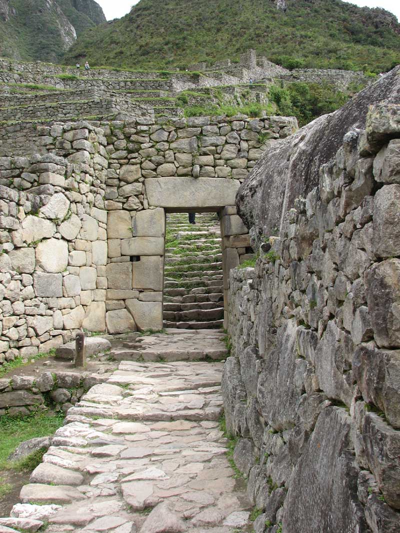
We then walked up and out of the city gate. The gate could be closed with large logs, that hung down in front of the door with large ropes. For us, it was just an empty doorway. This is the beginning (or end) of the Inca trail. We started walking up the hill, towards some of the watch towers where guards looked for intruders approaching Machu Picchu. Because of our time constraints, we made it only to the first guard tower. This, for whatever reason, was the spot where the only gold in the Machu Picchu area was found.
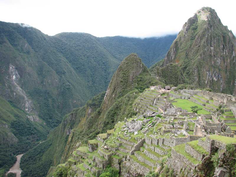

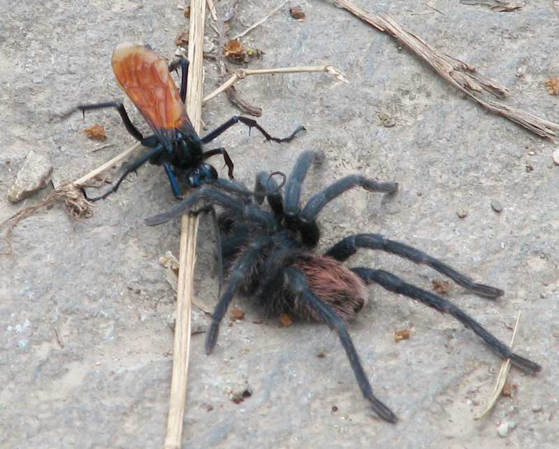
On the way back down the hill towards the bus stop, we saw a wasp that Willy had told us about during our time in the Amazon. This wasp uses tarantulas as a host for its eggs. The wasp temporarily paralyzes the tarantula, lays its eggs under the skin of the tarantula, and leaves. The tarantula wakes up and goes on about its business until the time all of the eggs hatch and break out. Think the movie "Alien," but on a smaller scale. We saw a wasp dragging a paralyzed tarantula across the path. It must have just happened, because we had not seen this on the walk up.
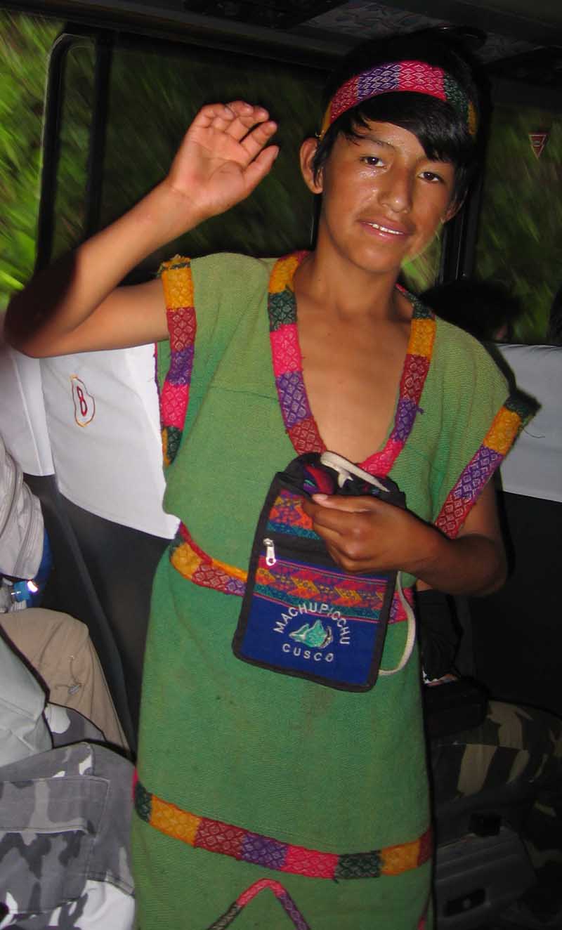
We made our way back to the bus stop and started down the hill. At every switchback, a young kid (maybe 10-13 years old) would wave hello. The same kid, every switchback. There are stairs that go from the top to the bottom of the hill, and he would run down the stairs fast enough to keep up with the bus as it descended the switchbacks. At the bottom, the bus driver let him on the bus, and the kid proceeded to ask from gratuities. We figure there were about 50 people on the bus, so if he got even $1 from everyone, that's a ton of money for the area. Presumably, he could do this every day, in which case he might be one of the highest paid persons in the region. Go figure.
We took the train back to Ollantaytambo only. Our driver picked us up there, because the train has to go uphill from Ollantaytambo to Cusco, and the car can go faster than the train. As it turned out, we probably would have preferred the train. It was just getting dark when we got to Ollantaytambo, and the streets are not well lit. Moreover, because of the darkness, all of the drivers used their high beams. Our car had some "Hella" high beams as well – we think we could see San Diego off in the distance. As cars would approach each other on the two-lane highway, they would blind each other until they turned down their lights. This would not have been so bad if it was just cars, but the shoulders were often populated by vendors, kids playing games, dogs, and assorted other things we didn't want to run into. All said, though, it was still better than navigating the Amazon in the dark.
As we climbed the hill, Justin thought he might be allergic to something that grew at the high elevation. He had no problems in Iquitos, Ollantaytambo, or Machu Picchu, but every time he was in or near Cusco he began to sneeze and cough. When we got back to the hotel, we decided we were more tired than hungry, so we just went to sleep.