Crystal’s every-day alarm went off at 06:30. We didn’t really need an alarm today, as we didn’t have any fixed events until much later in the day, and we could move around the order of some things if necessary. We’d slept okay, better than the last couple of nights, but that could’ve been from sheer exhaustion. We packed up and then got breakfast. There were plenty of folks at breakfast, as this was a fairly big hotel and Vik was one of the most popular spots to stay outside of Reykjavik. Somehow we missed each other at breakfast, so we ate separately.
|
We were on the road a bit before 08:00, and the Ring Road was basically empty. We did see a fox scurry across the road, however. This was now the third time Justin had seen a fox, and he’d never had the opportunity to take a photo. At Churchill in 2023 it went by perpendicular to the back of the bus we were in, and only Justin and one other person saw it. In Colombia earlier this year, while walking to dinner in Tayrona there was a “dog” on the path, and when it ran off, the fluffy tail gave it away.
 |
 |
 |
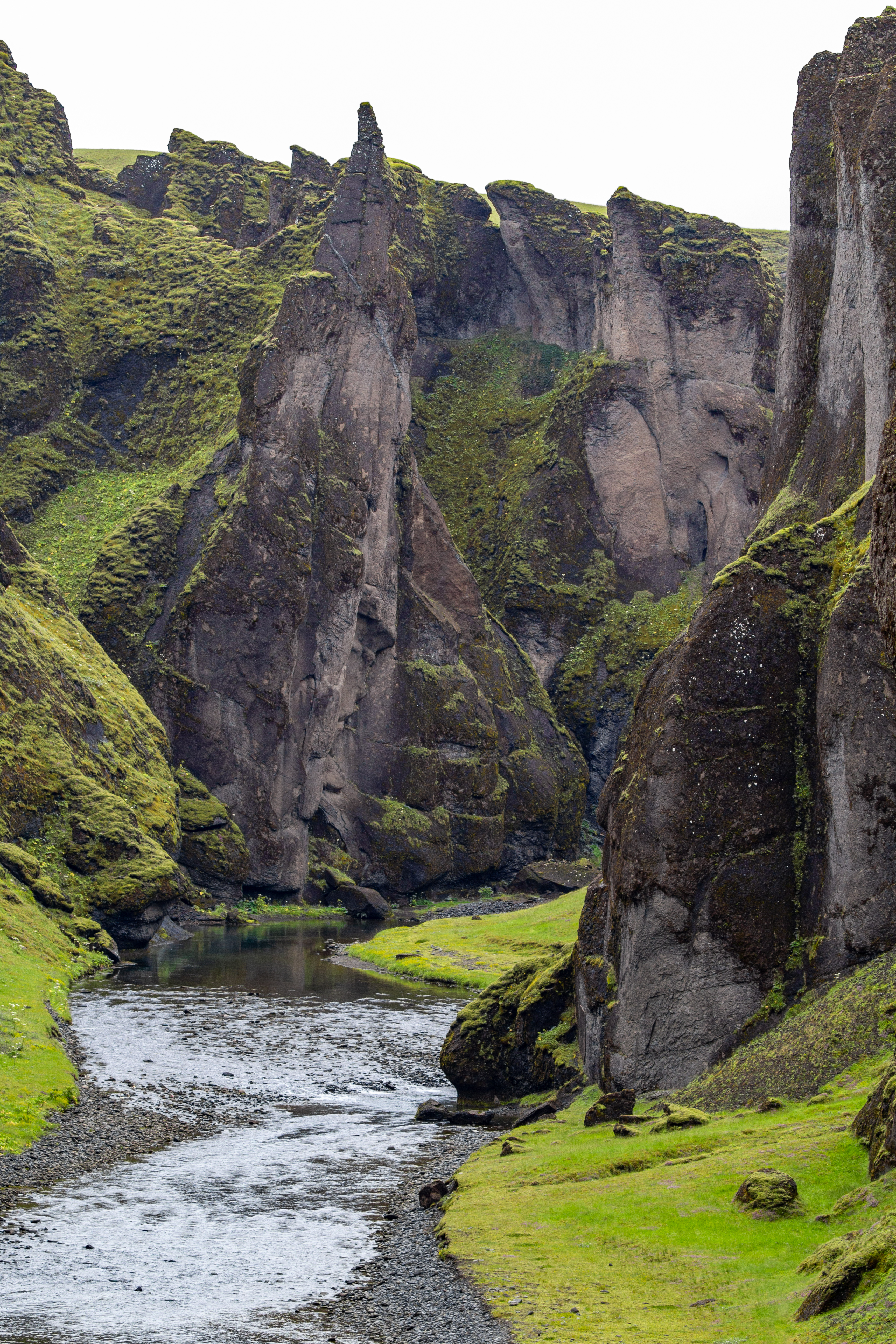 |
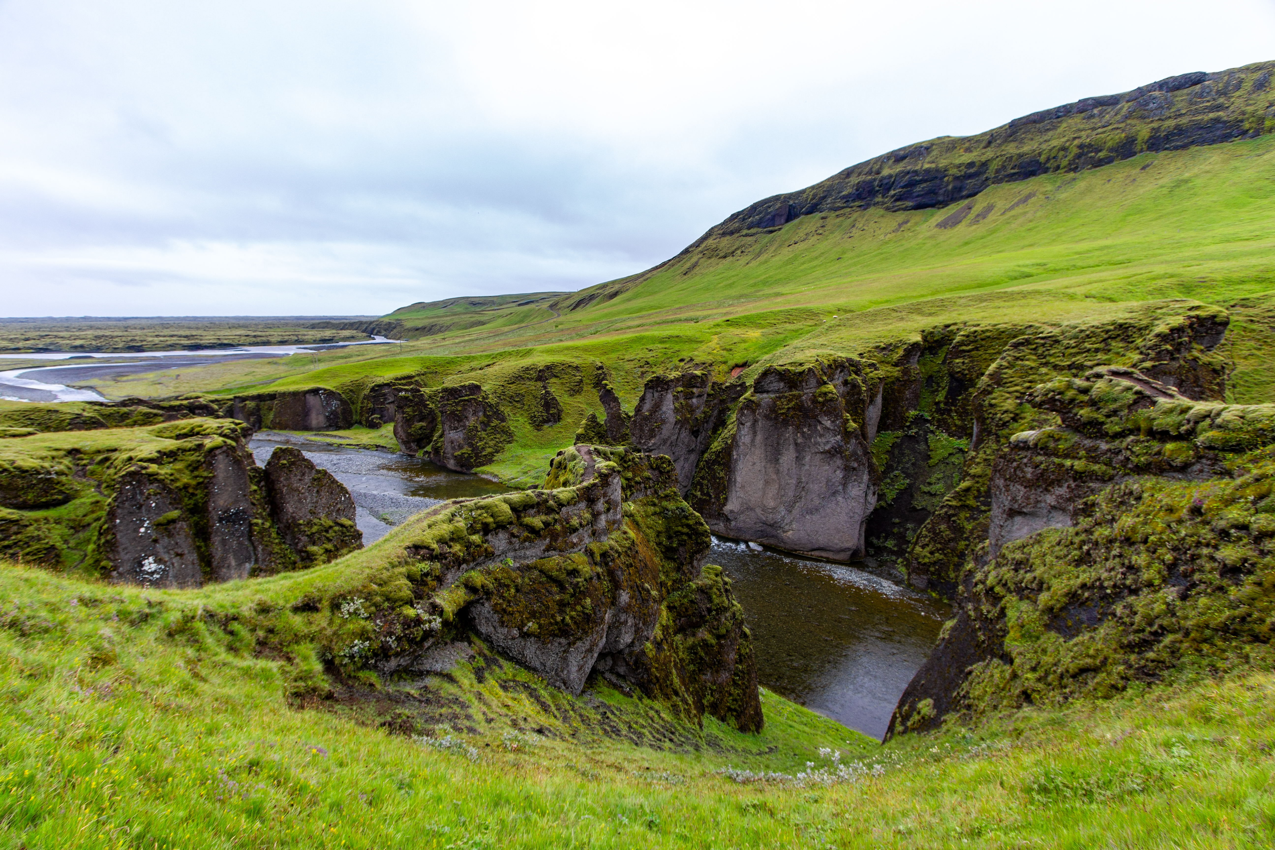
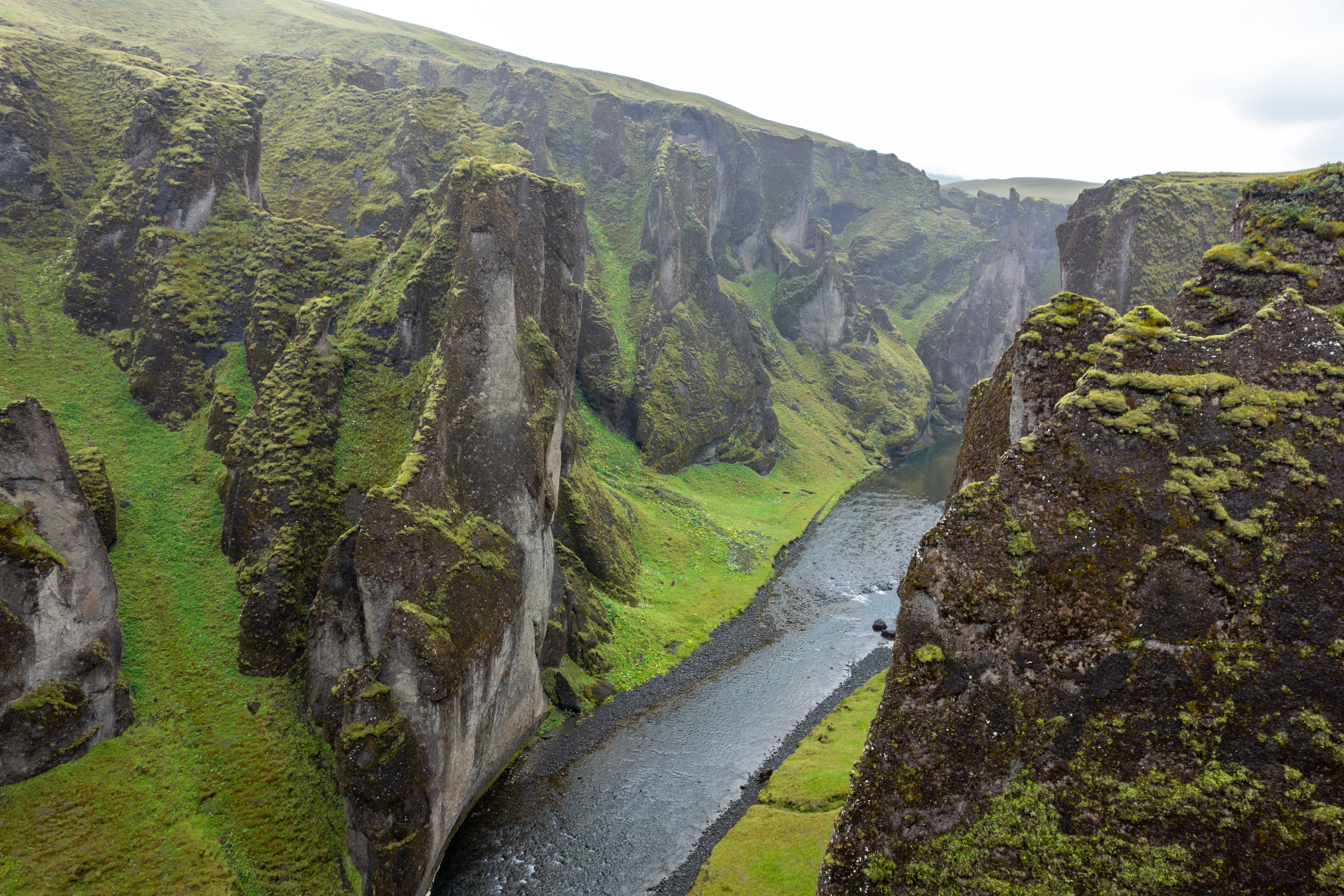
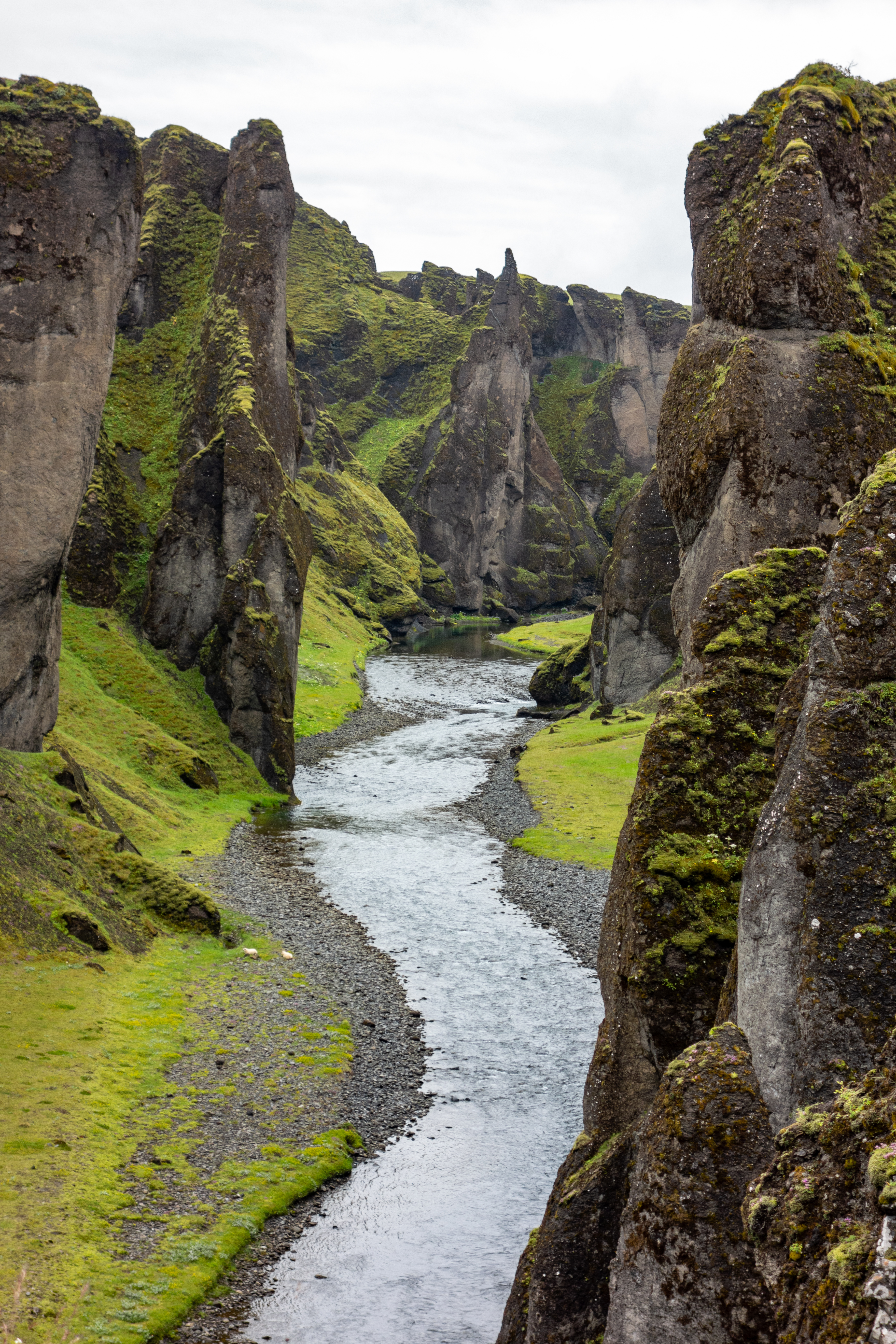
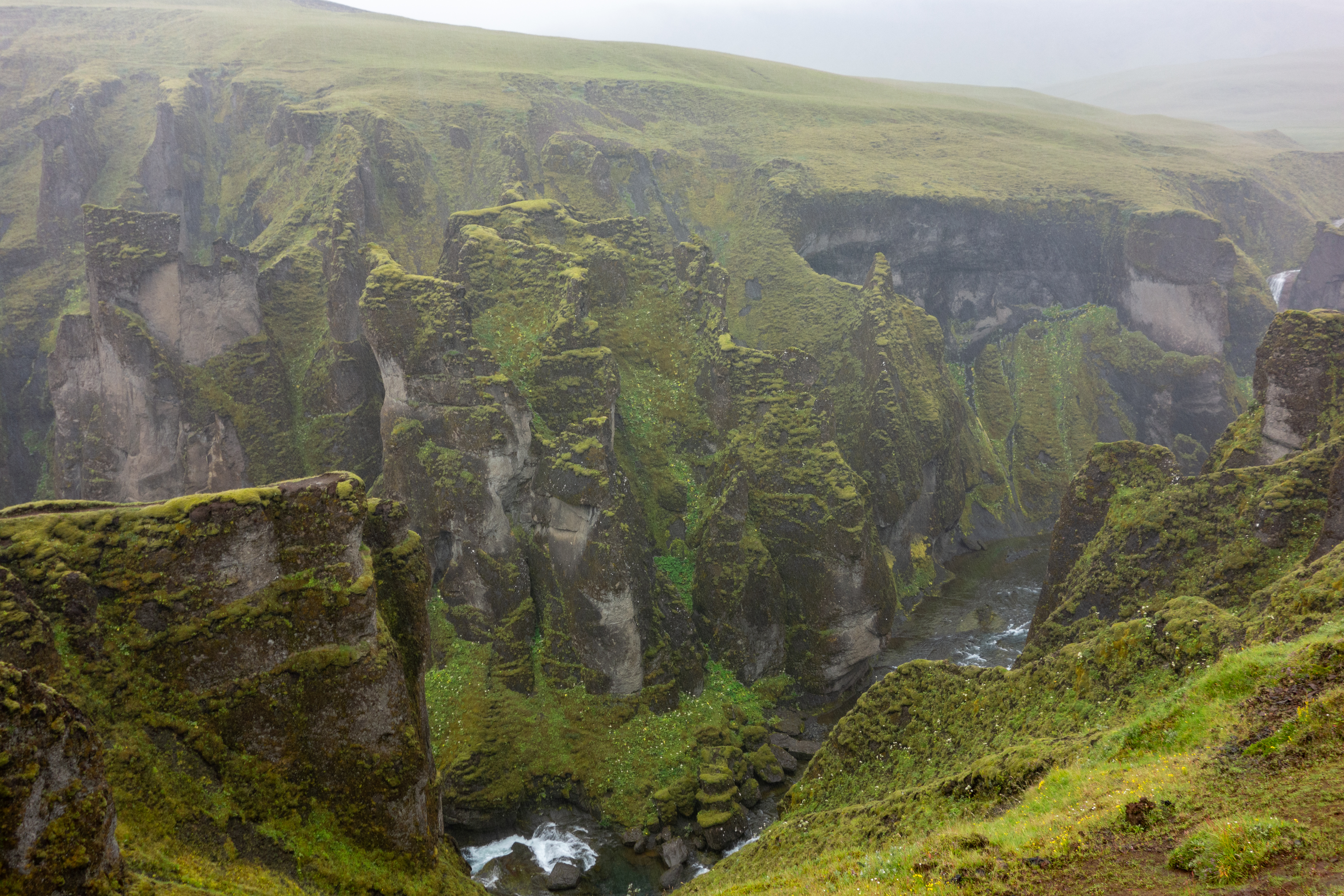
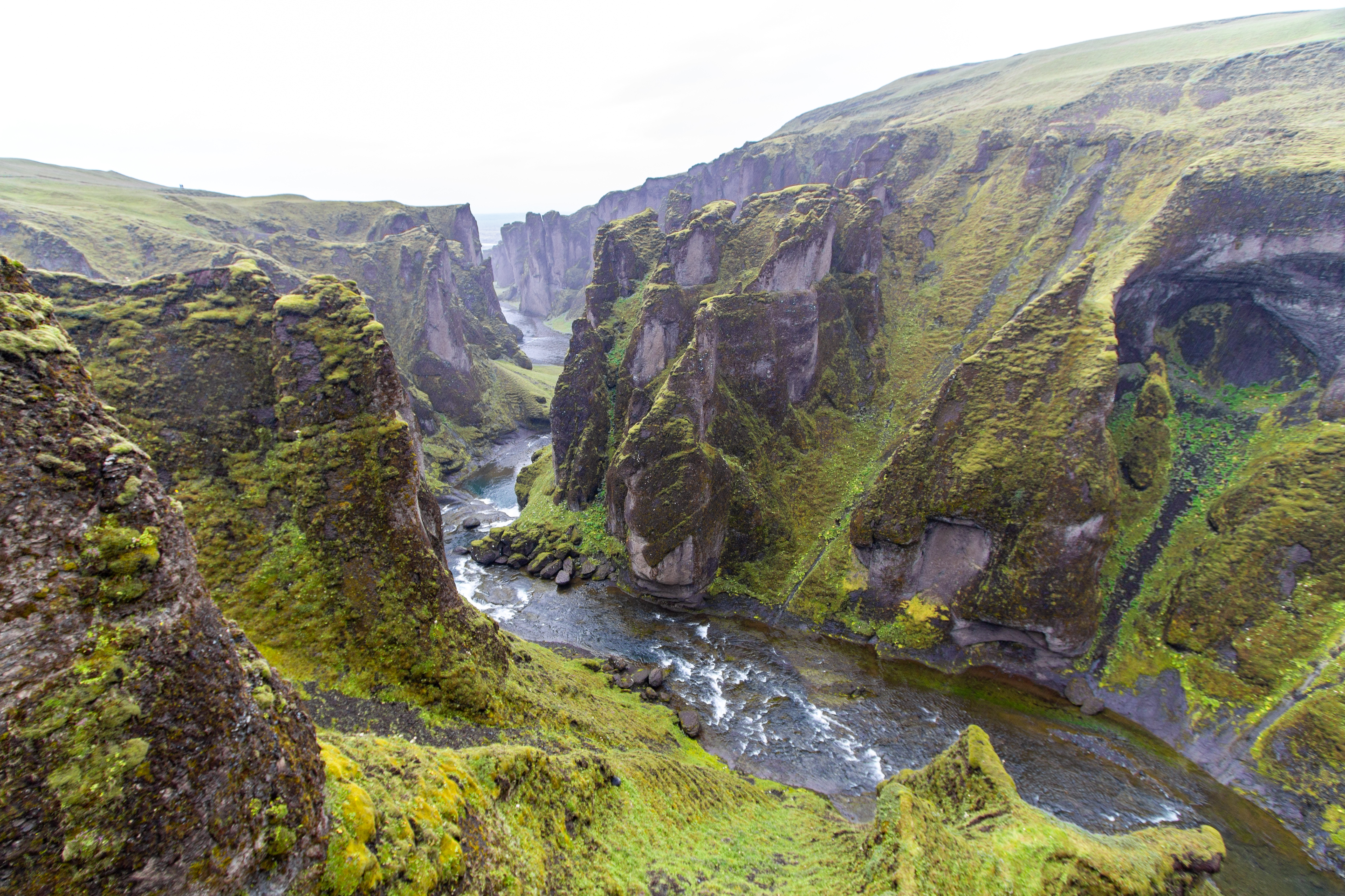
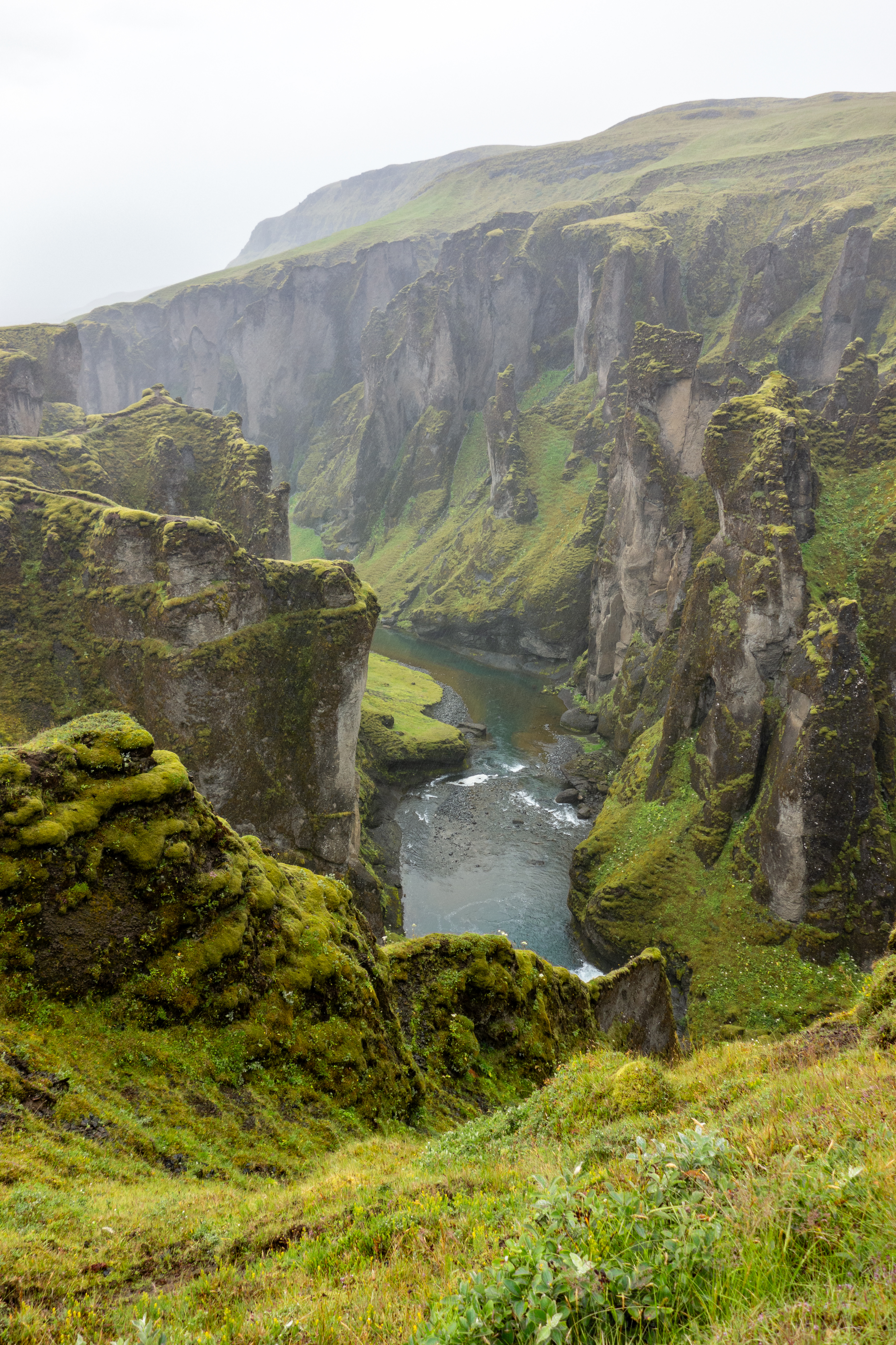
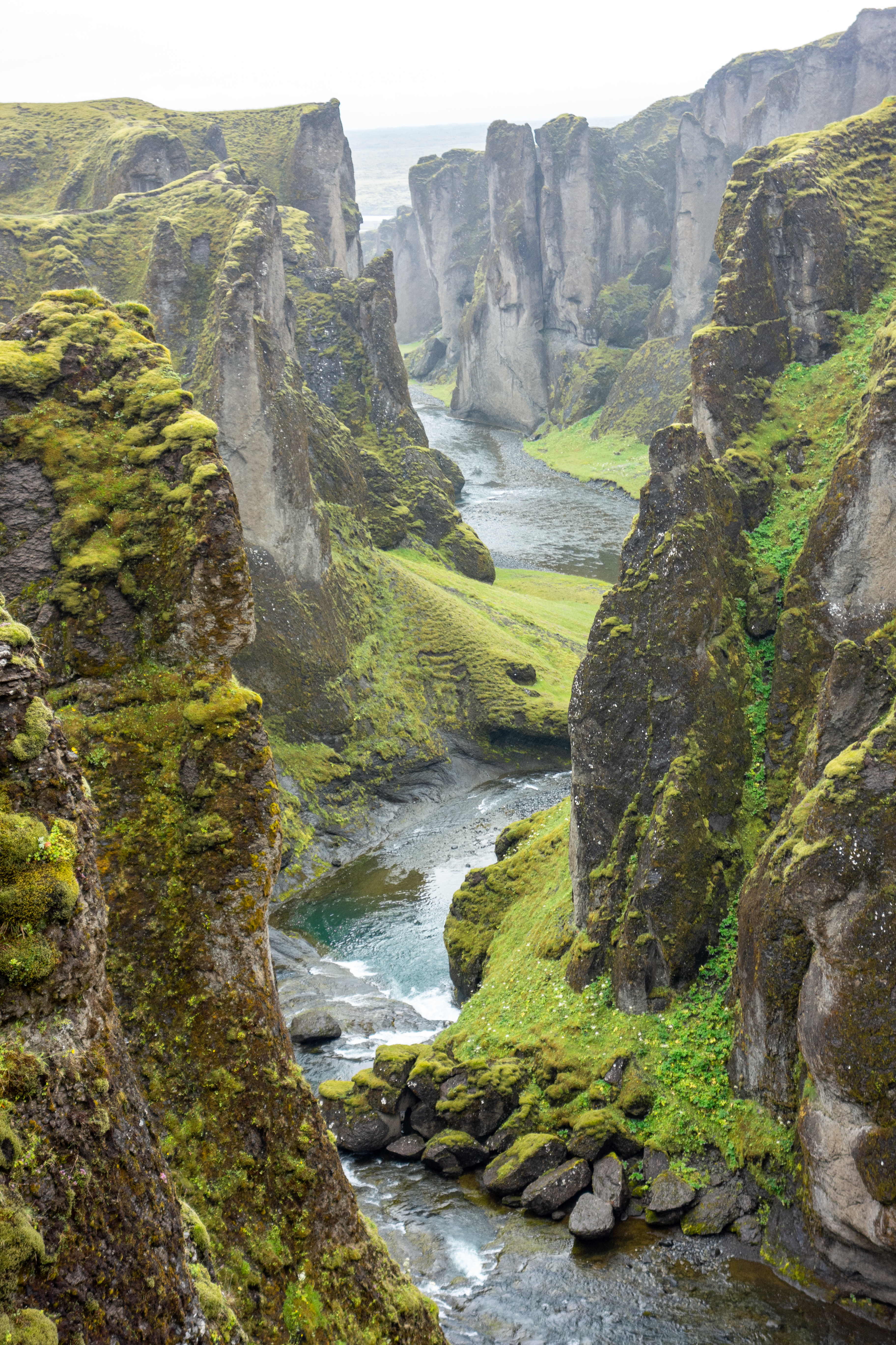
For how empty the road was, the few cars were seemingly all going to the same place, Fjaðrárgljúfur. It wasn’t misting when we arrived, but it started on our walk. We hoped this wasn’t going to be a continuation of yesterday. Fjaðrárgljúfur is much more popular than it used to be, and sadly this meant a new path, further from the edges of the cliffs, with the best vantage points now roped off. Some of the “best” vantage points did look admittedly sketchy, and even Justin thought so, but whoever put in the new paths had over-corrected.
 |
 |
 |
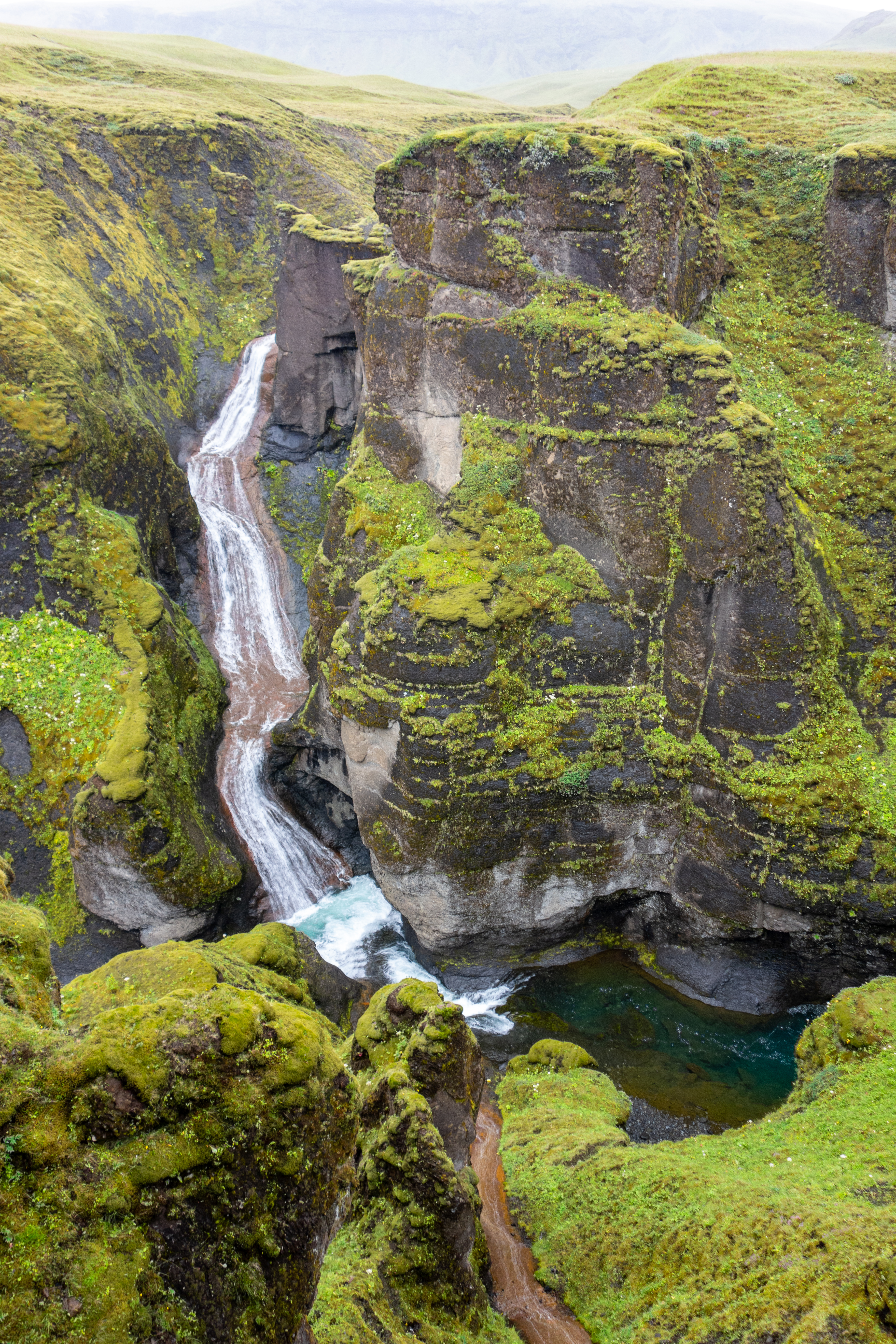 |
The topography at Fjaðrárgljúfur was unlike anything we’d seen so far. Because we couldn’t begin to pronounce it correctly, we just referred to it as “Squiggly Canyon”, as there was a river winding through the hills, and sharp green cliffs rising up from the river. Several rocks jutted up above the rim here and there, like canine teeth. Sadly, there were several vantage points where the broken Sony would’ve been nice, as the zoom lens couldn’t fit everything in the frame, and the old Sony couldn’t quite zoom in enough.
 |
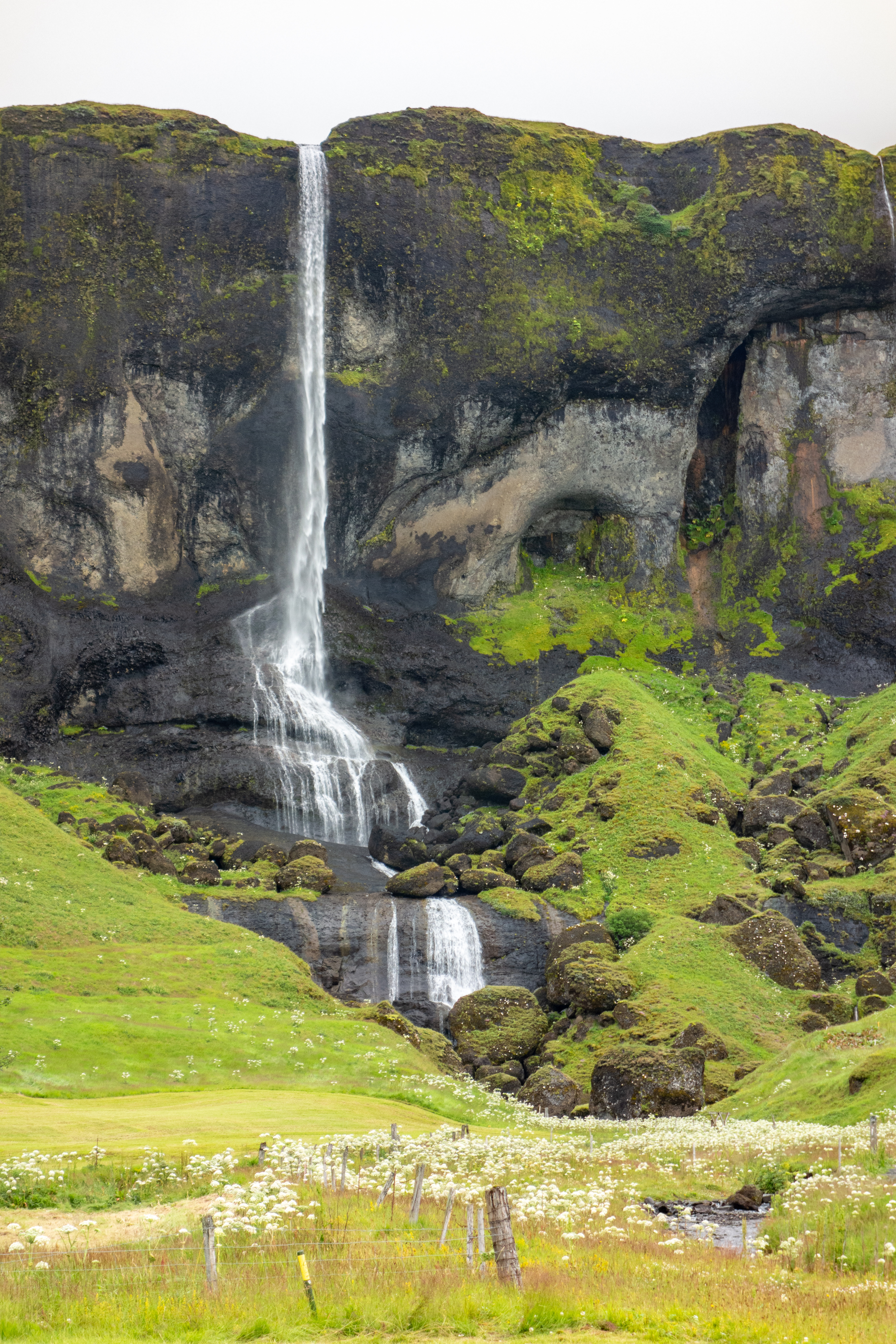 |
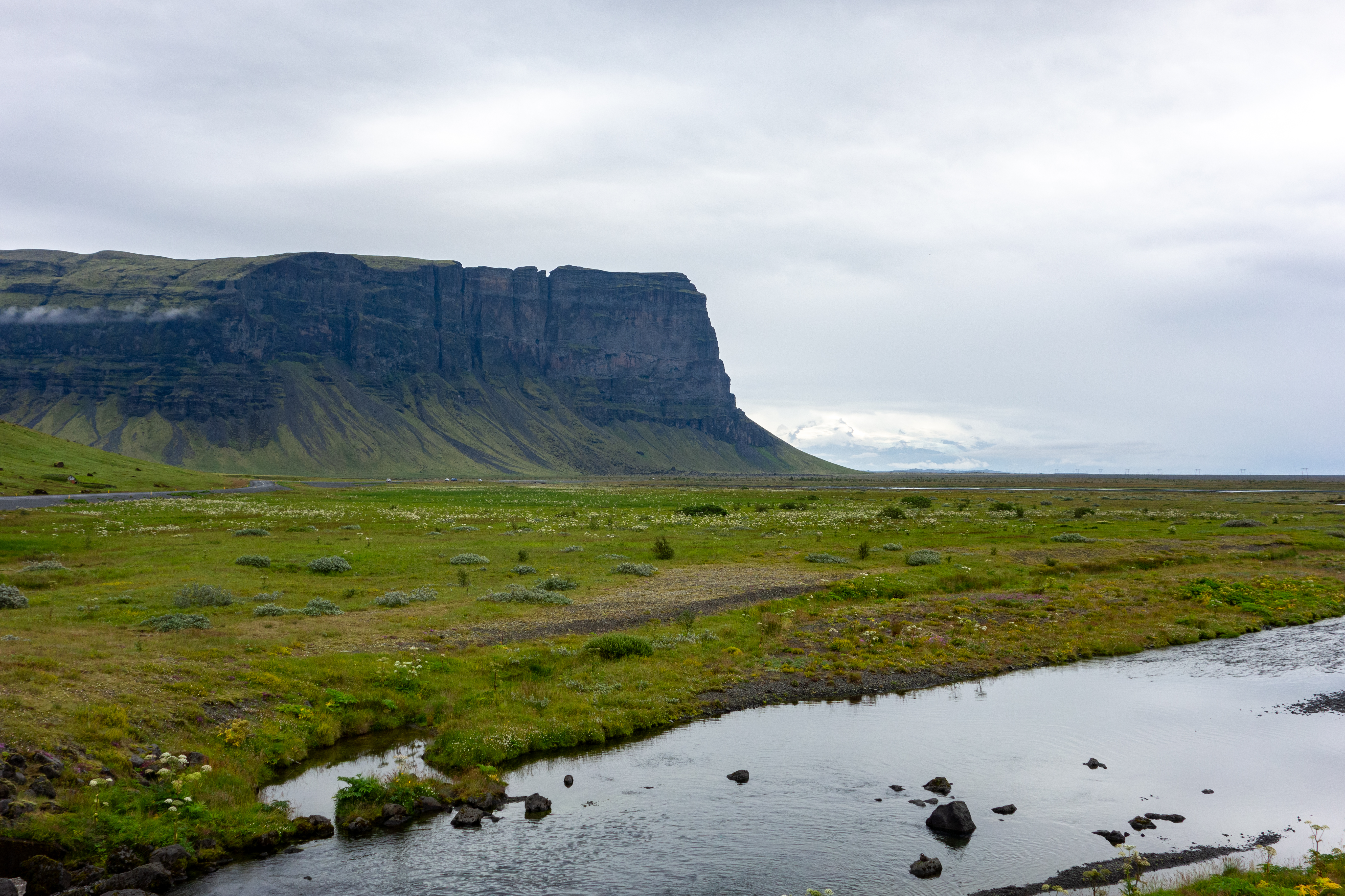
On the way out, Crystal got a photo of a sign for Heidi (not spelled exactly like that, it was with Icelandic letters). We continued east on the Ring Road and stopped briefly for a photo of Foss á Síðu, which wasn’t on our itinerary, but was a huge waterfall right off the road. Our next planned stop was a large green mesa that theoretically resembled Monument Valley, but it was green so it’s tough to compare. The viewpoint was east of the mesa, but we found a small turnoff on the west side, and took some photos from there. This was good because it started to rain just before we arrived at the official viewpoint (bad luck yet again), and so we took pictures from rolled down windows in the car.
 |
 |
We continued to see this butte/mesa the rest of the day, as it was a prominent point at the southwest part of the portion of the island we were visiting. We continued on to Skaftafell, but there were too many “Skaftafells” in the area, and we inadvertently went right past it towards some other location with a similar name, but fortunately the spot where we turned around had great views. We eventually found the correct spot (“Skaftafellsstofa” is probably the best search term to put in Google Maps, FYI), parked, and put some stuff in our waterproof backpacks for a hike.
 |
 |
 |
 |
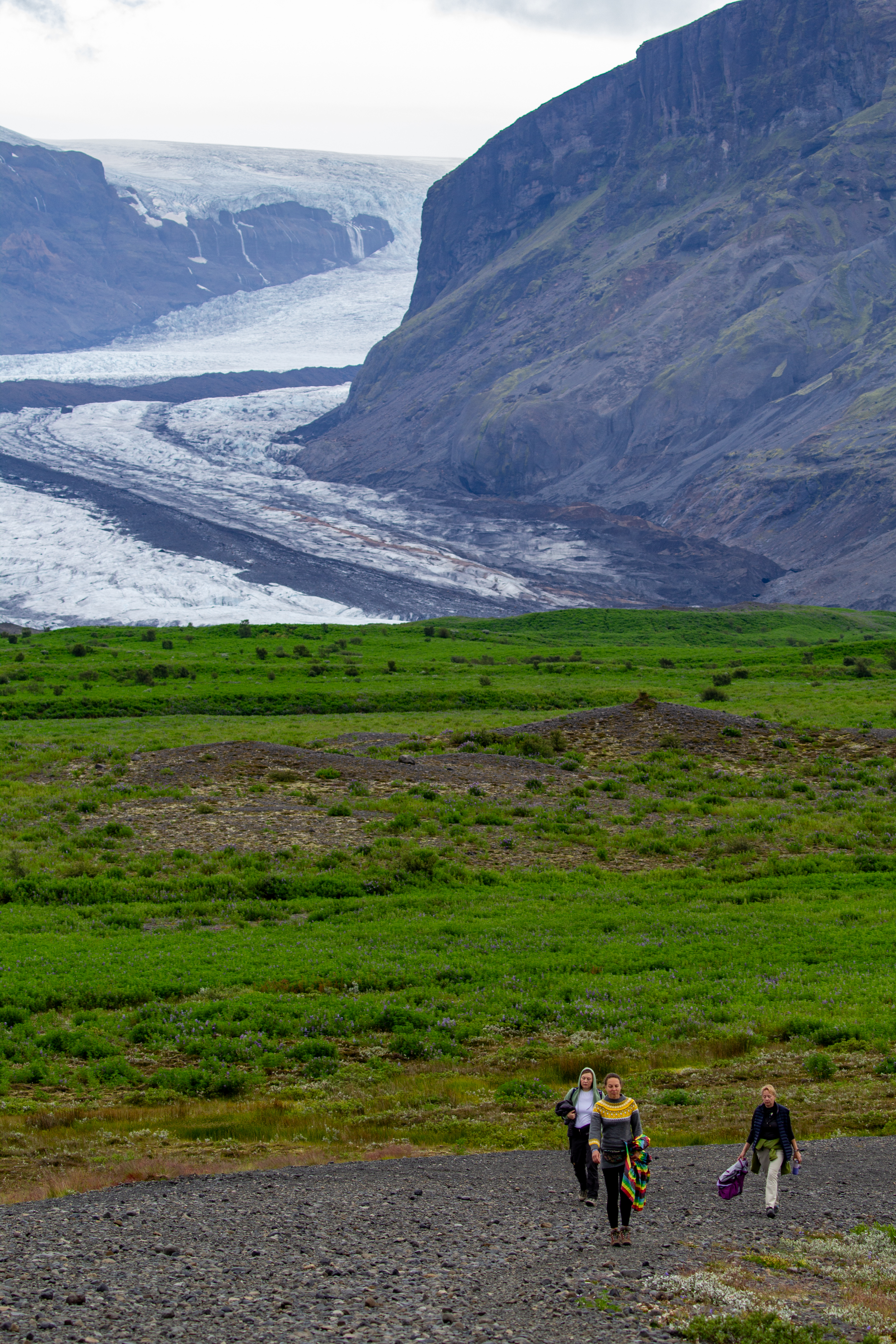
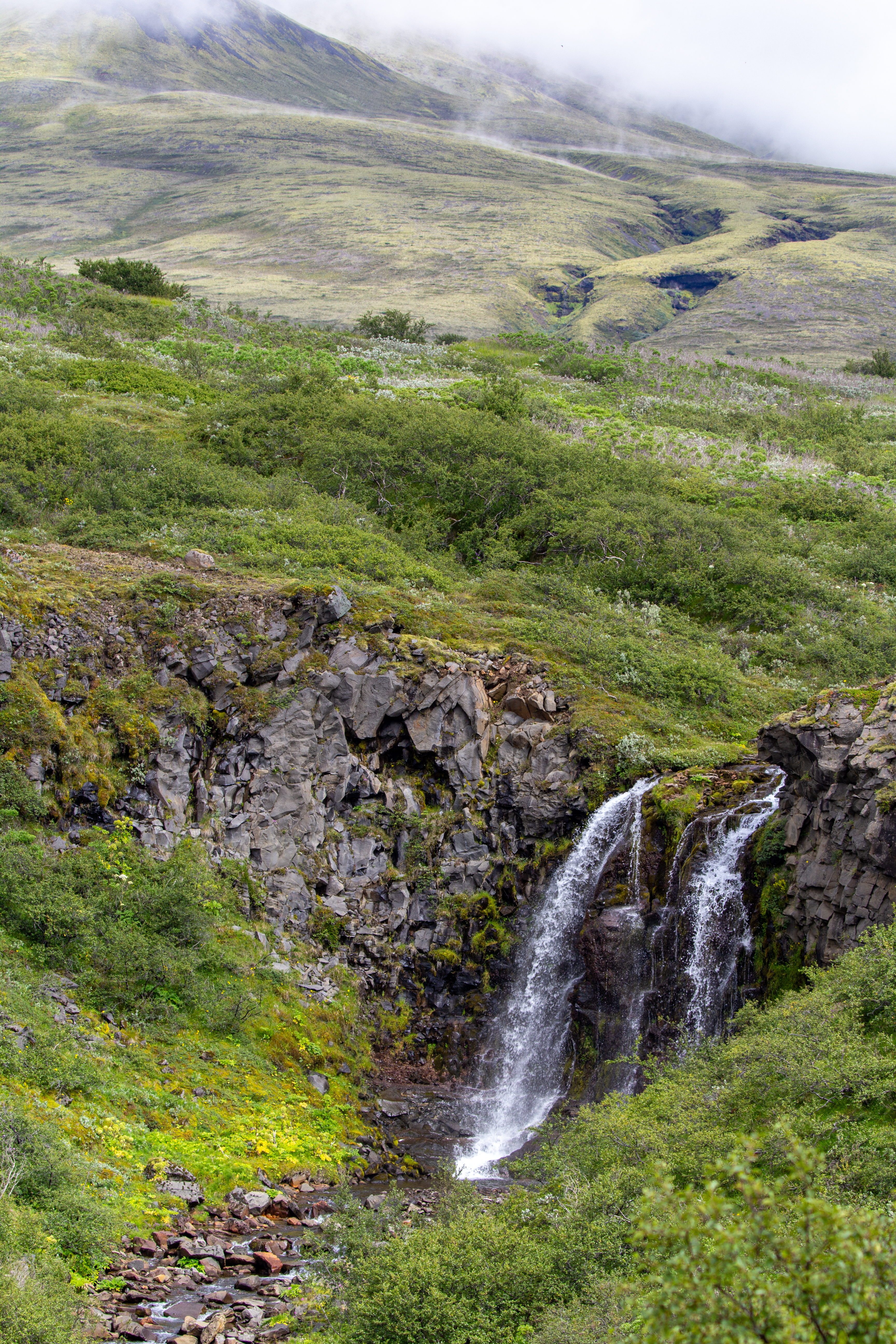
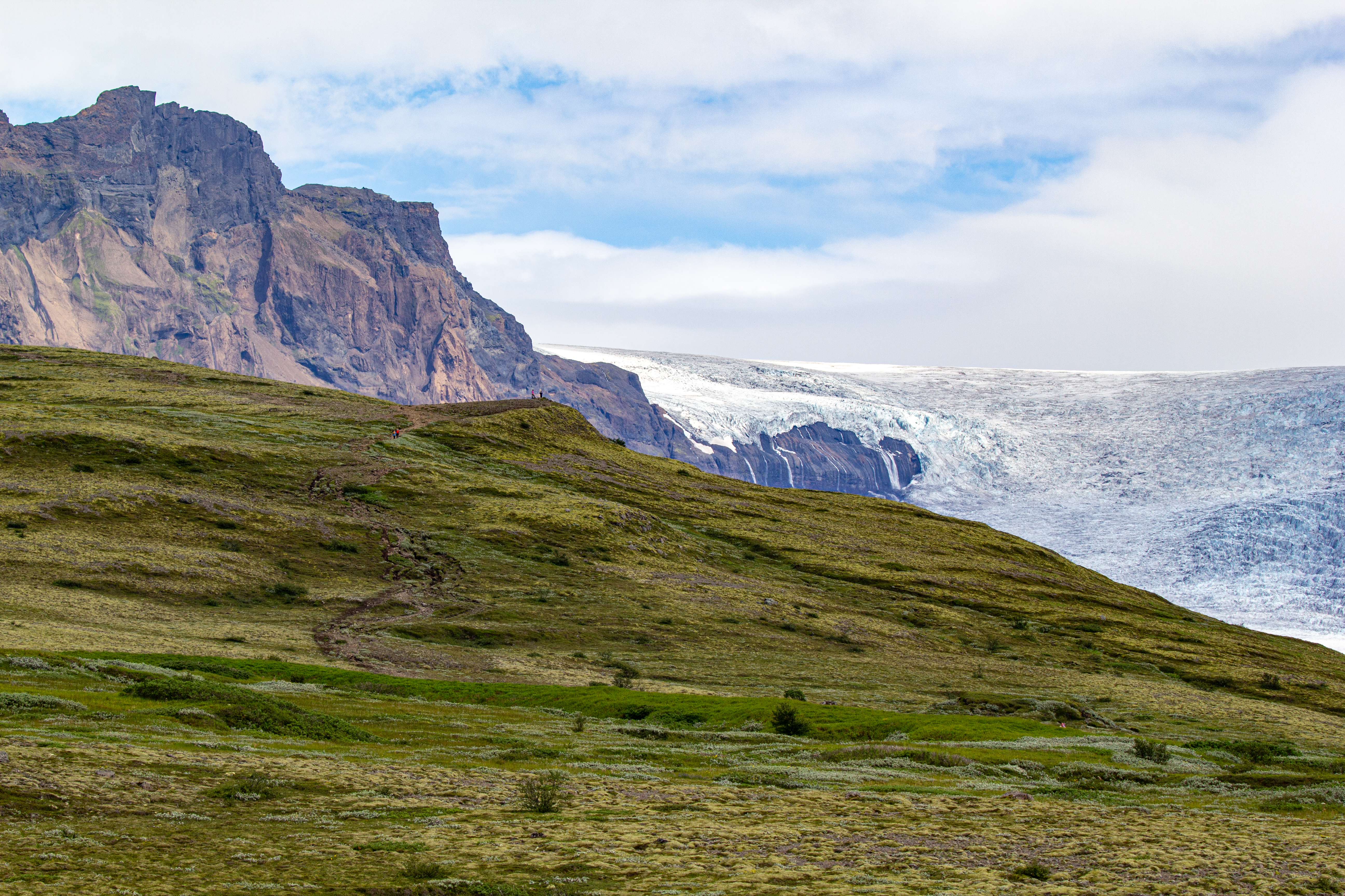
We had chosen to do a loop hike that visited both Svartifoss, a waterfall, and Skaftafell Glacier high-altitude observation point. We had in our notes to go counterclockwise (in bold no less), but we weren’t sure why going that direction was so important. First we had to find the start location, which we missed in the beginning. Lots of some shrub was blooming everywhere - we’ve seen this plant all over the island, but today it seemed to have the densest clusters. We saw a “small” waterfall on the way up to Svartifoss, Magnúsarfoss. In many places we’ve visited, this waterfall would’ve been an attraction on its own. Here, we didn’t even know its name, we had to look it up after-the-fact.
 |
 |
 |
 |
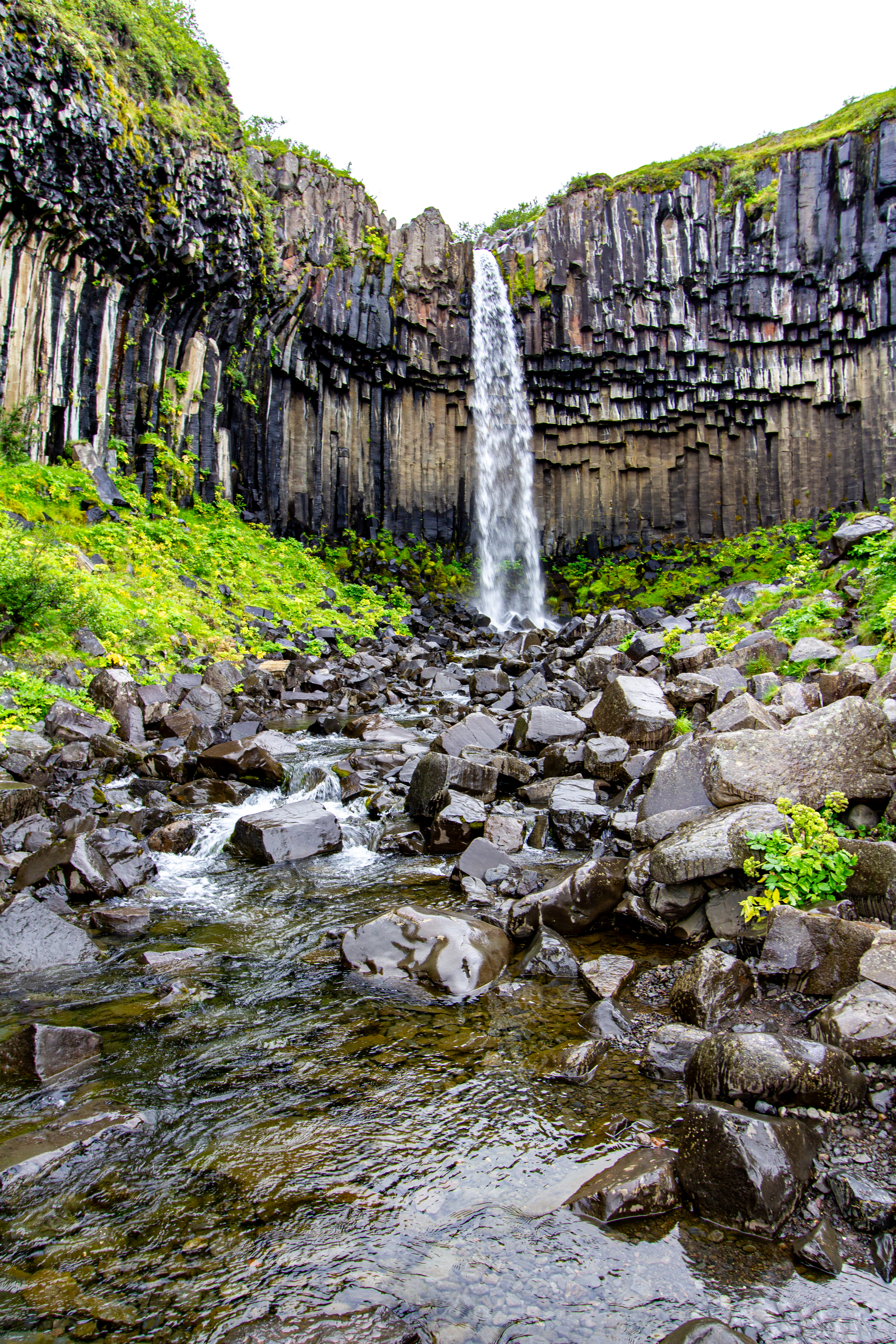
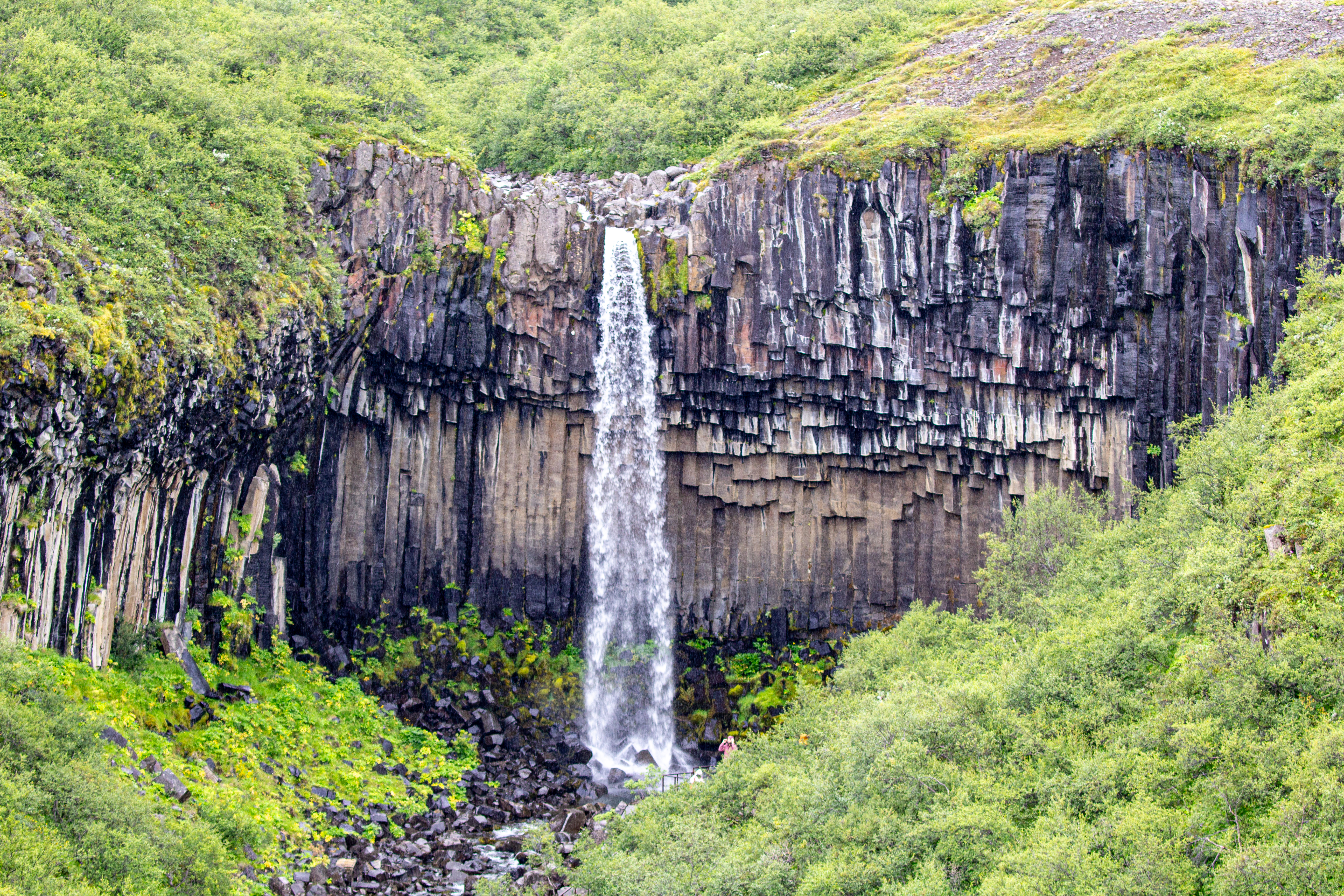
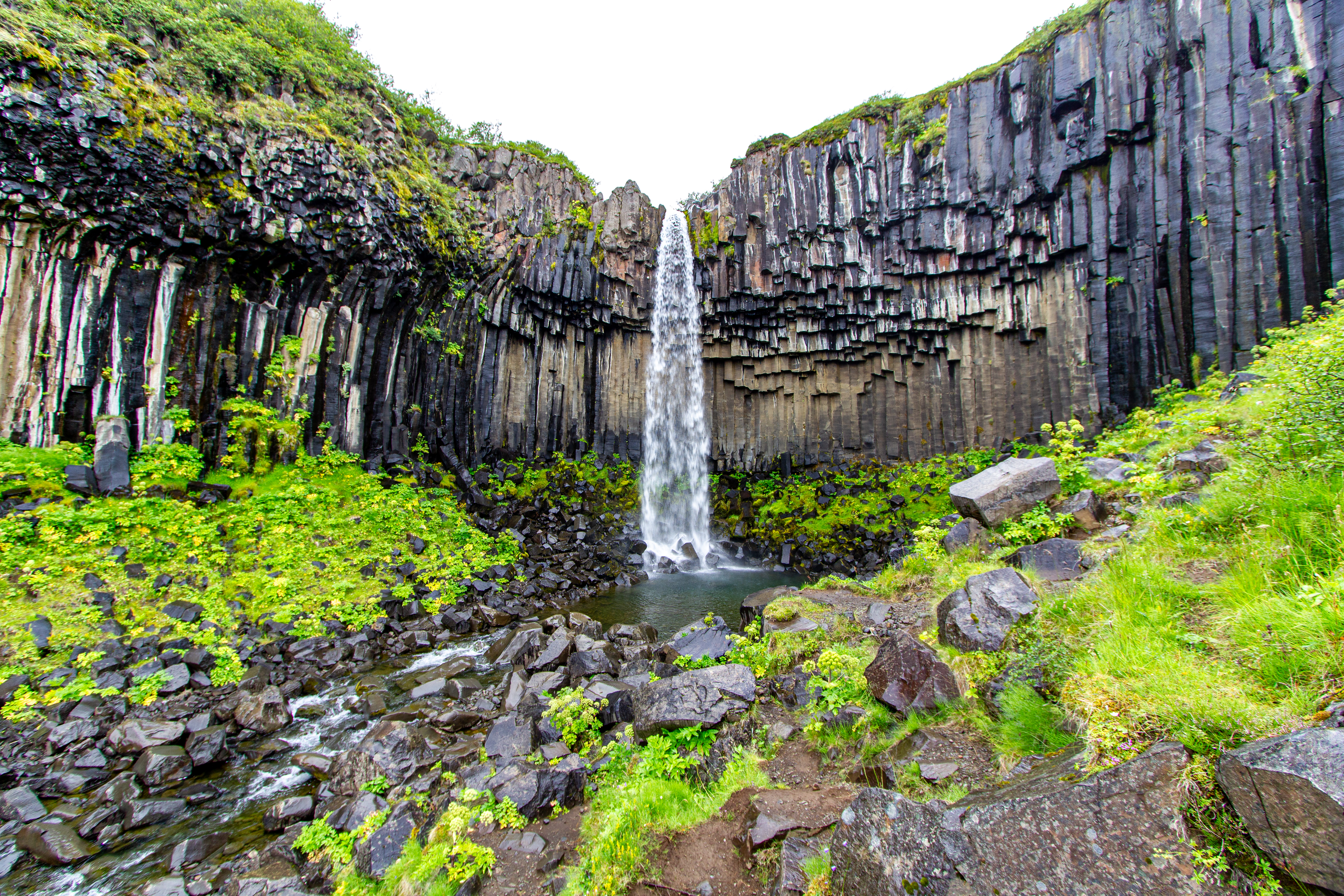
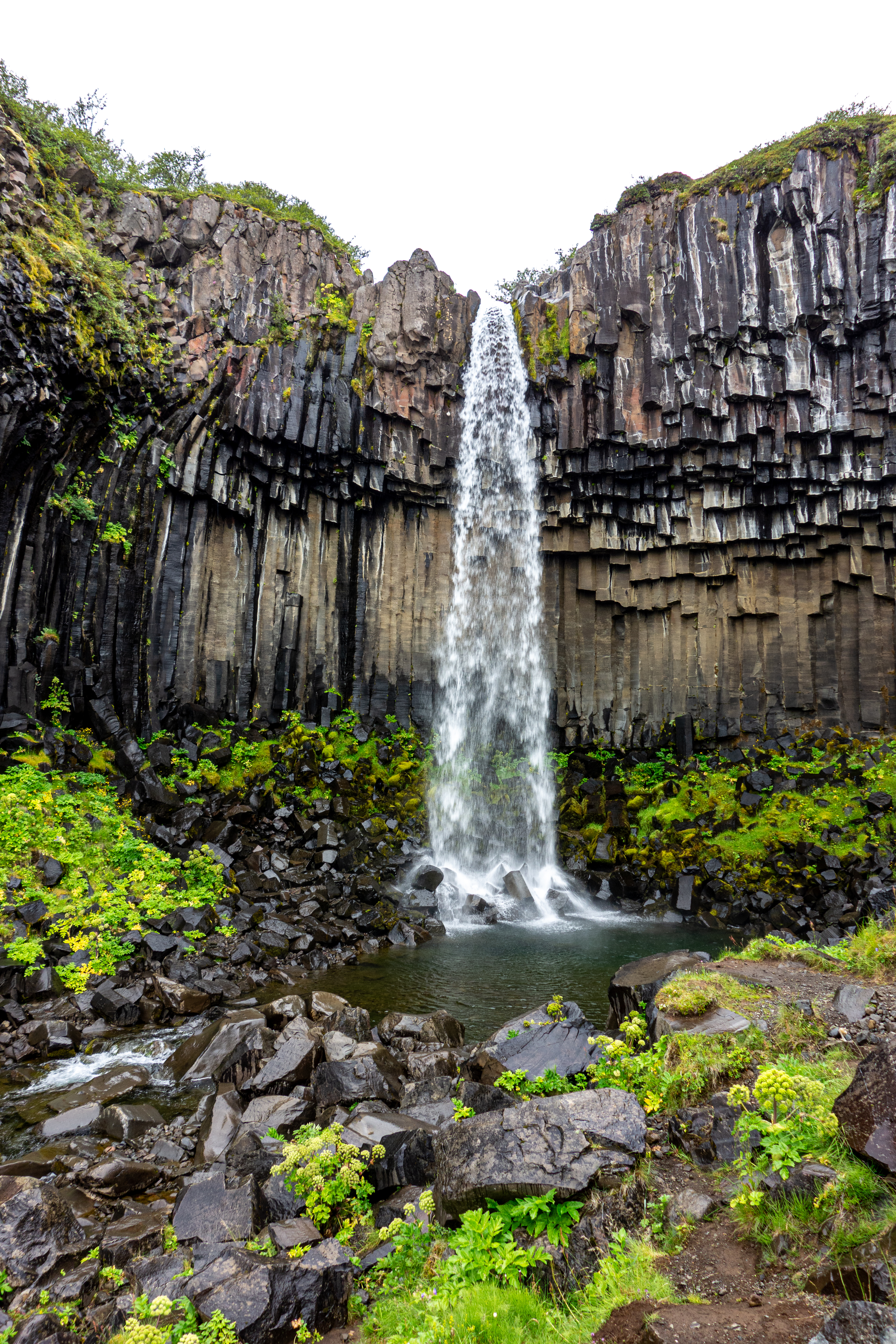
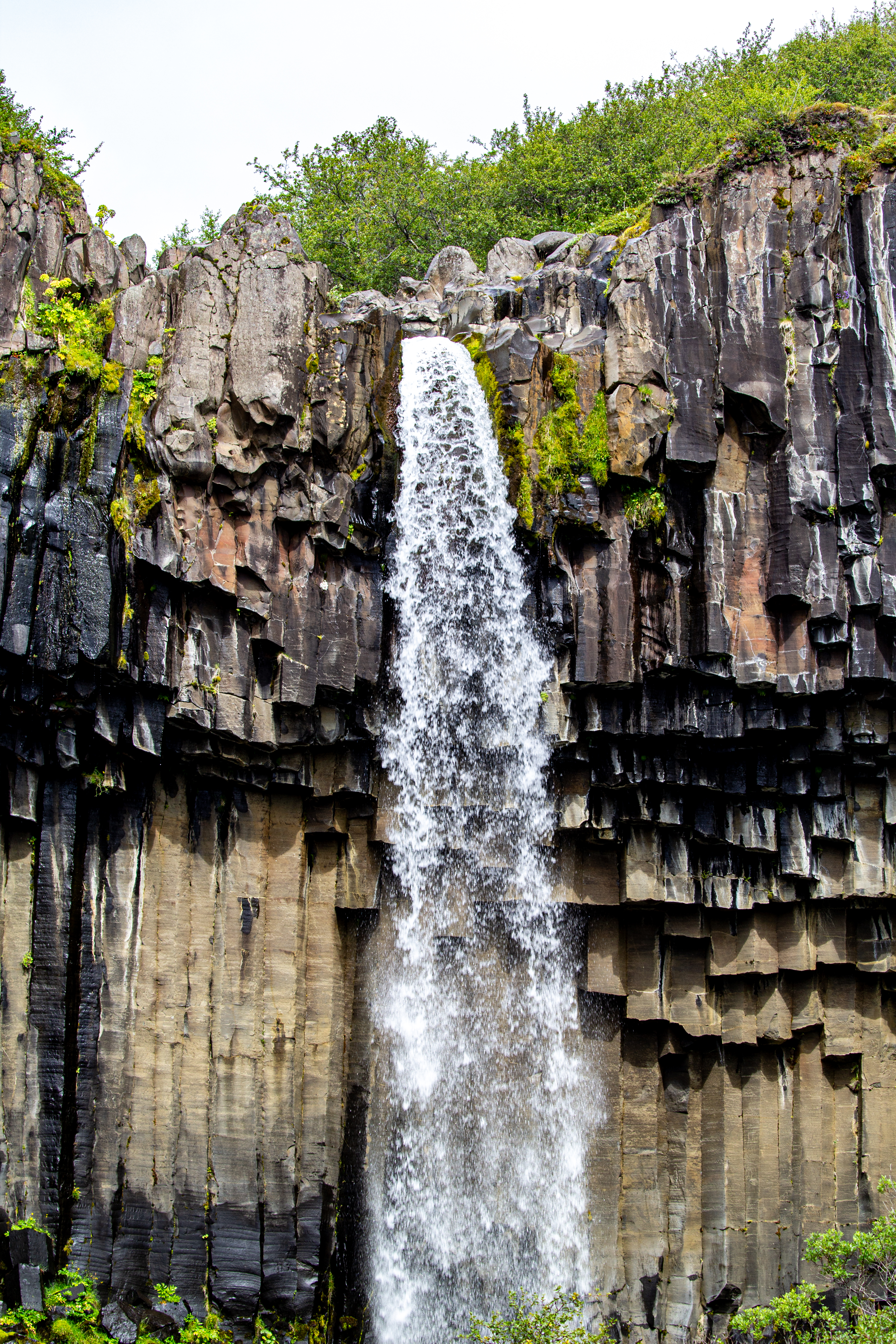
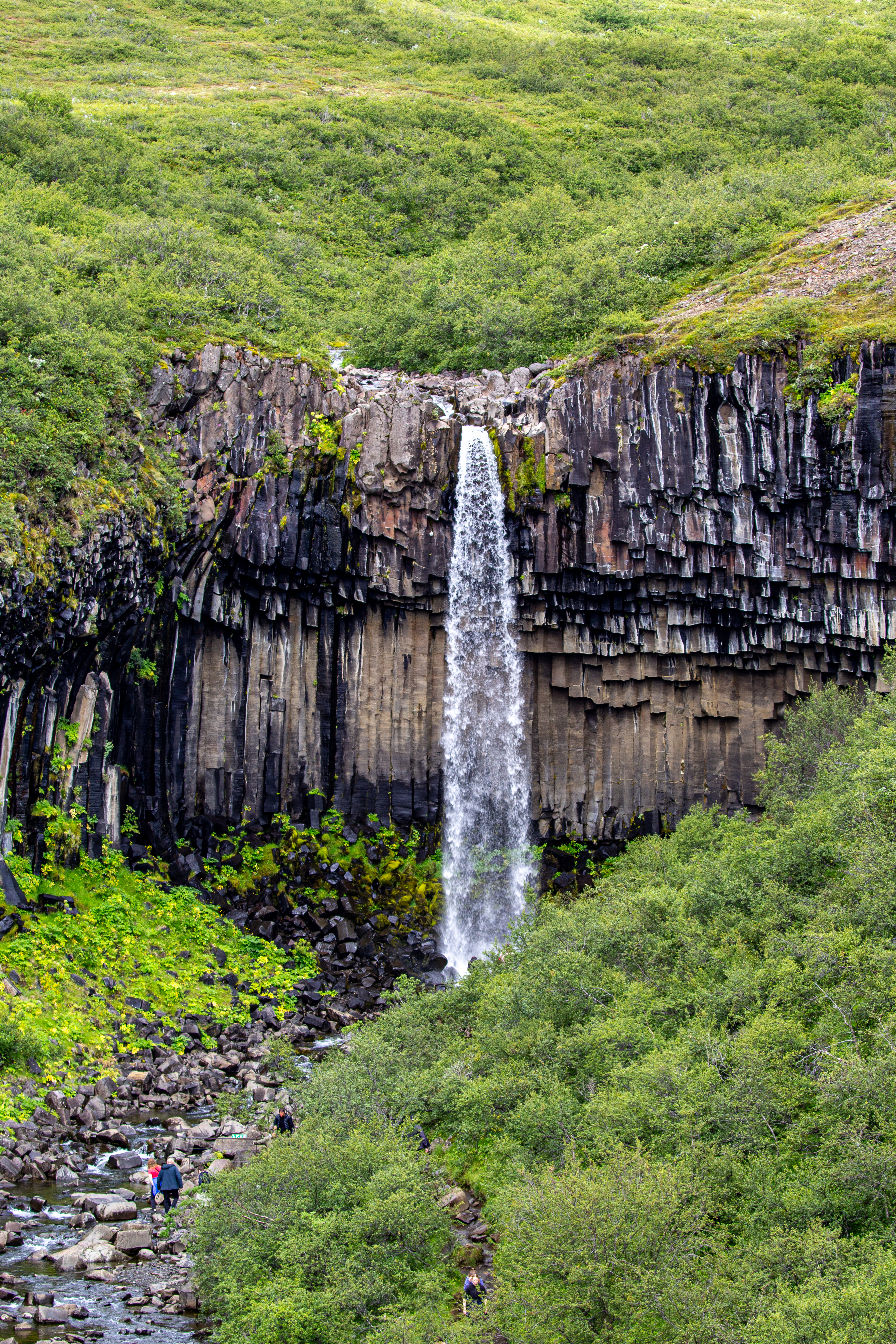
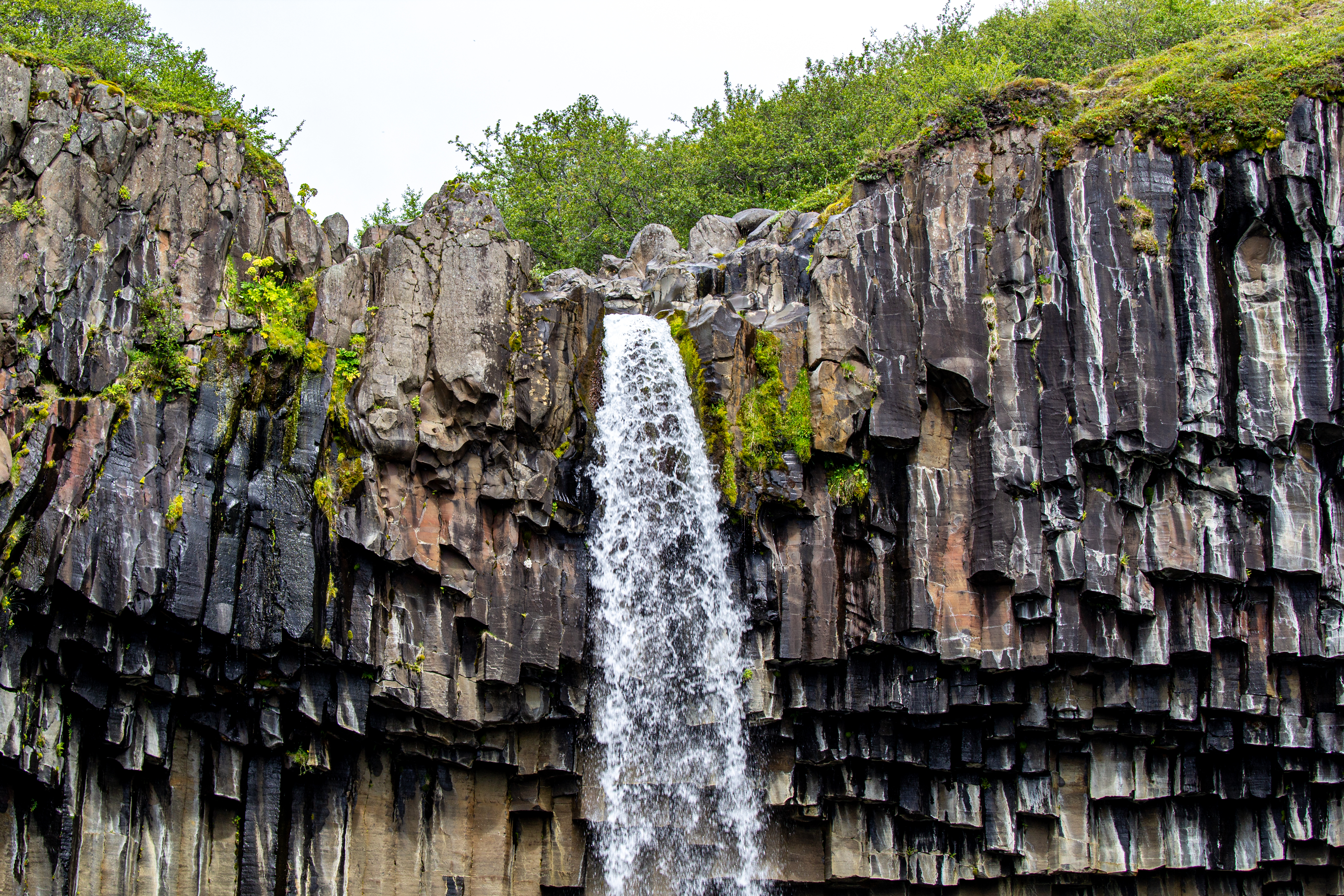
There was a good view of Svartifoss from afar before walking down into a canyon to see it more up close and personal. Perhaps this sneak peak was the reason for going counterclockwise? Svartifoss is famous for the hexagonal basalt columns all around. Apparently the shape is hexagonal because when basalt cools from a molten state, the cooling process creates stress, and the most efficient way to relieve the stress is by fracturing into hexagonal shapes. As the lava cools, cracks propagate downwards, meaning the hexagons from the surface become hexagonal columns.
 |
 |
After checking out the waterfall for a bit, we continued past it to the left, and suddenly there weren’t many people around. We came to a fork, and Justin double-checked the Alltrails app. This was good, because we had gone the wrong way from the falls. Walking down towards the falls from that first viewpoint was actually a spur off of the main path. So we had to backtrack a bit, nothing too bad. When we got back to the falls, it was sunny, so at least there was that.
 |
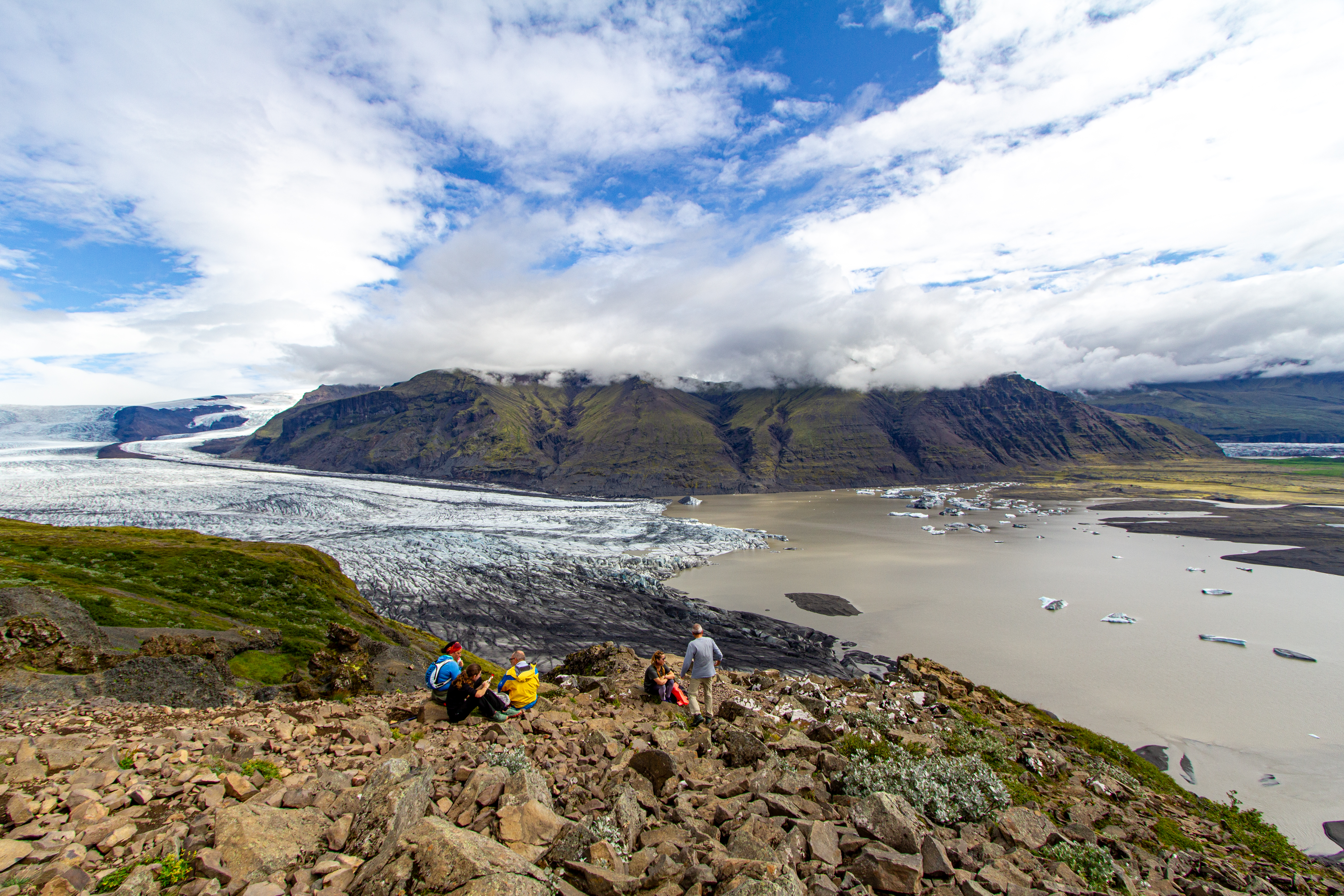 |
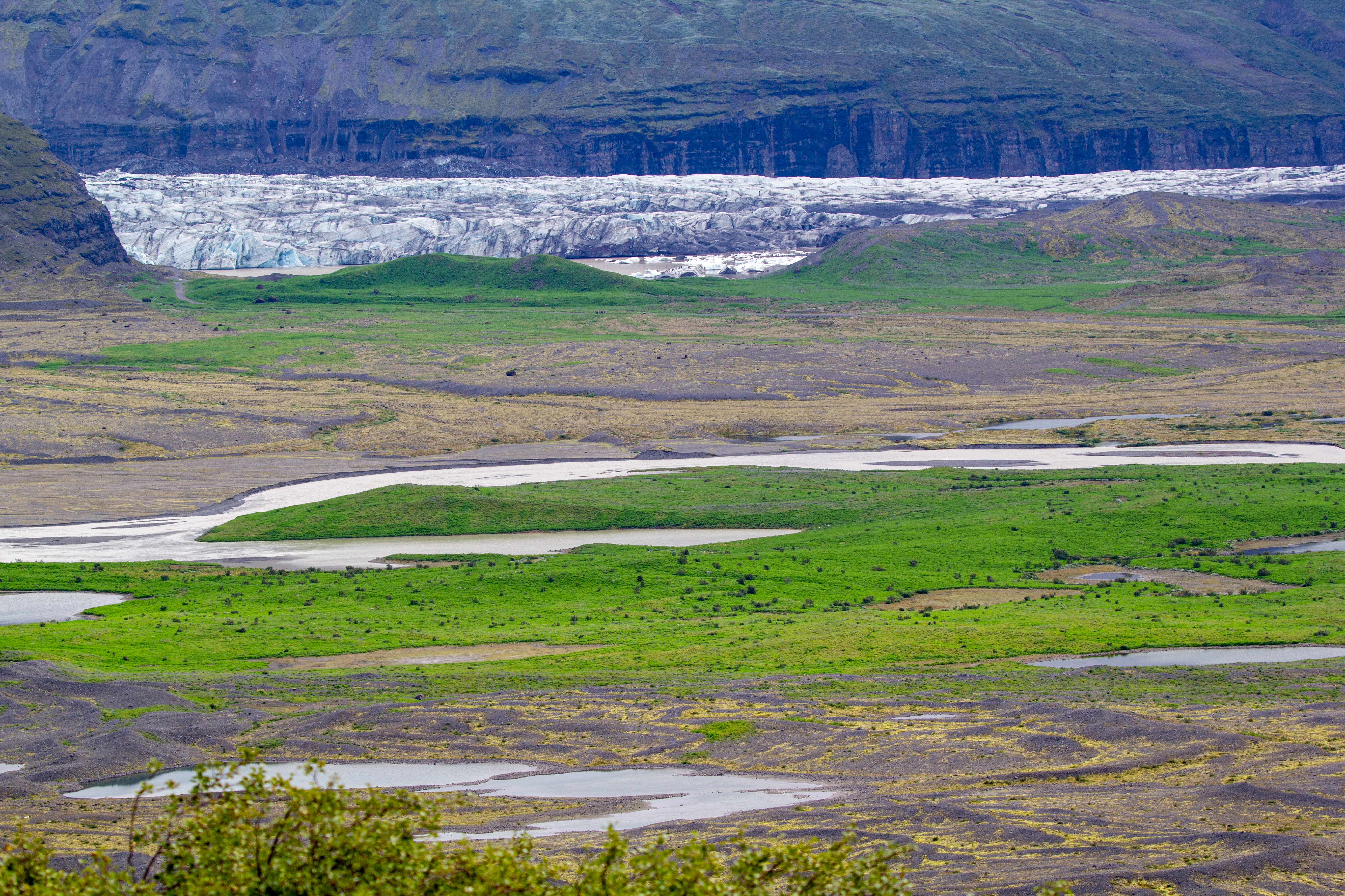
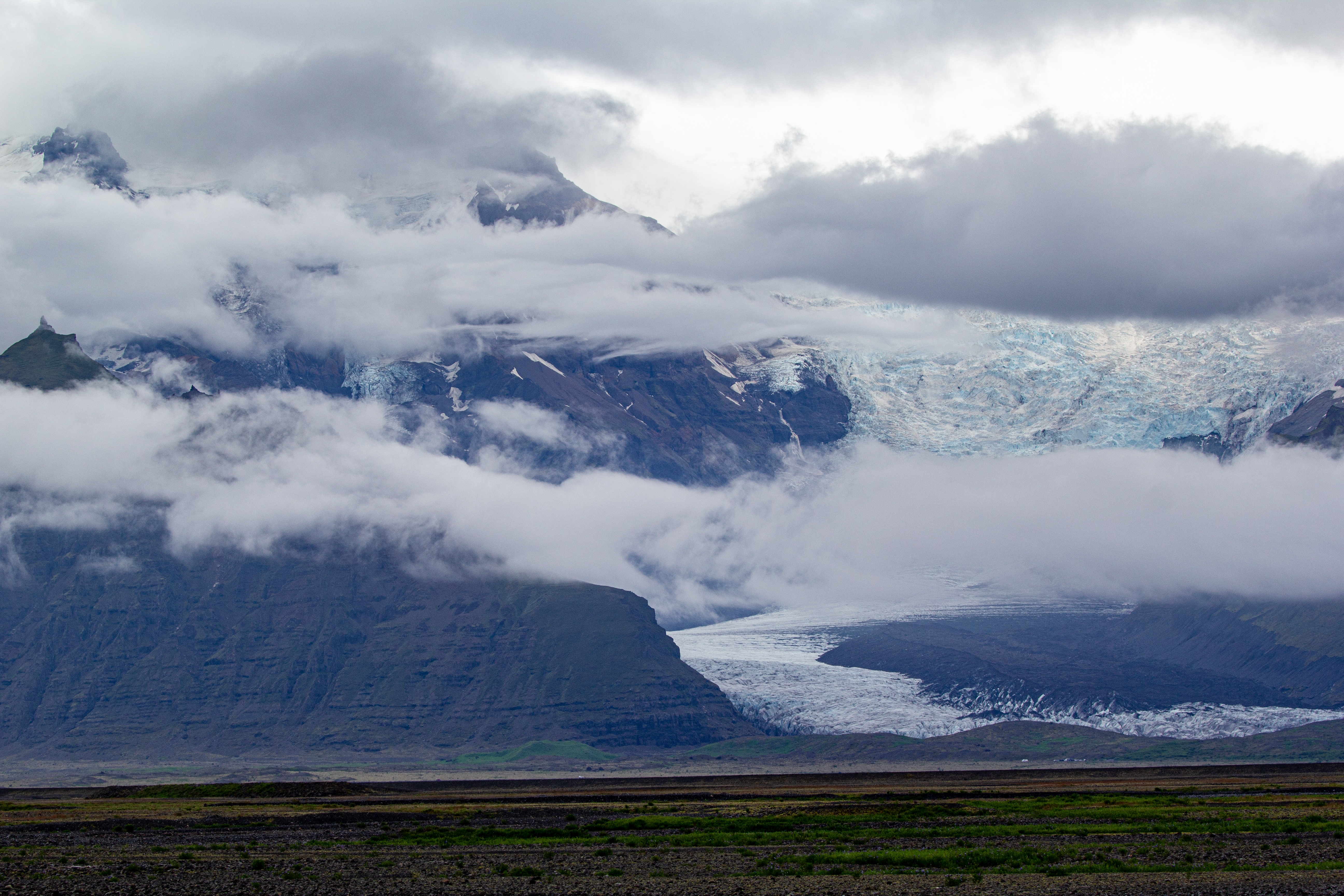
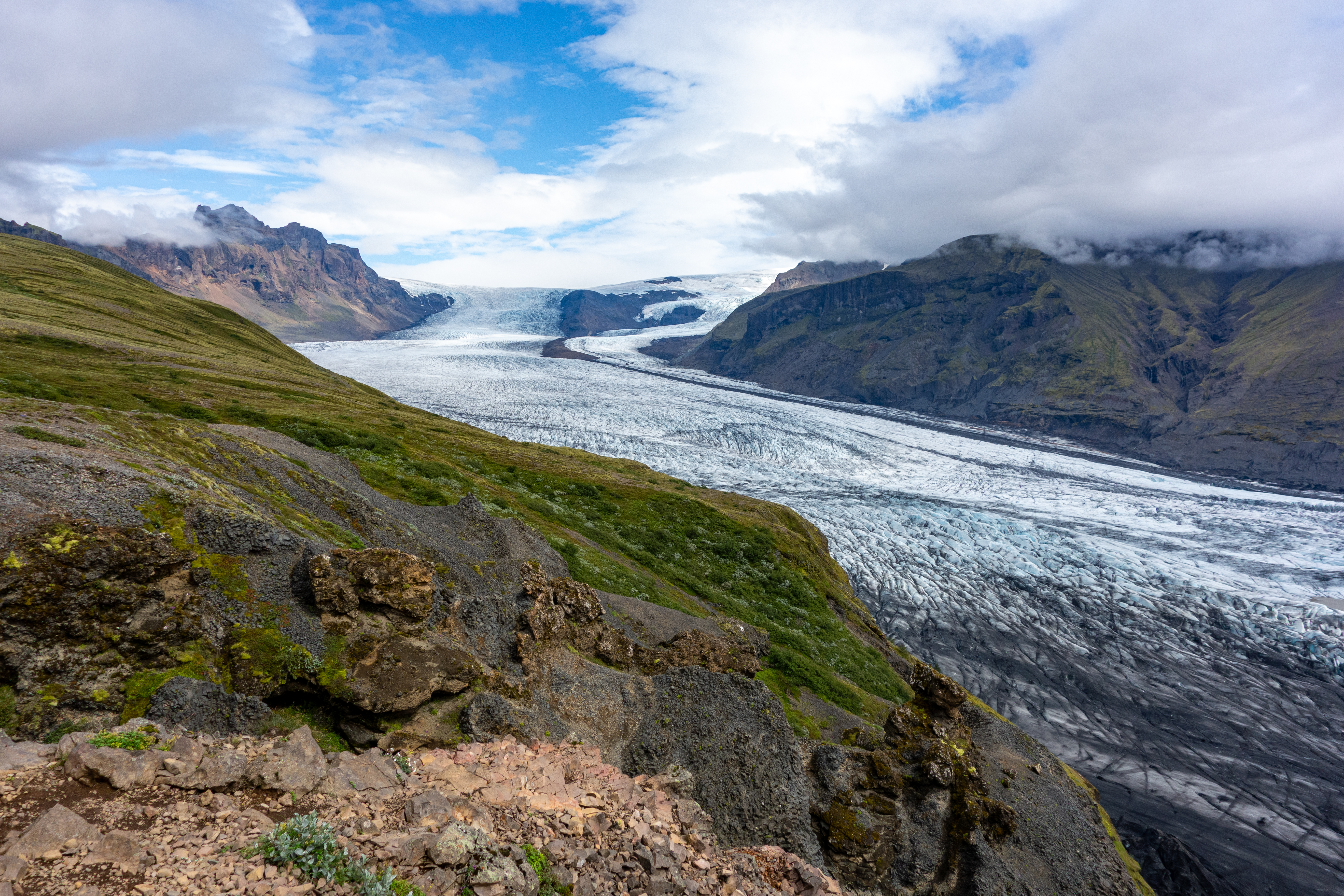
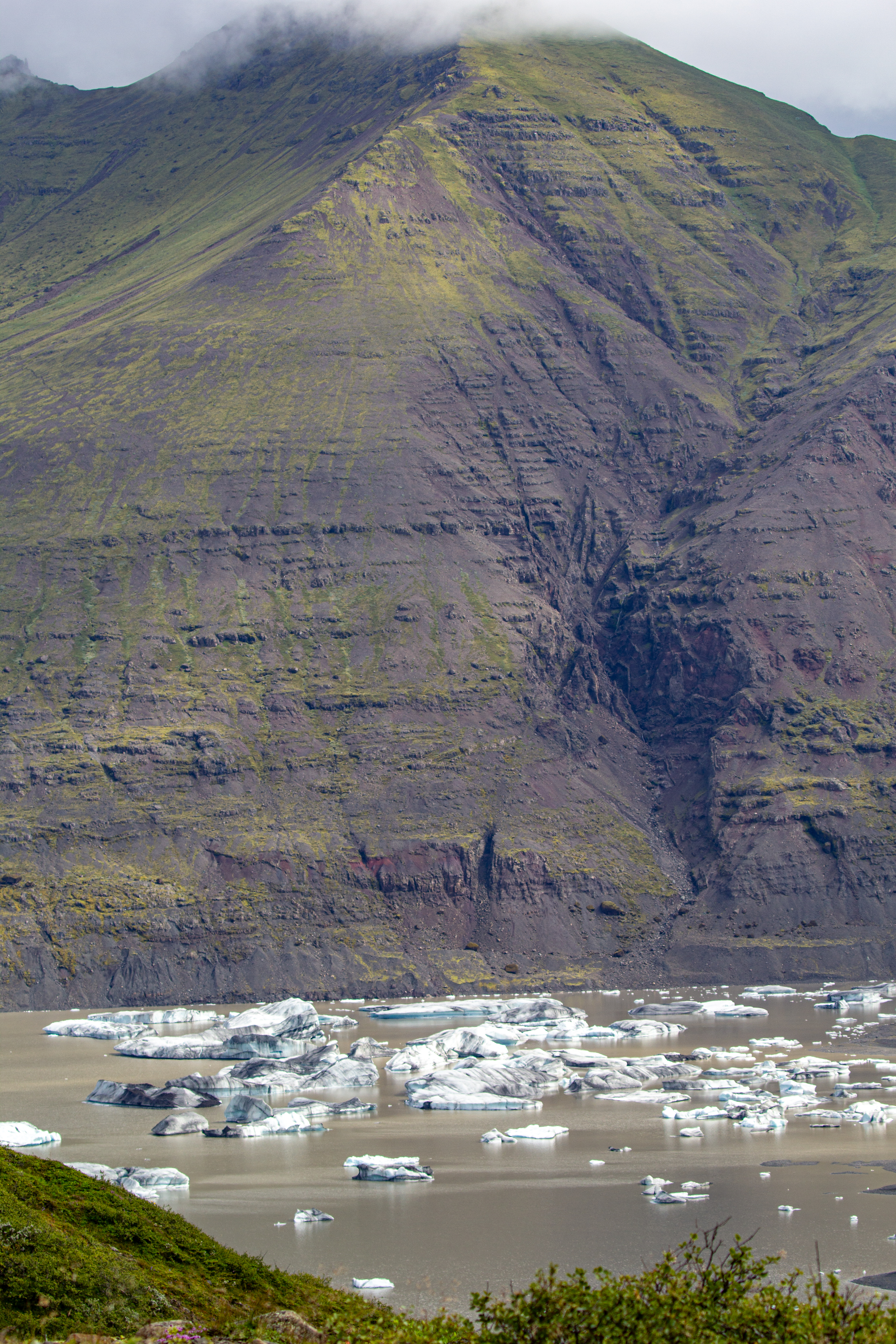
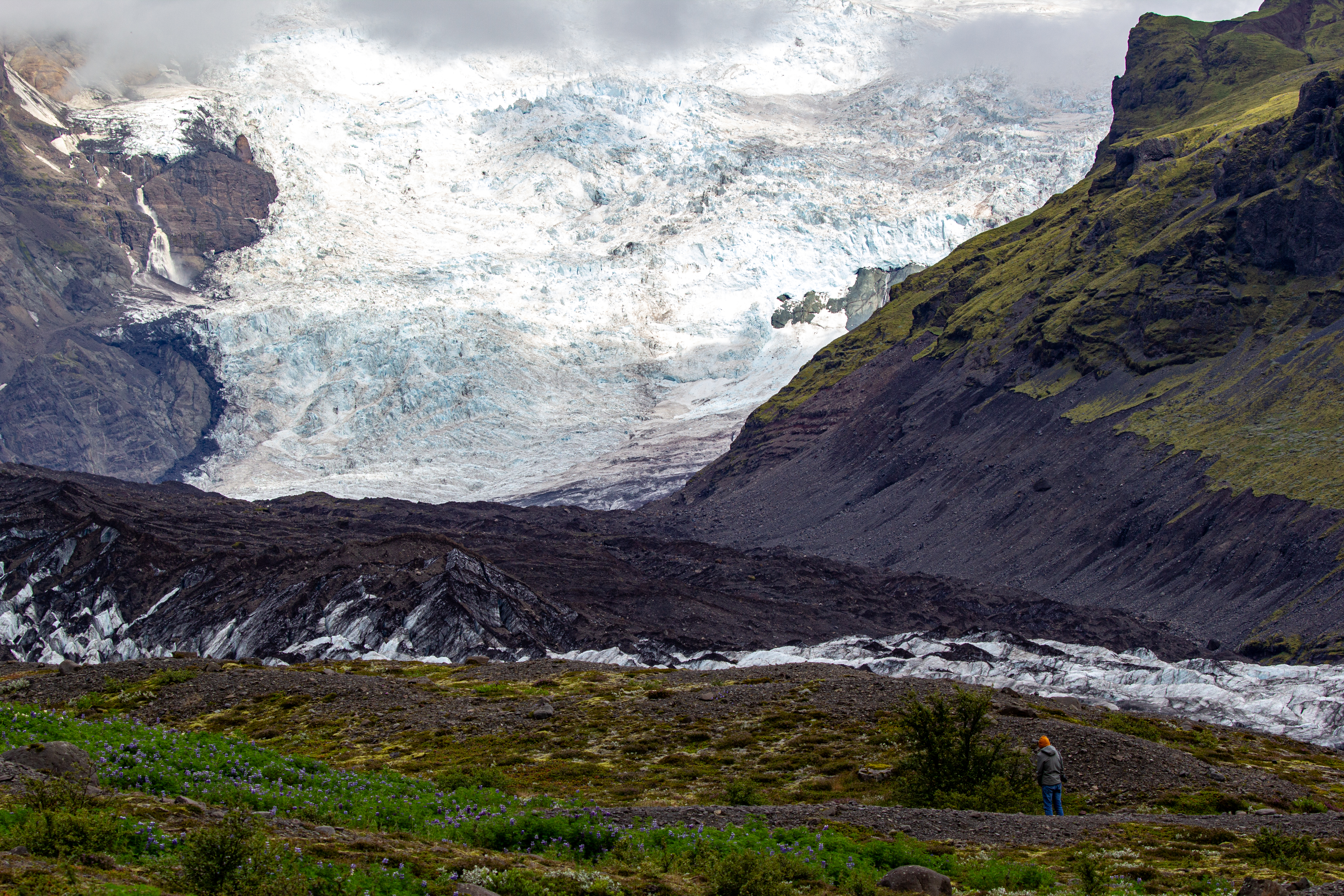
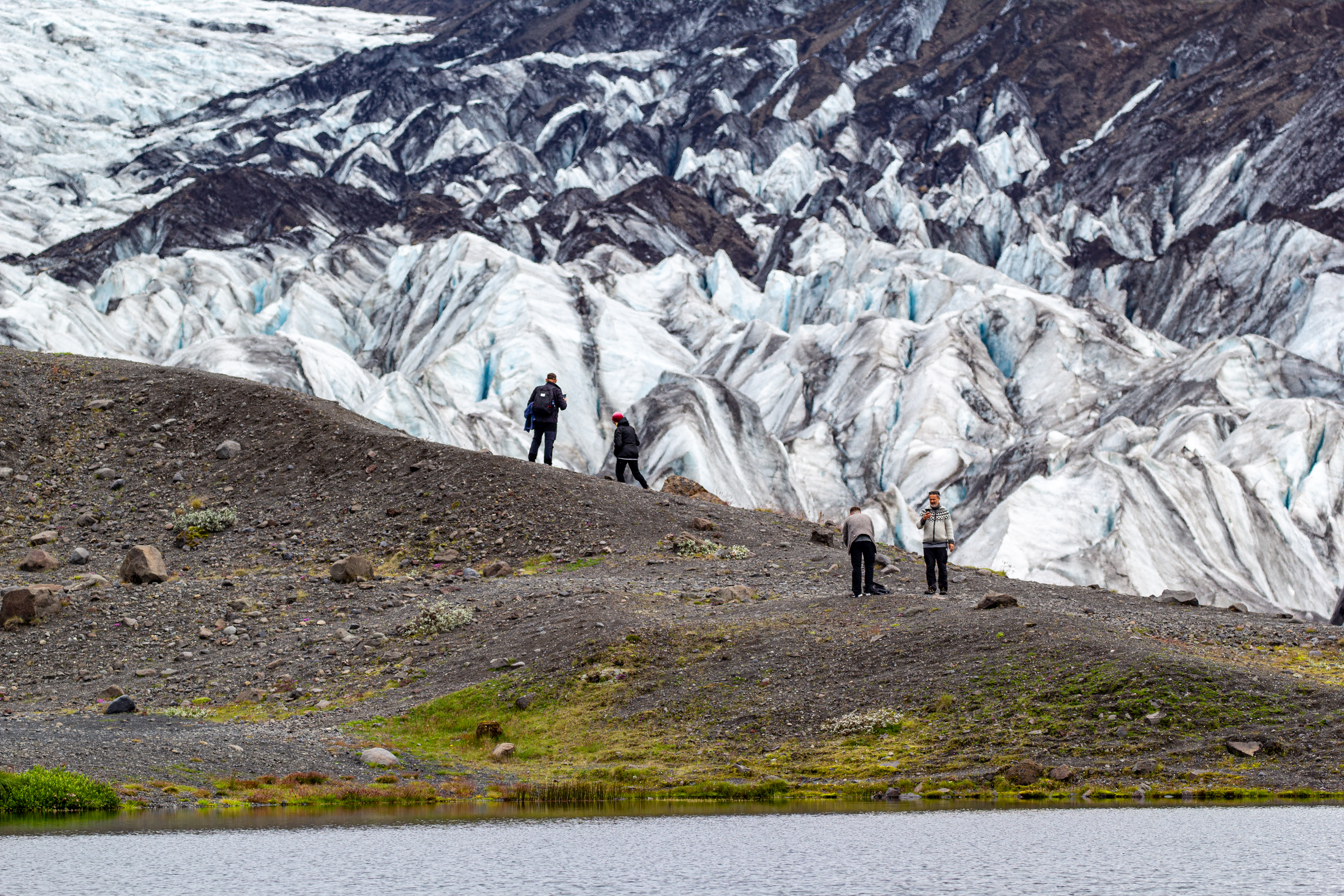
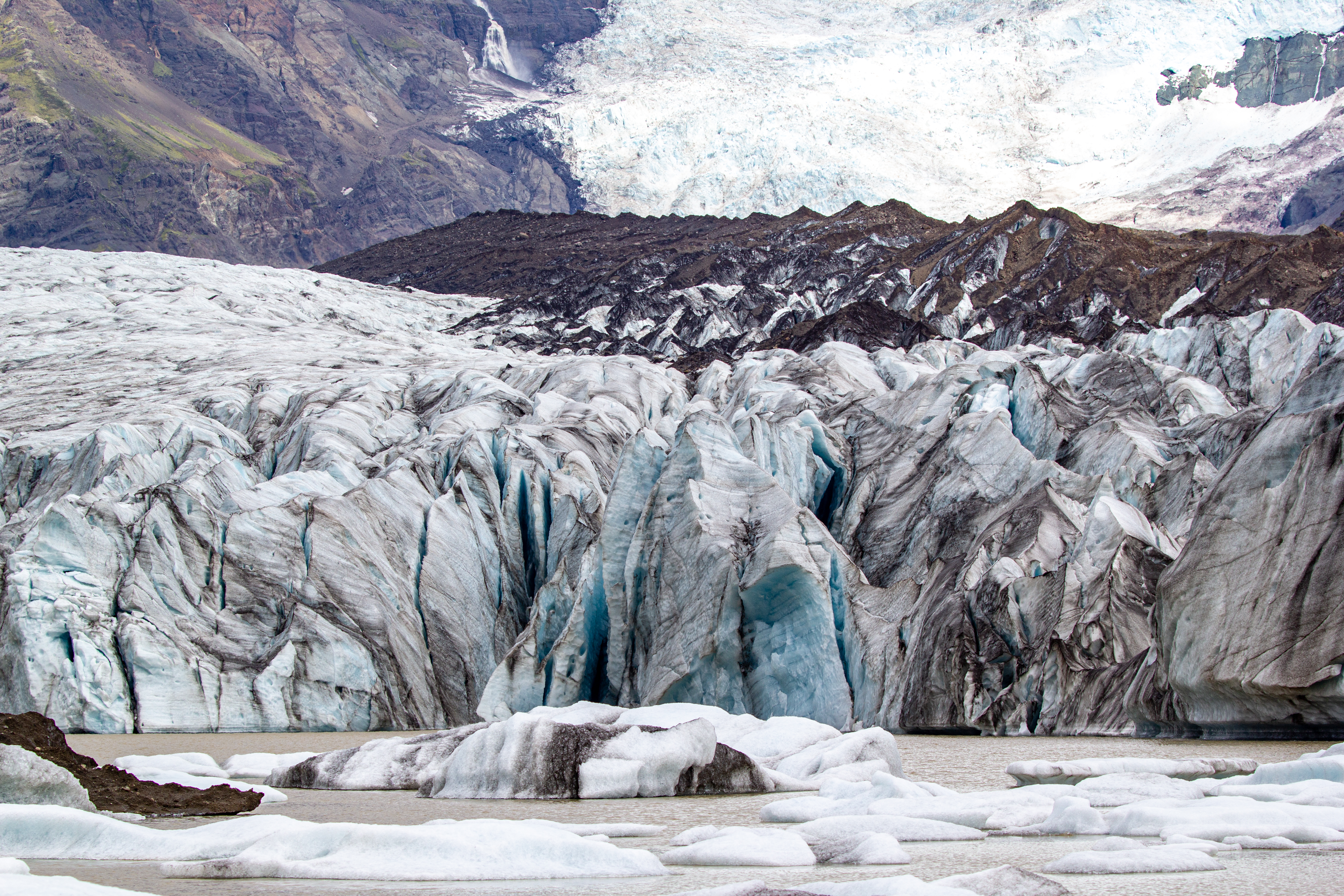
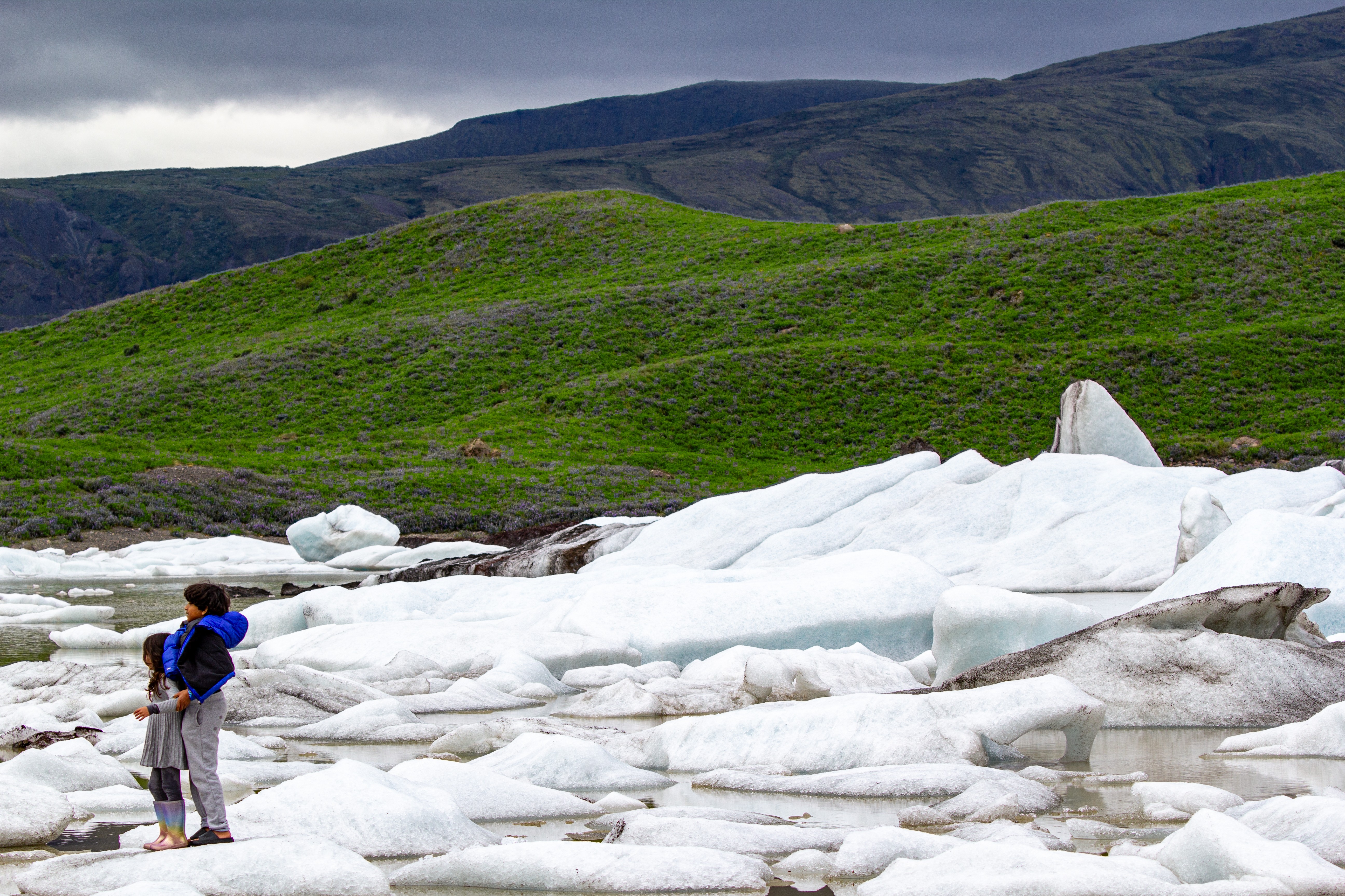
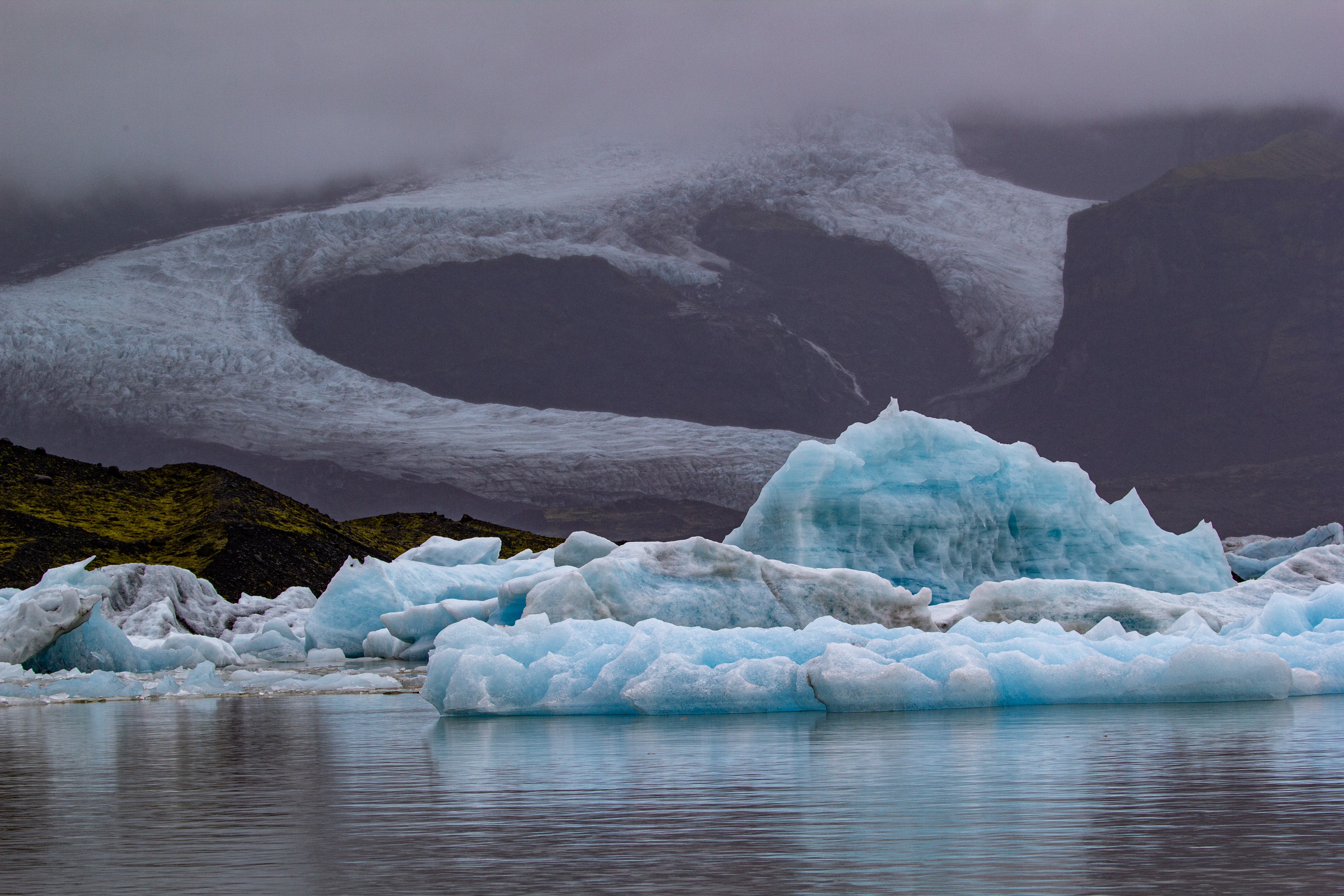
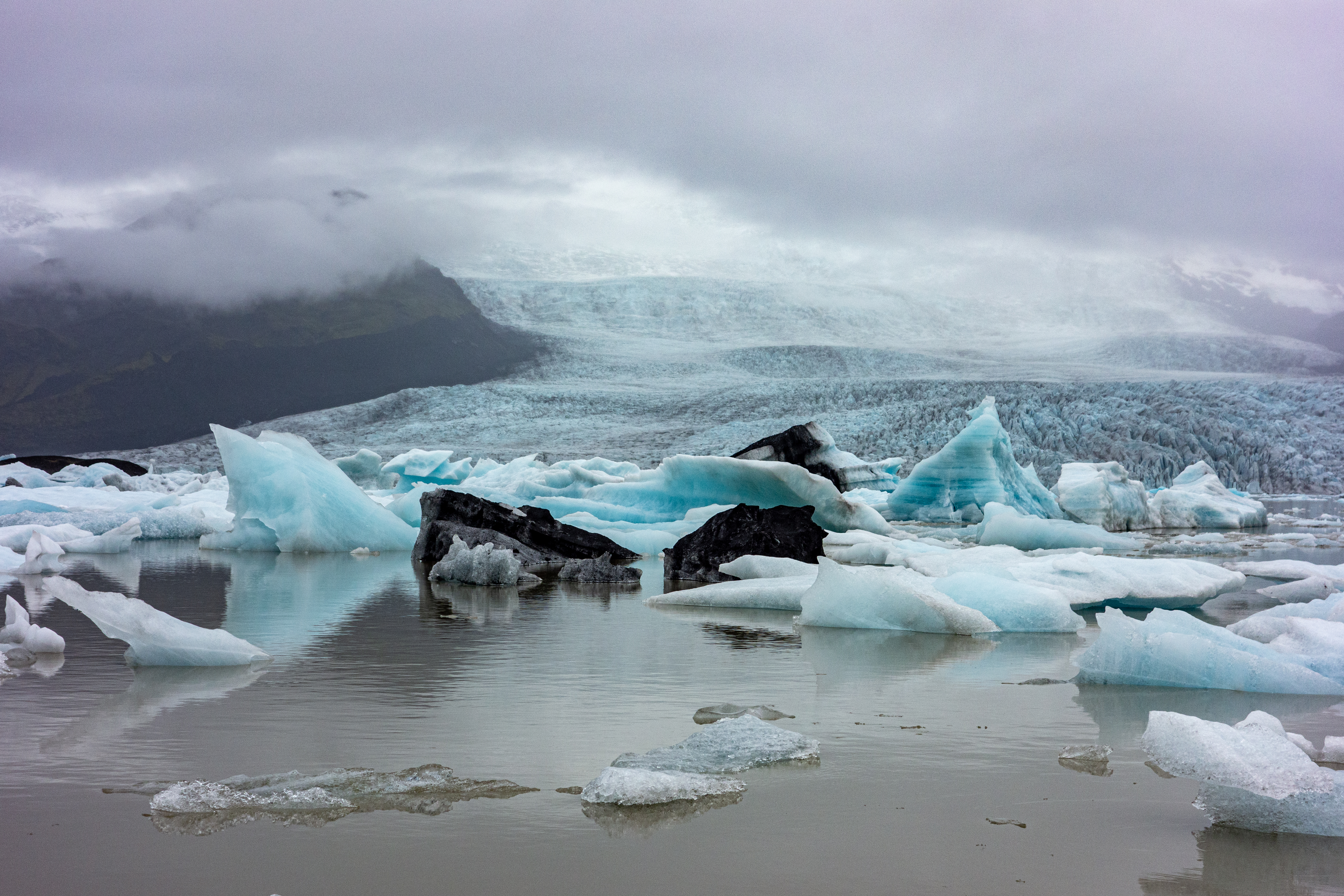
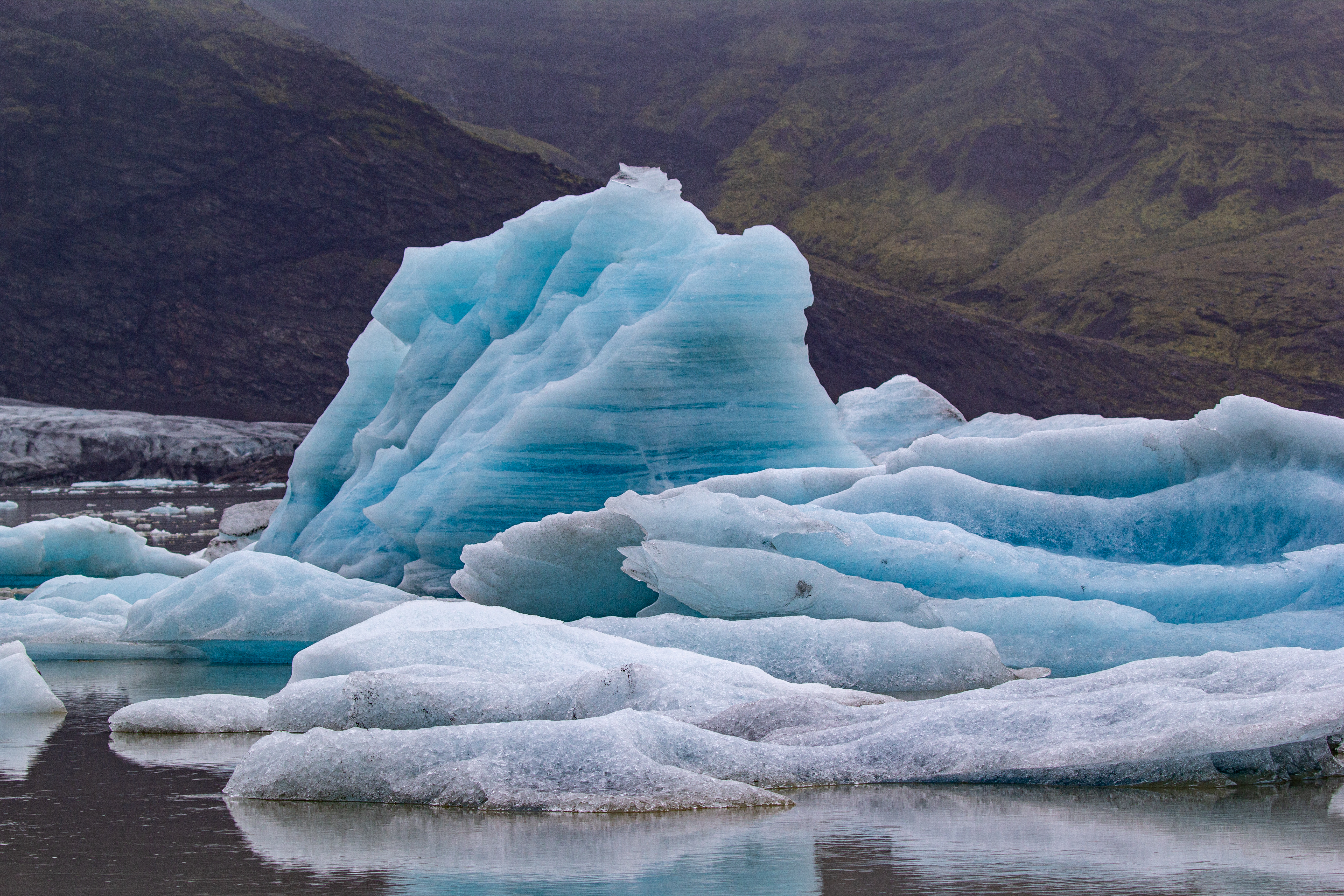
The sun was out for most of the walk from Svartifoss to the glacial lookout. The white on the glacier was super bright in the afternoon sun. We had sweeping views of the whole south and southeast coast, with glaciers all around. When we approached the lookout, there was a big reveal - a lake at the bottom of the glacier full of icebergs. Perhaps this was the reason for the counterclockwise route - to allow for the big surprise reveal. Some of this ice was black as well - presumably from ash from E16 (but maybe not).
 |
|
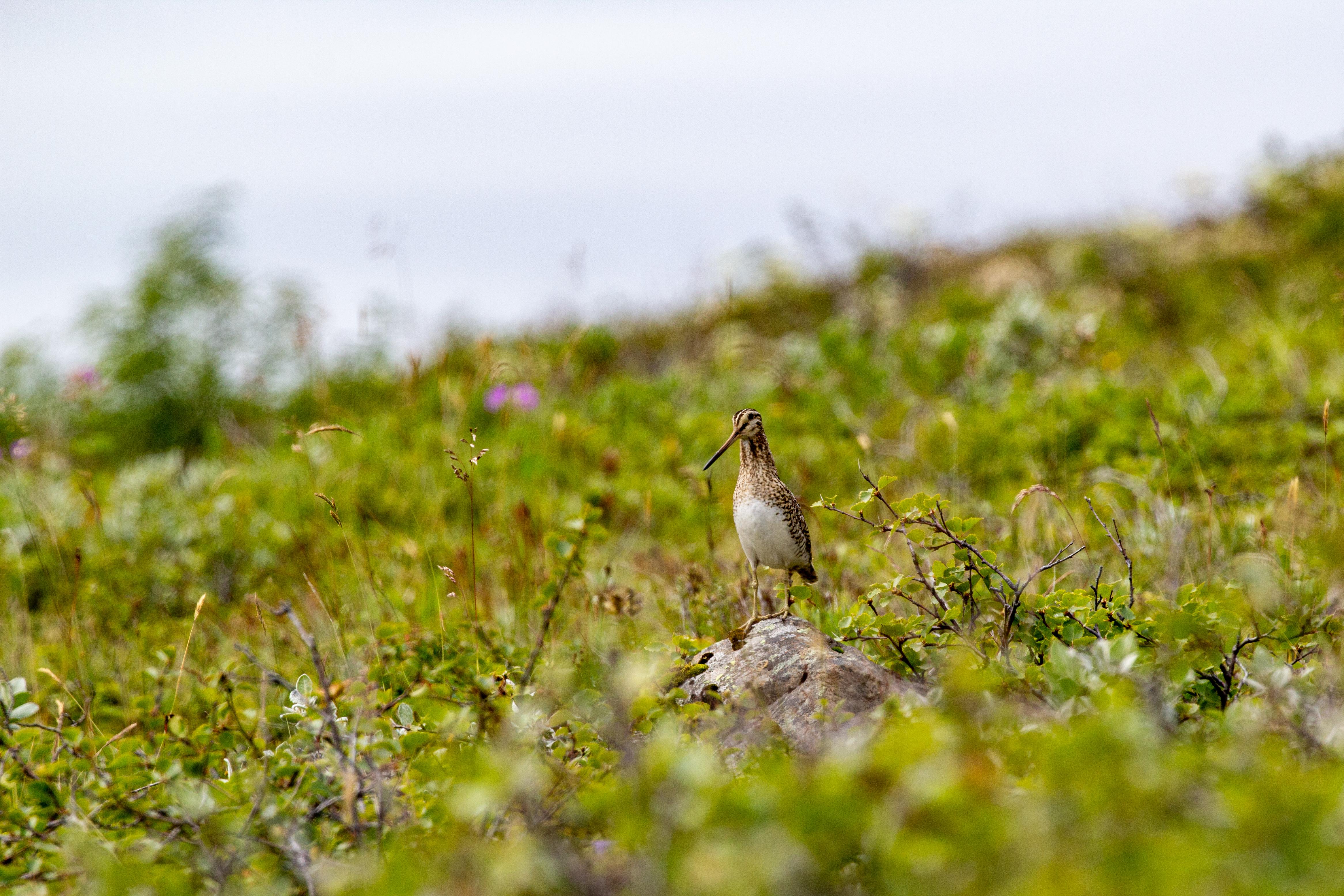
On the walk down, we took a picture of some random bird, since other people were trying to get a photo of it, and we thought it might be special. [It apparently was a common snipe, which at least based on its name, probably isn’t special.] The hike took a bit longer than expected, largely because of our wrong turn, but we were doing just fine on time. We refilled our water bottles at the visitor’s center - we were trying to be better about drinking water. We had large water bottles, but the last couple days we hadn’t even finished them, let alone refilled them.
 |
 |
 |
 |
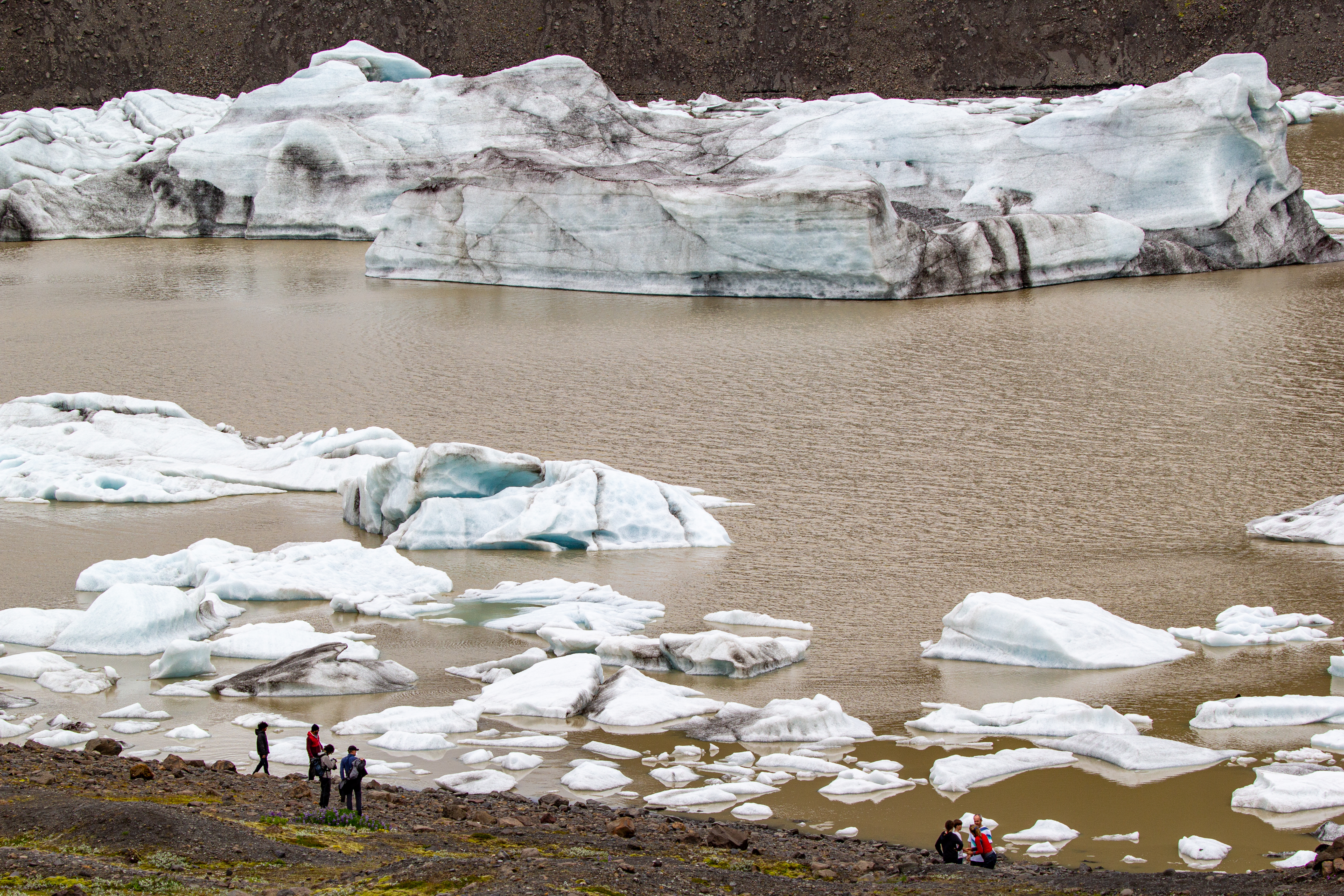
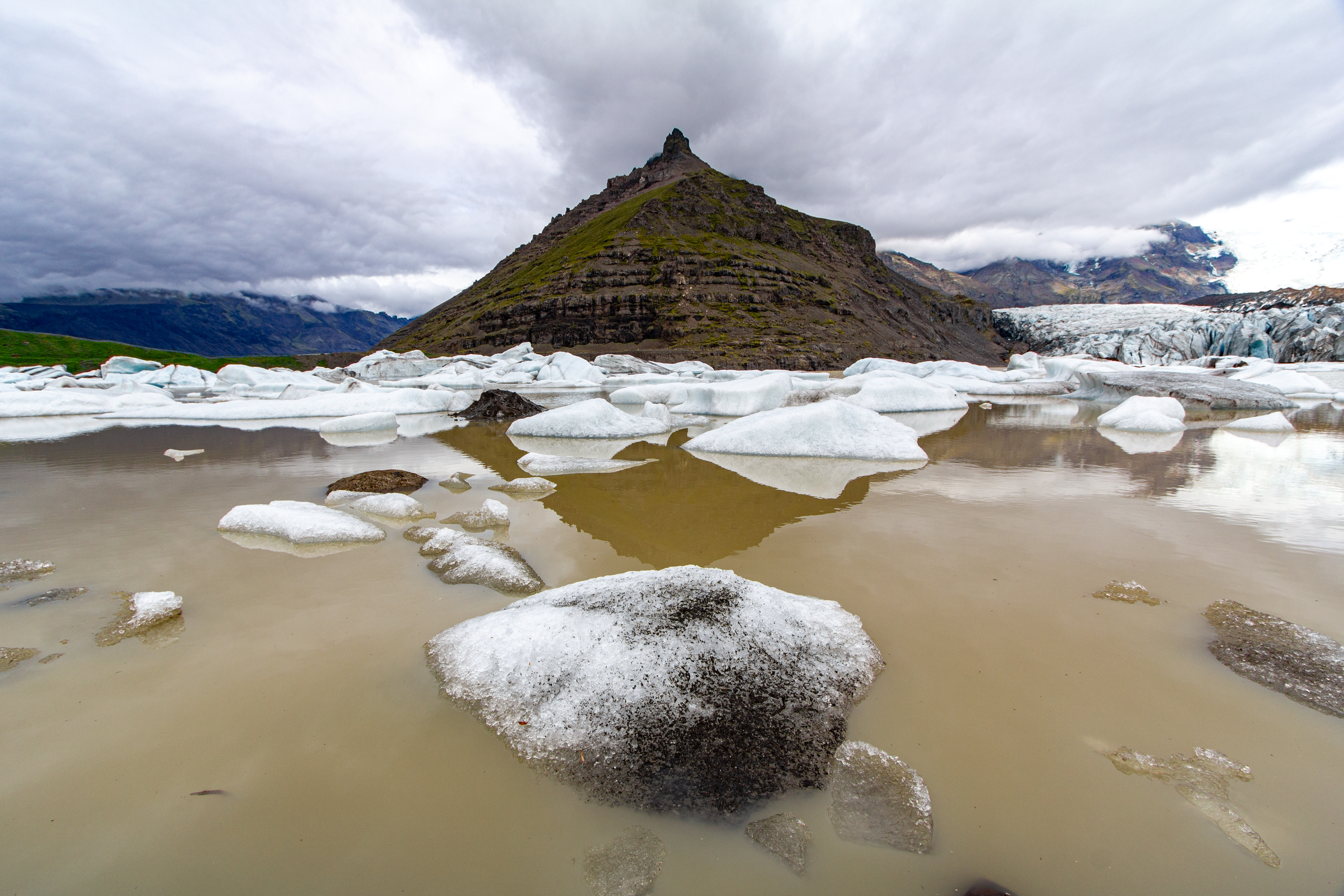
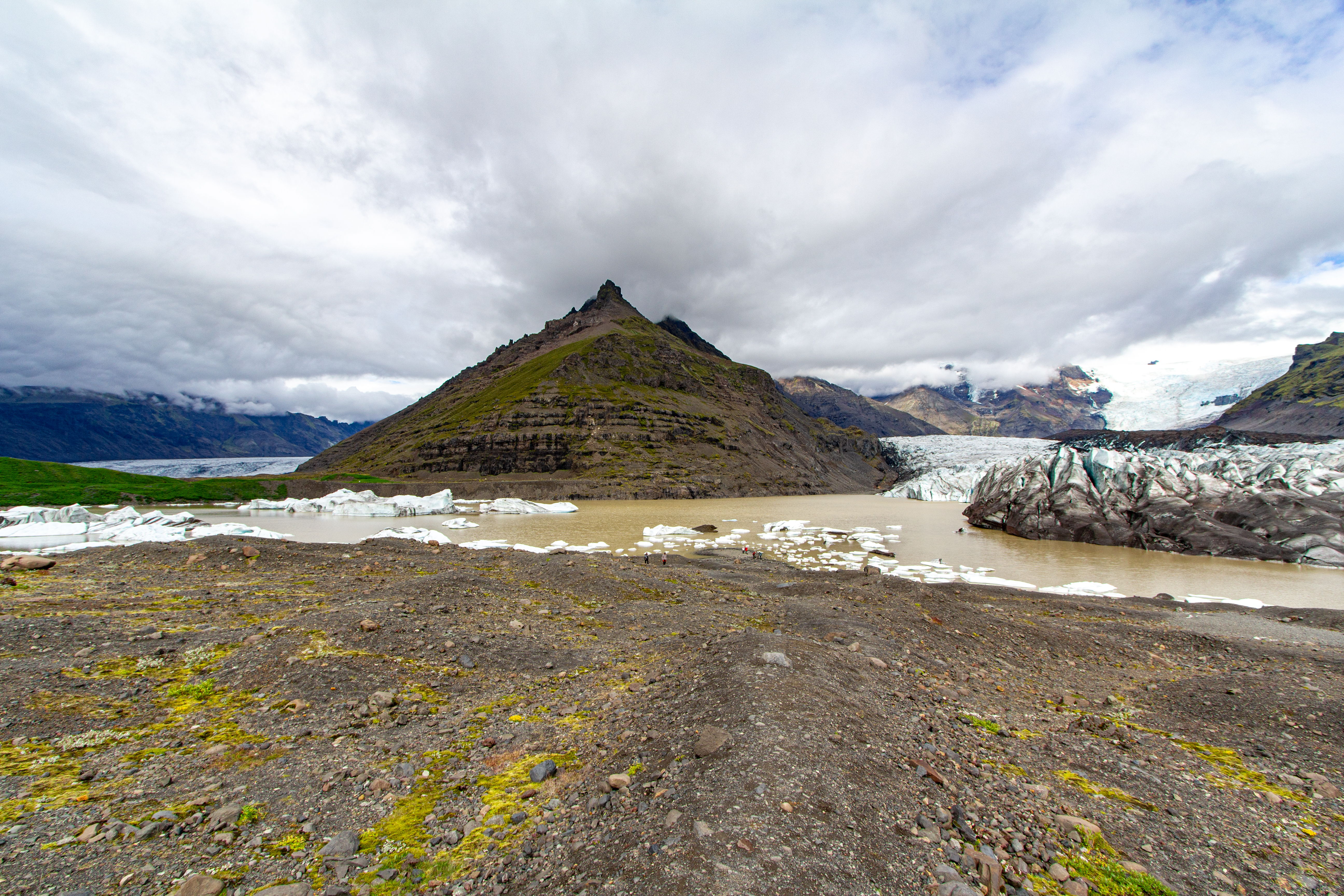
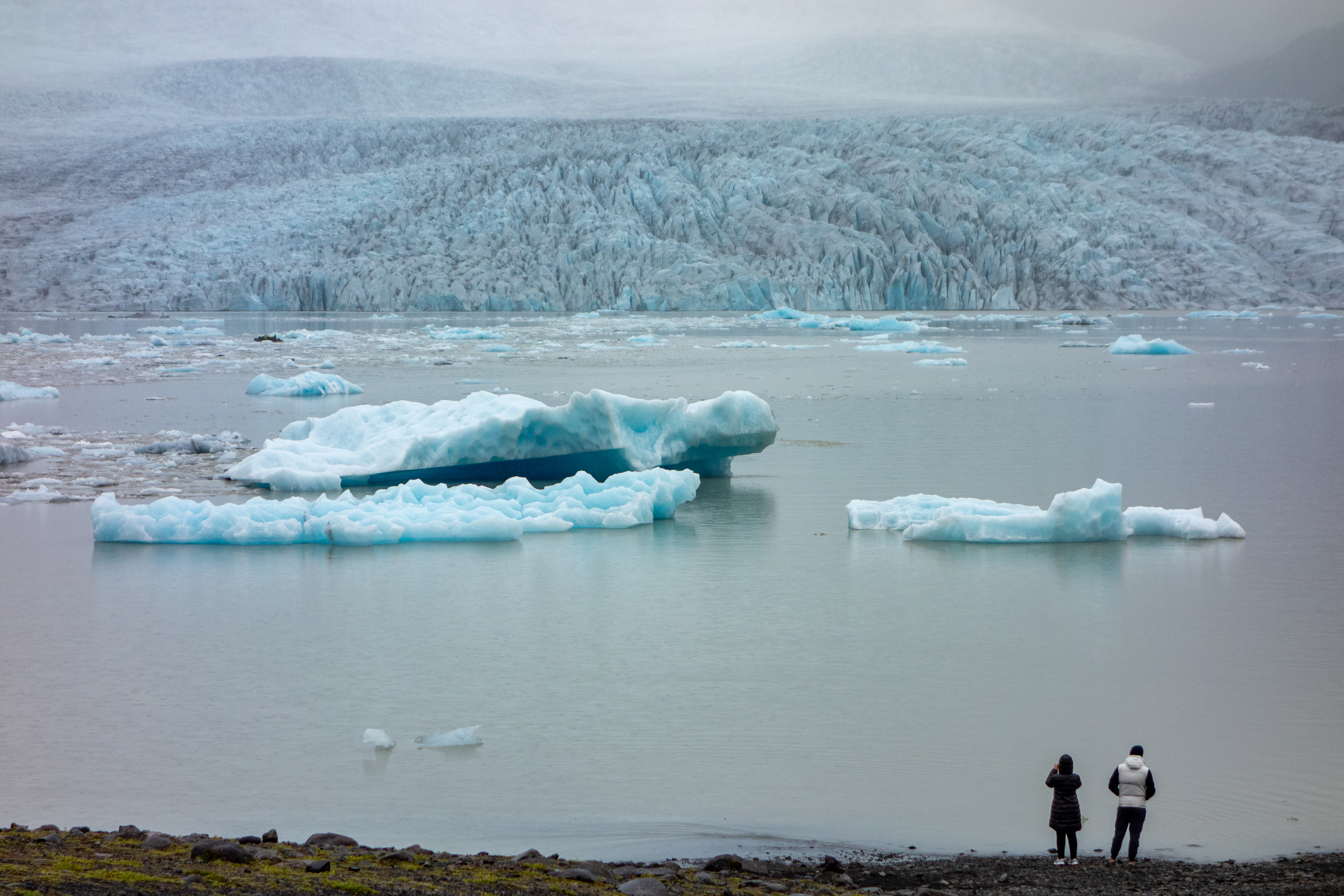
Our next stop was very close, another glacial lookout, but a different glacier, Svínafellsjökull. We wondered if it was the same glacier we’d just seen, but it seemed like a different one. [It was, although Svínafellsjökull was visible in the distance from our hike.] There are numerous glaciers off of the main ice cap in the southeast. A good number of people were at the iceberg lagoon in front of Svínafellsjökull, but it wasn’t packed or anything. This was another of the few places allowing drones, so sure enough, a couple were out. We discussed with each other whether there are any non-drone owners who like drones? It seems like no. We also wondered what percentage of drone pilots are male, 98% or 99%? Two separate glaciers were visible, with the one on the right (Svínafellsjökull) having icebergs in a lake right in front of us, and there was a pyramidal green mountain in between. Some of the icebergs were quite large, bigger than a car.
 |
 |
 |
 |
 |
 |
From there we continued heading east, driving out of the “sun” (at least relatively speaking) into a dark and dreary misty land. We drove past Mulagljufur Canyon, which we were going to hike if we’d had inclement weather at Fjaðrárgljúfur this morning. Whenever we come back, we’d like to do this hike, as it looks pretty similar, and arguably better, but a little more demanding. We stopped at Fjallsárlón. This was another iceberg lagoon, and supposedly a smaller version of what we were going to see at the next stop. If this was the small version, we wondered what the big one would look like. The ice seemed more blue than at the prior stop, but perhaps that could’ve been because there was less light out. We didn’t spend a ton of time, not only because of the cruddy weather, but also because we couldn’t be late to our Zodiac tour. We’d been keeping an eye on the clock all day, and we were doing fine, but we didn’t want to screw anything up at the last minute.
 |
 |
 |
 |
 |
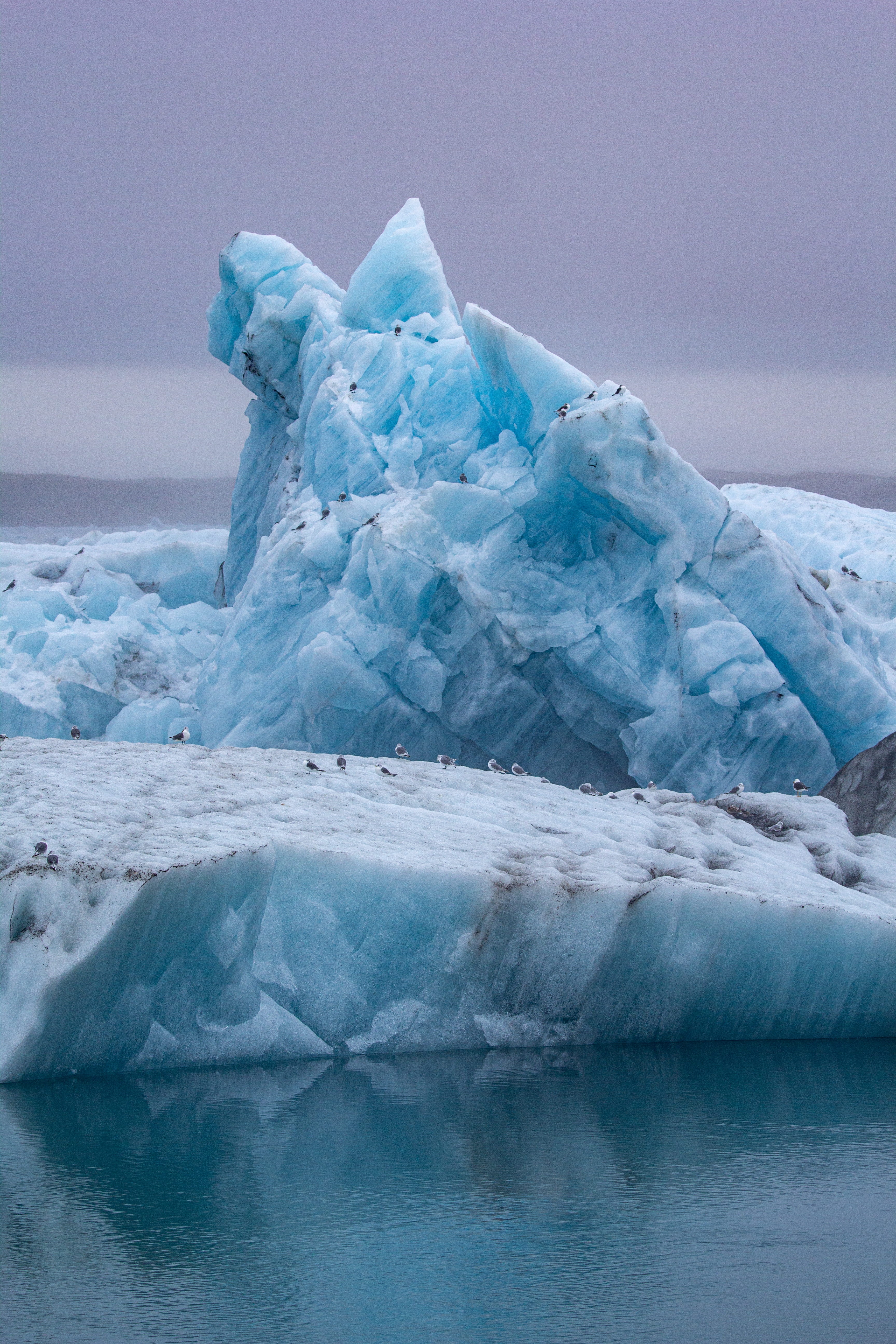 |
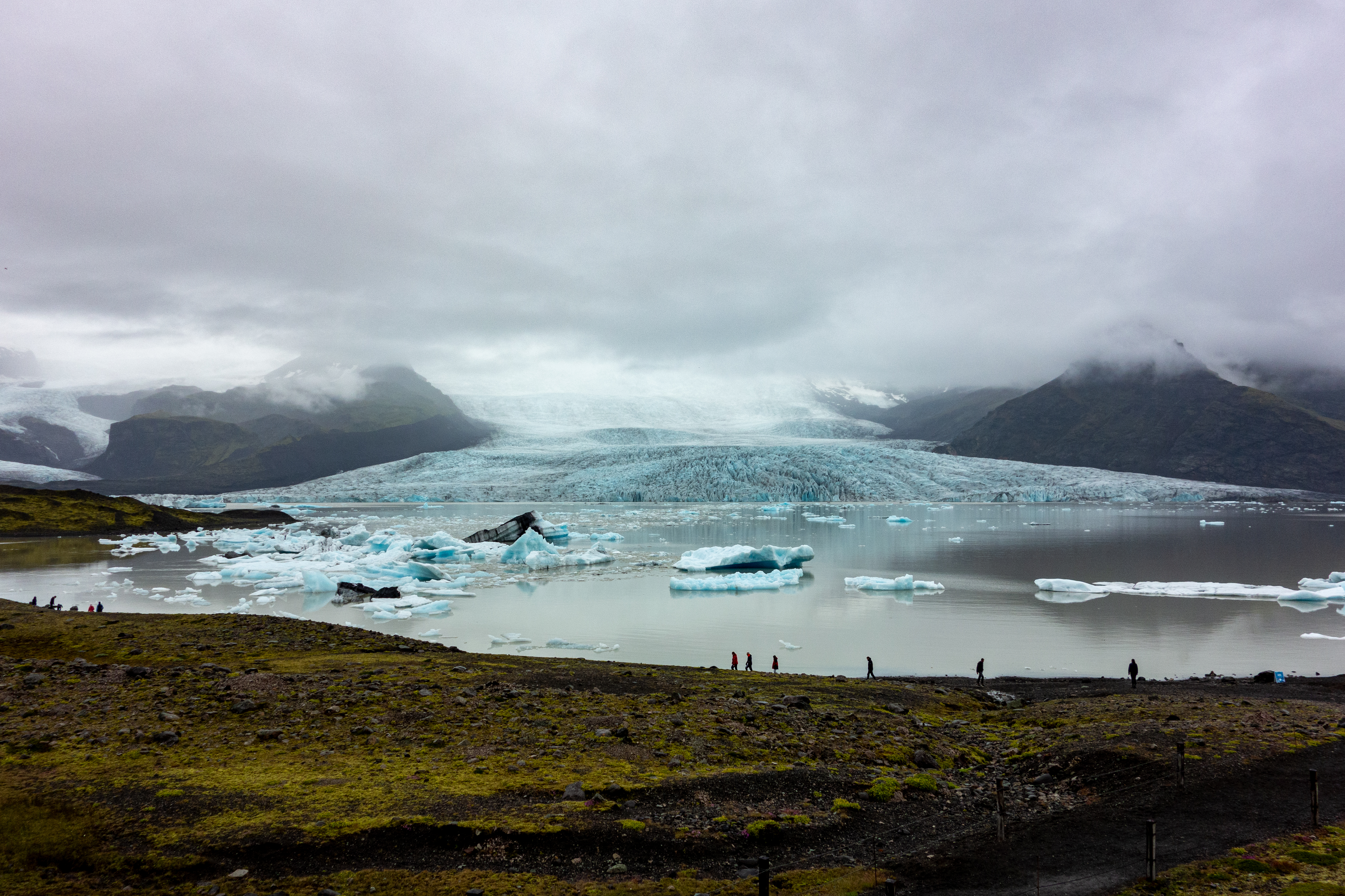
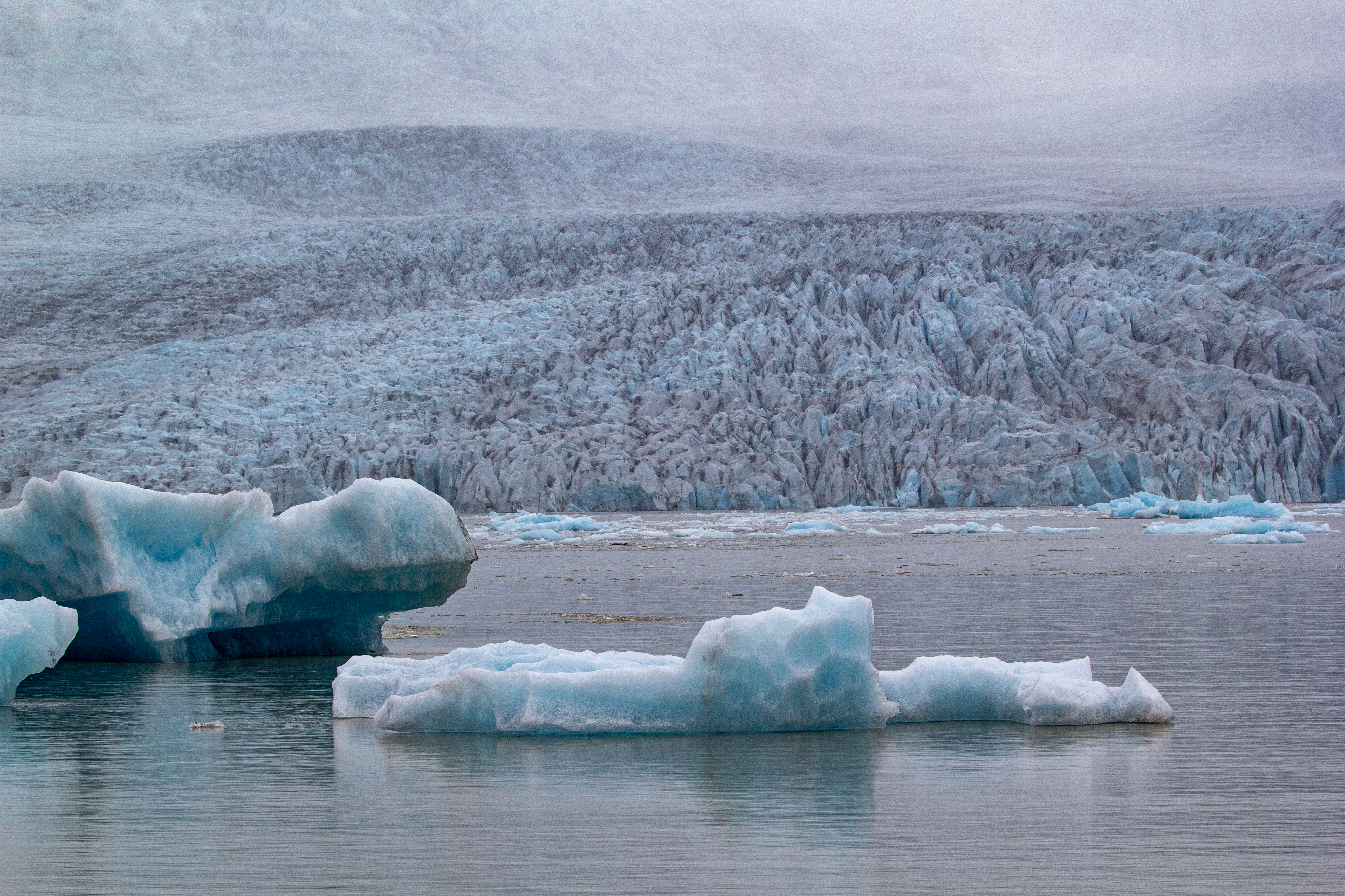
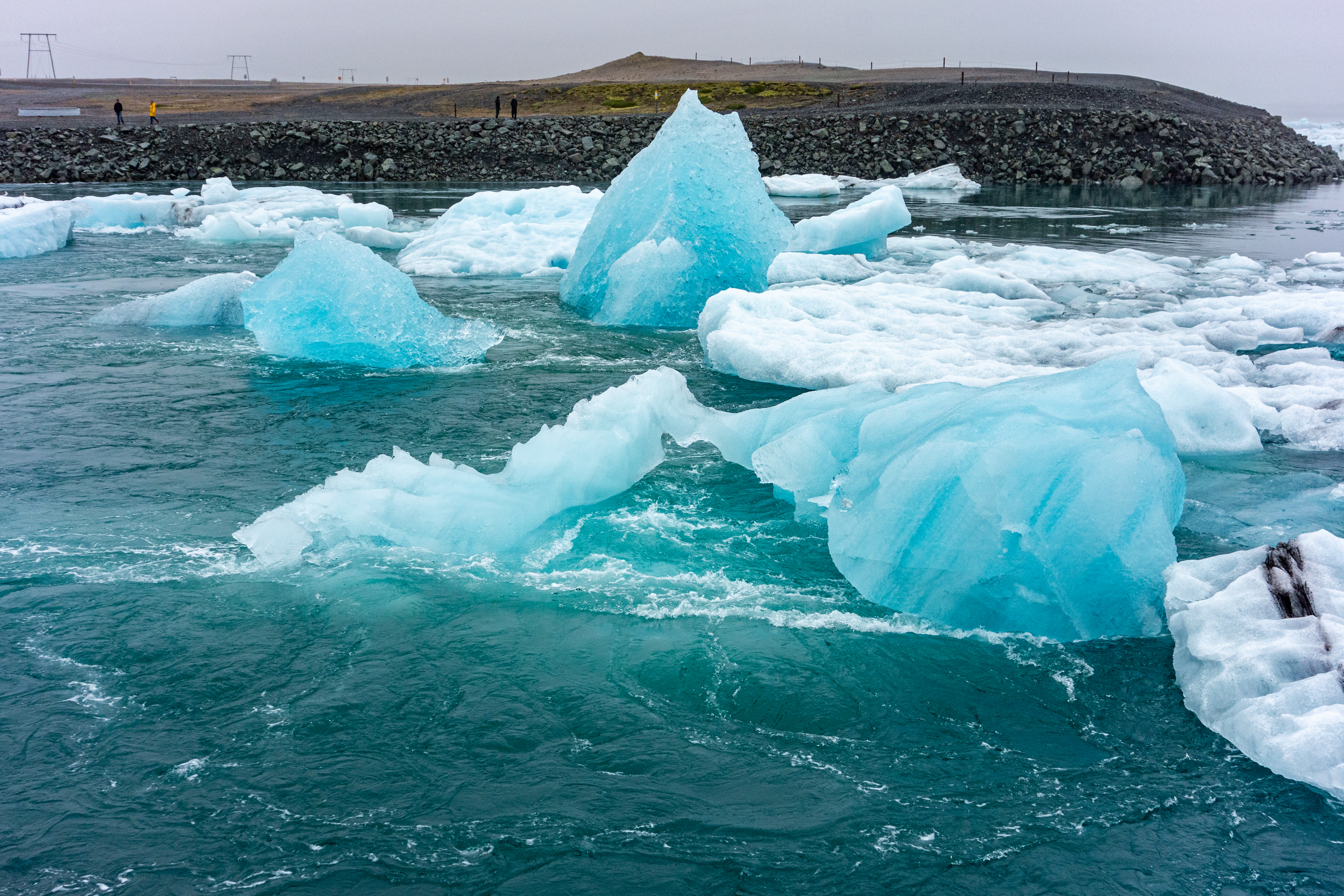
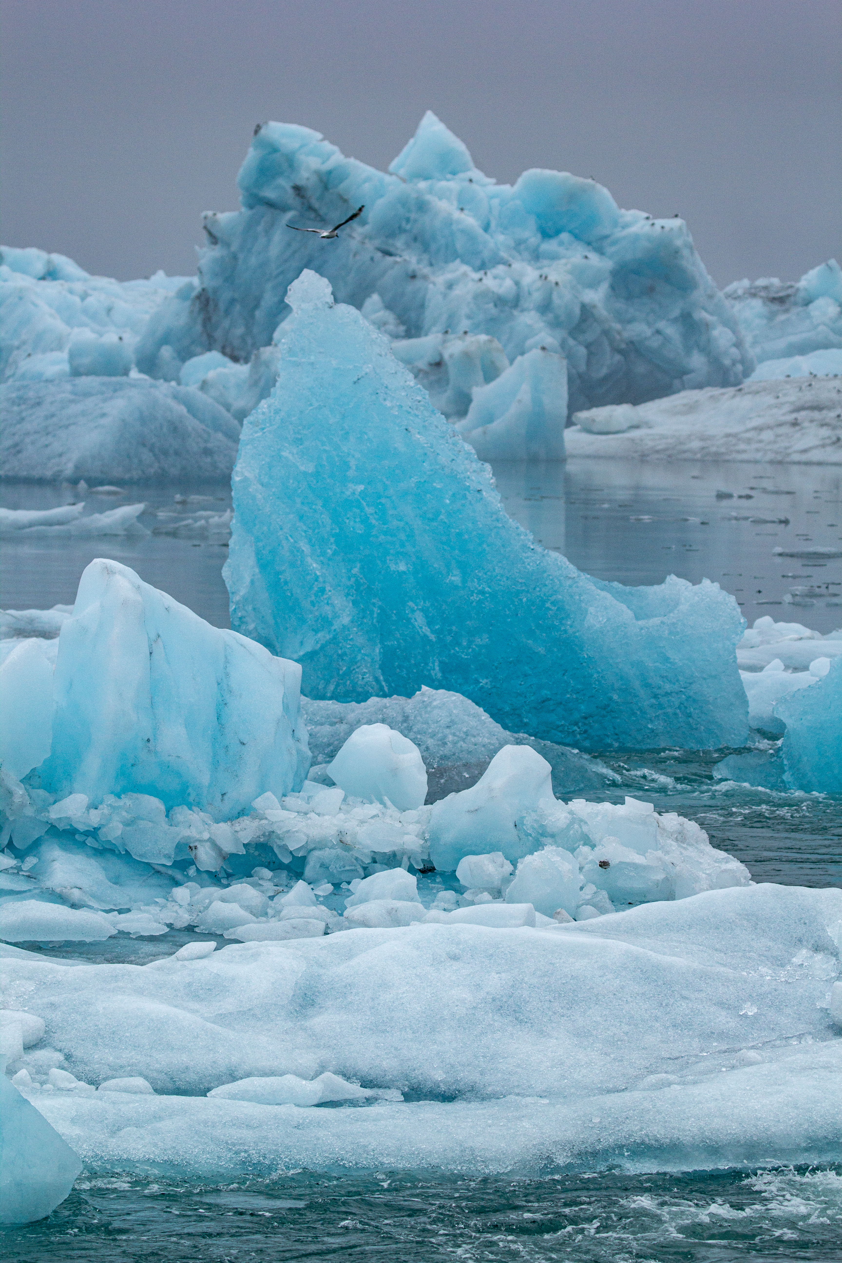
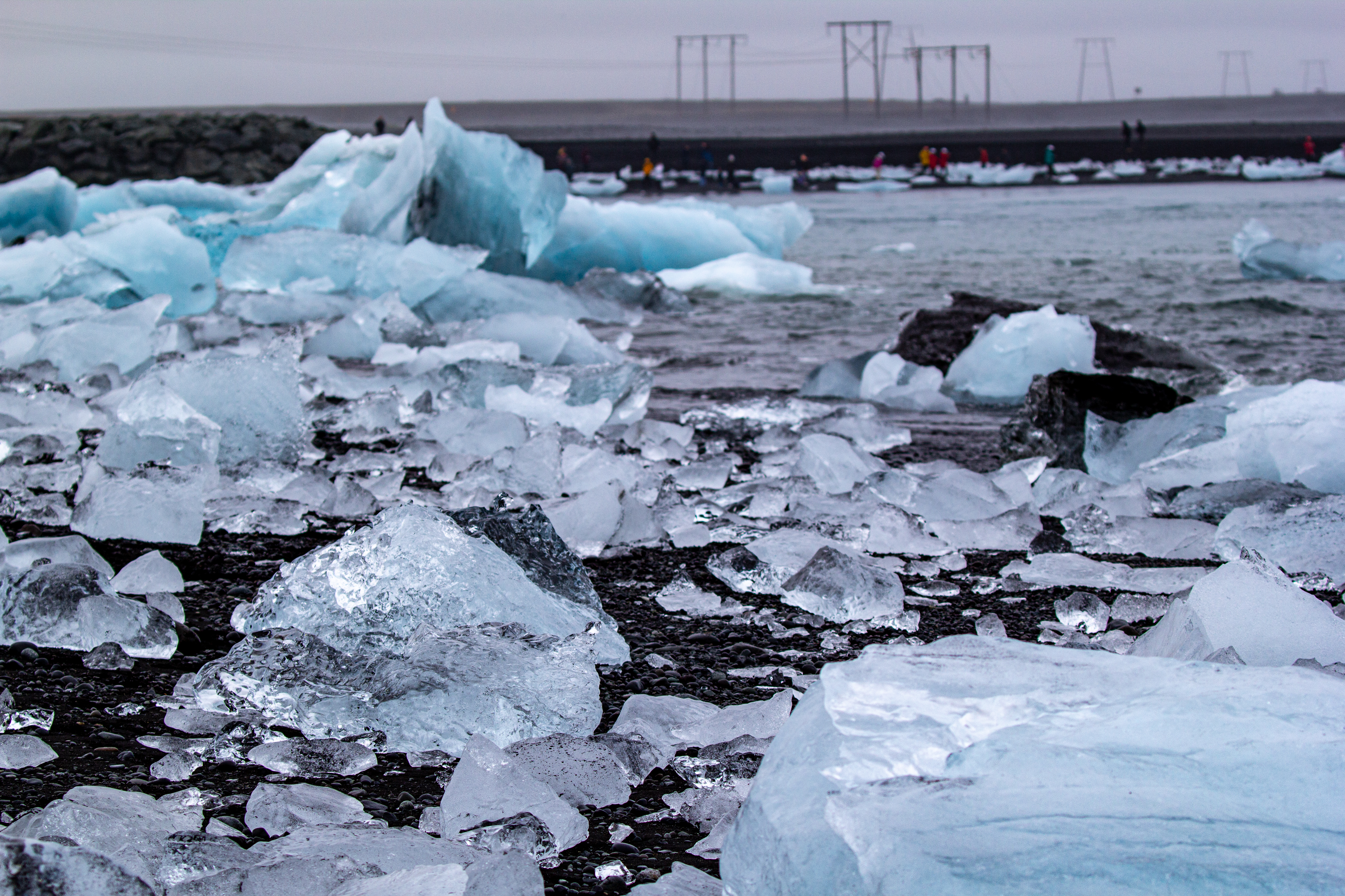
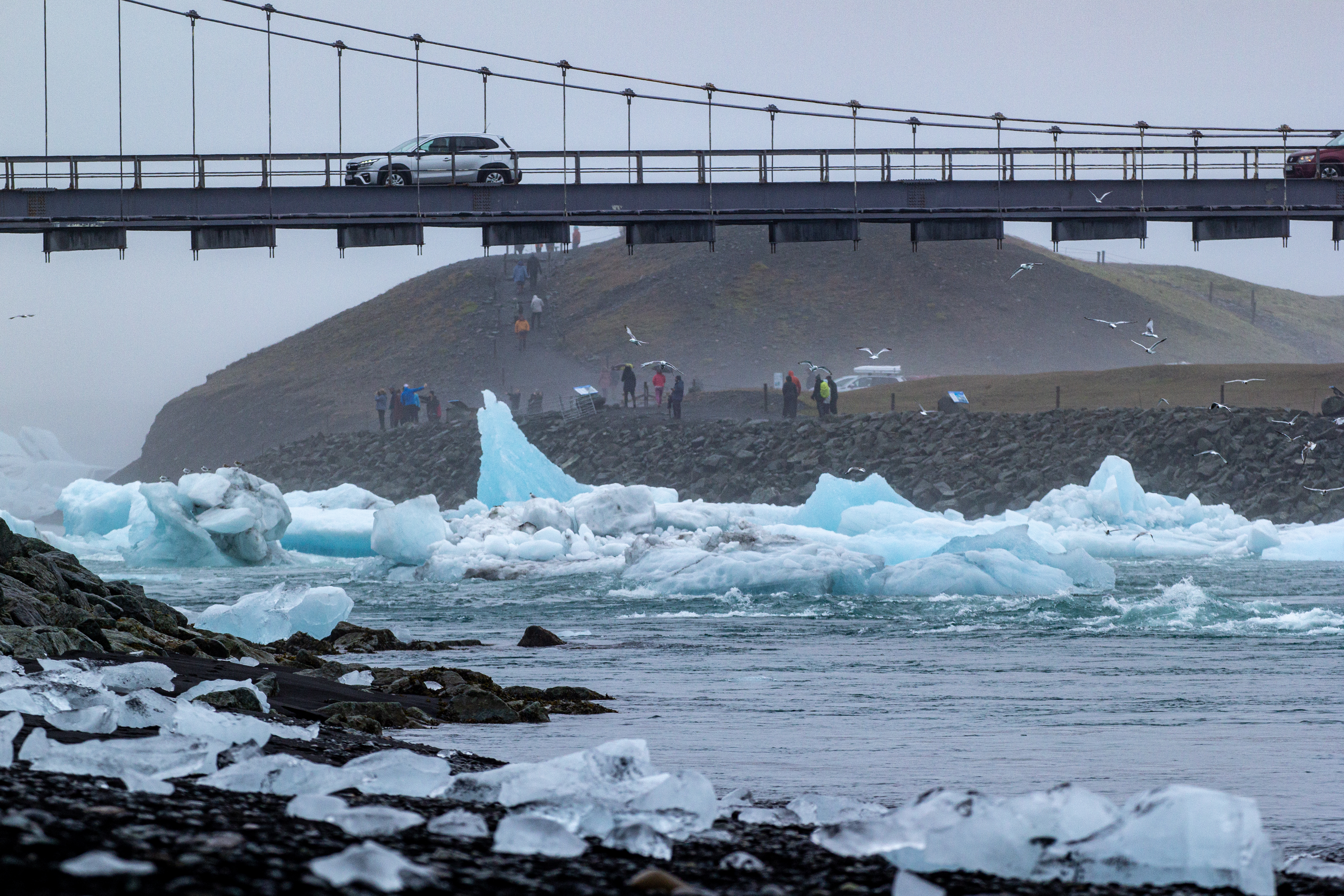
Fortunately it was just a short 10 minute drive east to Jökulsárlón. We crossed over the famous bridge where icebergs float below out a narrow channel to the ocean, and there was ice everywhere. We had about 30 minutes before our check-in, so we walked around a bit, and then Crystal went back in the car to get out of the cold misty weather. It was either a light rain or a heavy mist, and it was about 10 degrees. The lagoon was absolutely full of ice, and there were birds (seemingly nesting birds) on some of the larger icebergs.
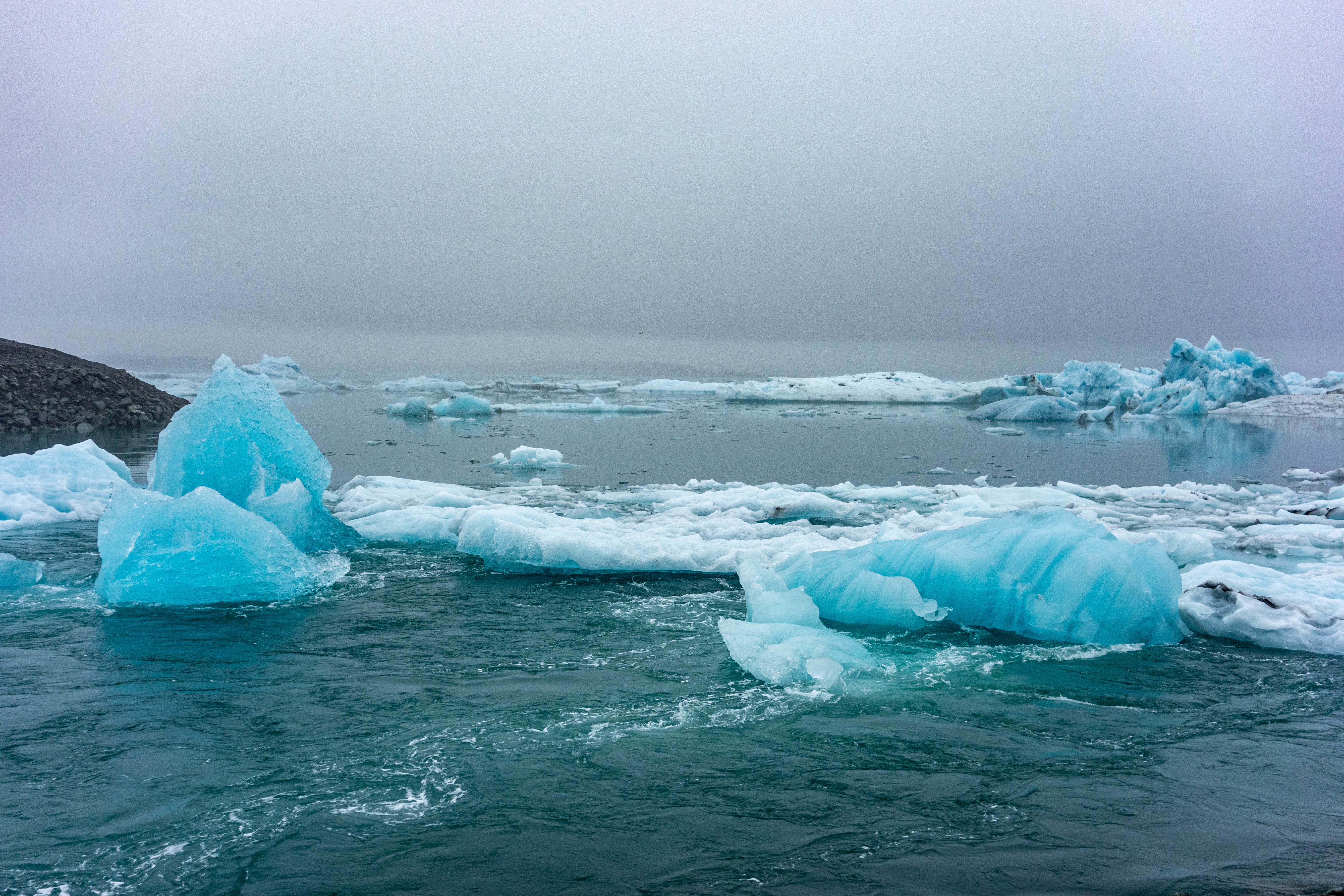 |
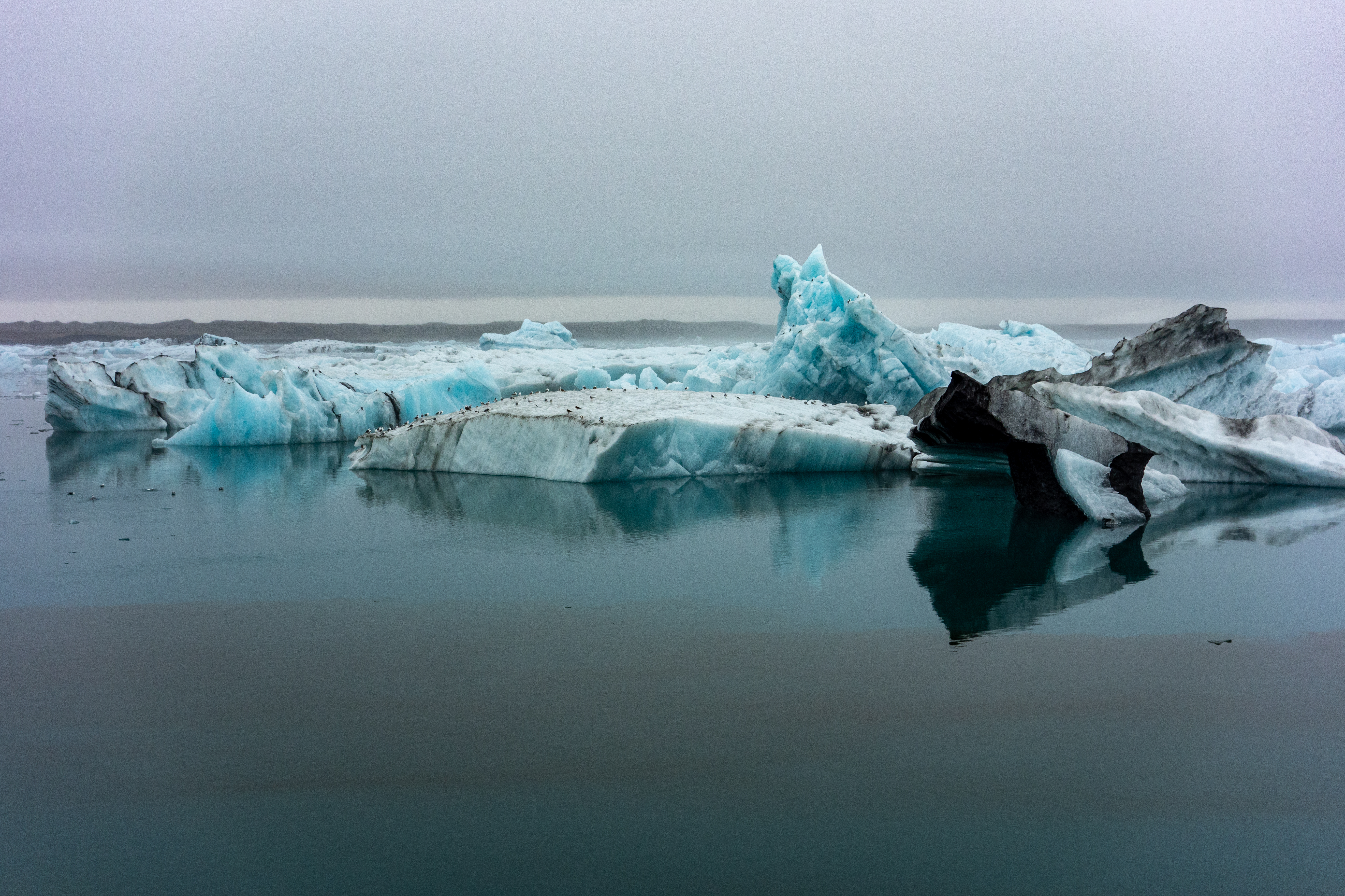 |
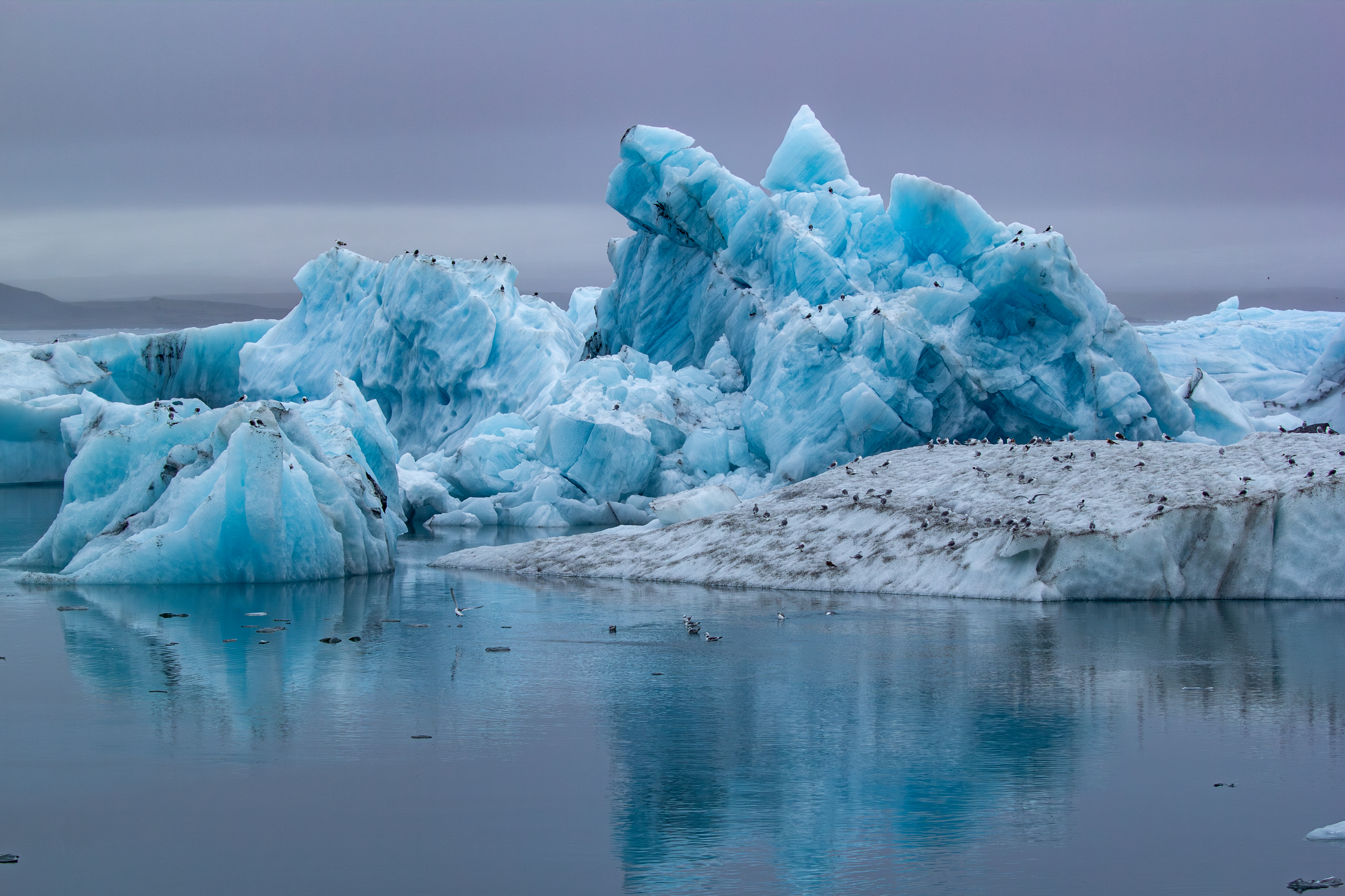 |
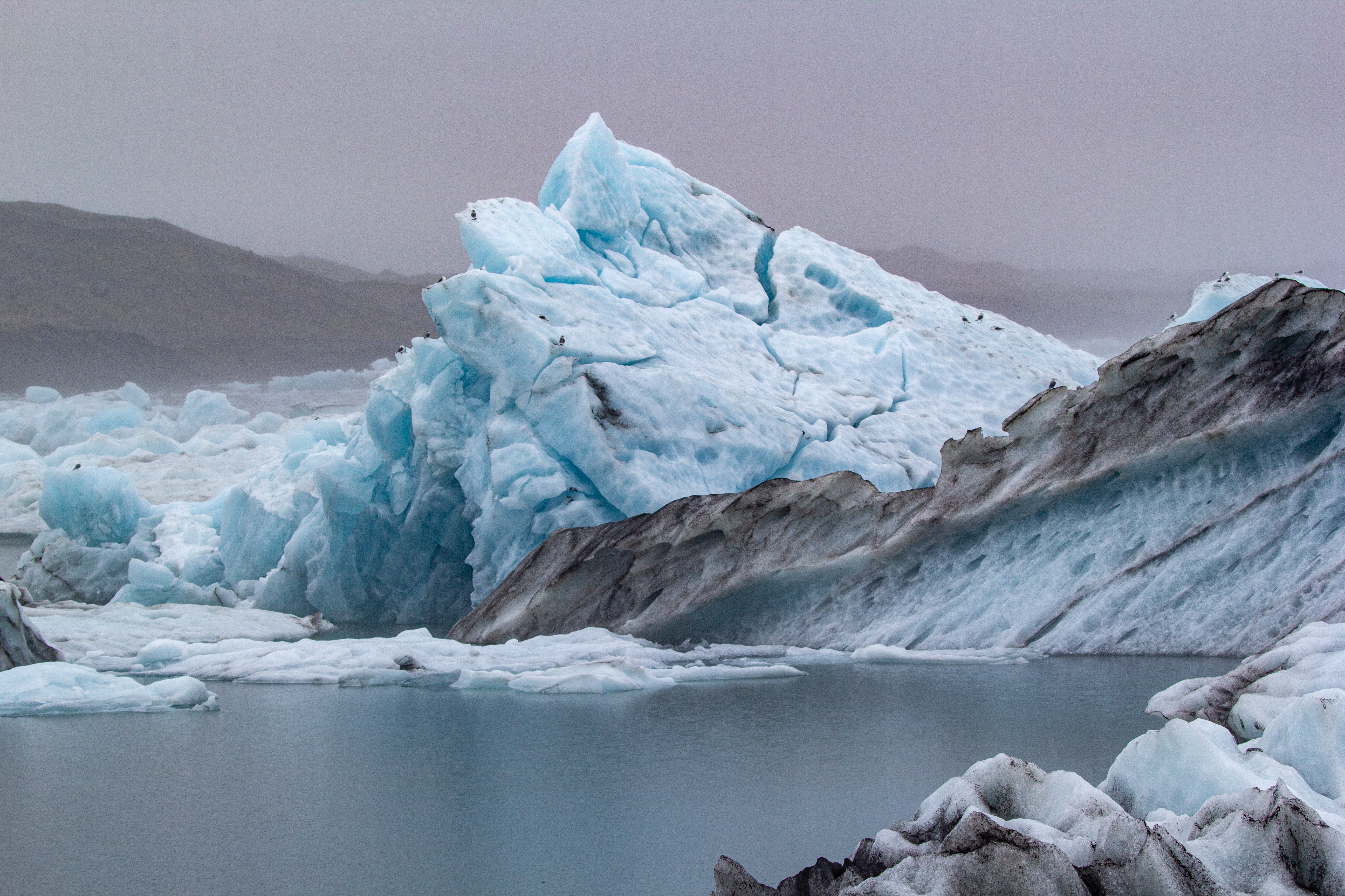 |
The weather was awful (granted, it could’ve been worse), and we wondered how cold we’d be on our Zodiac tour. We wondered whether we should put a second waterproof layer over the clothes we were already wearing. It turns out we didn’t need to worry about this - our tour was canceled, as there was too much ice in the lagoon for the boats to get around. We weren’t bummed out at all. The only bummer was that because of the fog/mist, we couldn’t get an idea of how big the lagoon was.
 |
 |
 |
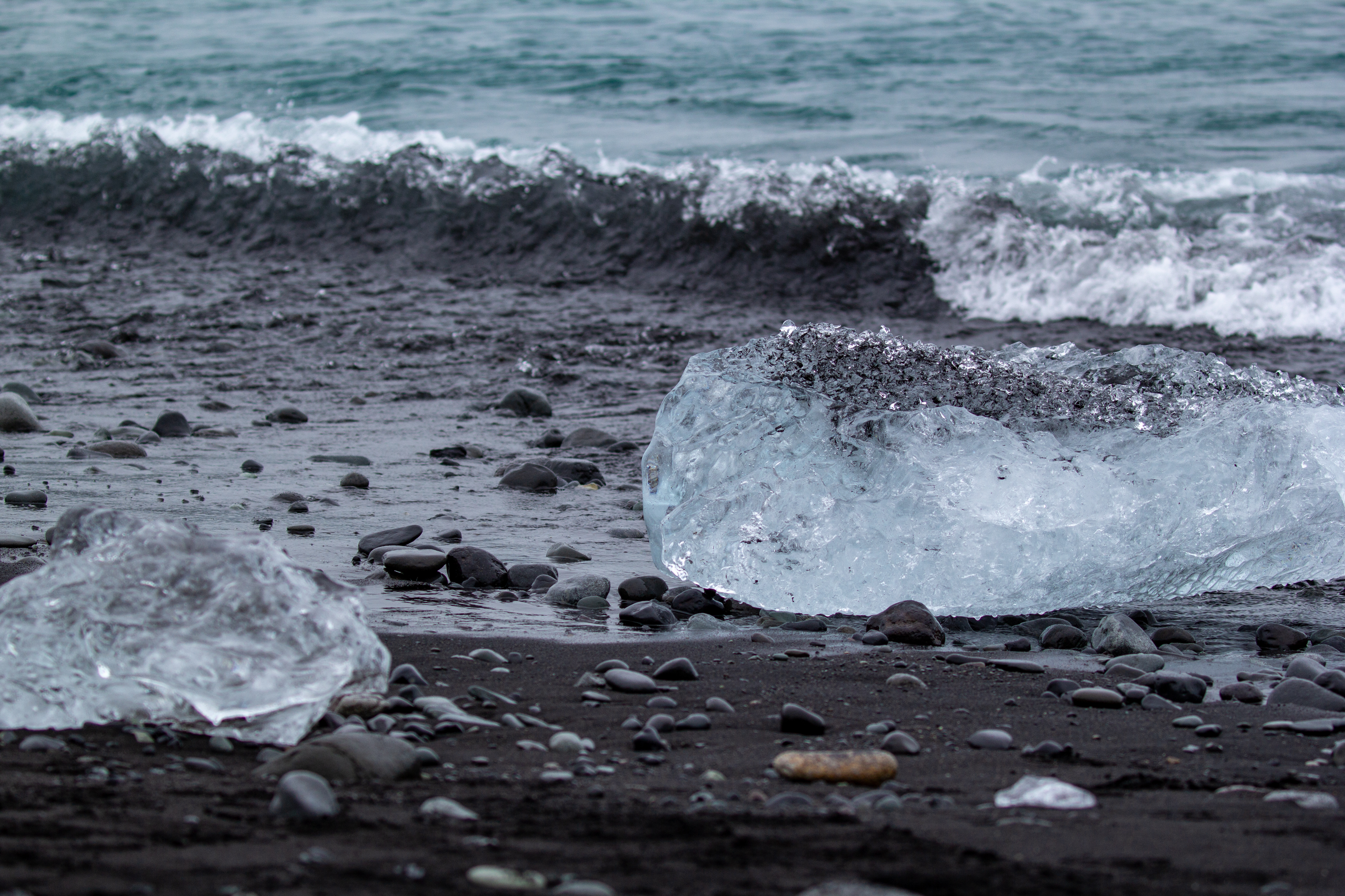 |
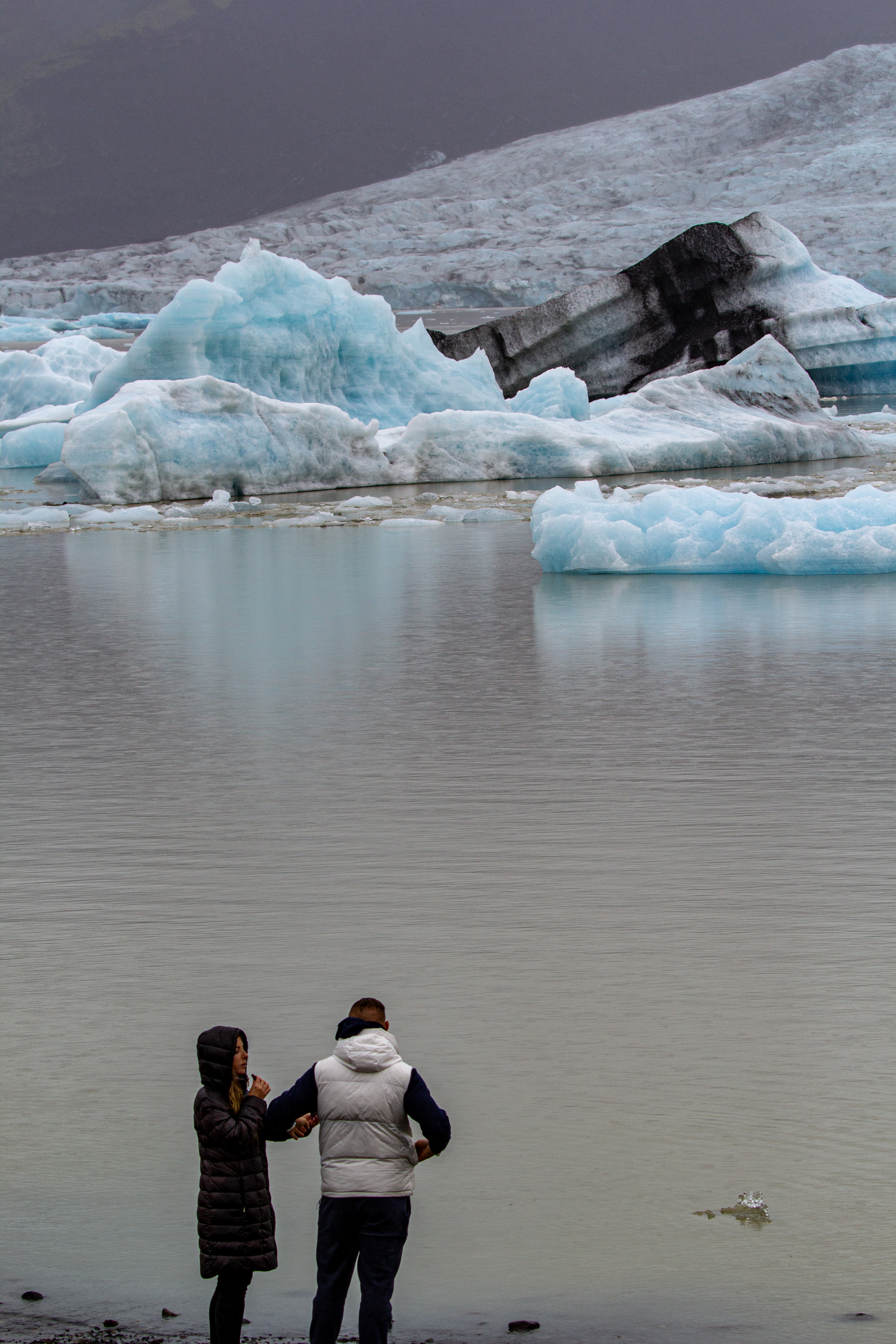
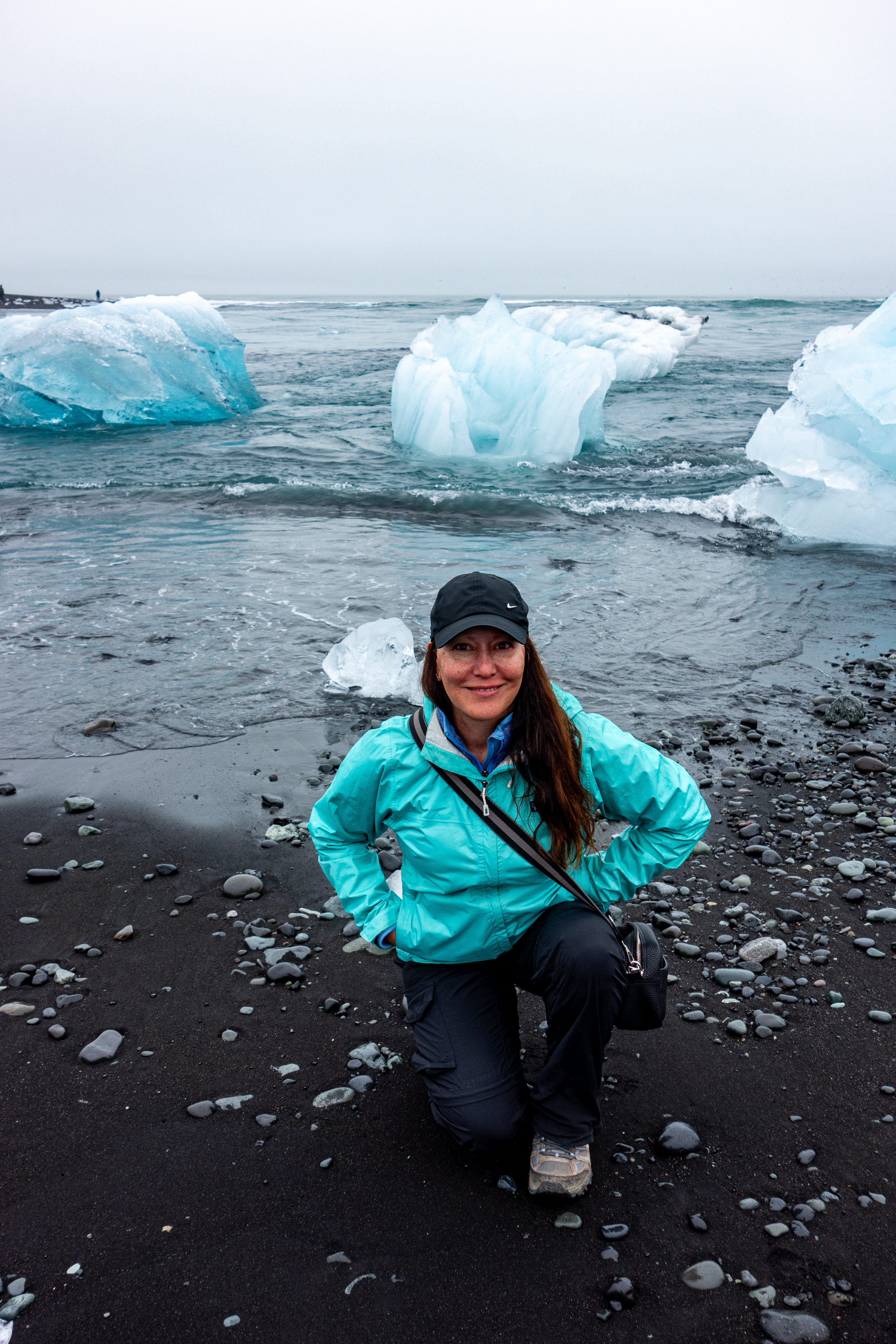
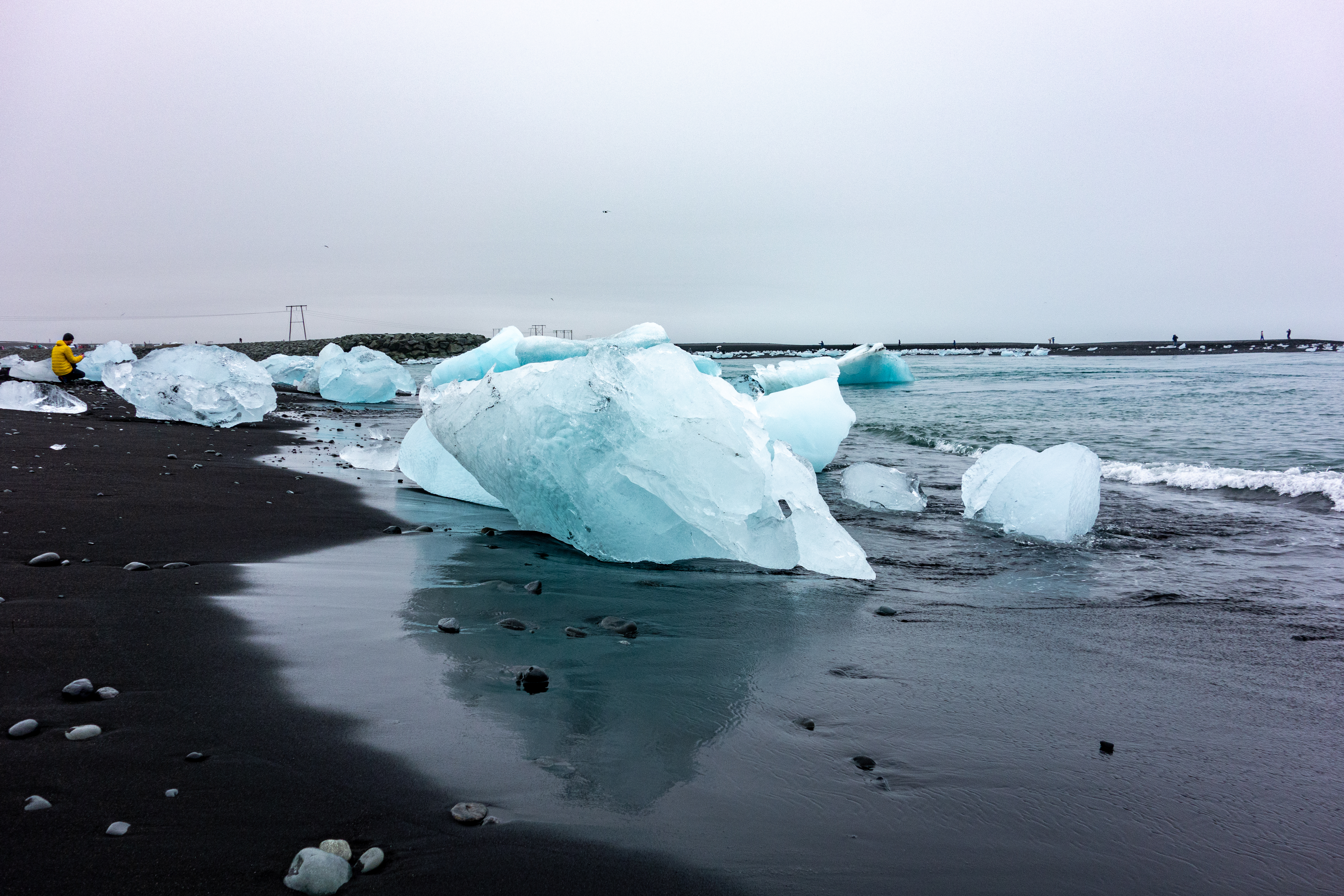
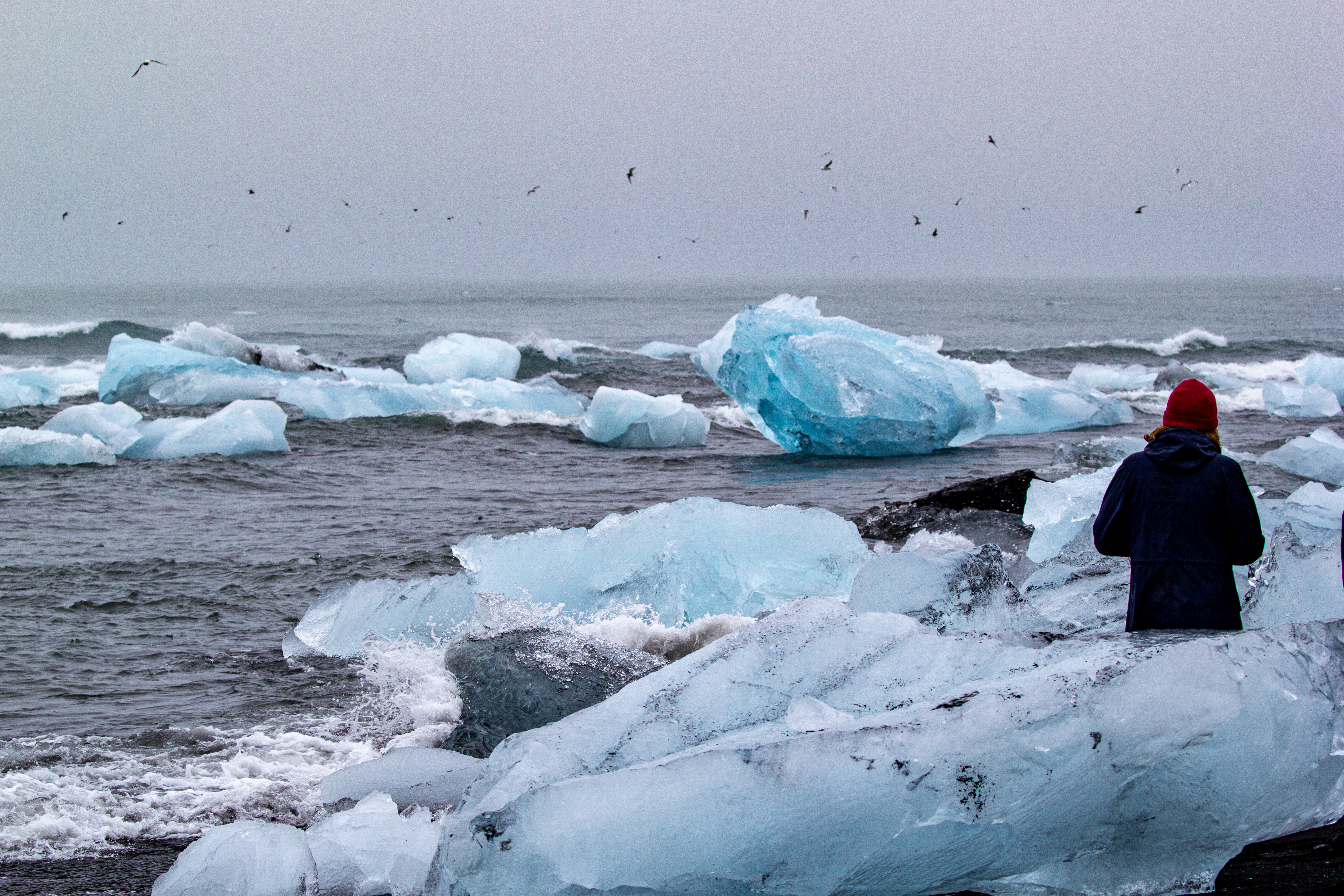
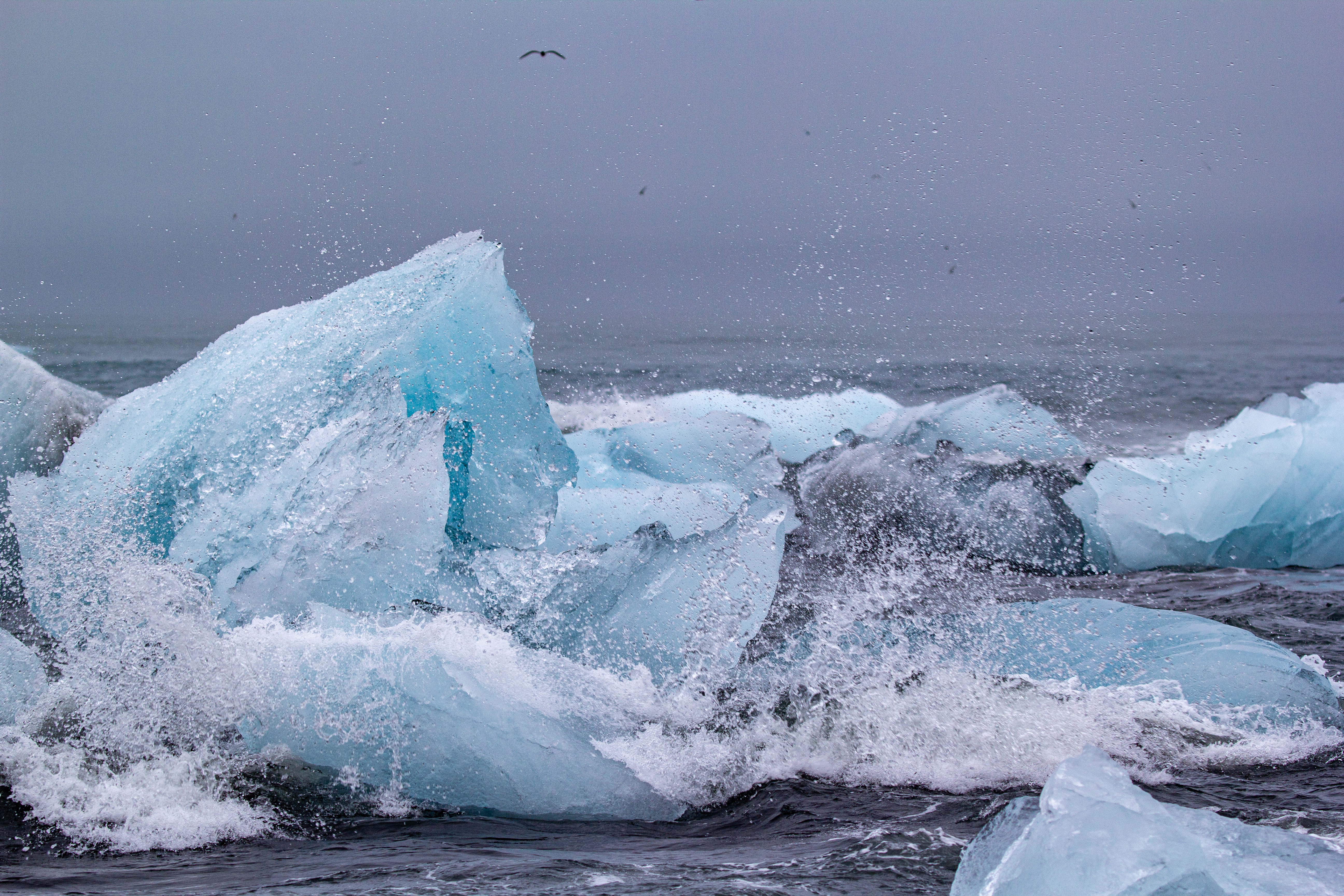
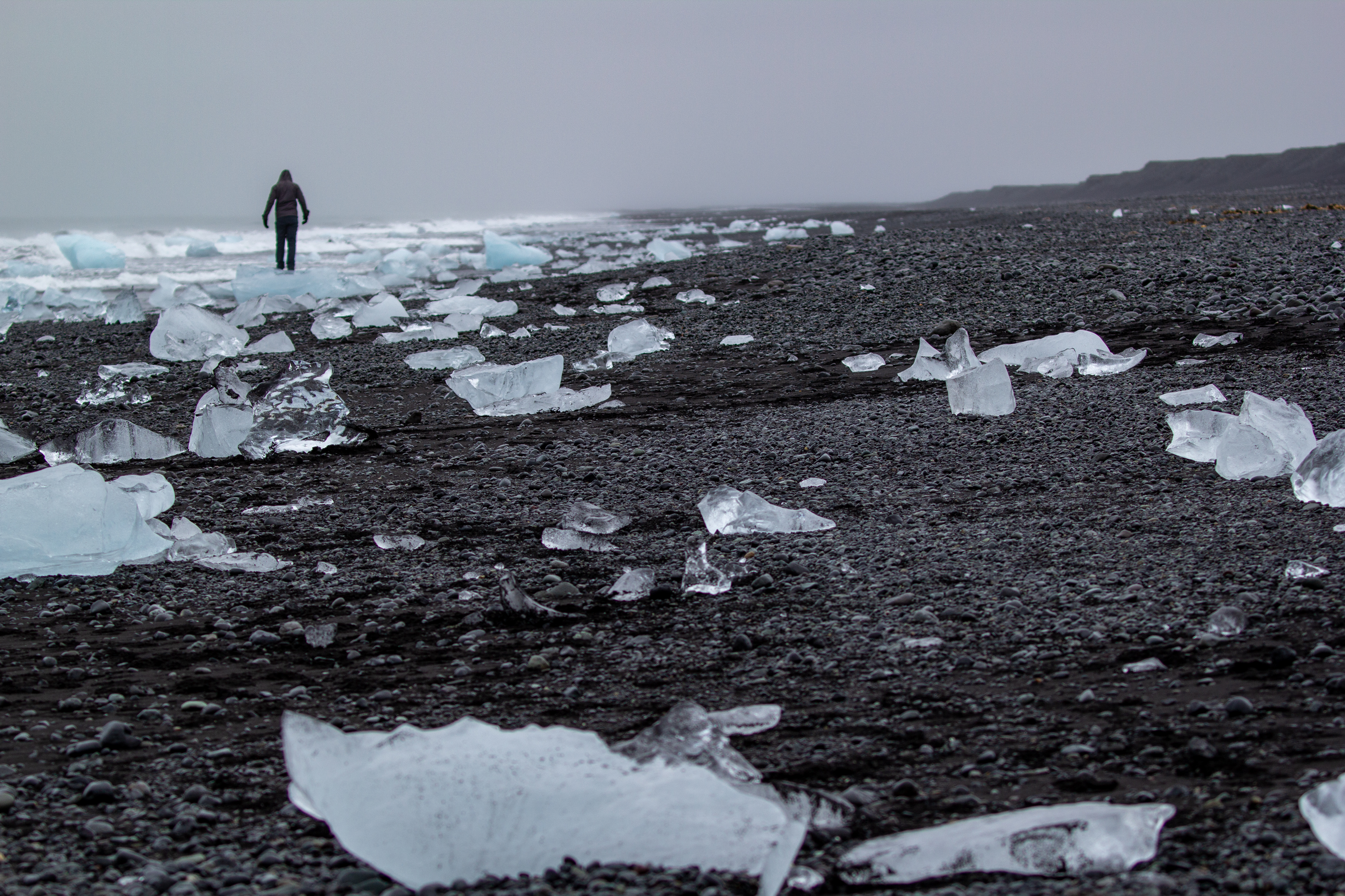
We used the newfound extra time to head back across the bridge and hang out at Diamond Beach. While Diamond Beach is shown on Google Maps as being on the east side of the channel, today the overwhelming majority of the icebergs were on the west side. The reason for all the icebergs on the beach is that they leave the lagoon and head out to sea, but the waves immediately push them back on shore, and on shore they slowly melt into smaller pieces of ice before they completely disappear.
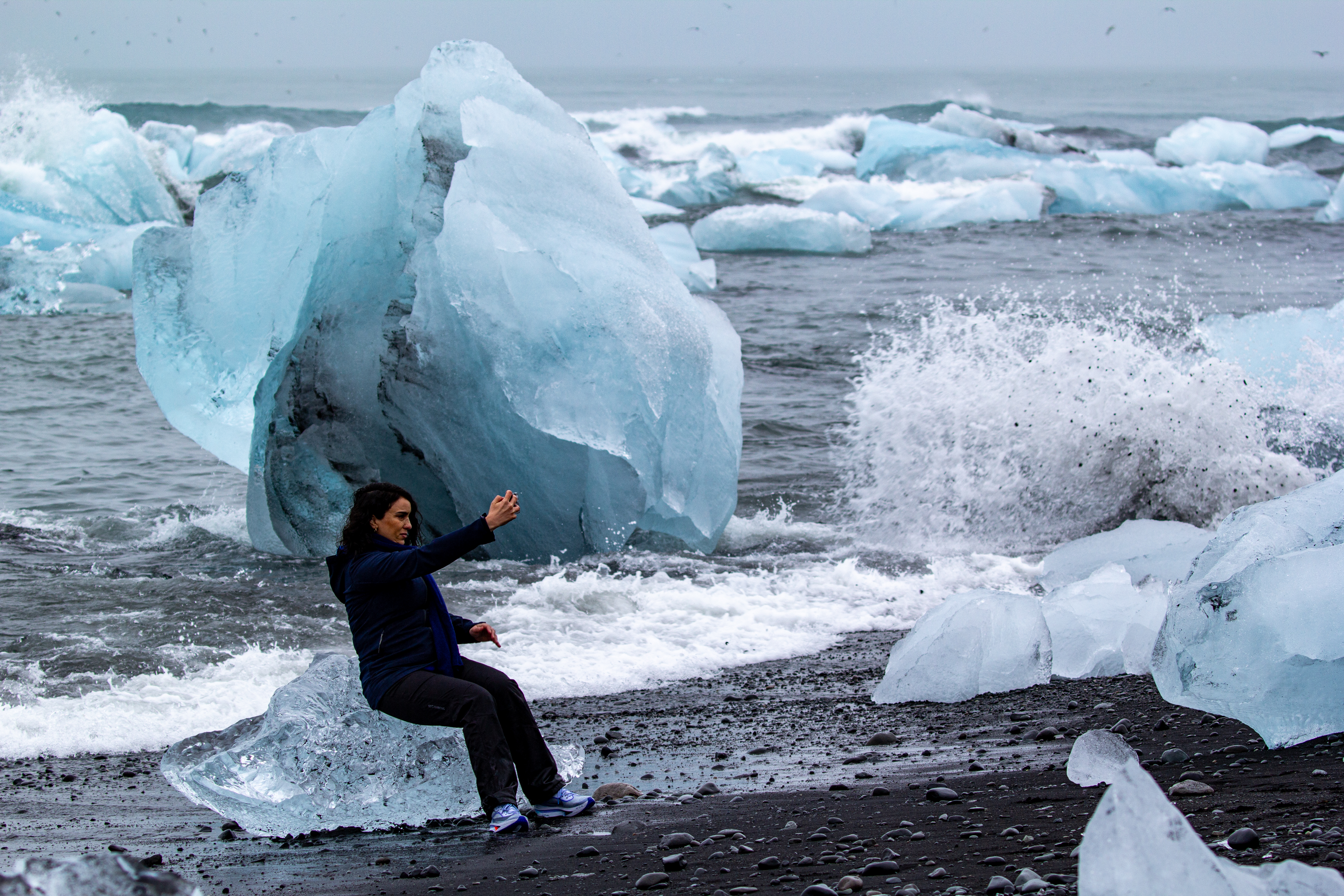
Because of how full the lagoon was with ice, it occurred to us that perhaps Diamond Beach was much more full than usual as well - so I guess this was the Yang to the Yin of us missing our tour. While perhaps a sunny, blue skies day would’ve made for better pictures, we tend to think the ice looks more ice-y in bad weather. It’s a bit like our favorite polar bear photos from Churchill being from the brief time it was snowing. While at Diamond Beach we almost saw the poster child for our soon-to-be Instagram hit account, “Influencers Gone Mild.” A woman was taking a selfie on an iceberg with her back to the icy ocean - we were hoping for a sneaker wave. [We’re bad people, we know.] We hung out at the beach (or, in Crystal’s case, a mix of the beach and the car) until 18:00.
 |
 |
 |
 |
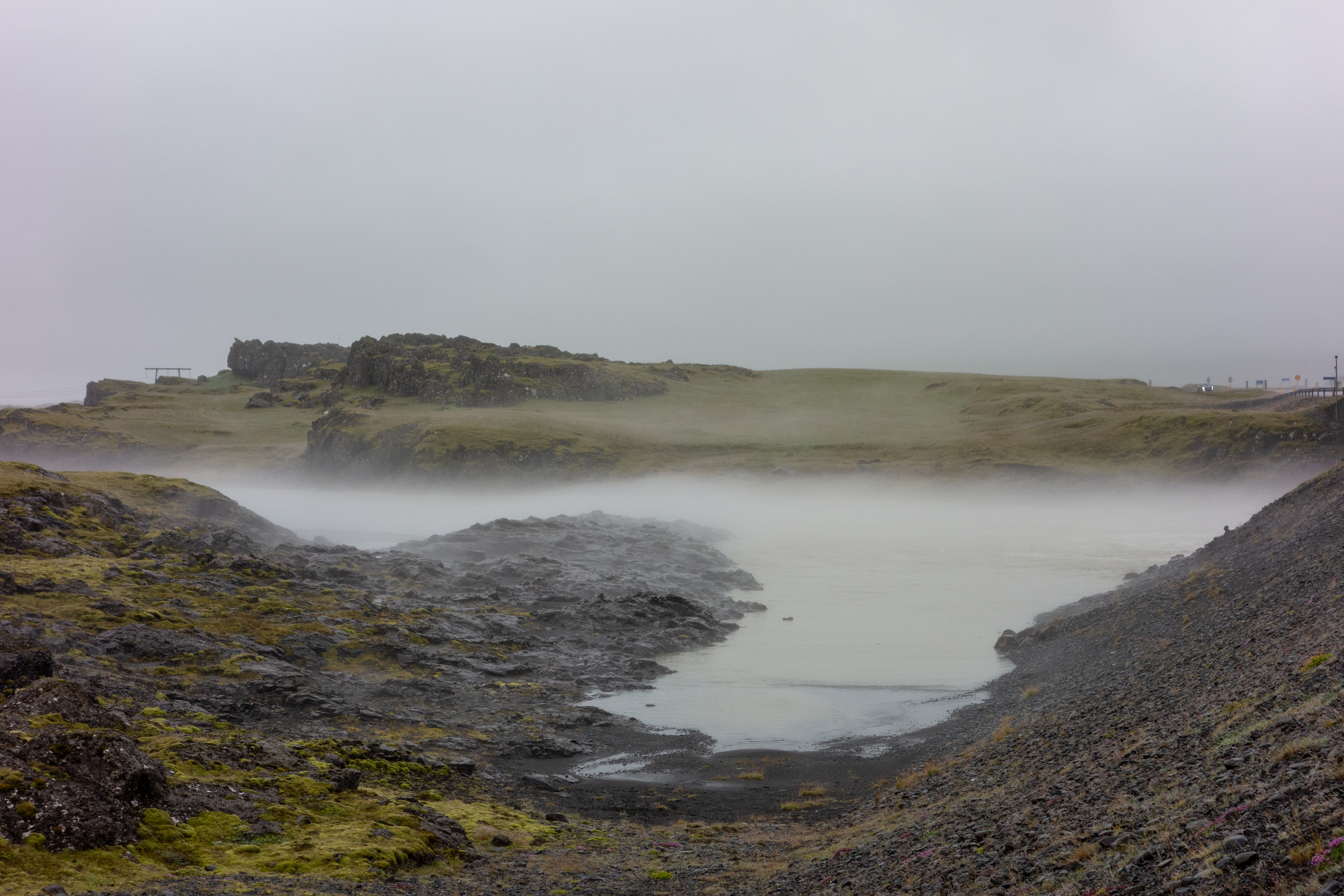
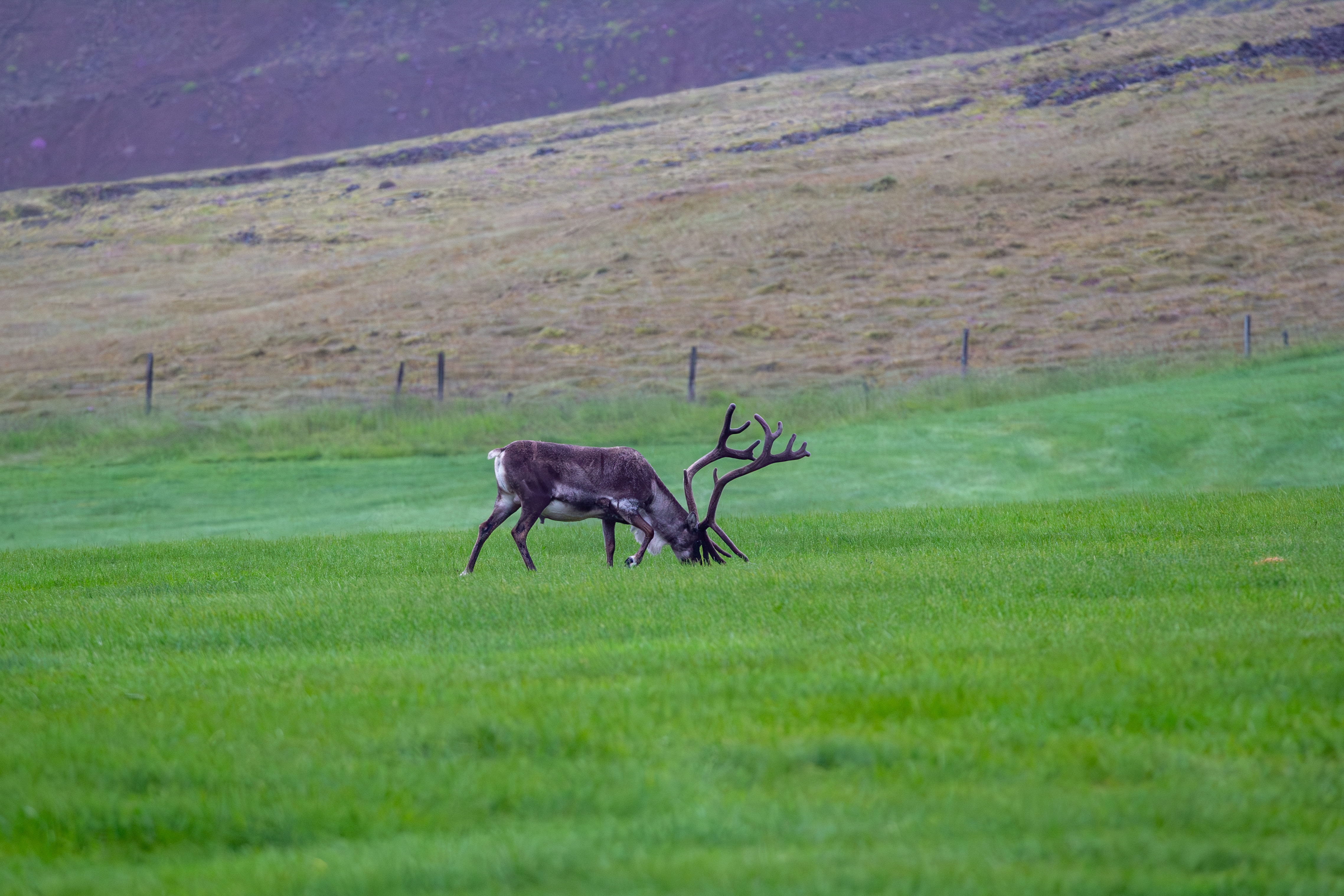
After the past two days being so late and us missing dinner (and lunch yesterday), we wanted a proper meal, so Crystal found us a restaurant in Höfn. It was about an hour to drive there, but we had some excitement on the way. Just before getting to Höfn, we went over this bridge, and perhaps the water was near a geothermal pool, but whatever the case, it was smoking. Between that and the thick fog, when we were on the bridge it was like we were floating in the clouds - we couldn’t see anything but the bridge itself. It really weirded us out and gave us the Willie’s, especially Justin who was driving. Shortly thereafter we came across two reindeer - maybe Rudolph could’ve led us through the clouds.
 |
 |
 |
 |
In Höfn we found the restaurant Crystal had found, Pakkhús. This was our first proper meal in 72 hours. We arrived at the restaurant after seemingly half of Höfn. They told us it would be about an hour, but they had a waiting area downstairs. We used the time down there to write down what we’d done today. Whilst waiting, we met a Polish guy and his trilingual son. We discussed Christmas time in Warsaw, since we’d just made our plans for this December to visit there and the Baltic states.
Eventually we got upstairs, and our waitress from Slovakia. Crystal told her we’d been to Bratislava three times, and we assume she probably doesn’t hear that too often. Crystal got langostino soup and the cod. Justin got burrata and the lamb. Crystal got a Slovak white wine, and Justin got Olafsson gin and tonic, which they were out of on the plane. Everything was very good, but again, crazy expensive. Even Zurich and Singapore would blush at the prices. On the way out of town, we saw a large building (like for a factory or something) being used for some sort of rave or concert. Getting into our room (at Sefdalur Guesthouse) was easy, we just used a lockbox. Everything was good, but the plugs were odd (maybe an old outdated style?), so we had to power everything off of a power strip they left in the room. We went to bed around 23:00.
| Previous Entry |