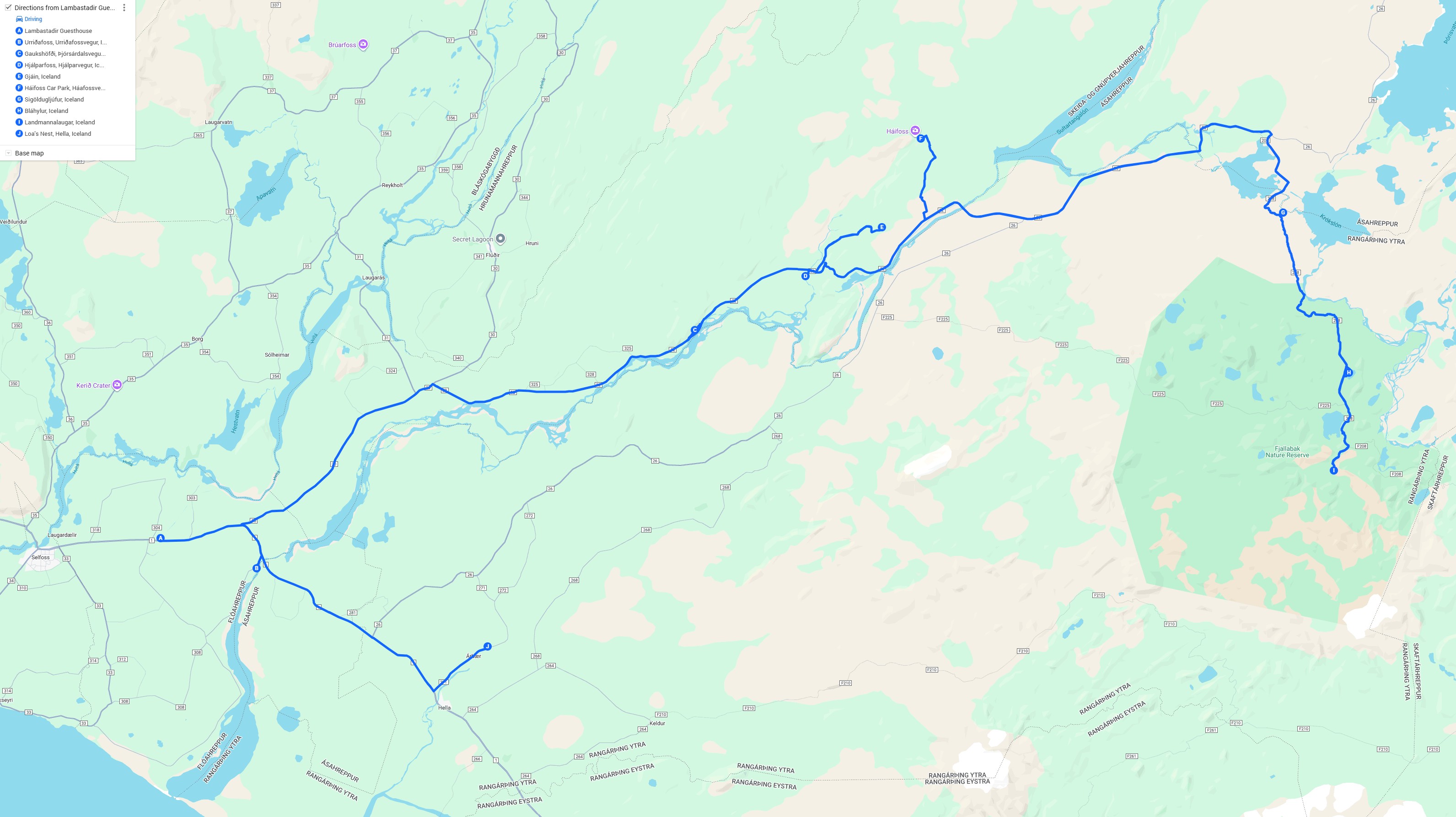
We got up around 06:30, and got ready for the day relatively slowly, taking about an hour. We each got the Wordle in 3, so our brains seemed sharp. We had a quick breakfast, and we were out the door at 08:00. Right as we were leaving, one of the employees asked what we were up to, and we went over our plans, and he made some recommendations and also told us that on the return part of the trip we might want to go a different way since the river crossings would be a bit more daunting in view of extra snow and ice melt the previous week.
|
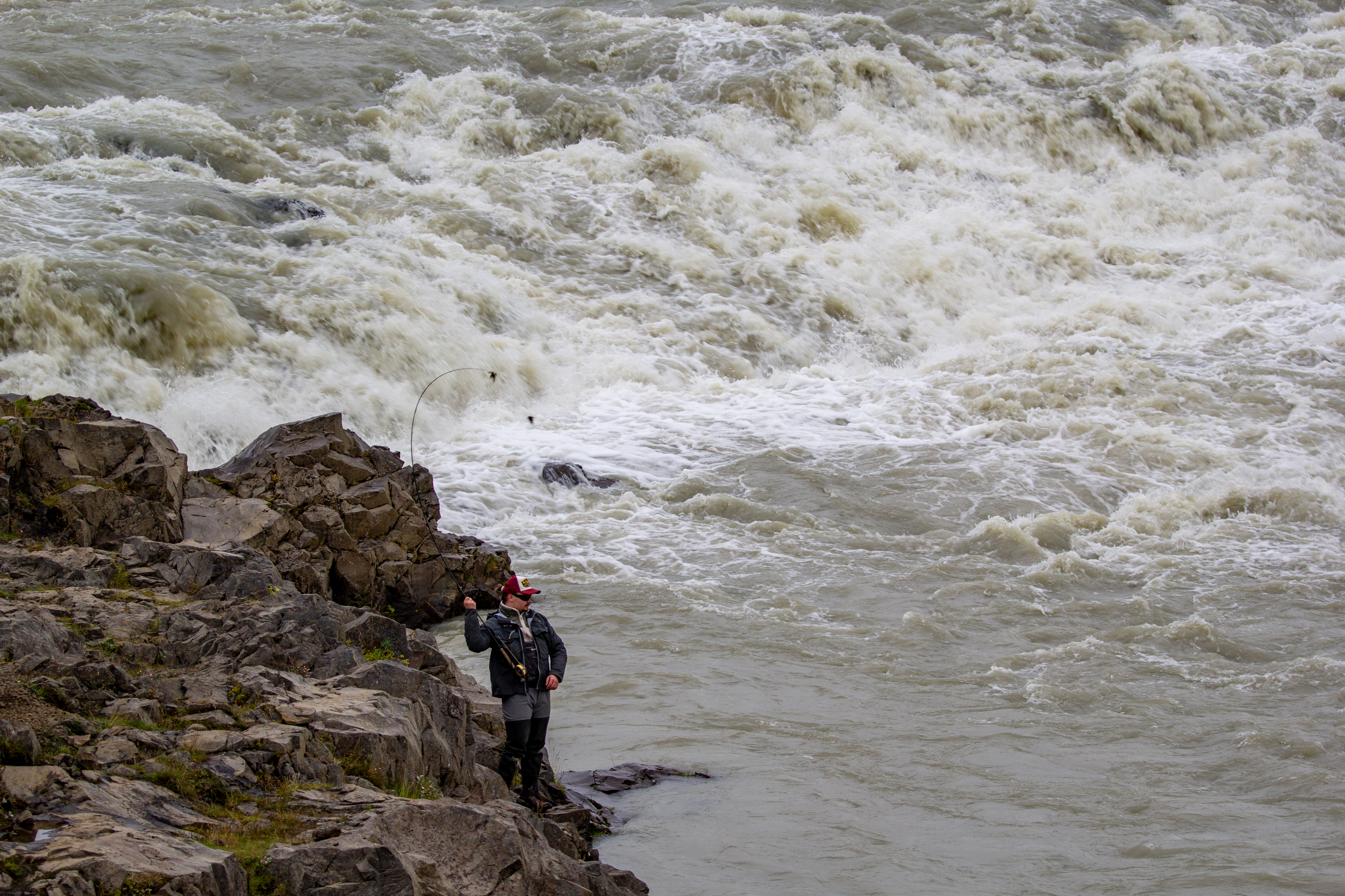
Our first stop was at a waterfall just a few minutes from the hotel, Urriðafoss. On the banks of the river there were some local men fishing, and during our short time there, Crystal saw one guy catch something. There was a falls in the middle of the river that looked like a horseshoe, and we couldn’t really get a good glimpse because of all the mist, but it didn’t look like the part of the river you’d want to be in if you were in a canoe. There were some sheep on the far bank, just above one of the smaller falls.
 |
 |
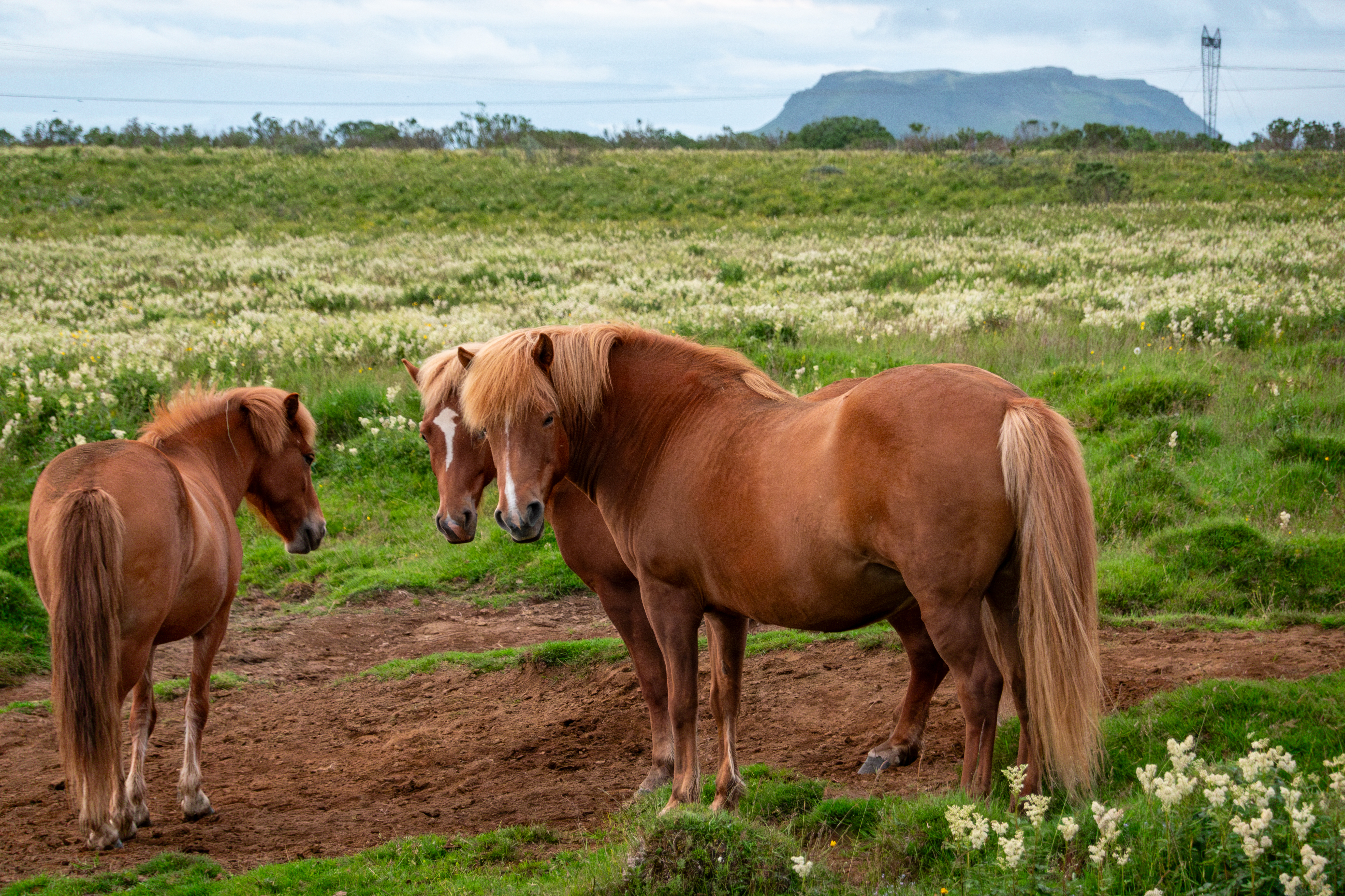
Nearby, we spotted the Walter Mitty Bridge just north of the Ring Road, crossing the same river, so just before we got back on the Ring Road (to backtrack a bit) we took a couple photos with the zoom lens. The Secret Life of Walter Mitty is one of Justin's favorite movies, for reasons described here, and a good chunk of it was filmed in Iceland, so wherever it wasn't too out of the way, we had plans to see some of the filming locations. Like yesterday morning, it was foggy and misting a bit, but nothing too bad, especially for Iceland standards. On the road inland (Road 30 and then Road 32), there were lots of horses, and lots of fluorescent green grass (or something) that was being used to make hay. Crystal asked aloud what all the horses were used for. Presumably it was neither food nor milk, so what then?
 |
 |
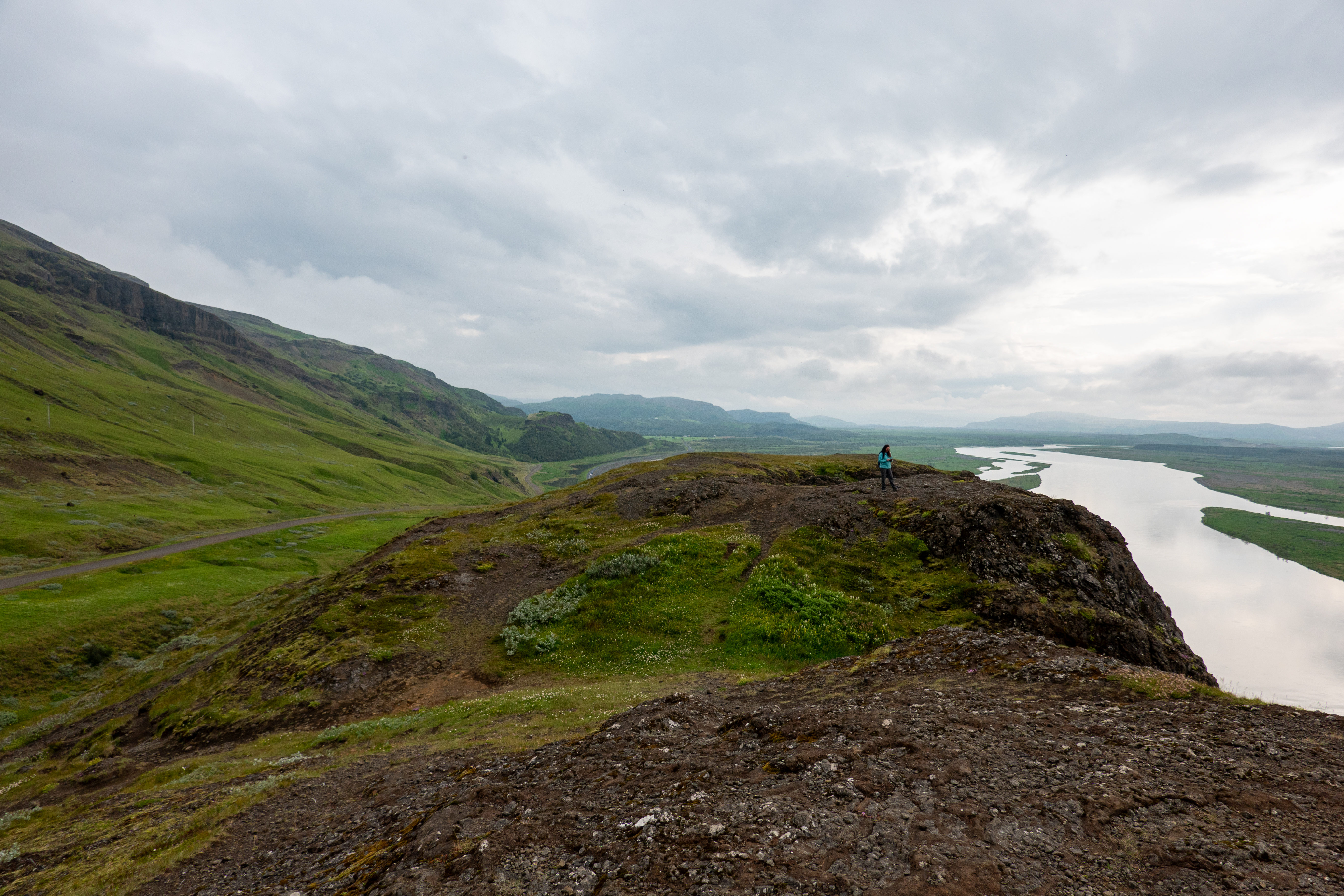
After about 35 minutes we stopped at Gaukshöfði, which we’d read about at the hotel the night before. It was basically right off the road, so not adding on much time. Well, technically it was right off the road, but up a steep incline, and after maybe 5 minutes we parked next to a camper van that had probably been there overnight. It had Austrian plates, which is a bit like seeing a Nebraska plate on a car on the Big Island. We took a 2-3 minute walk from the parking area to a cliff above the main road we’d been driving, with panoramic views out over the south. It was definitely worth the minor detour.
 |
 |
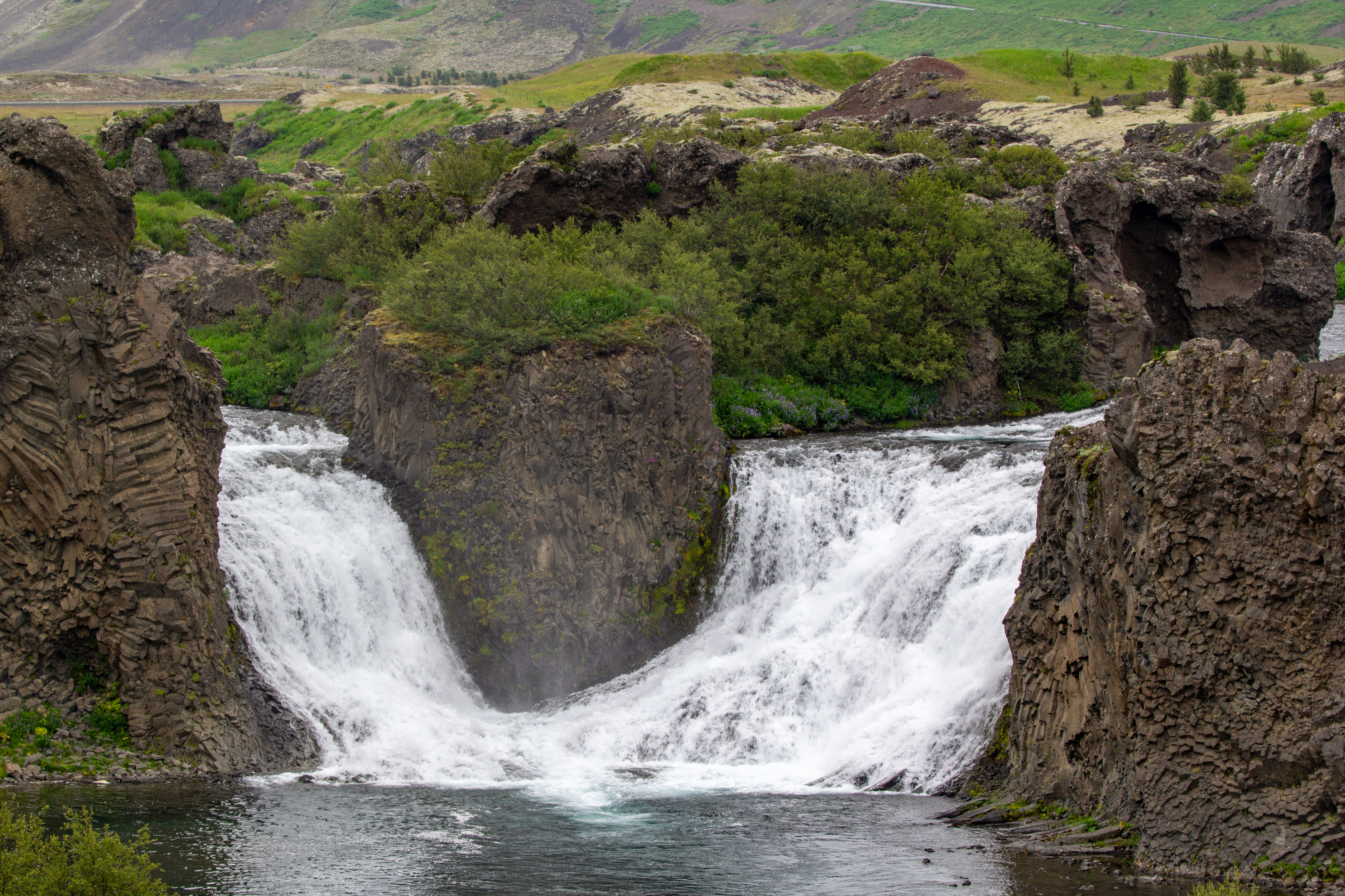 |
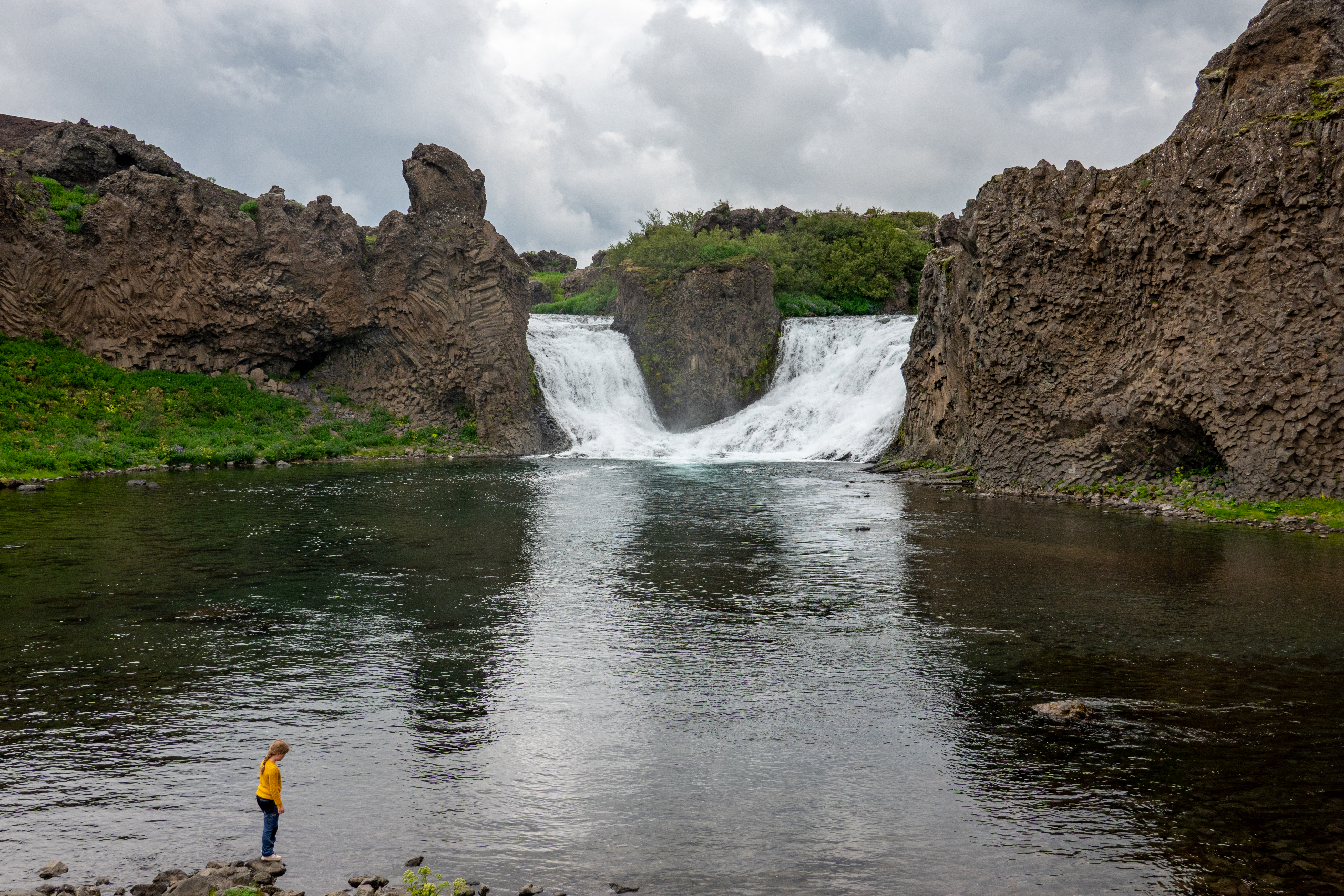
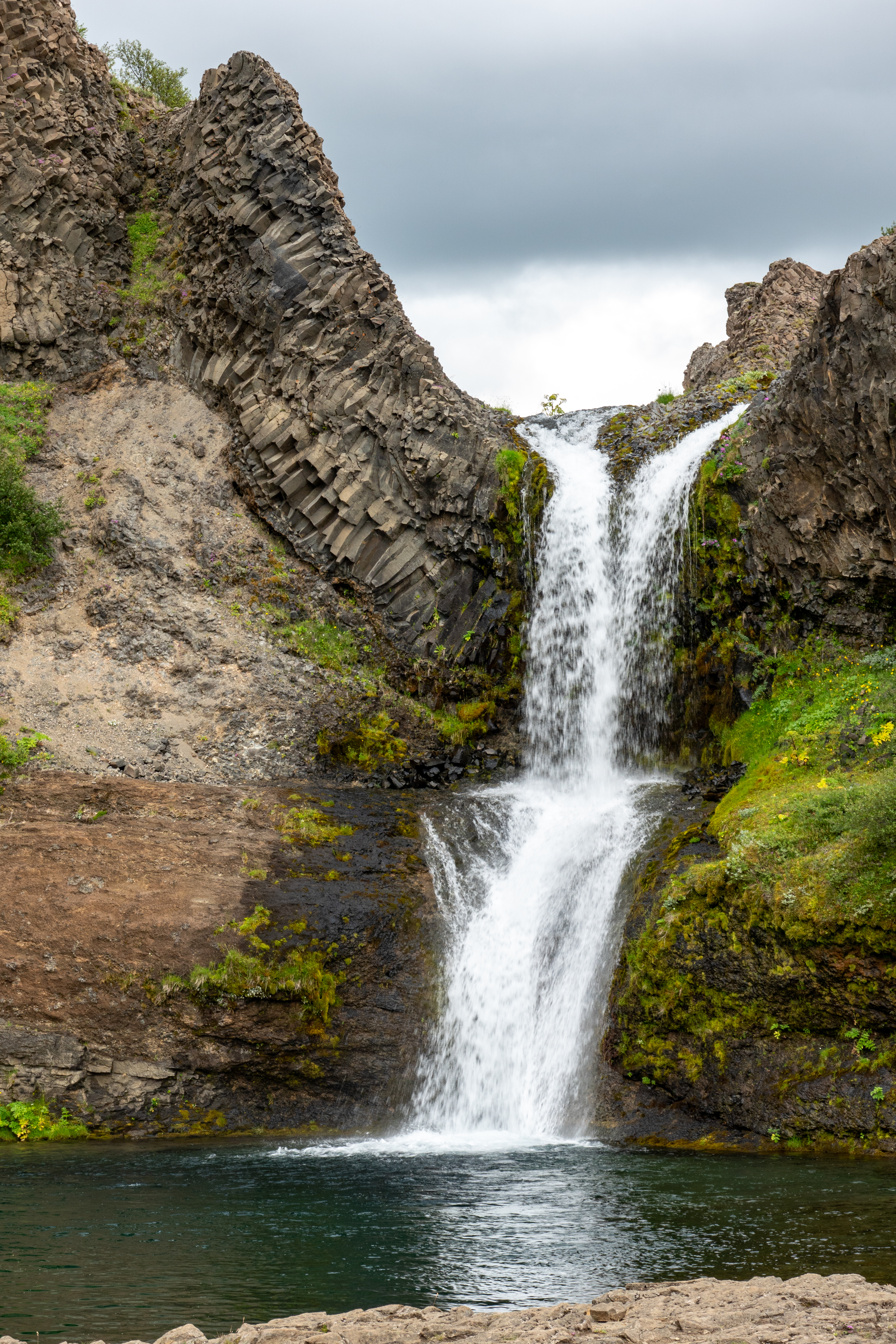
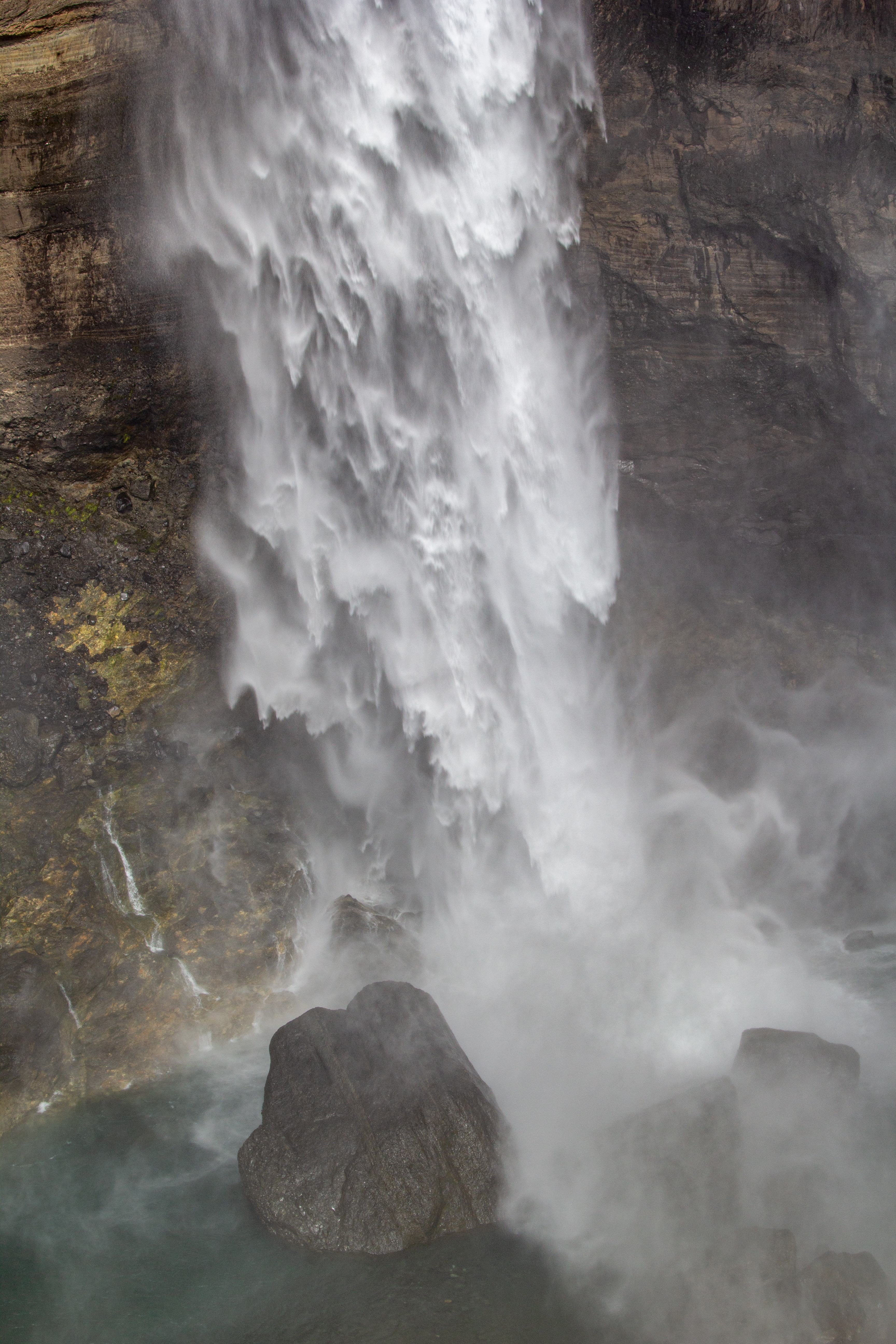
Next up was Hjalparfoss, also just off Road 32. The waterfall wasn’t that big, but it had an interesting shape, vaguely reminiscent of the Wu-Tang W. Speaking of Wu-Tang, Crystal was having a hell of a time with the Connections for today, as there were 8 words left including Wu-Tang, Pac, Glue, Cape Cod, Drums and Bass, and Mario World. The falls were fine, but what was more interesting were the basalt column rock formations on either side of the falls. We knew we’d see this in several places around the island, and apparently this was the first.
 |
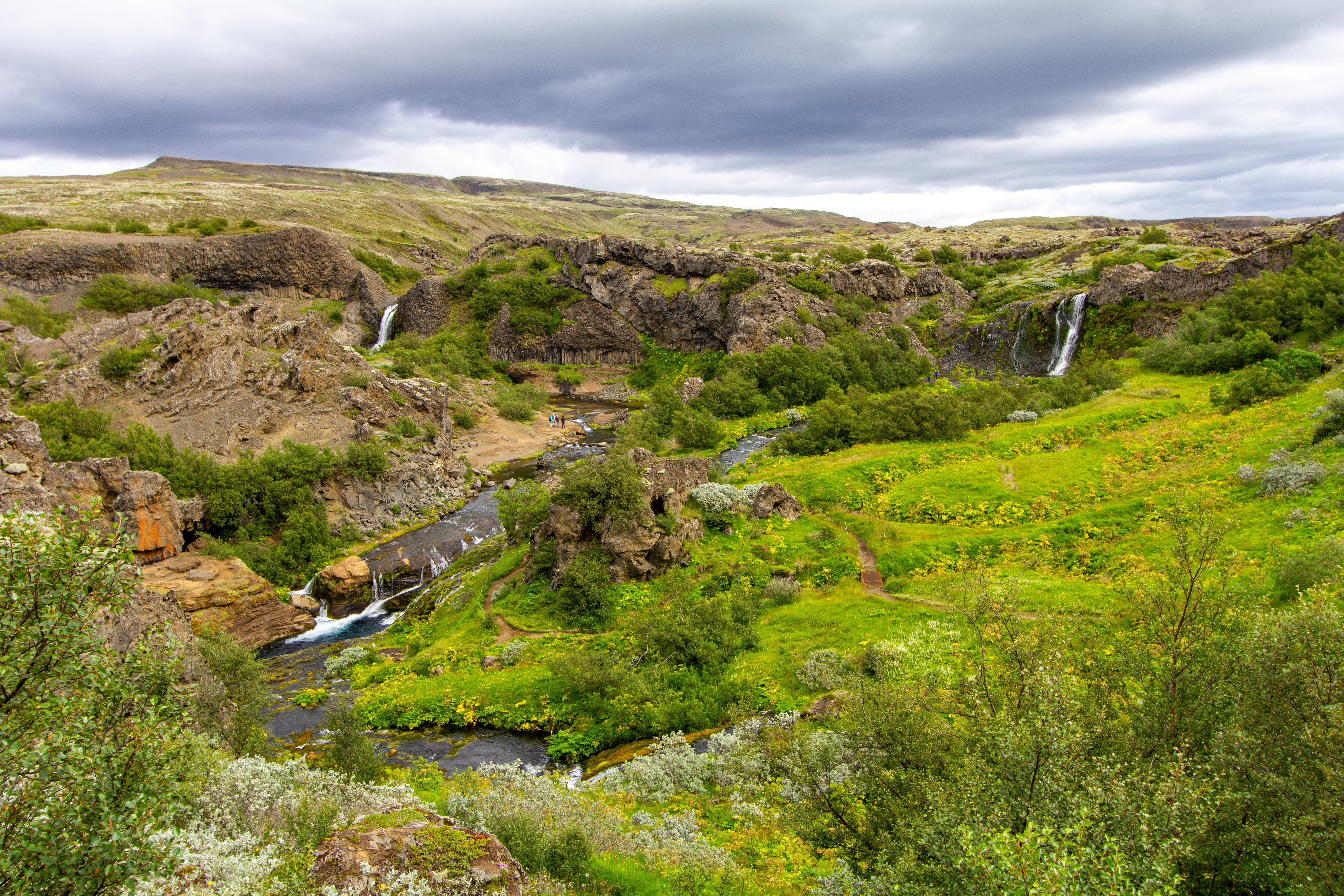 |
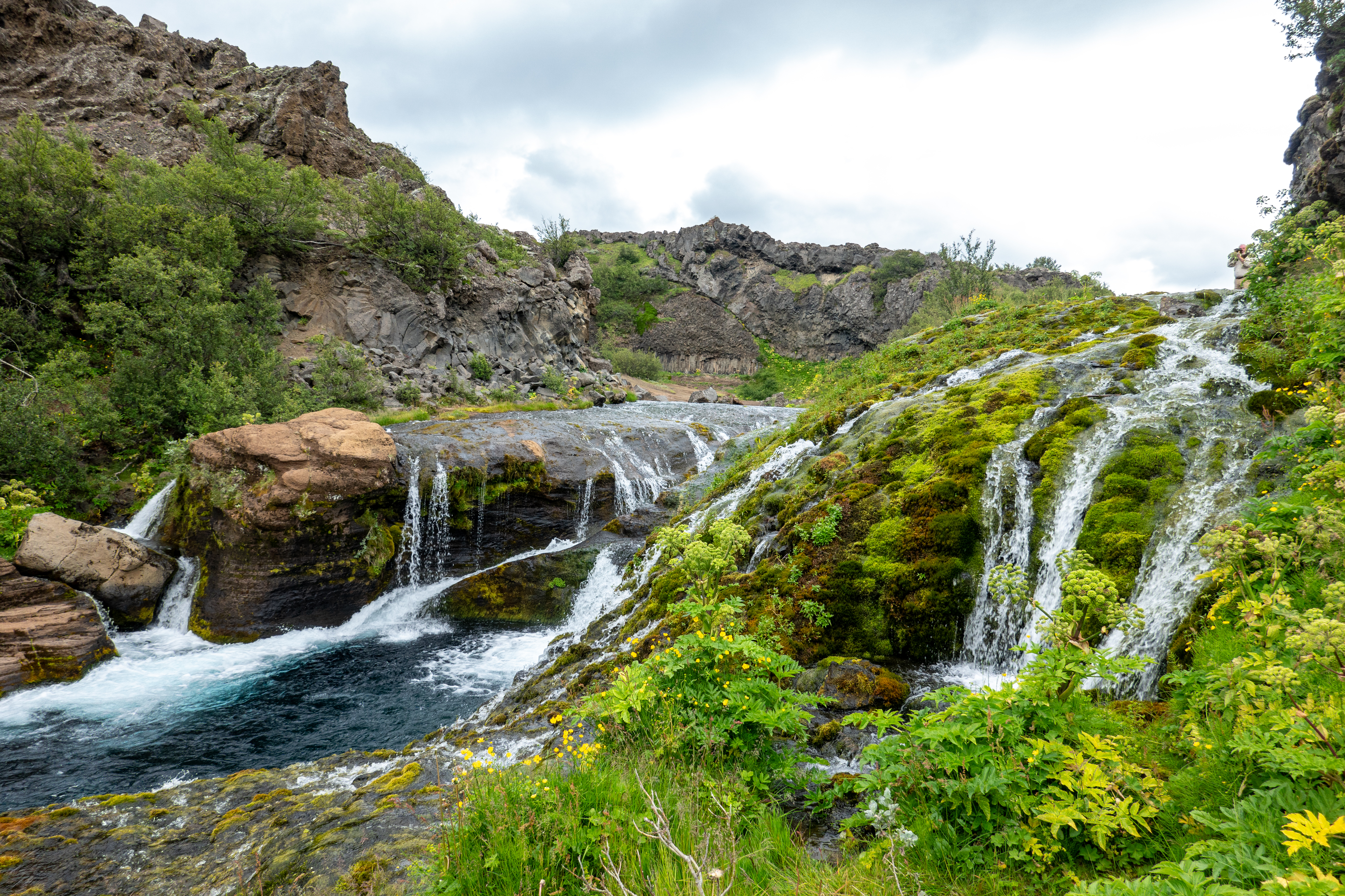
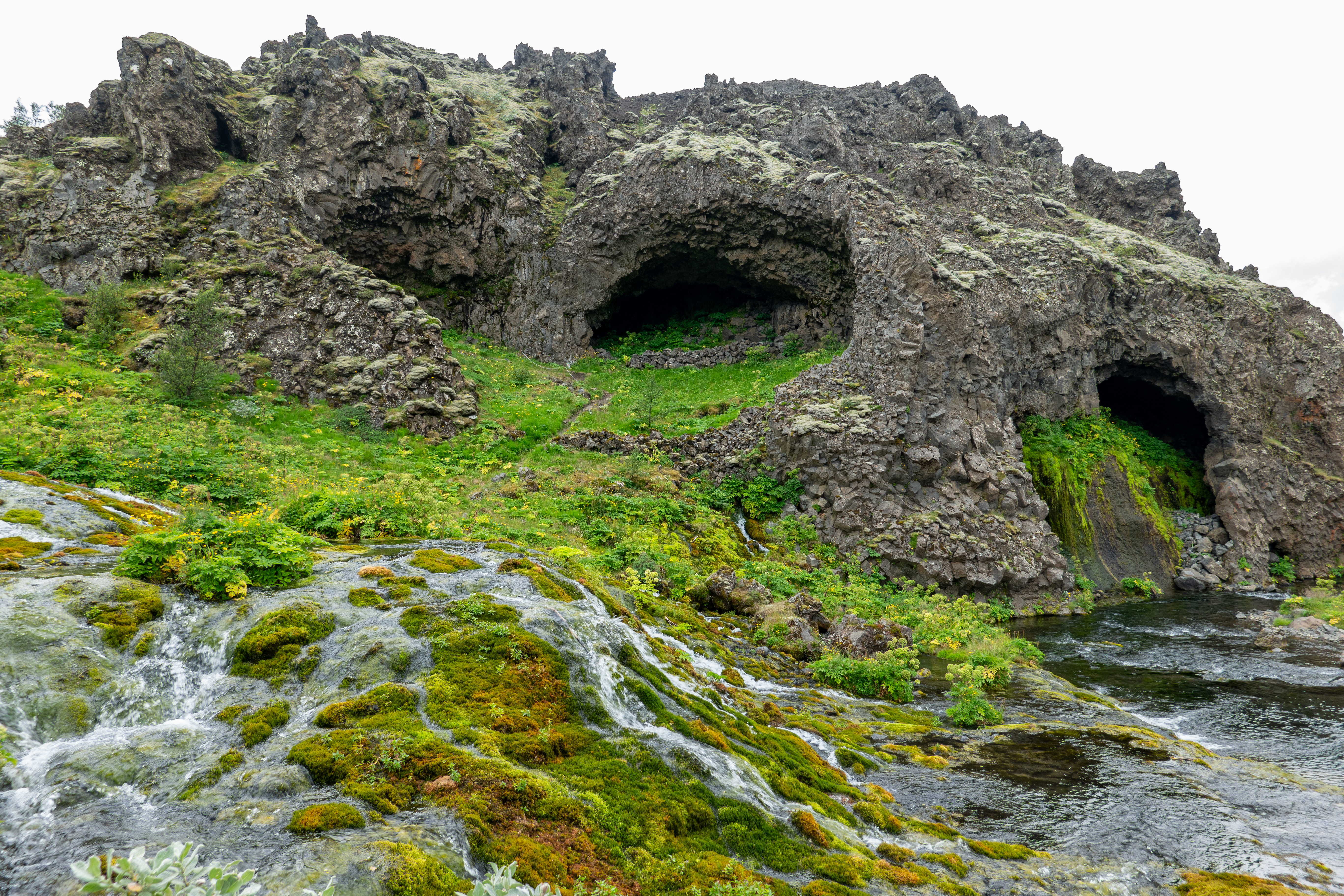
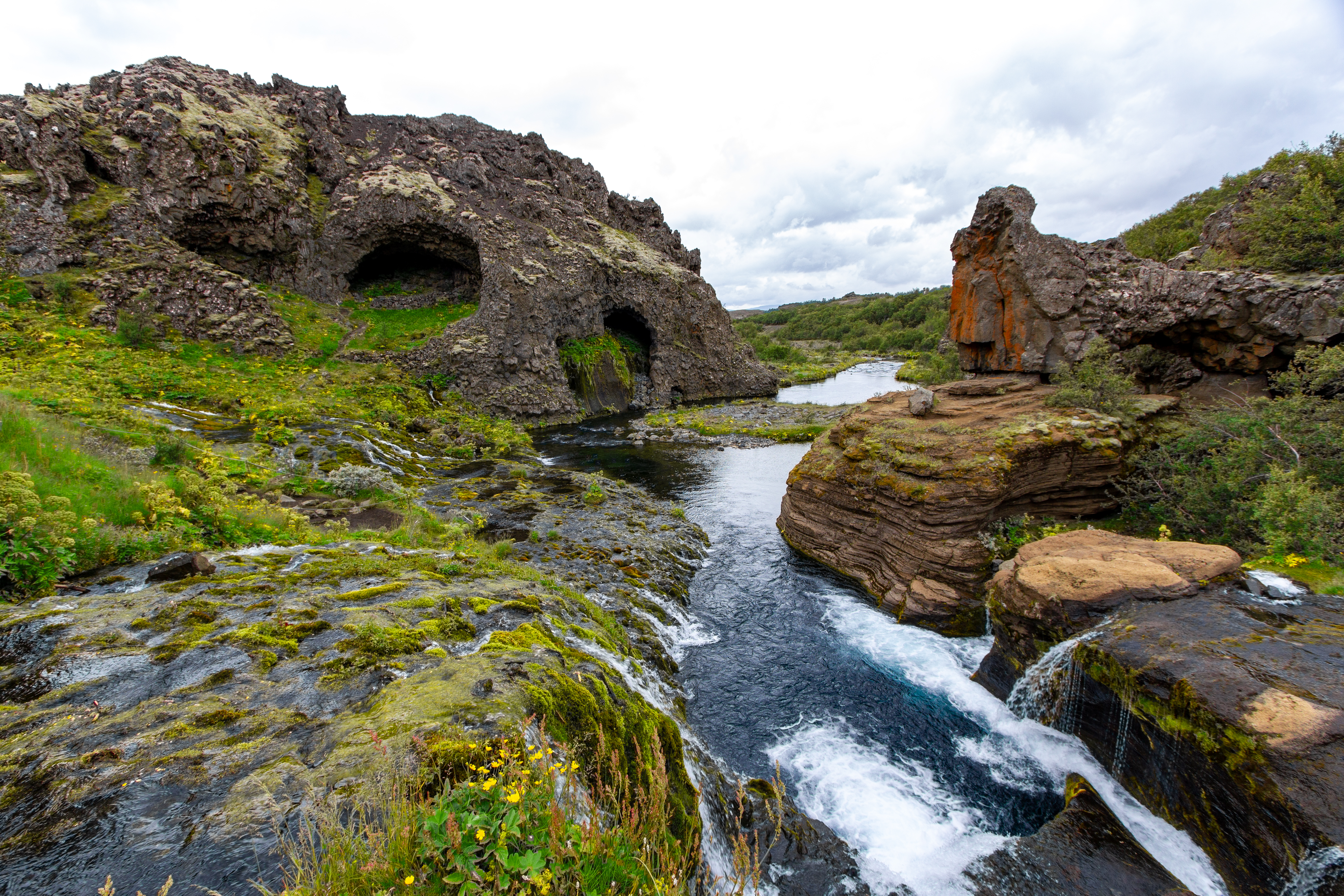
Our next stop was slightly further afield, maybe 15 minutes up a gravel road through the middle of nowhere, flat plains of rock, sand, dirt, and lava deposits. When we got to the parking lot for Gjáin, there were other cars, so we figured at least other people got hoodwinked as well. But then there was this circular depression in the countryside that was like an oasis. Gjáin was apparently a bowl that all the water made its way into. There were three separate waterfall areas, with turquoise water in the lowest one, all sorts of cool lava rock formations, and tons of greenery. It was an amazing oasis in the middle of nowhere.
 |
 |
 |
 |
Despite all his research, Justin had never seen or heard of it prior to seeing something in the book at Lambastadir the night before. So apparently staying there was worth it just for suggesting this place to us for today. We meandered around, up and down, to several of the falls and to some rock formations that looked like a face. Crystal went back to the car before Justin went to the furthest falls, which was across a narrow stream that she had no interest in traversing. The views from the very top, a bit away from the car park, were also amazing. So Gjáin ended up being a really nice unexpected surprise.
 |
 |
 |
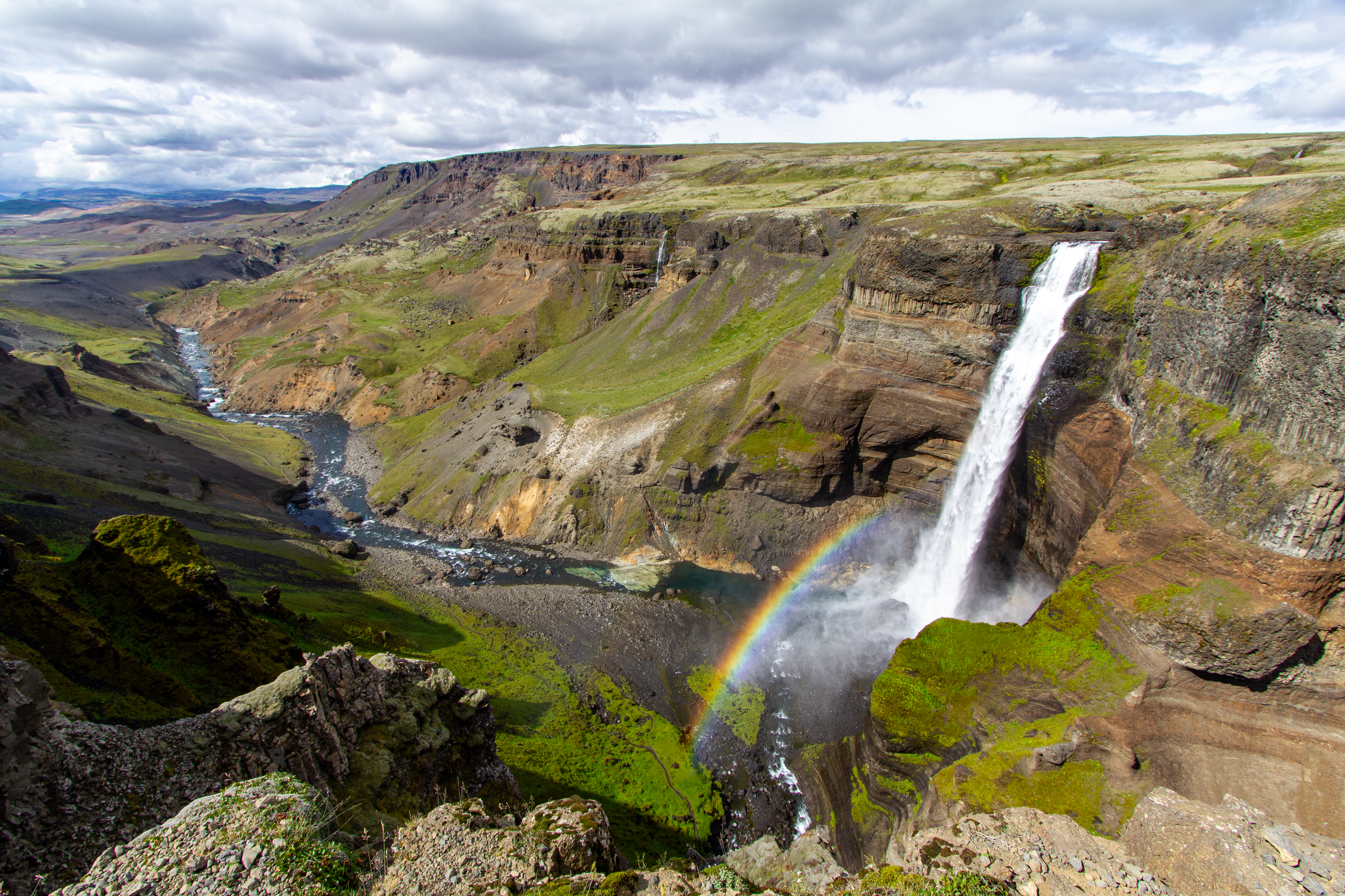 |
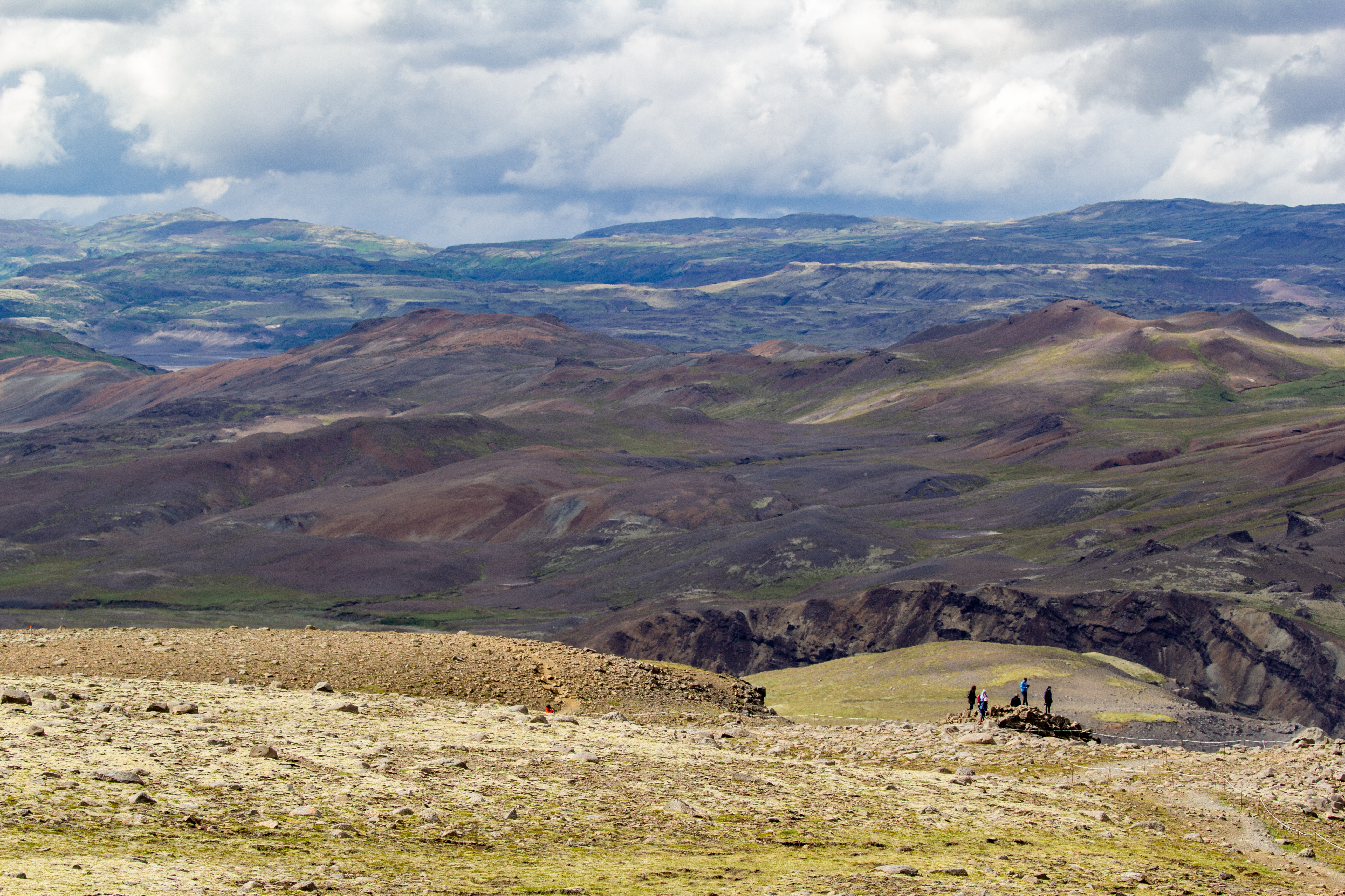
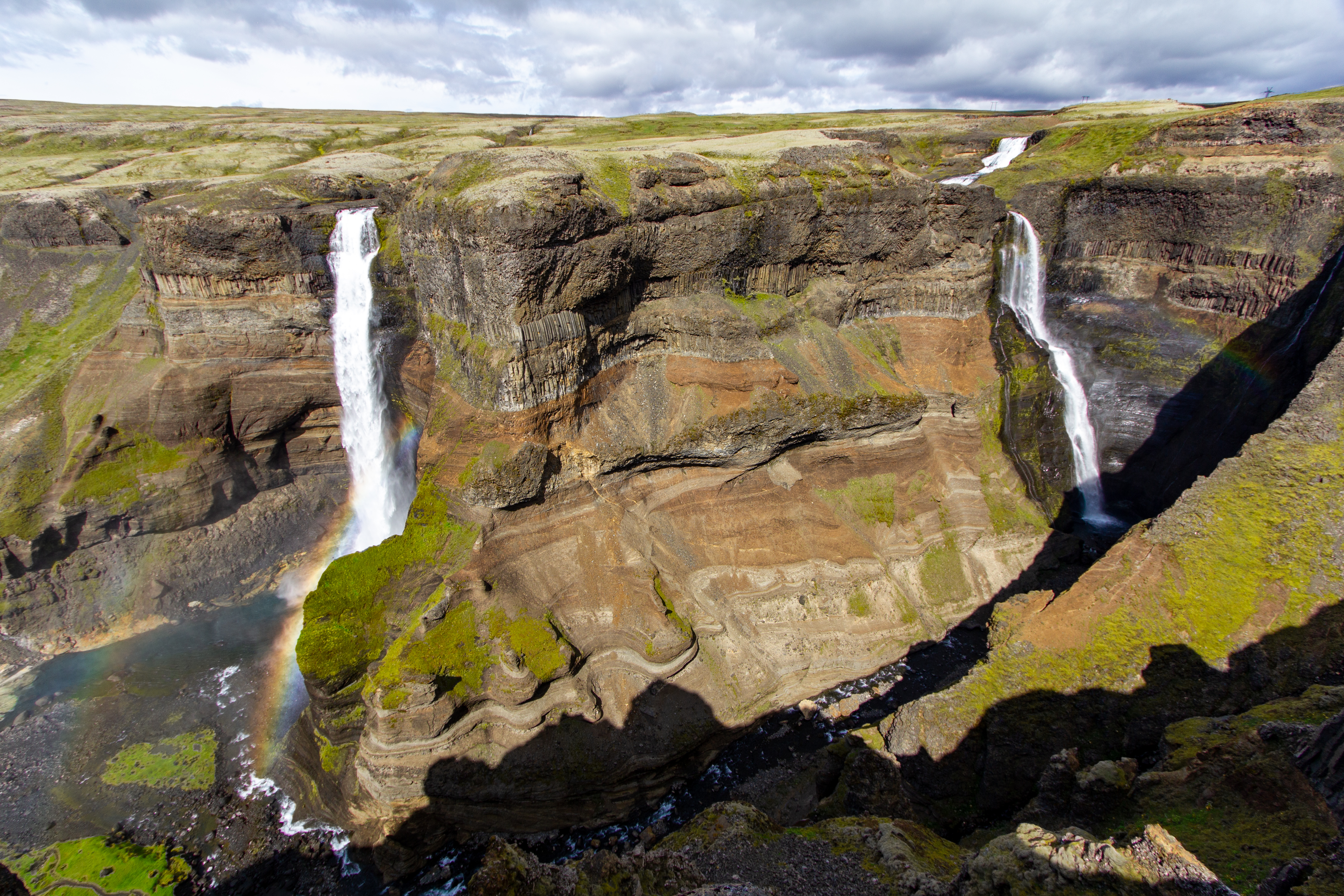
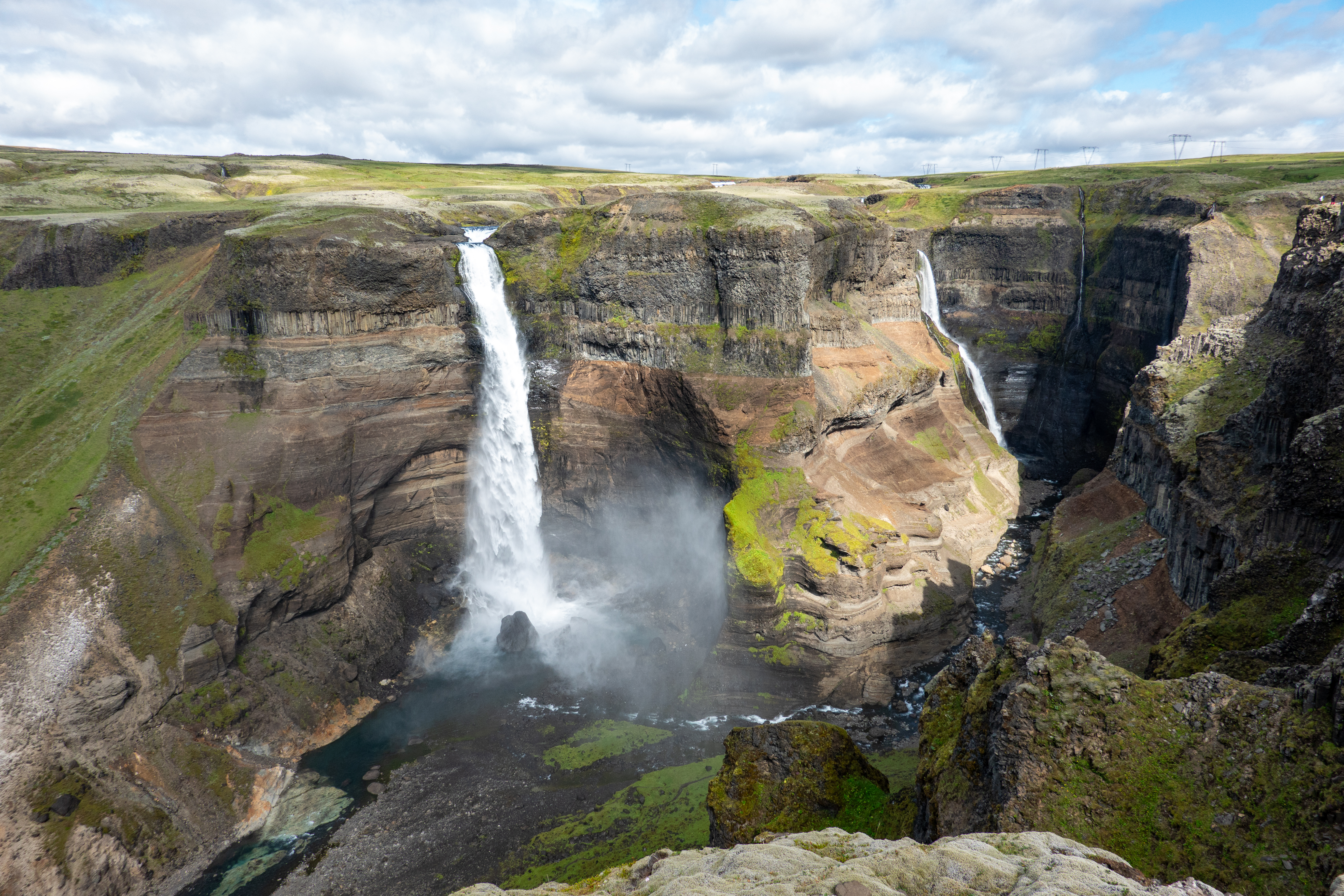
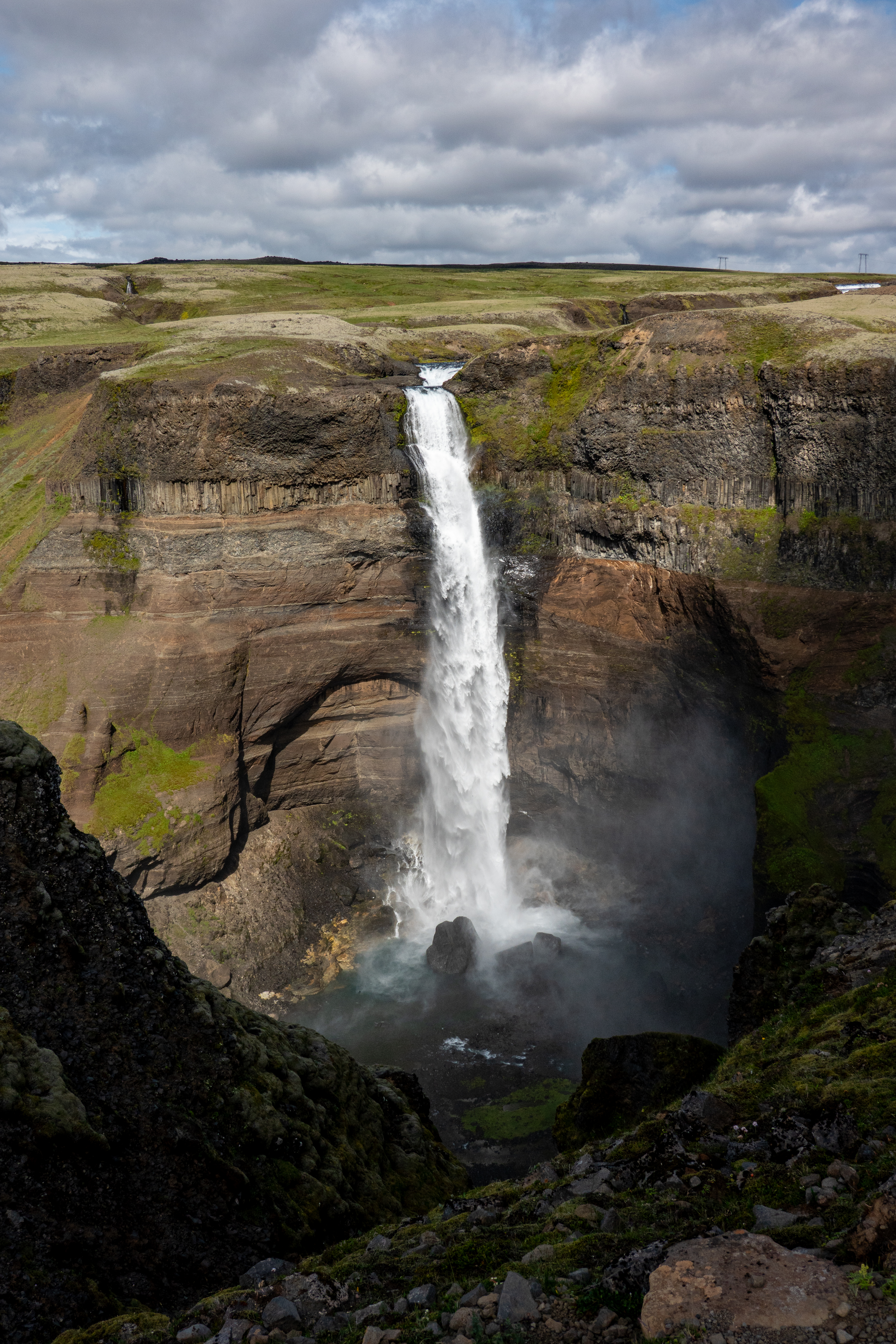
We got back on Road 32 headed east, but only briefly before we were off it again, onto more gravel roads, to head north to Háifoss. This was theoretically one of the tallest waterfalls in Iceland, the third highest. The Alltrails reviews of the trail there didn’t give us warm fuzzies, with descriptions of rockfalls and “disintegration.” So we figured we’d just walk until we could see the falls, then call it a day and head back. As it turns out, we had to walk just a few minutes. There were actually two falls, one a little bit more tucked in, another more prominent. It was sunny, the sun was behind us, and accordingly there were rainbows. The cliffs were impressive in their own right. A couple of people were flying drones, as apparently this one of the few areas in Iceland where this was still allowed. We enjoyed the view, but the drive to and from the falls was longer than our time there.
 |
 |
We continued down Road 32, which became Road 26, until we saw a store and a gas station, and we impulsively stopped. It turns out it was a place we had in the notes on our itinerary, but earlier in the notes than where it should have been, because of all the stuff we added the night before. What we had in our notes was that this place, Hrauneyjar, was the last place for food and gas before Landmannalaugar. It was around 13:00, so we grabbed lunch and filled up the gas tank. The table next to us at lunch was about 10 people on some sort of group tour. We overheard a good part of their conversation, as we were the only other table in this particular room.
 |
 |
Before getting in the car, we talked to a woman at an information desk, and asked her whether we should come back the way we came, or take F225, which would involve a couple small river crossings. Normally this would be a non-issue, but because it had been so hot the week before we arrived, the water levels were higher than usual. She said we’d probably be okay, and told us how to traverse them, and how going slow was better than rushing through and making a wave. The road continued inland, we turned south from Road 26 to Road 208, and just after a big geothermal plant the road turned from asphalt to gravel.
 |
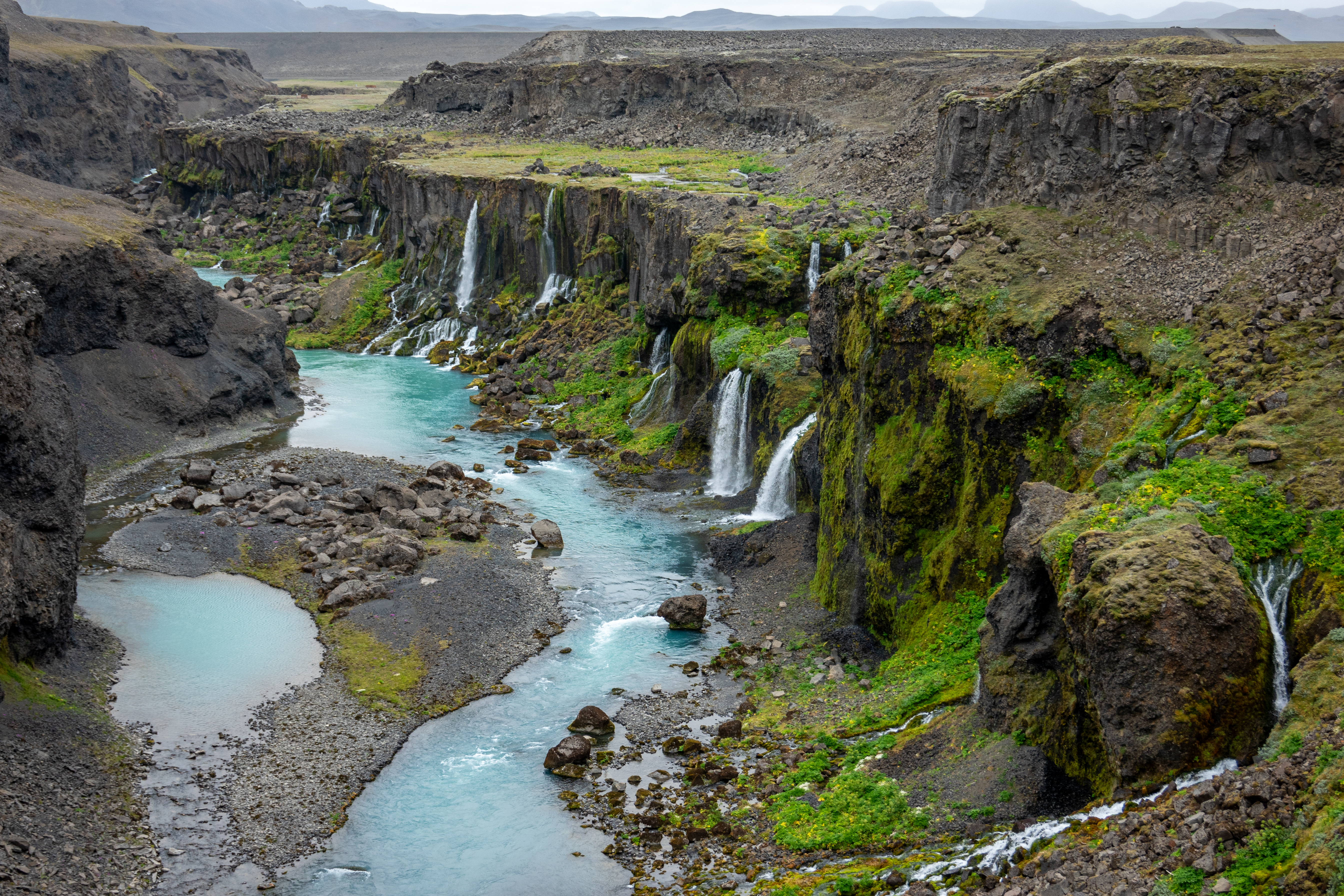 |
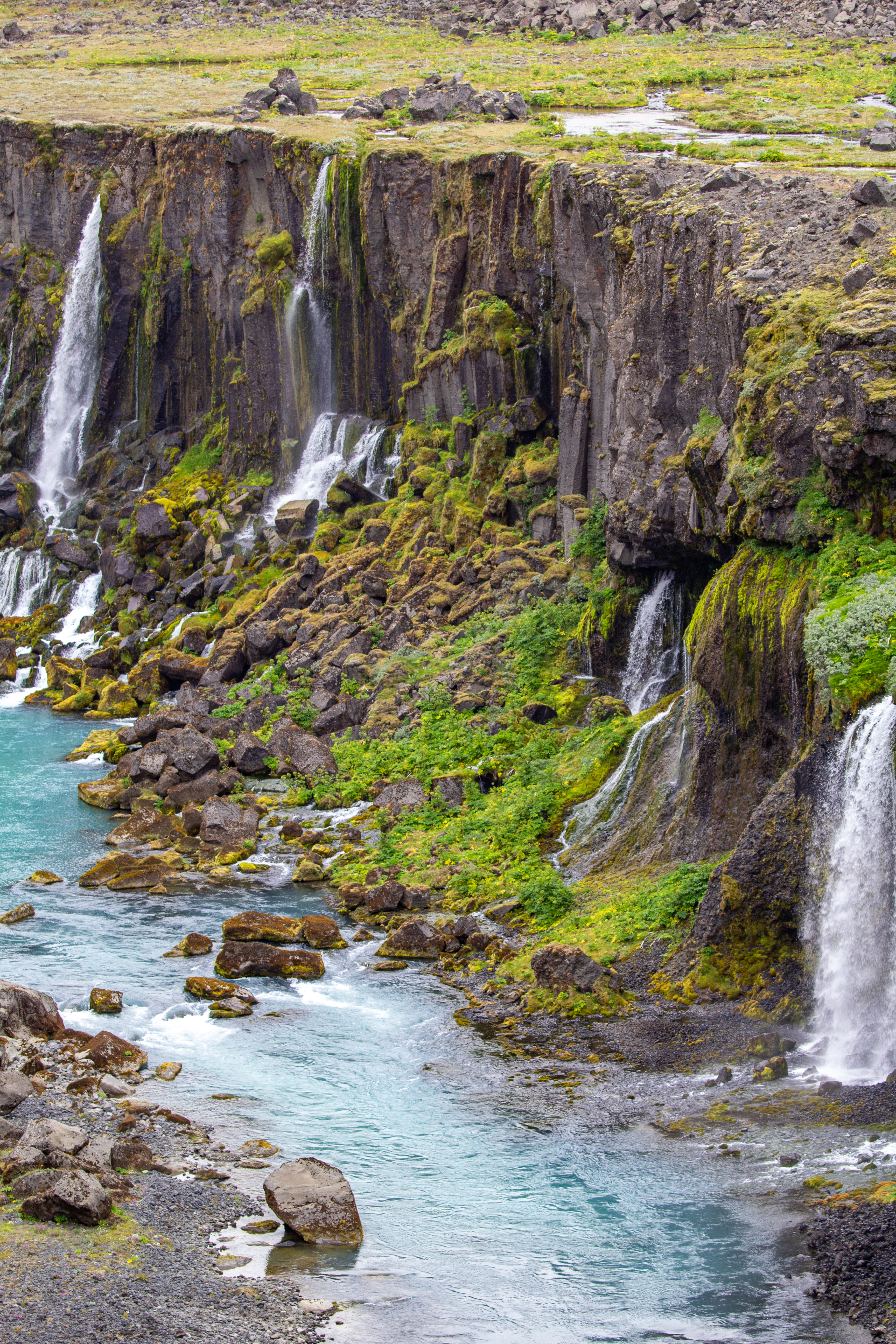
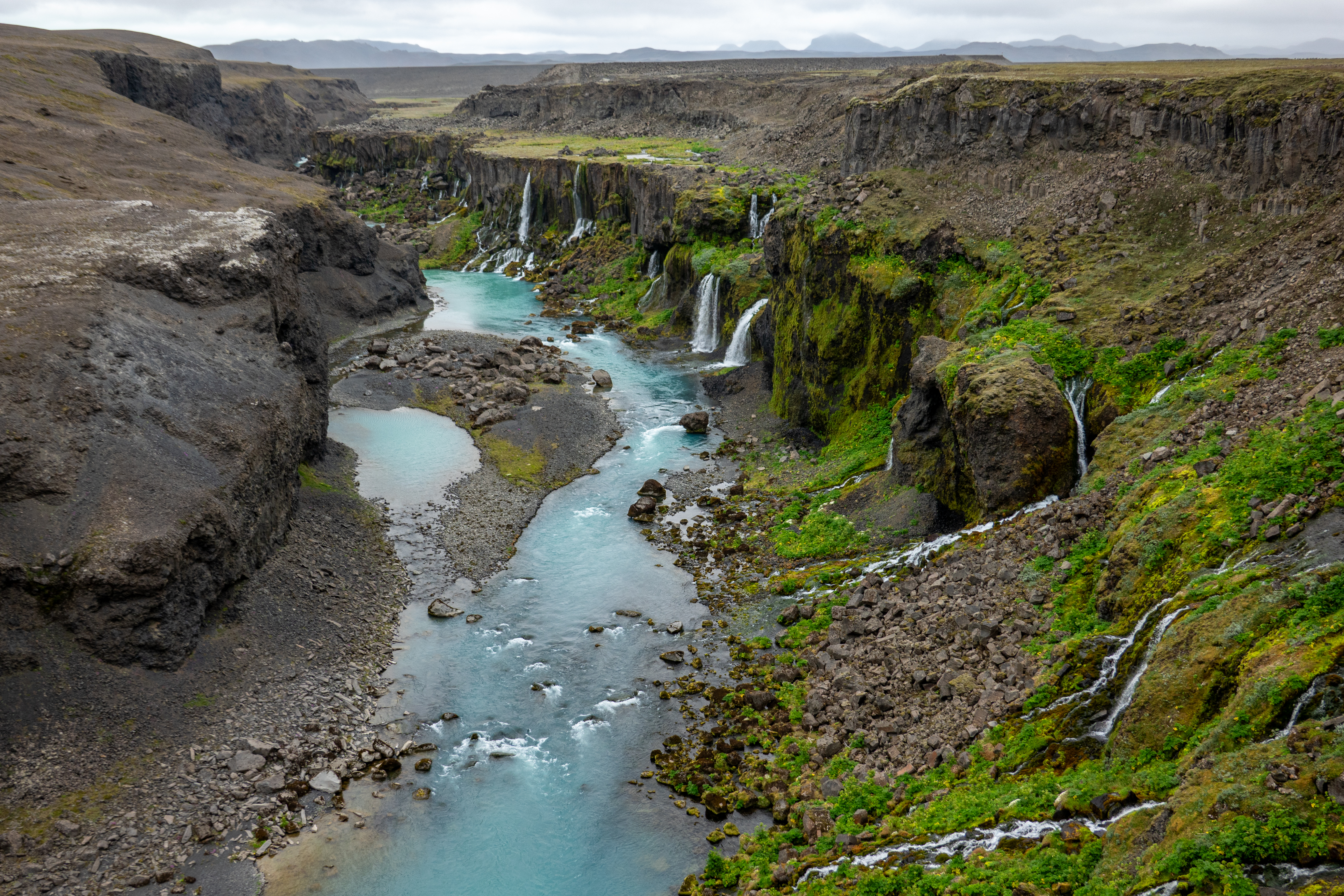
We went over a bridge where we could see turquoise water mixing with brown water, which was not something we saw every day. Right around there we turned off towards Sigöldugljúfur, which according to our notes had a canyon, waterfalls, and greenery. The spot where Gina (the Google Maps Navigation lady) told us to park was in an odd spot, at least seemingly, with no obvious parking lot nearby. We looked at Alltrails, and we were right near the halfway portion of the hike already. So we just parked at a spot that seemed most like a parking lot, and just went for it. A minute or two after we parked, another car parked next to us, so either we were in the right spot or we just created a parking lot.
 |
 |
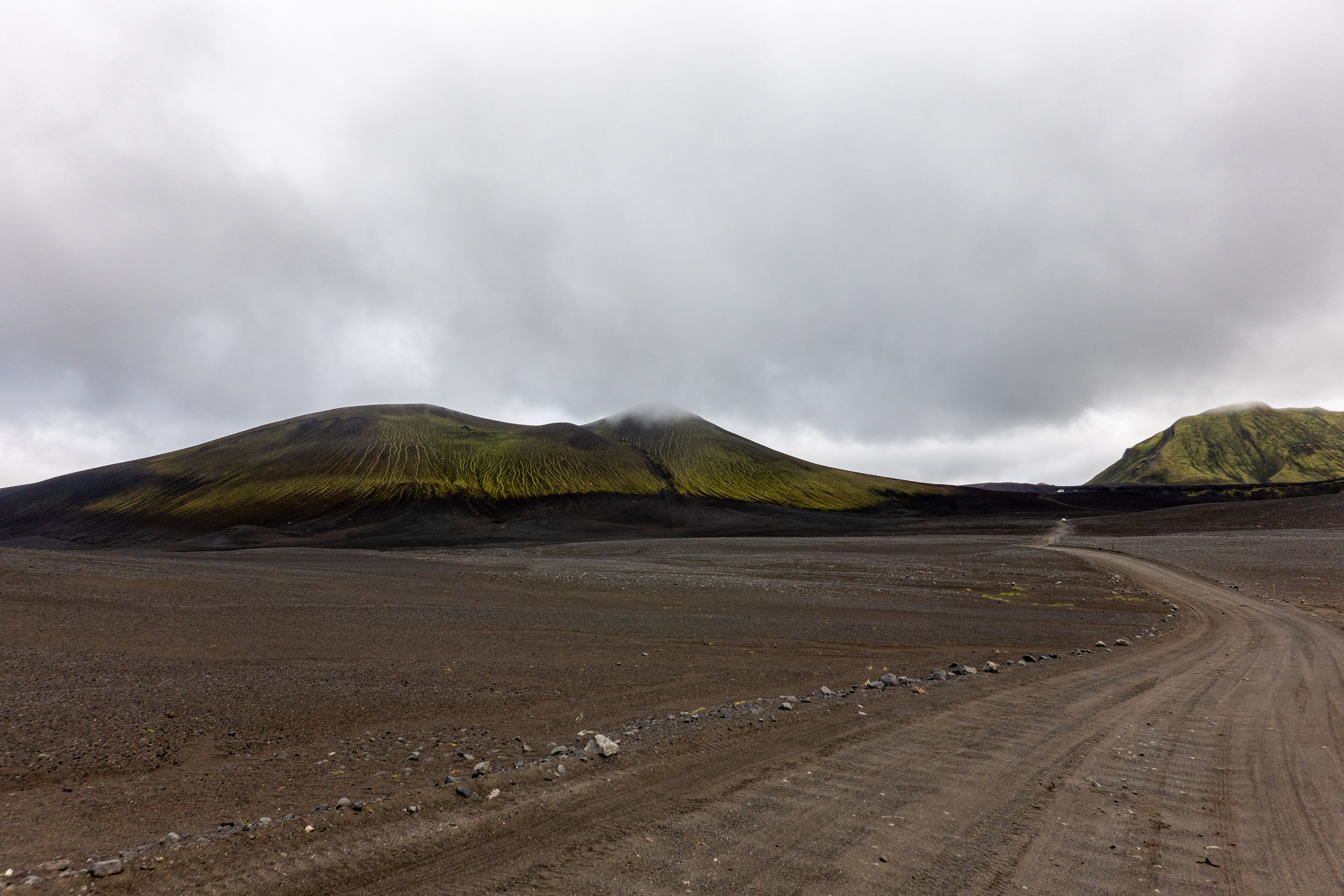
It was only a 5-10 minute walk to the edge of some cliffs, and we could see down and to the right several falls next to one another, with green cliffs and turquoise water. It was crazy windy, but there was no mist or rain, thankfully. It was quite photogenic, and we could have easily stayed longer, but we didn’t want to dilly-dally, as we still had a lot of driving, plus a hike, to do. Back headed south on Road 208, we were now really in the middle of nowhere, vaguely reminiscent of either the Saddle Road in Hawaii, or Southwest Bolivia.
 |
 |
 |
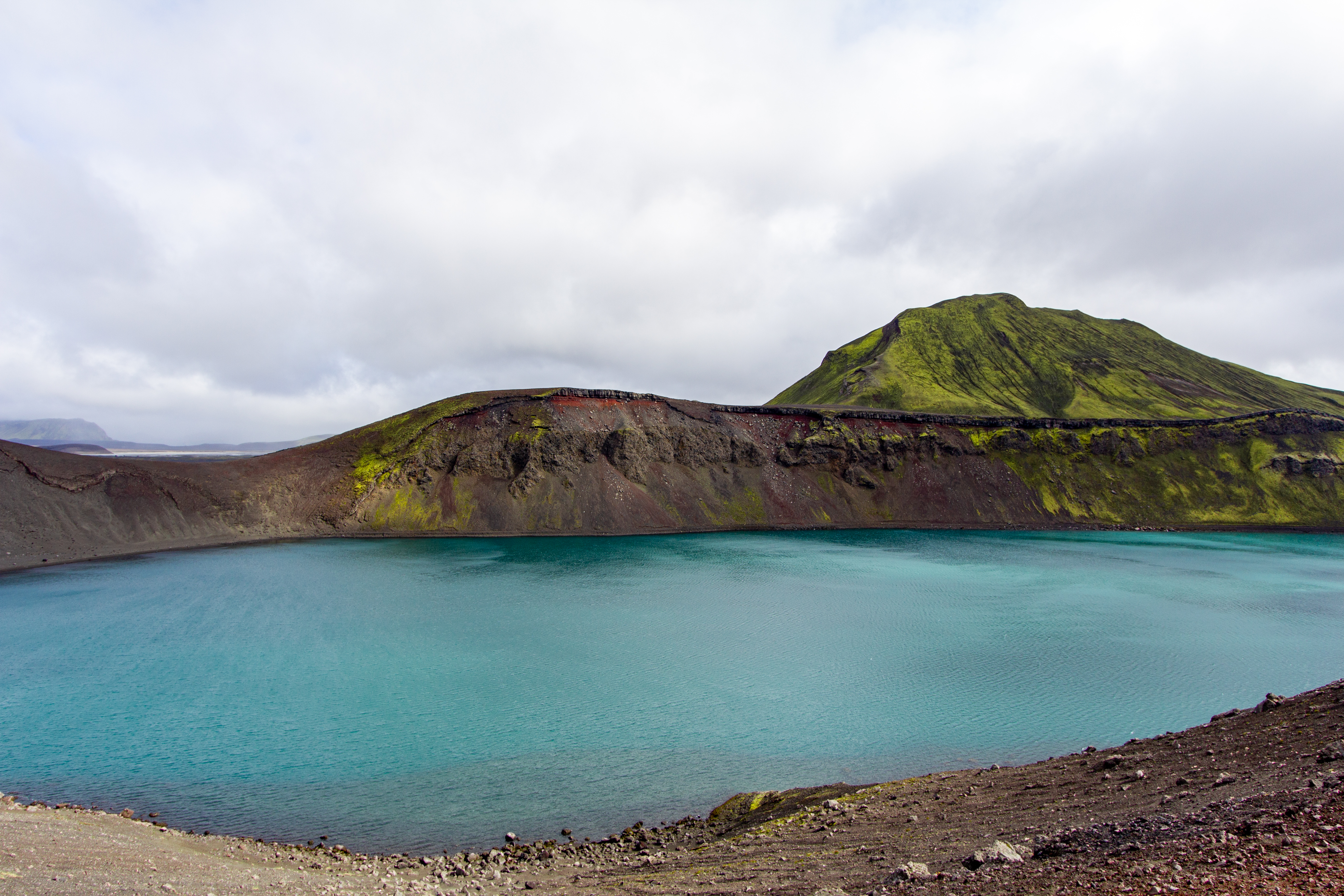 |
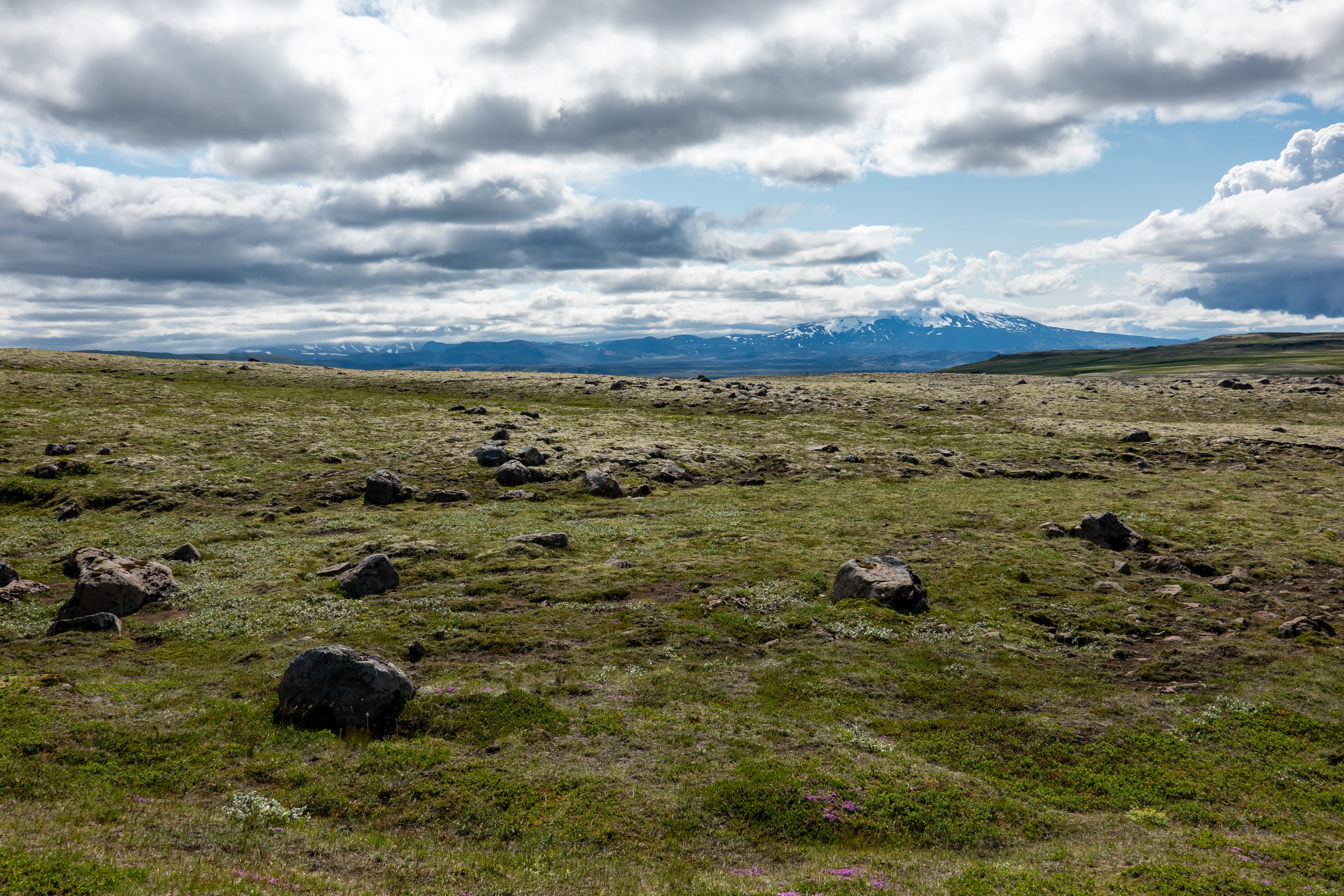
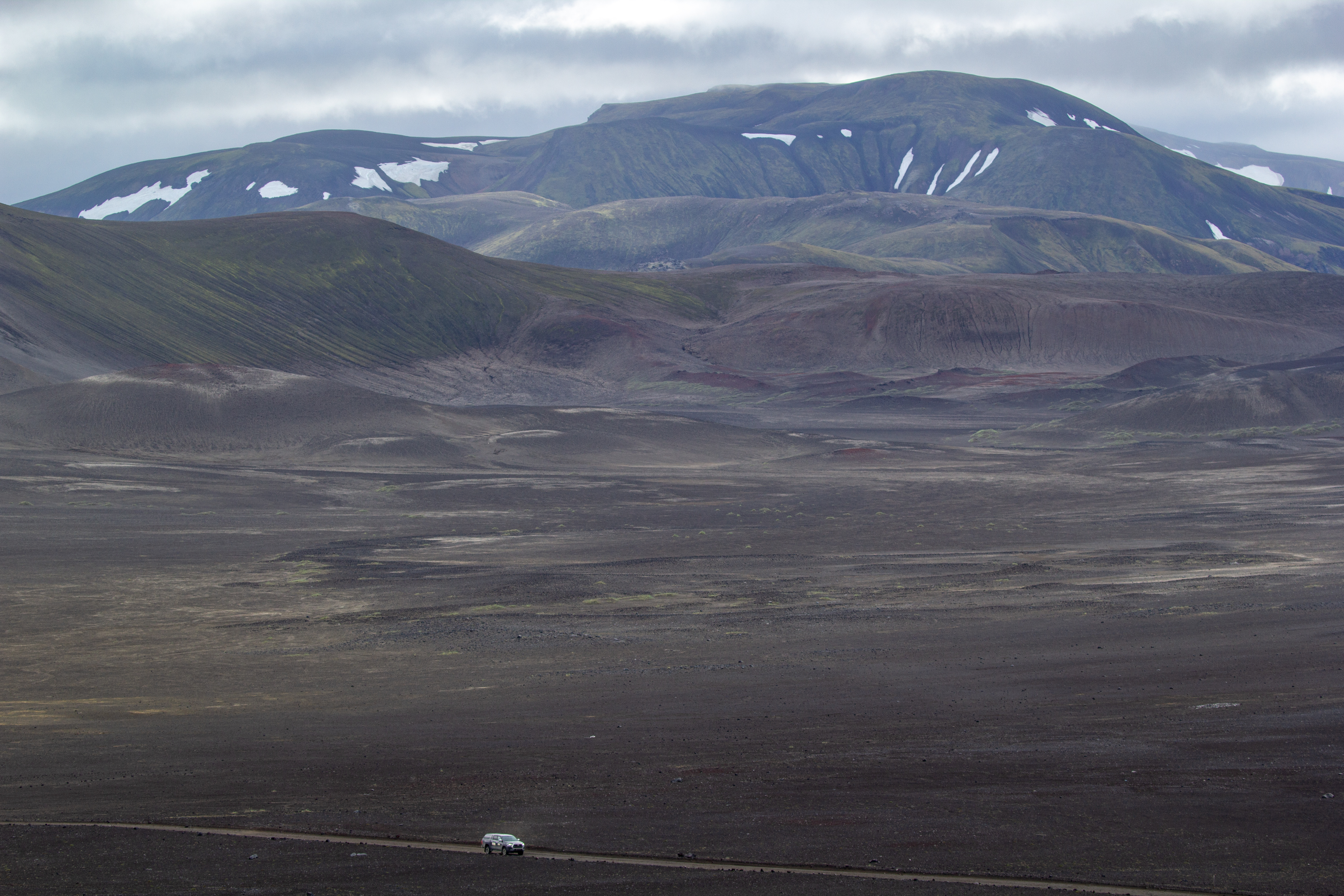
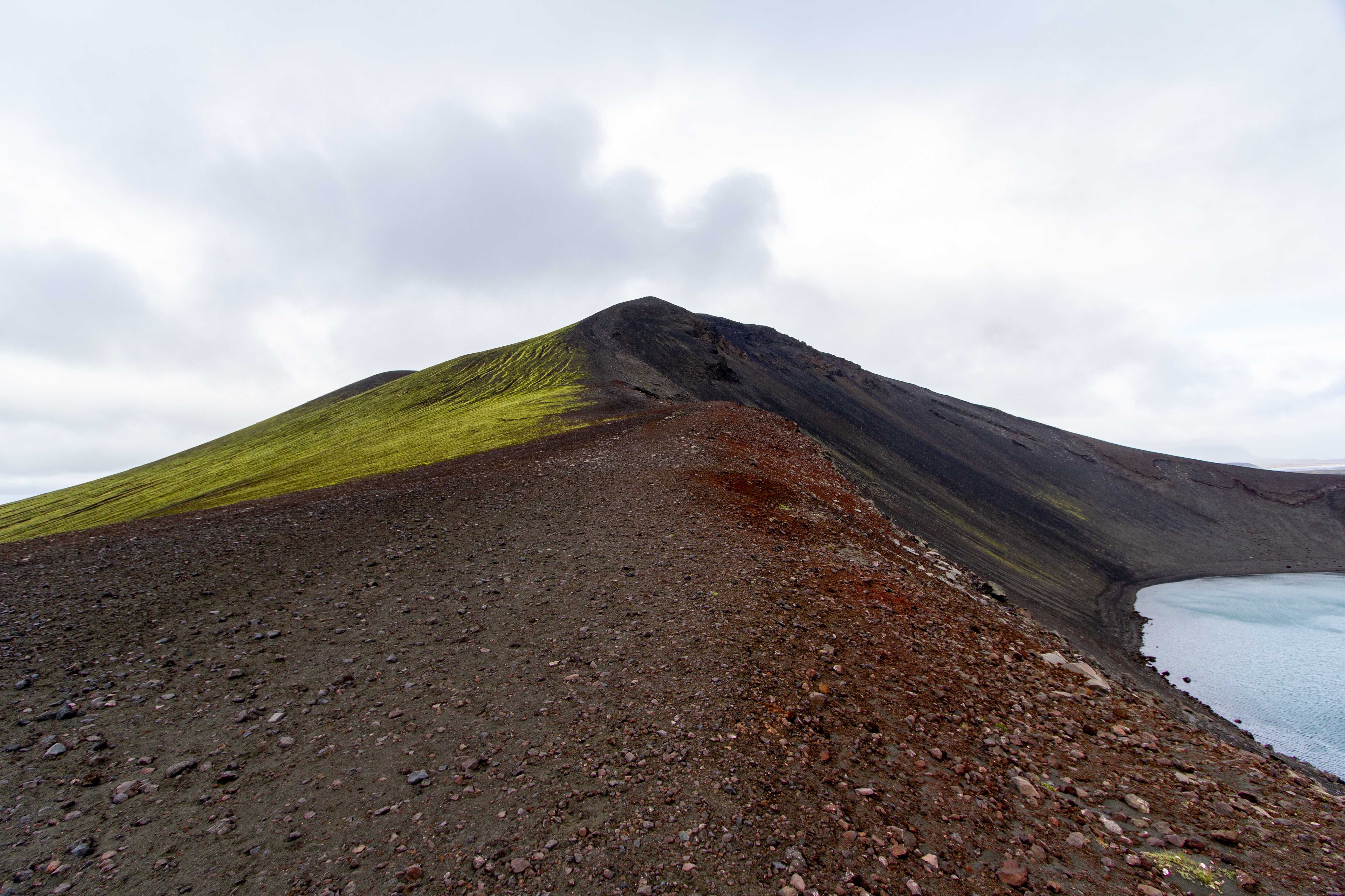
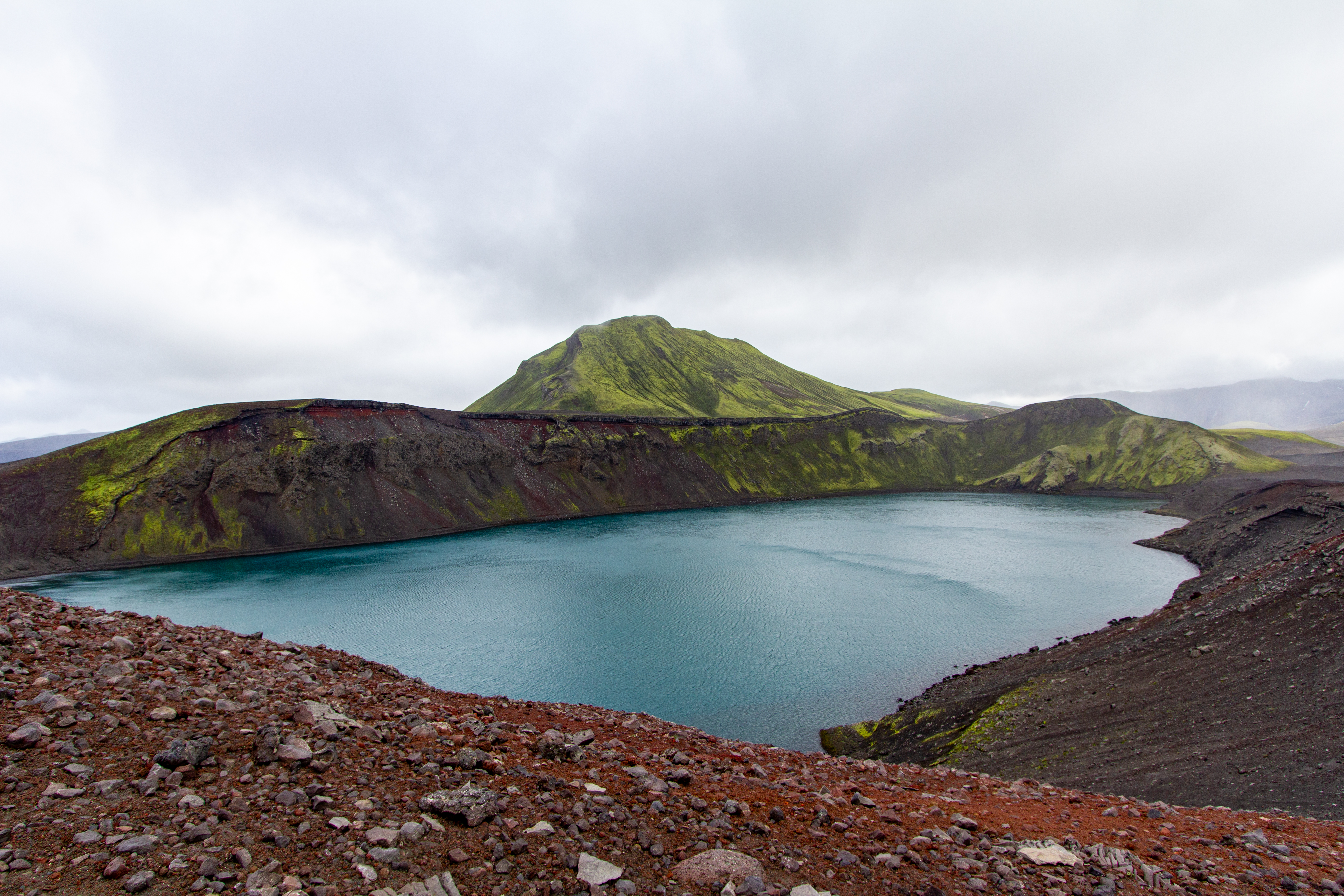
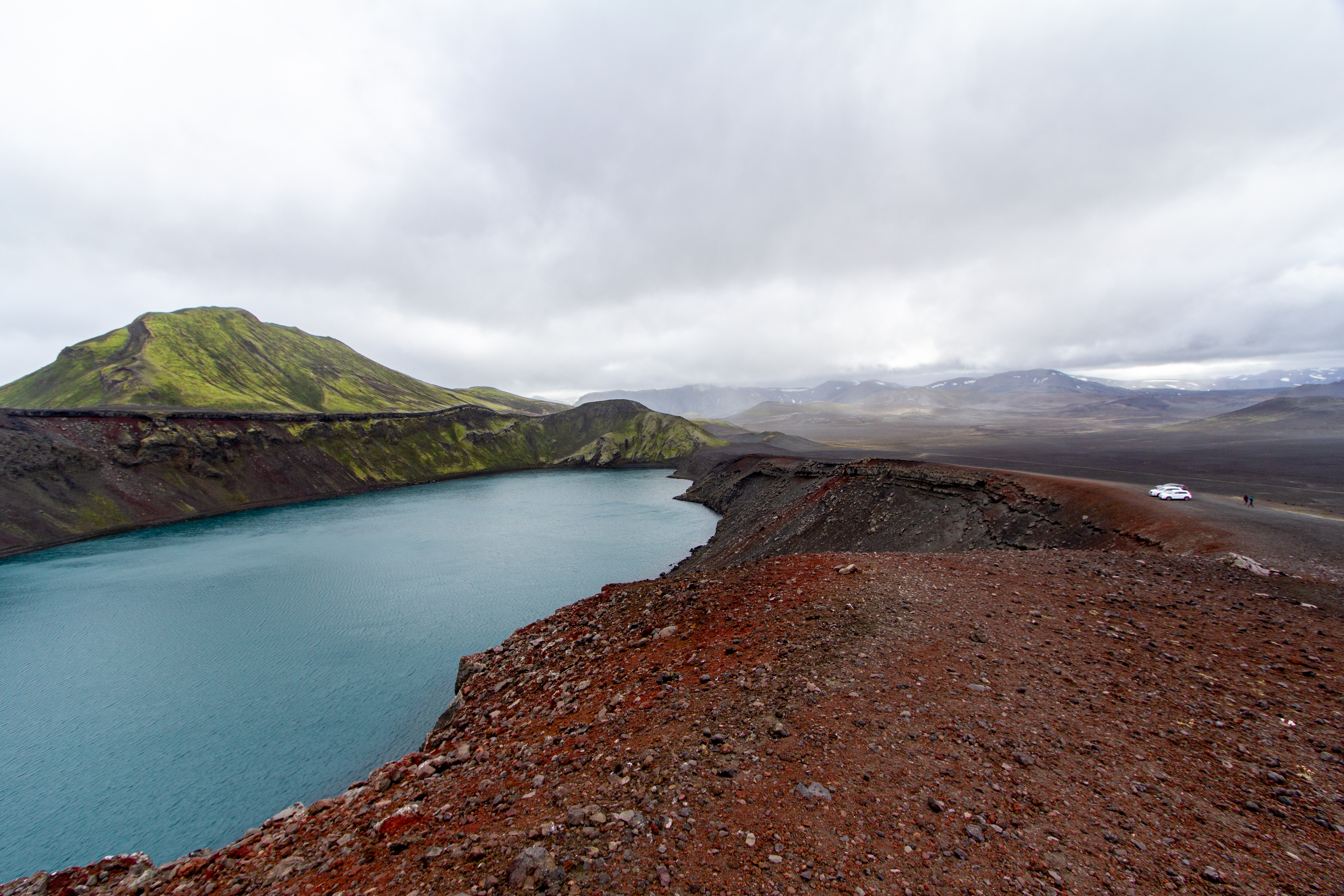
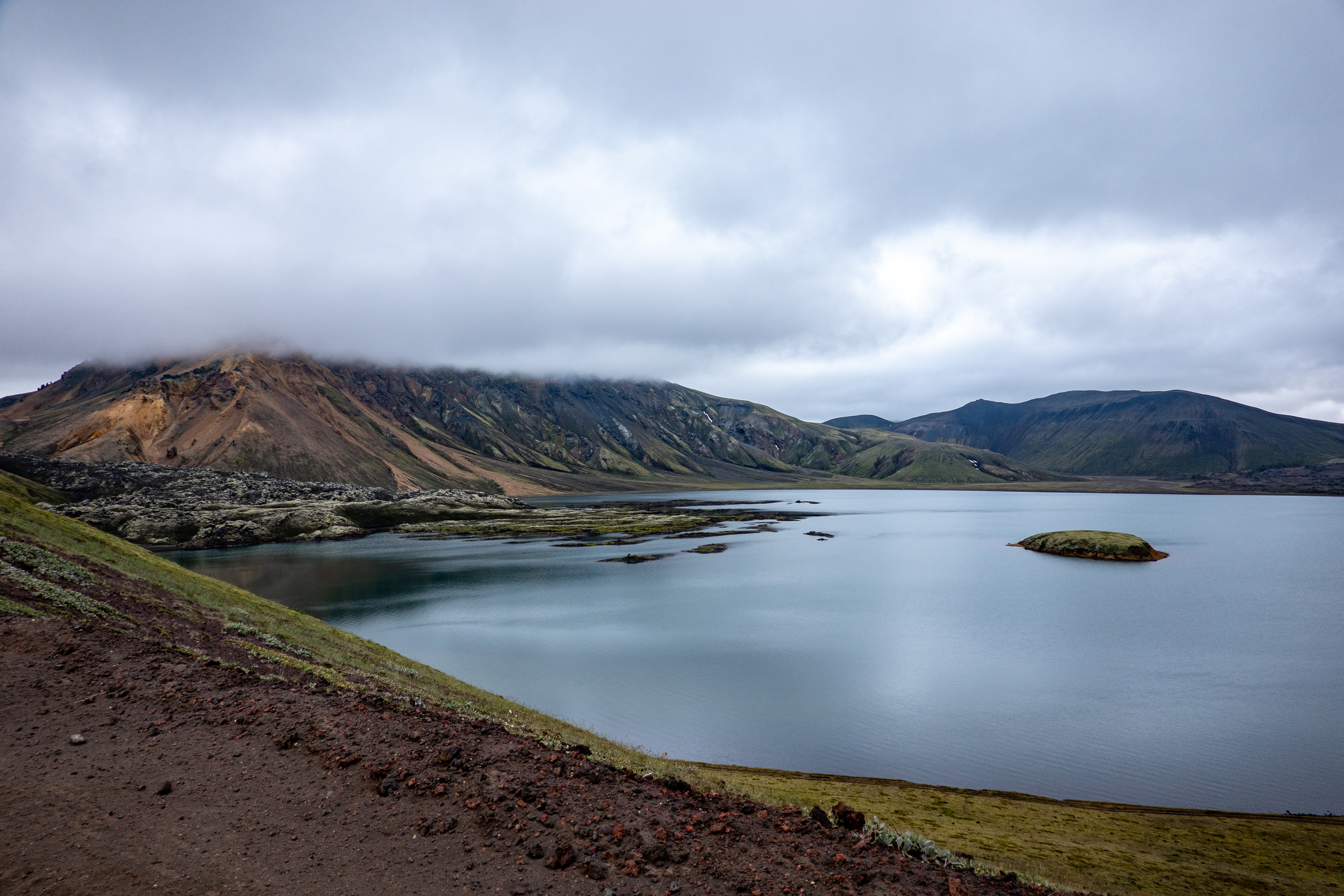
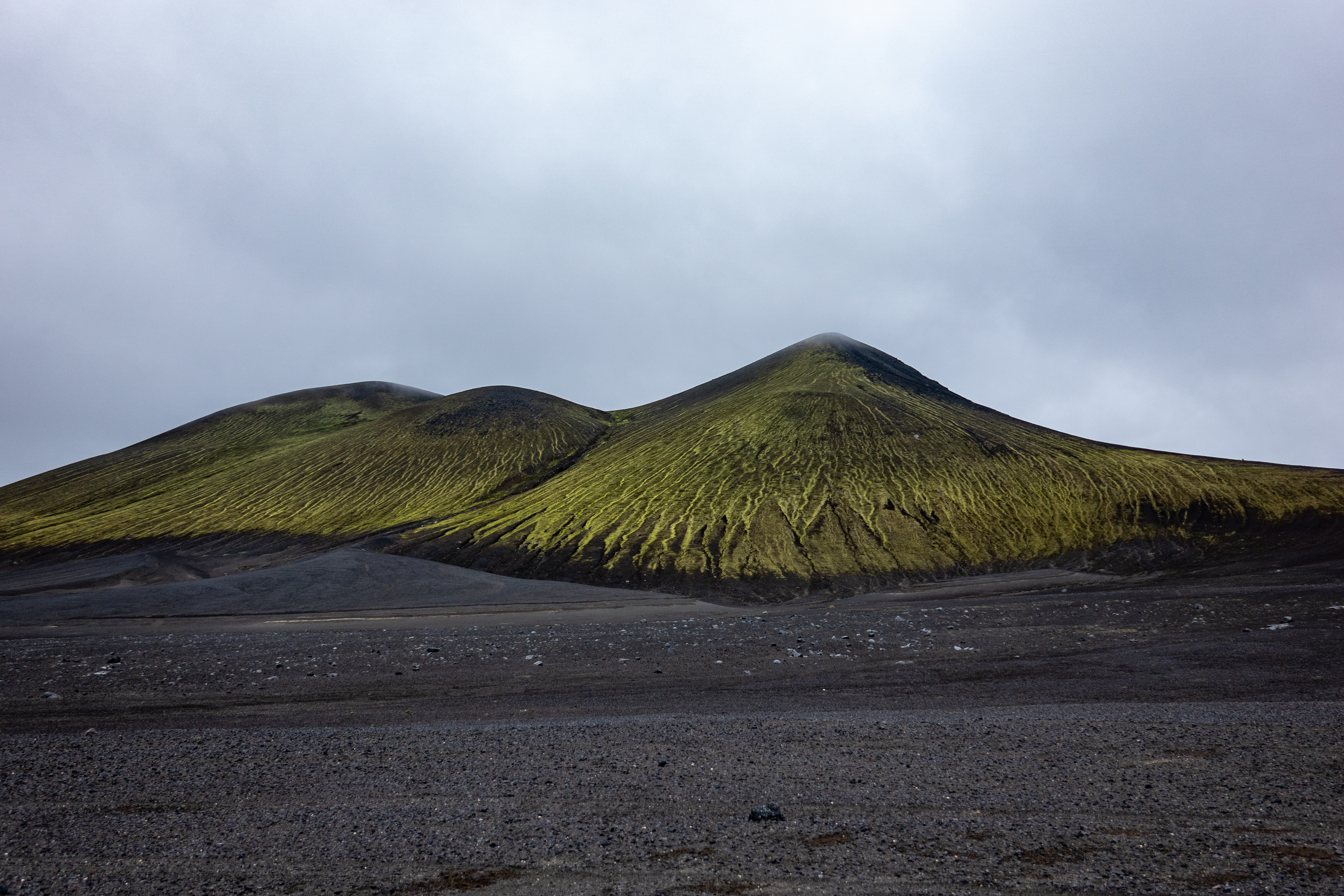
The road wasn’t too dusty, but it was washboarded and we were shaking quite a bit. We read up on how roads get like that (there was cell service everywhere), and it’s basically a steady state of ripples caused by tires bouncing up and down on unpaved roads. After what seemed a long time, we got to a turnoff for Bláhylur. We went up a steep embankment, and parked near the edge of a ridge. Below us was a turquoise lake, on the left was a neon green pyramidal mountain, and on the right was a reddish lava colored mountain - it was incredibly photogenic. Alas, the wind was howling, and there was water vapor in the air, and Justin was having all sorts of issues keeping water off his lenses. Then he couldn’t dry them, even in the car, and he was quite frustrated, as we had just started the trip. Eventually it stopped raining, and he found one cloth that got the moisture off the lenses. The view changed substantially once the sun came out, with the colors changing hues.
|
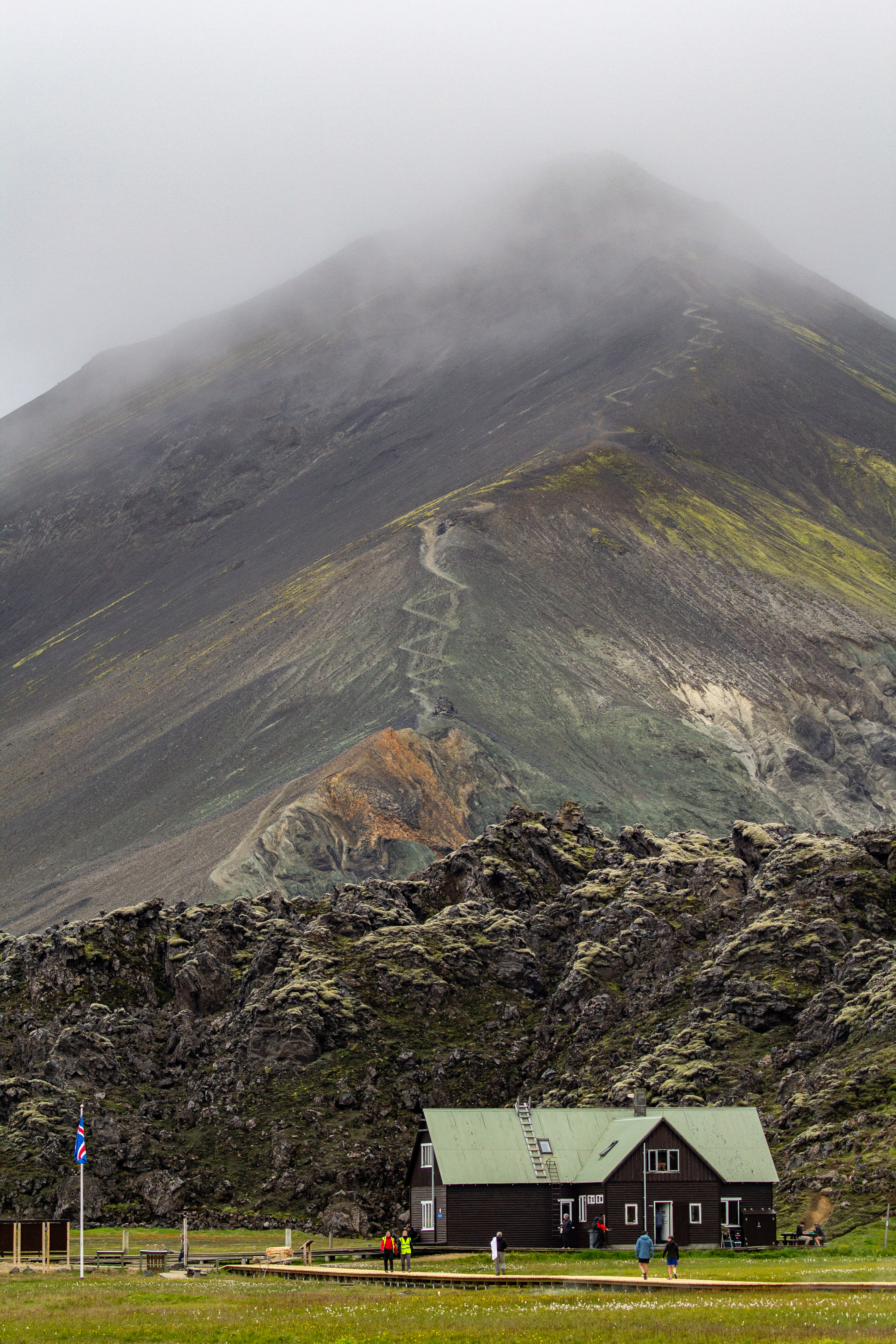 |
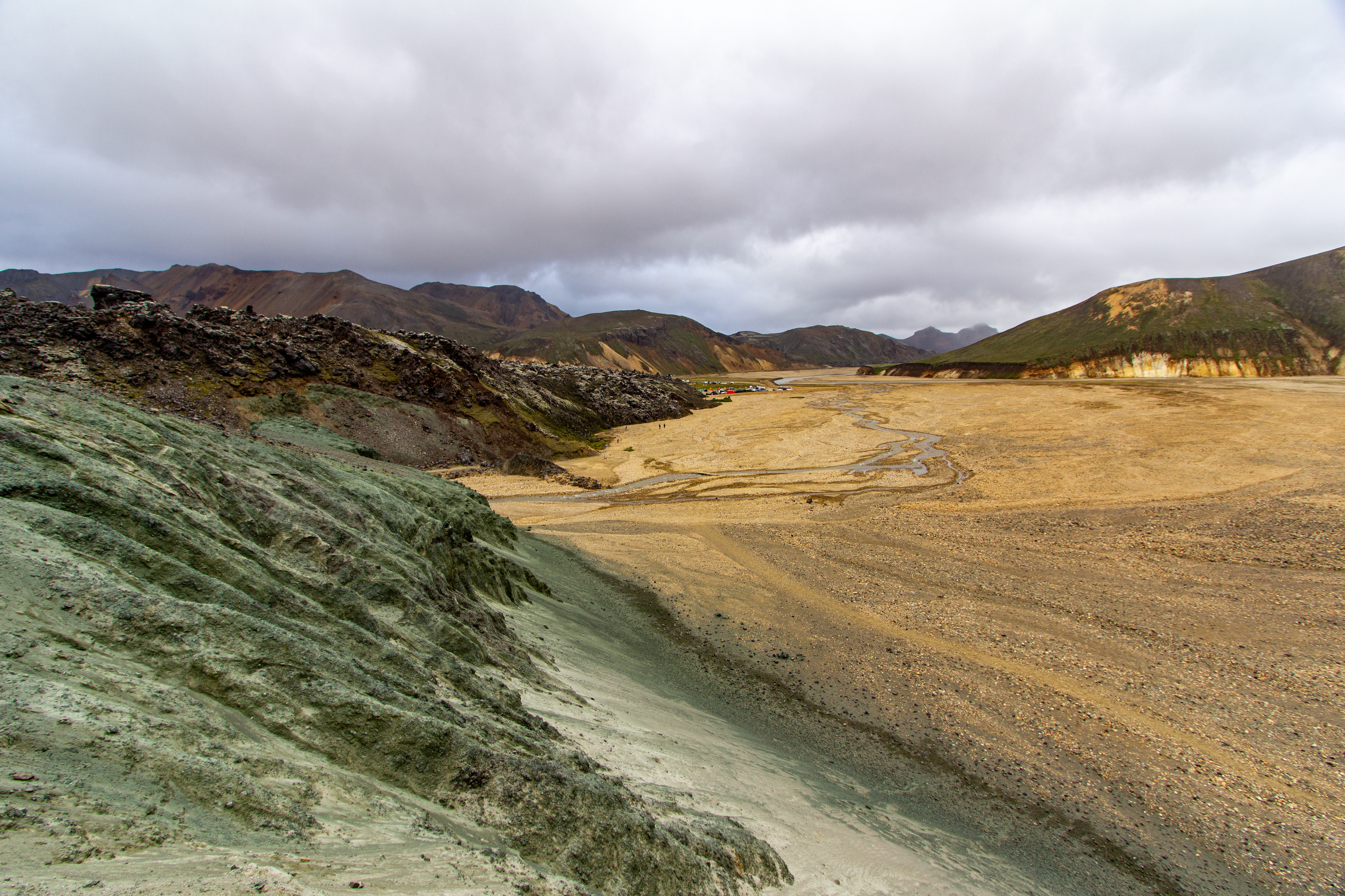
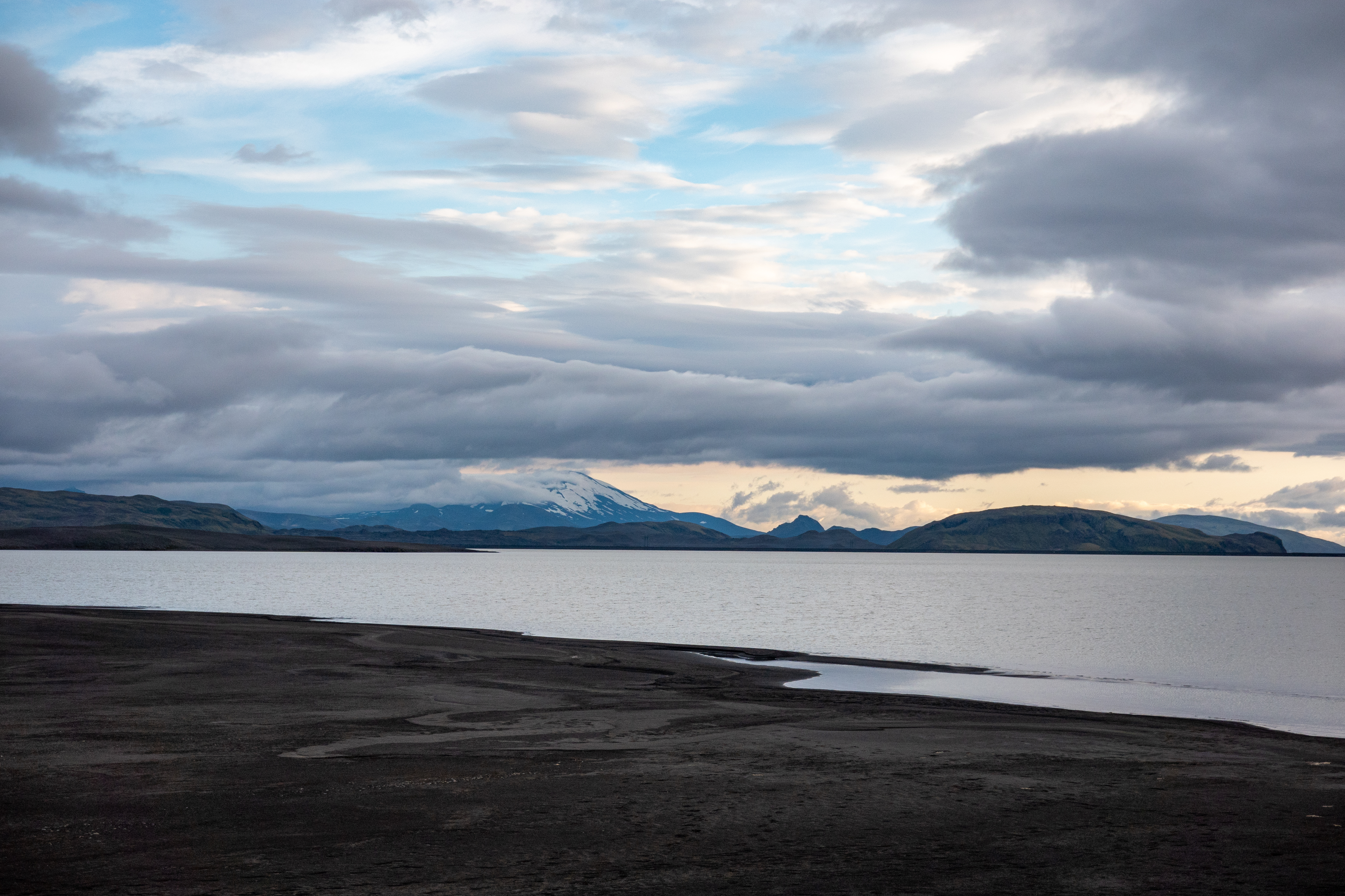
We continued south on Road 208 just a little bit more until we arrived at the parking lot for Landmannalaugar. As the woman at the information desk at lunch had said, we walked over a couple wooden bridges from the parking lot to the main area. At the information desk there, we asked directions to the start of our hike, and also about Road 208 versus Road 225 once we were done. They said it was up to us, as both were nice. This wasn’t especially helpful, and we wondered about the wisdom of crossing rivers in the evening - we at least knew the one way we’d already driven was fine.
 |
 |
 |
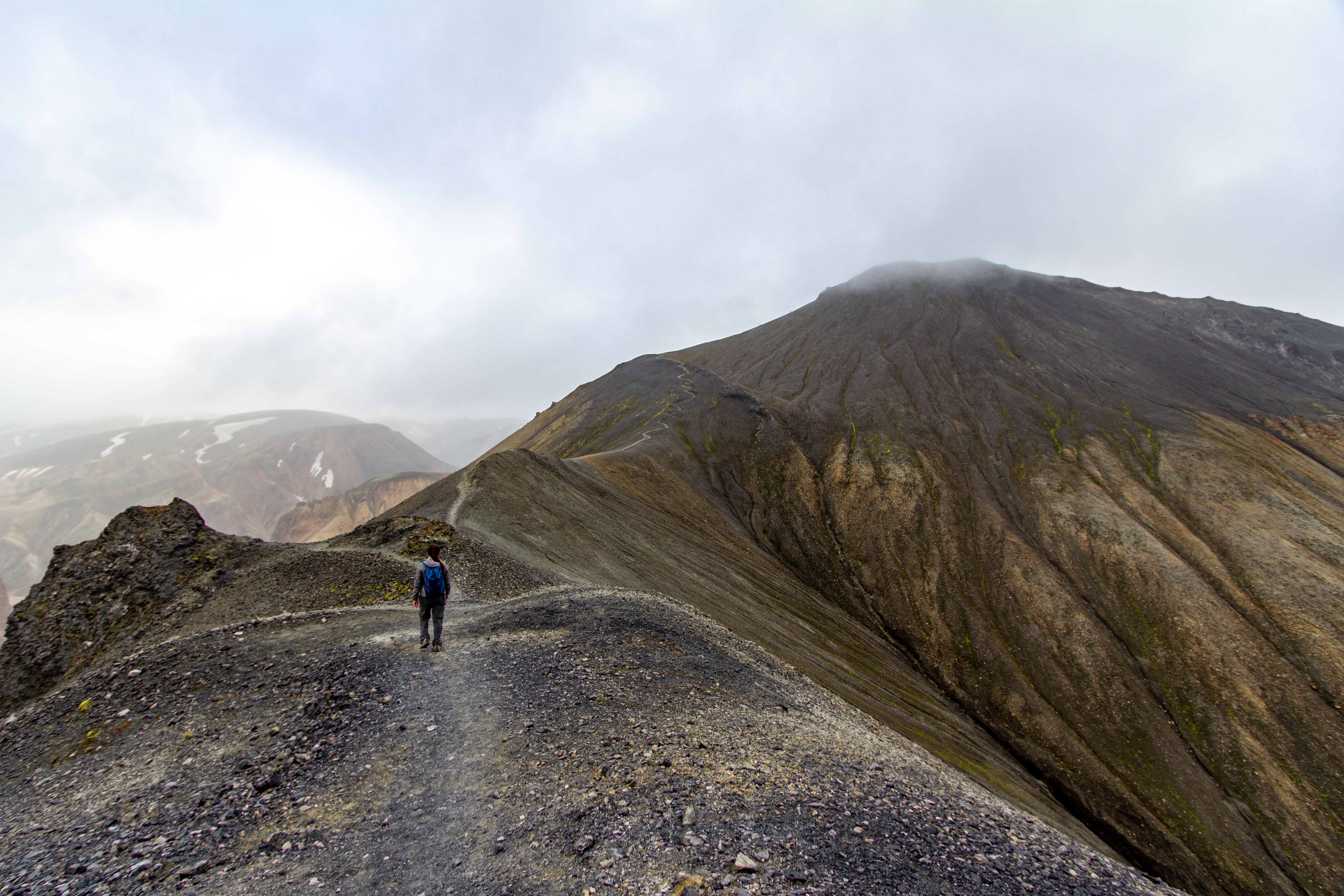 |
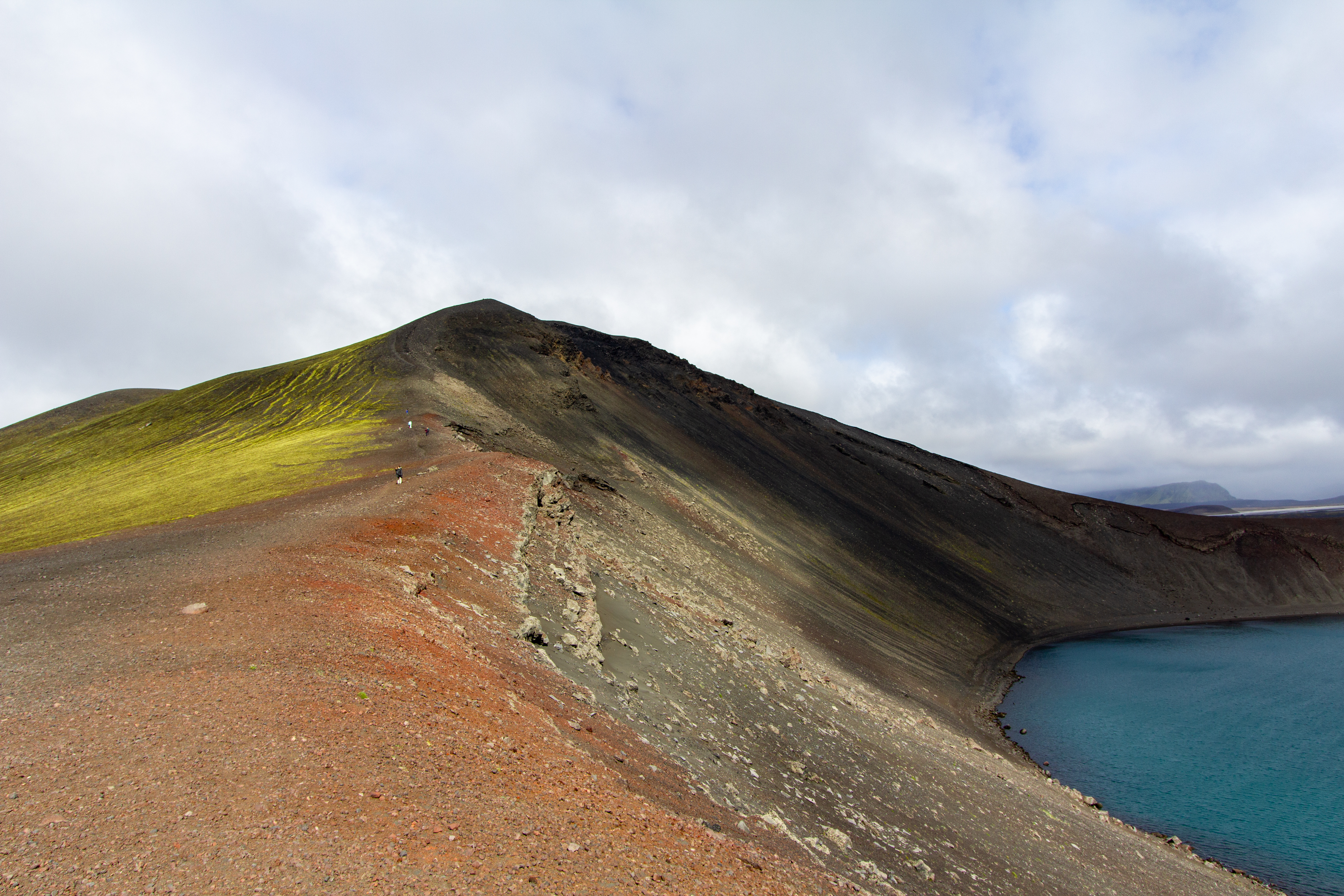
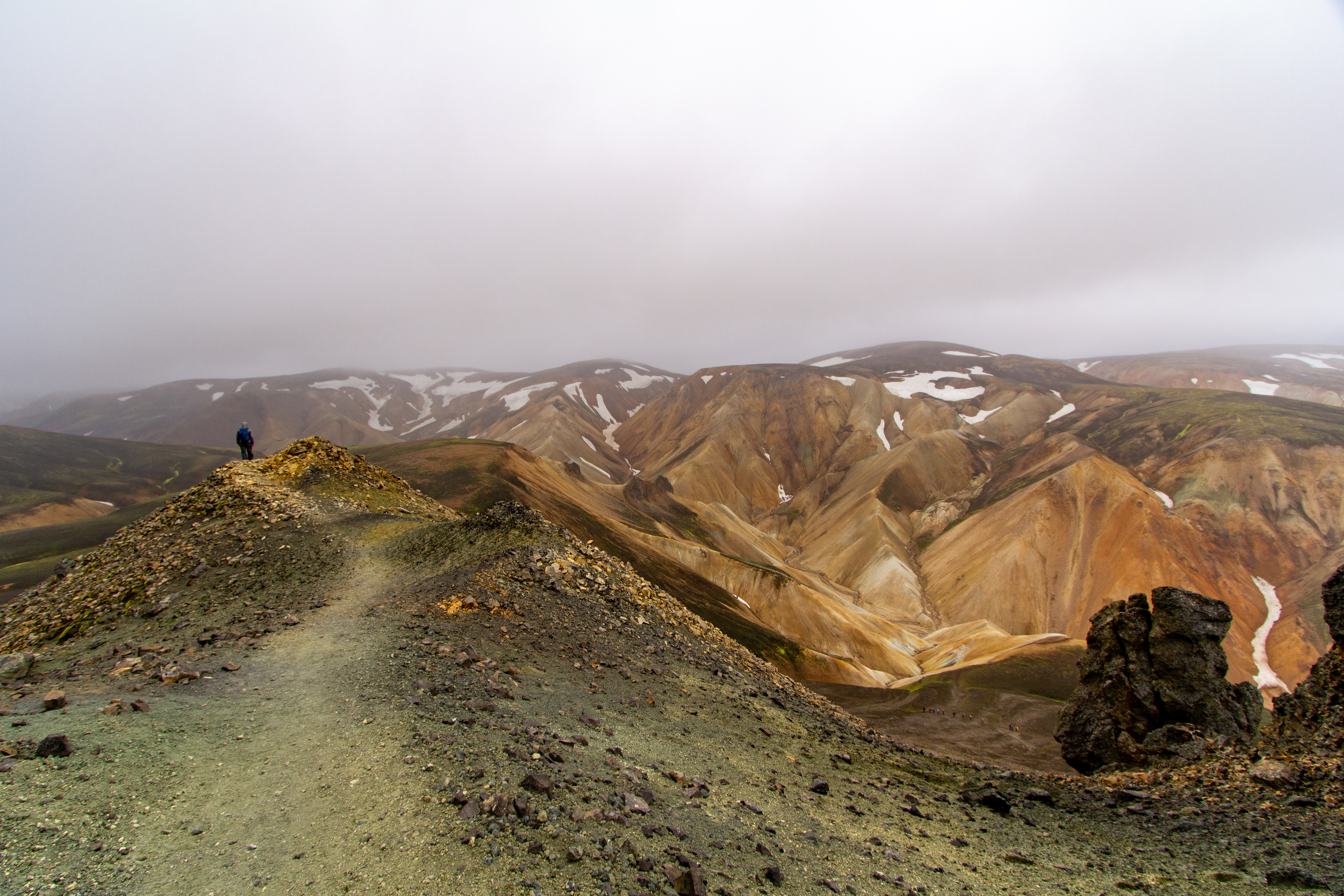
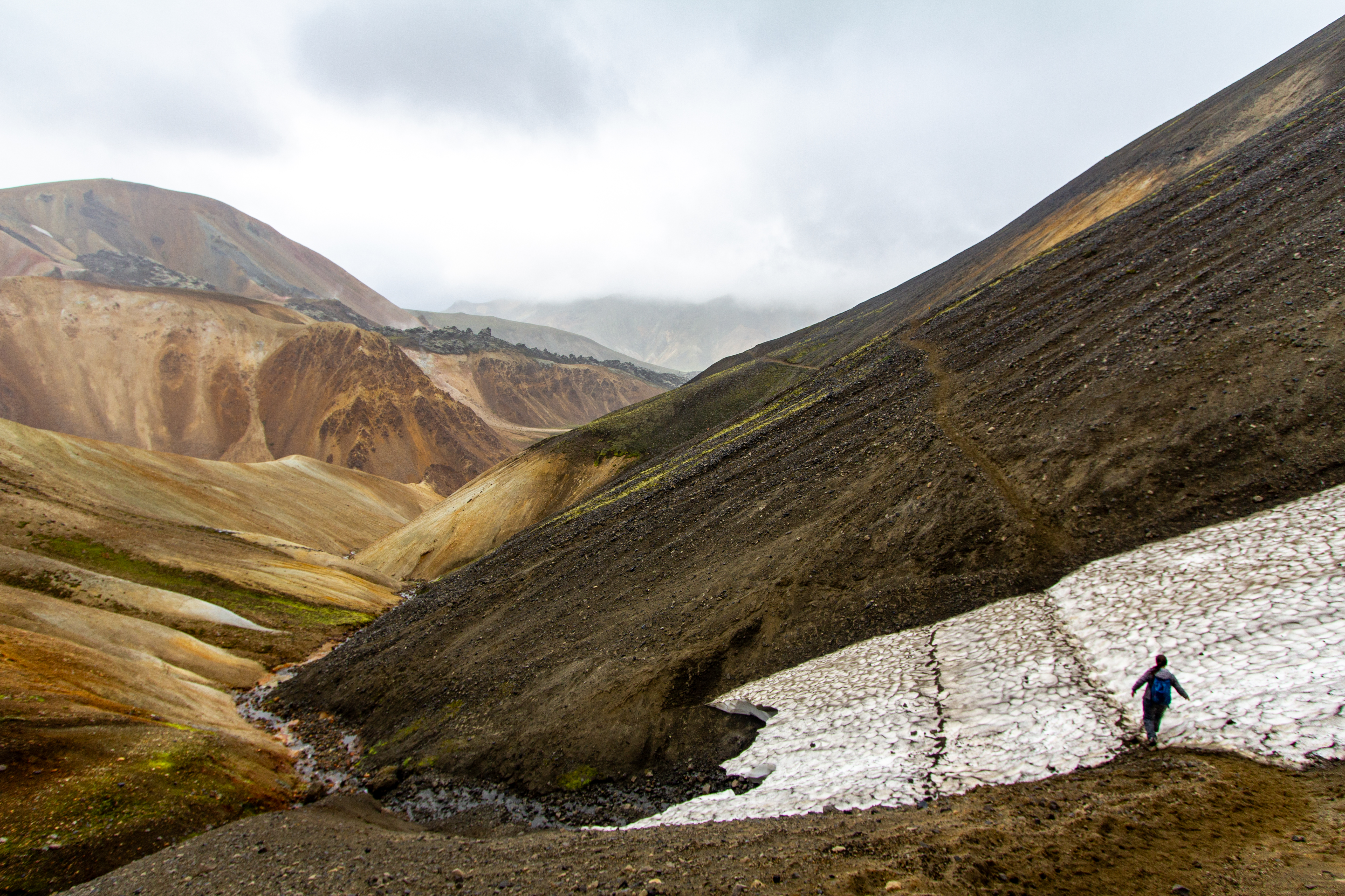
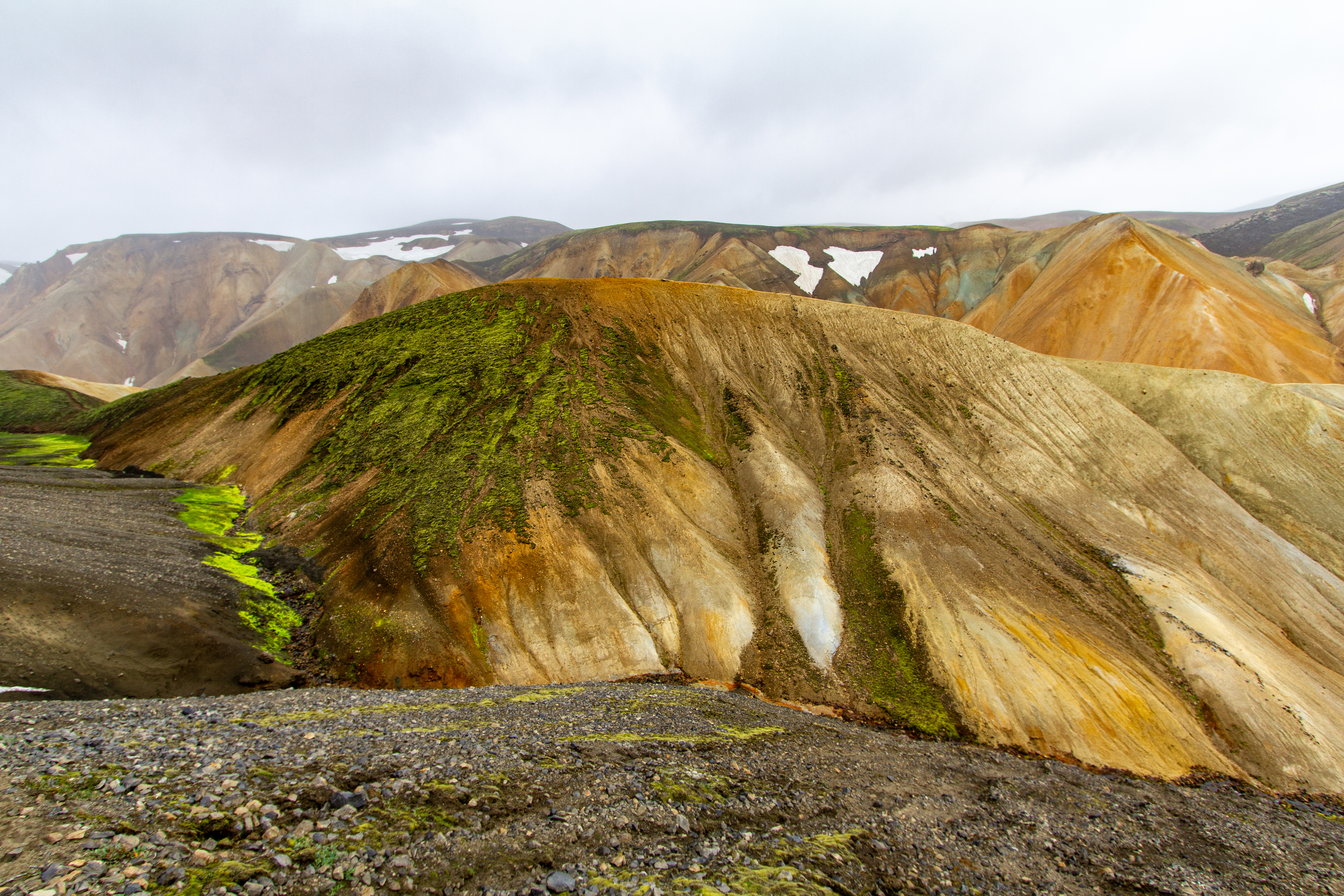
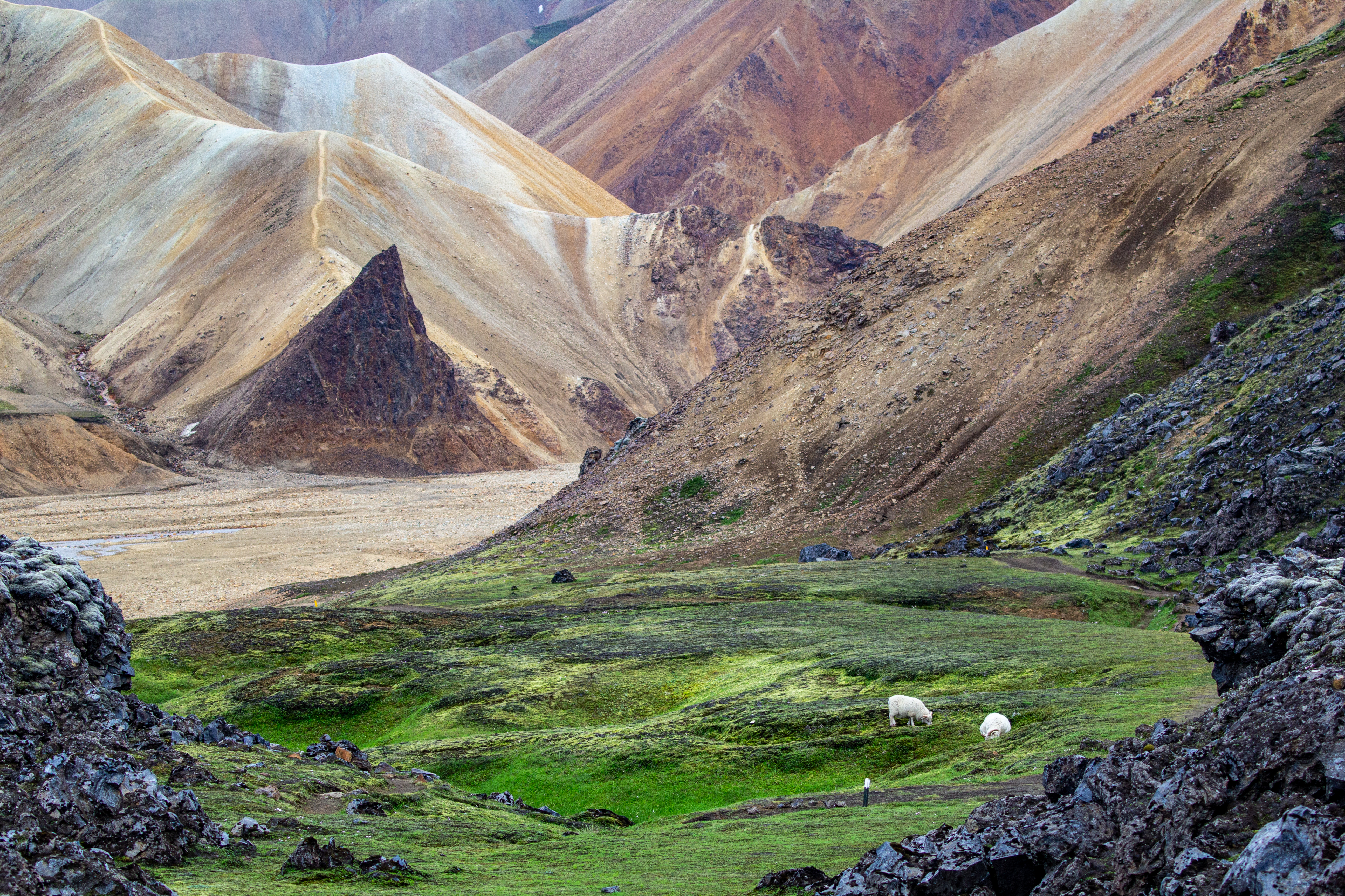
It was quite windy as we started our hike, a loop hike going up to Bláhnjúkur peak and then back through some lava fields. We went clockwise, as the first part looked steep, and we’d rather go up steep than go down it. The first part was right up the side of a mountain, which was sort of turquoise-greenish. It was kind of like the green sand beach on the Big Island, but a bit more blue and a bit darker; we wondered what element this was from. Crystal was not a fan of walking on the ridgeline in such windy conditions, but she kept on, one step at a time.
 |
 |
 |
 |
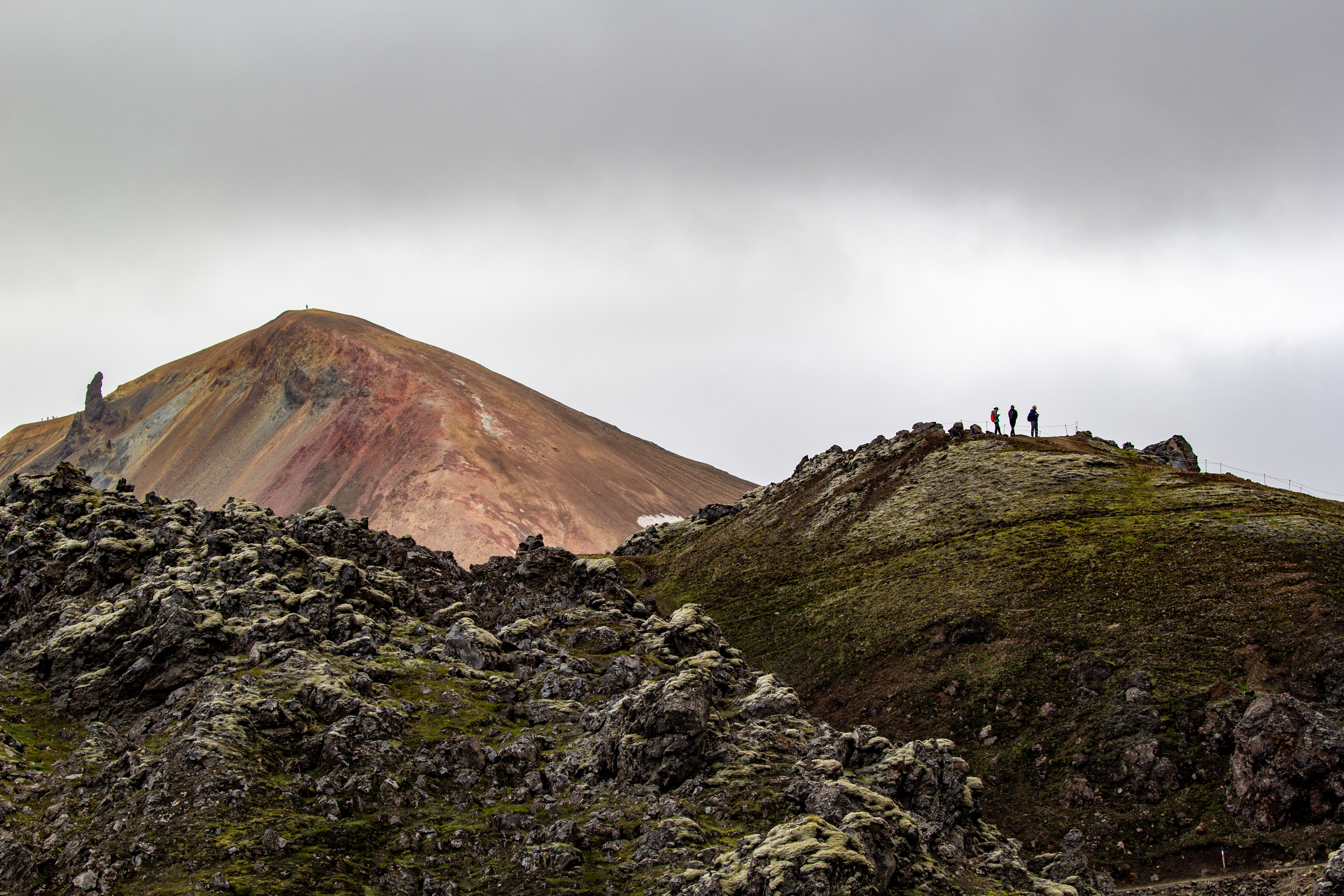
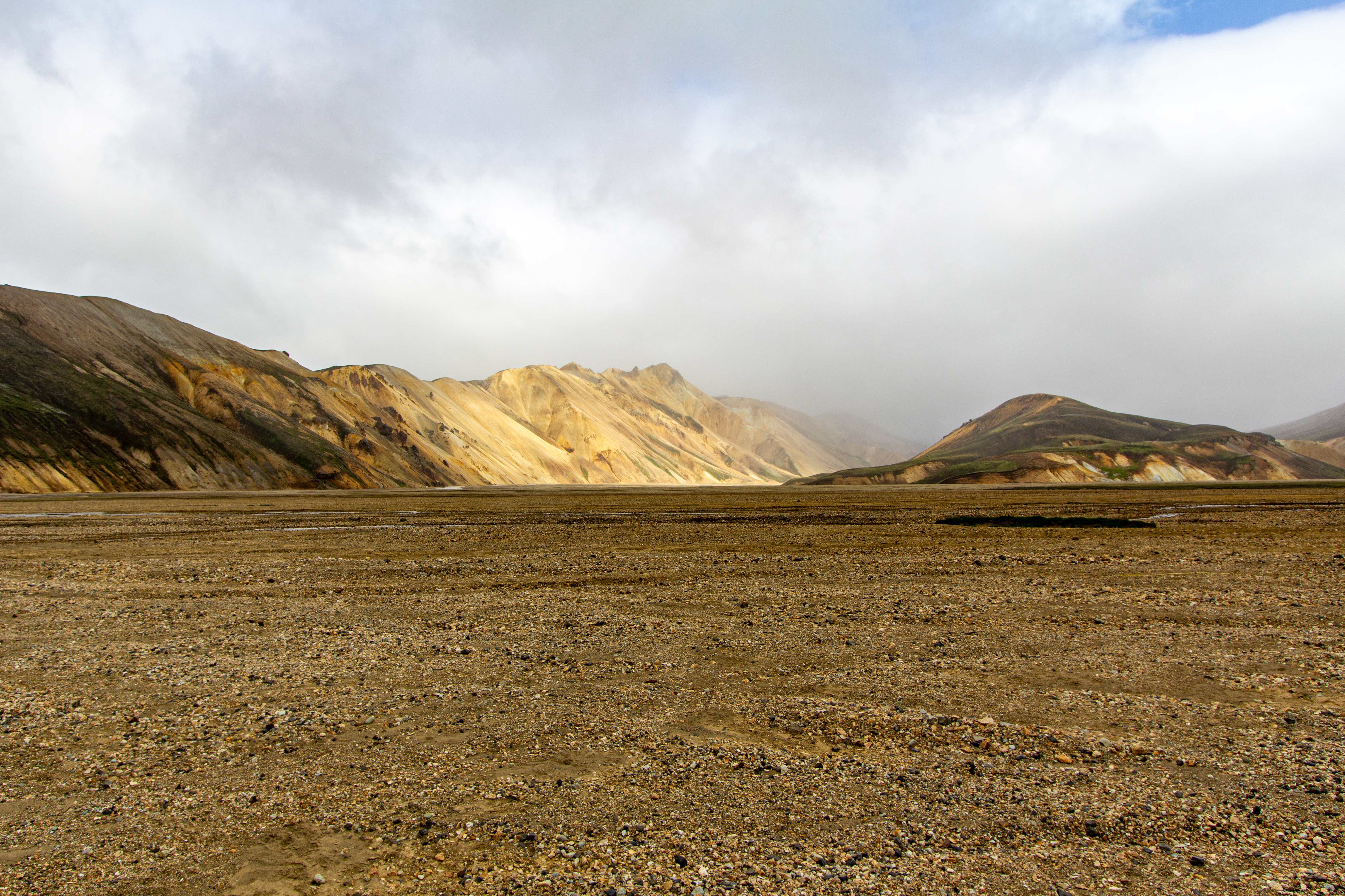
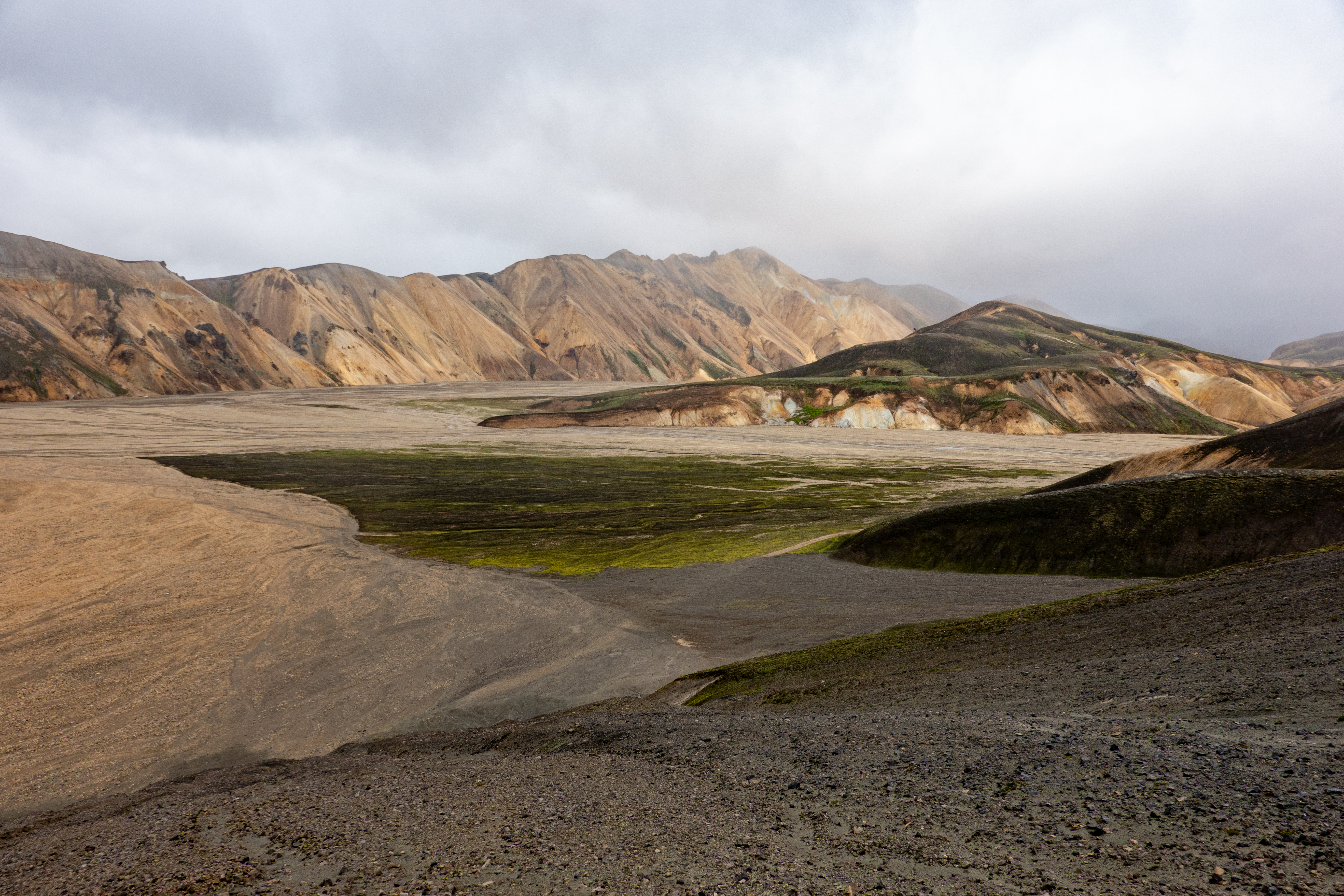
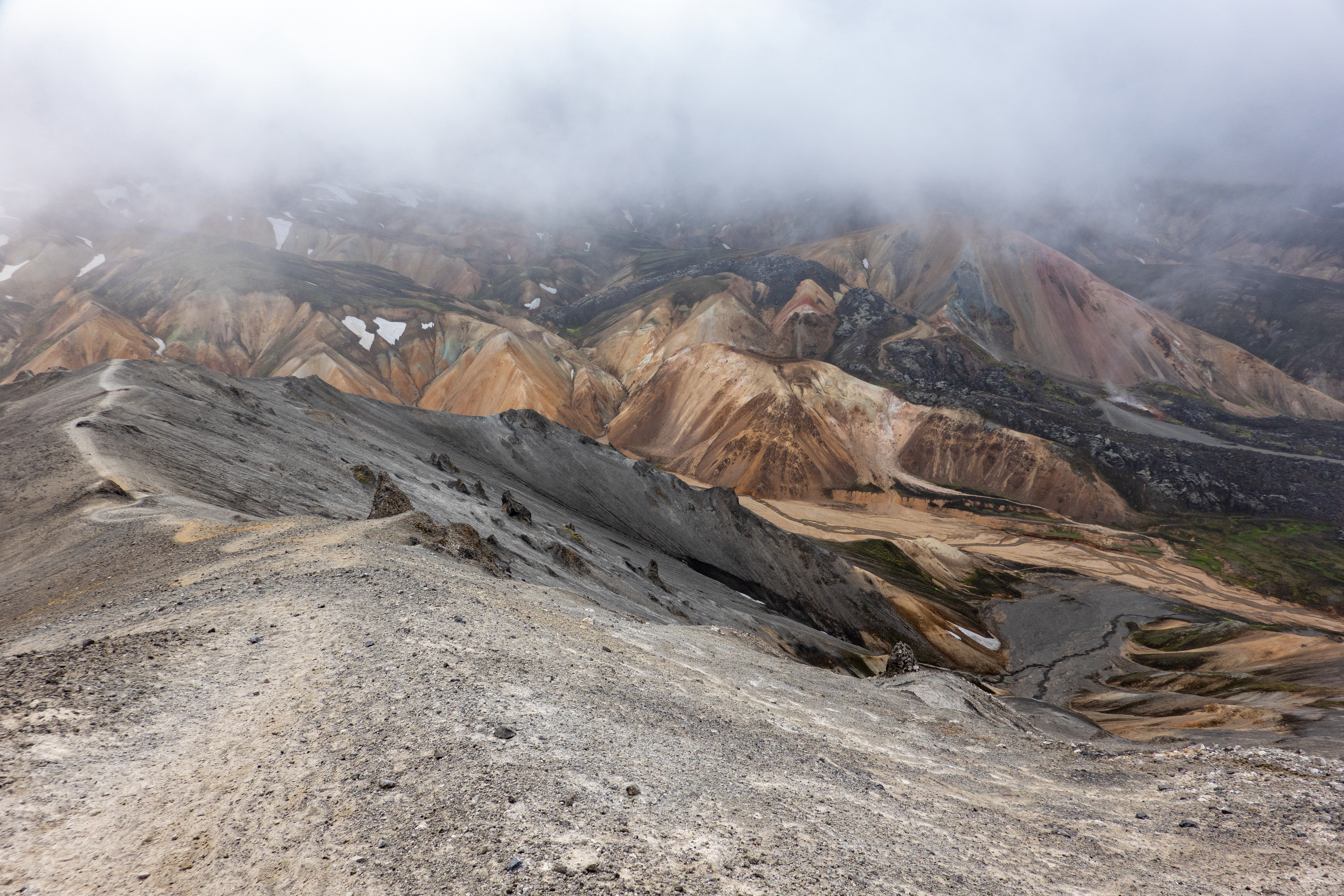
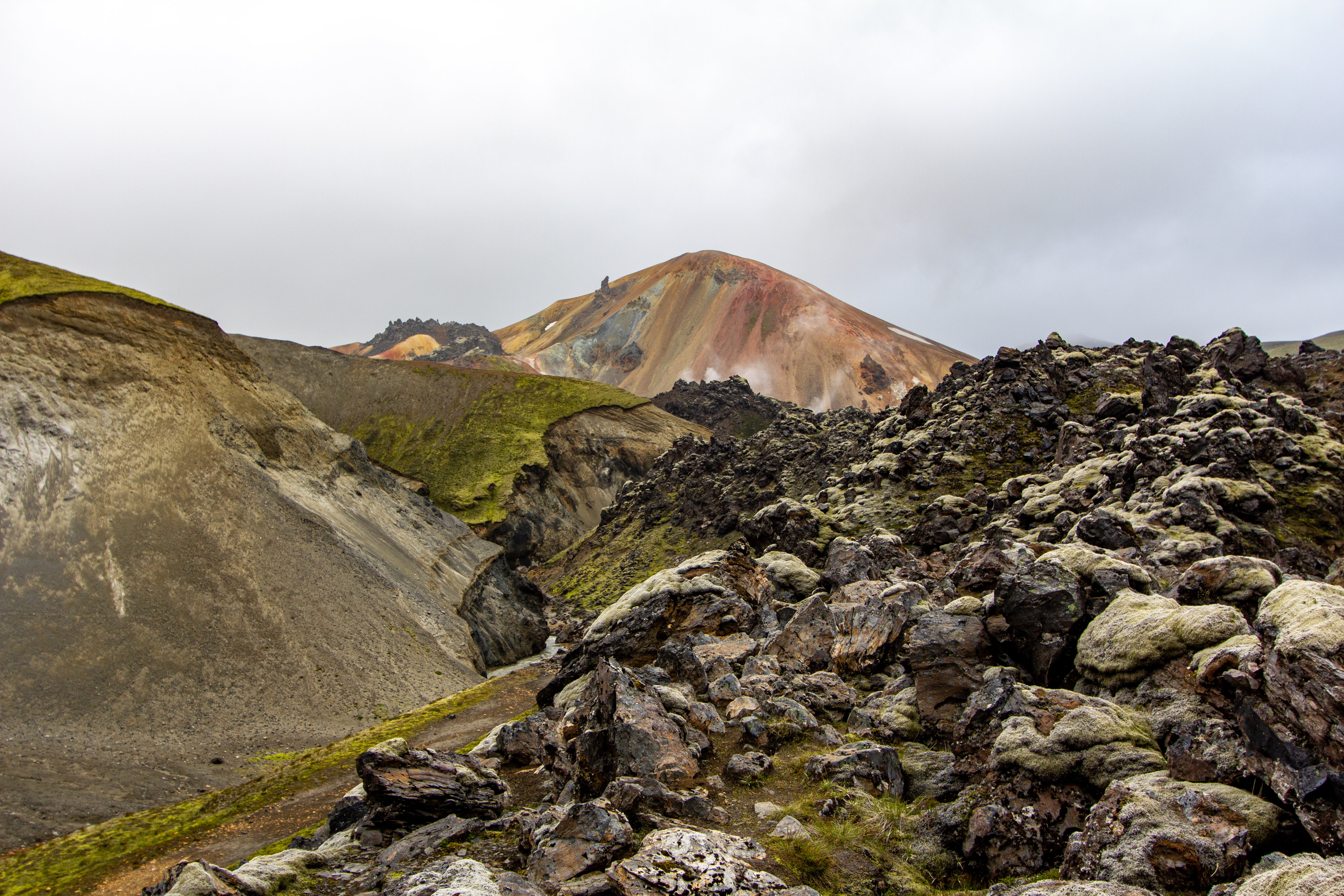
We reached a peak, but then we saw a second peak, and she asked Justin “are we walking all the way up there?!” He responded by saying he didn’t know, as he hadn’t been to Iceland before. But we were going to end up walking all the way up there. The scenery was spectacular, and would’ve been better but for the mist from the constant wind. The guy at lunch with the group told them confidently it wasn’t going to rain in the area this afternoon - this was technically accurate, but we were walking through a cloud, which was basically like being rained on.
 |
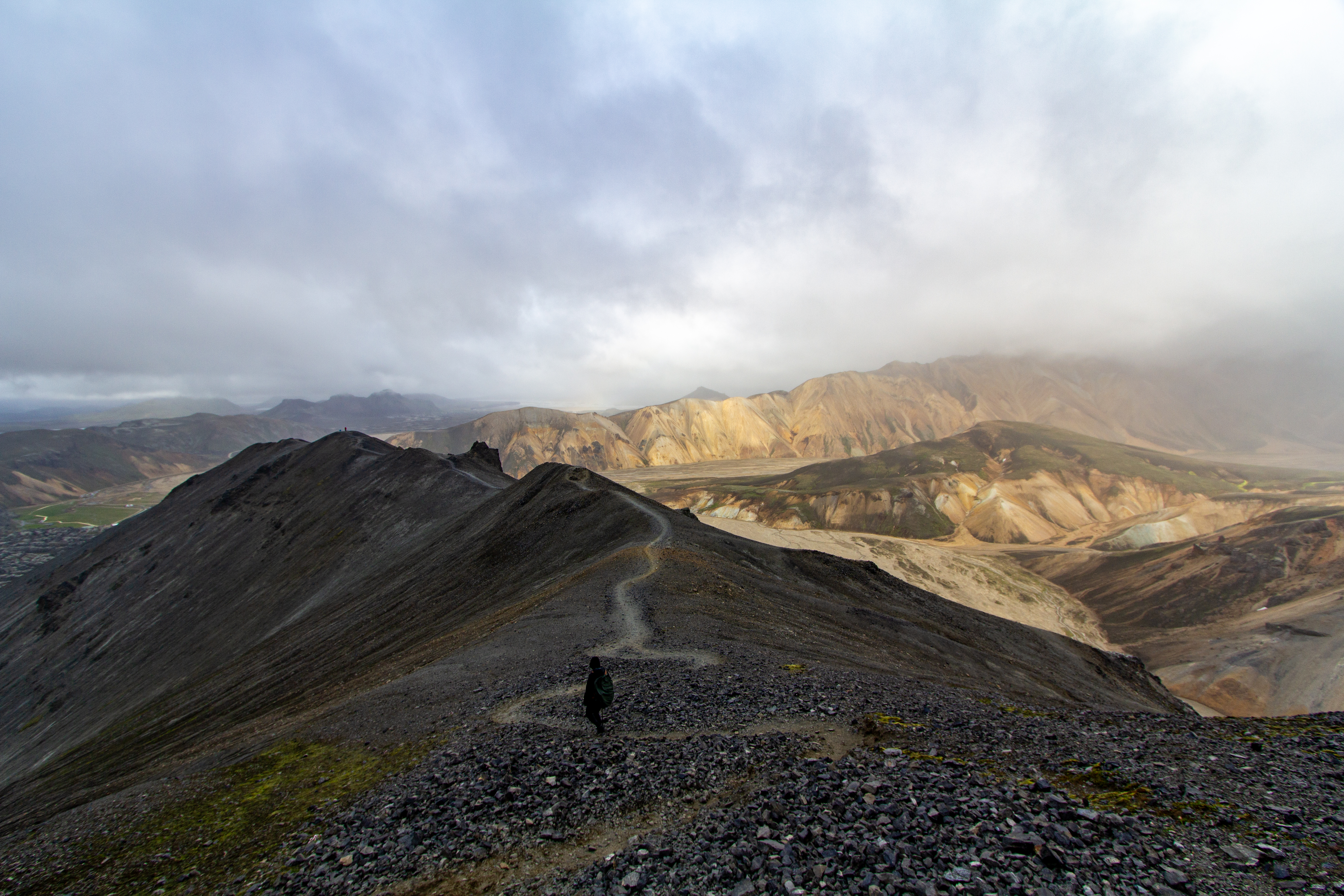
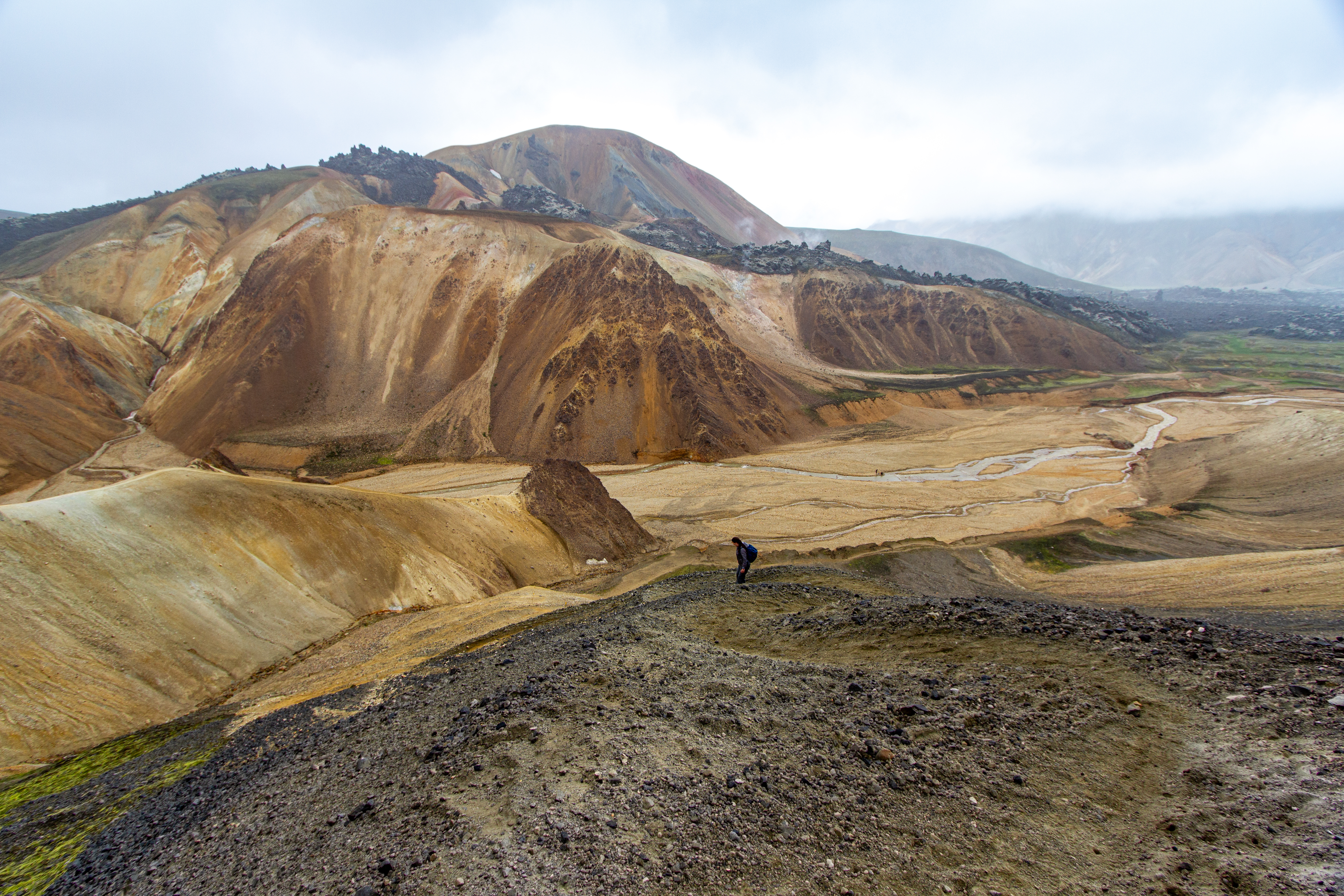
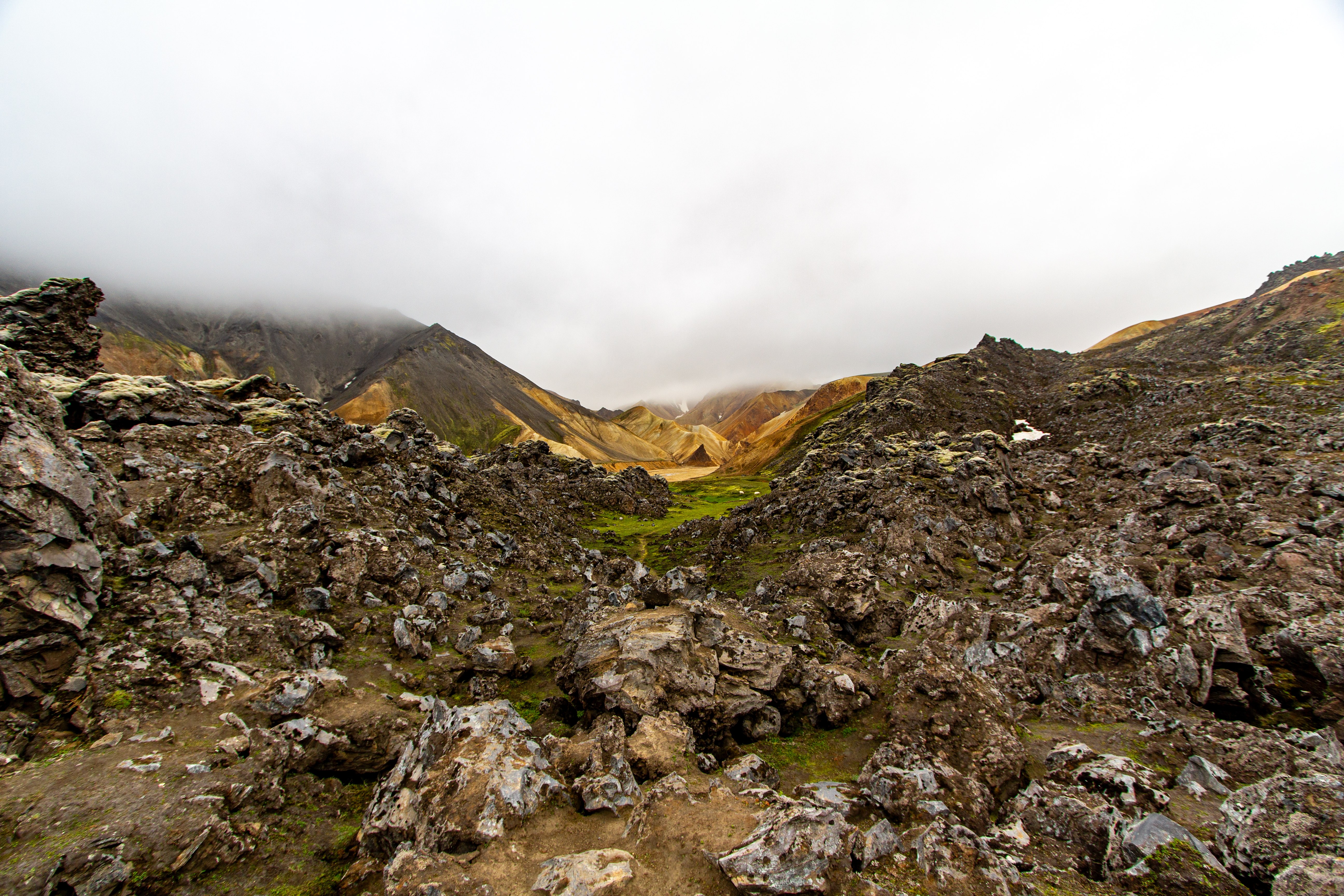
Coincidentally, once at the very top, we started down around the backside and saw the group from lunch (in the lower right here). They were apparently doing the same hike, but counter-clockwise. Right after we saw them, we were finally protected from the wind, and we saw that the left side of us was all wet, and the right was dry. This part of the walk was better, except for Justin still being irked with his cameras, which he couldn’t get clean nor dry. We had to walk across a small glacier about halfway down. Thankfully we didn’t slip or fall through. The last little bit before the valley floor was clay, which was a bit slippery from the mist, and we took it very slow.
 |
 |
 |
 |
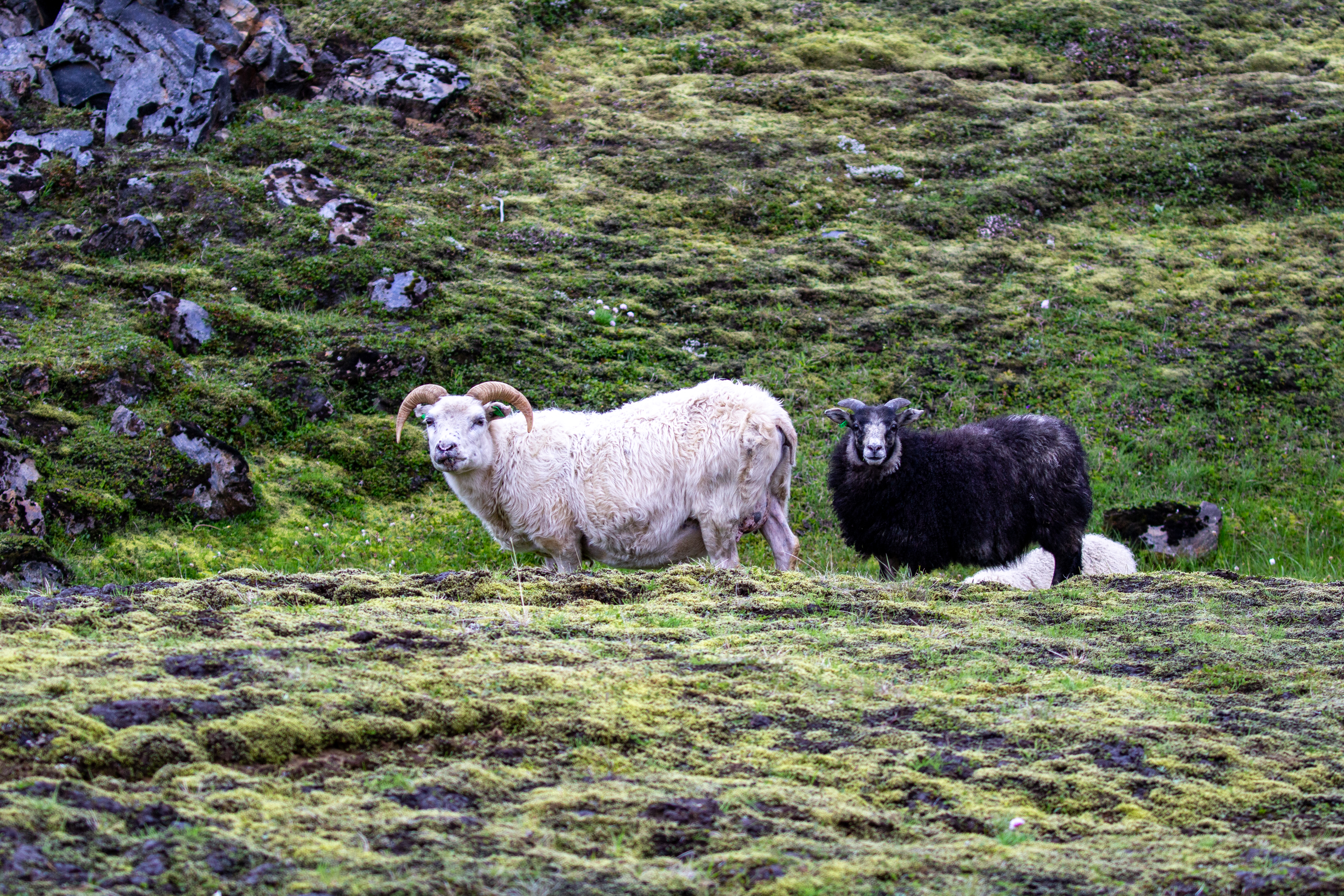
At the valley floor, we had to cross a river, which wasn’t fun, and we got a bit of water in our shoes (more for Crystal). We’d actually brought water sandals specifically for things like this, but they were in the back of our vehicle, a couple of kilometers away, so we’d screwed this up. Thankfully we were well over half done with the hike. We walked through an A’a lava field for a bit, and saw some sheep in a grassy area. We wondered how they’d gotten there - had they walked across the lava?
 |
 |
 |
 |
As we were nearing the end, we saw the big group coming down the mountain right where we’d started. We “beat” them to the end by a minute or two. Back in the little camping village right by the visitor center, we got some provisions from a drunk guy in a school bus (his “store”) who was chatting up all the people trying to buy stuff. For the drive home, we decided to just go back the way we came. The drive took forever, way longer than we expected. We weren’t sure why, but we think Gina estimated our driving speeds on the gravel road to be far faster than we actually went, or wanted to go.
 |
 |
 |
 |
There was a shorter route about 2/3 of the way back, but a minute or two after starting on it, we realized it was gravel, and Justin just turned around - he was through with gravel roads for the day. Back on Road 32 (or maybe Road 30), we saw a large group of horses, more or less where we’d seen them this morning. They were jogging by the road, and some even on the road - they probably weren’t expecting too many vehicles at 22:30. We and the other couple cars in the area were basically stopped though, so there was no issue. We got a photo of some other horses a bit later in the drive, just before getting back to the Ring Road.
 |
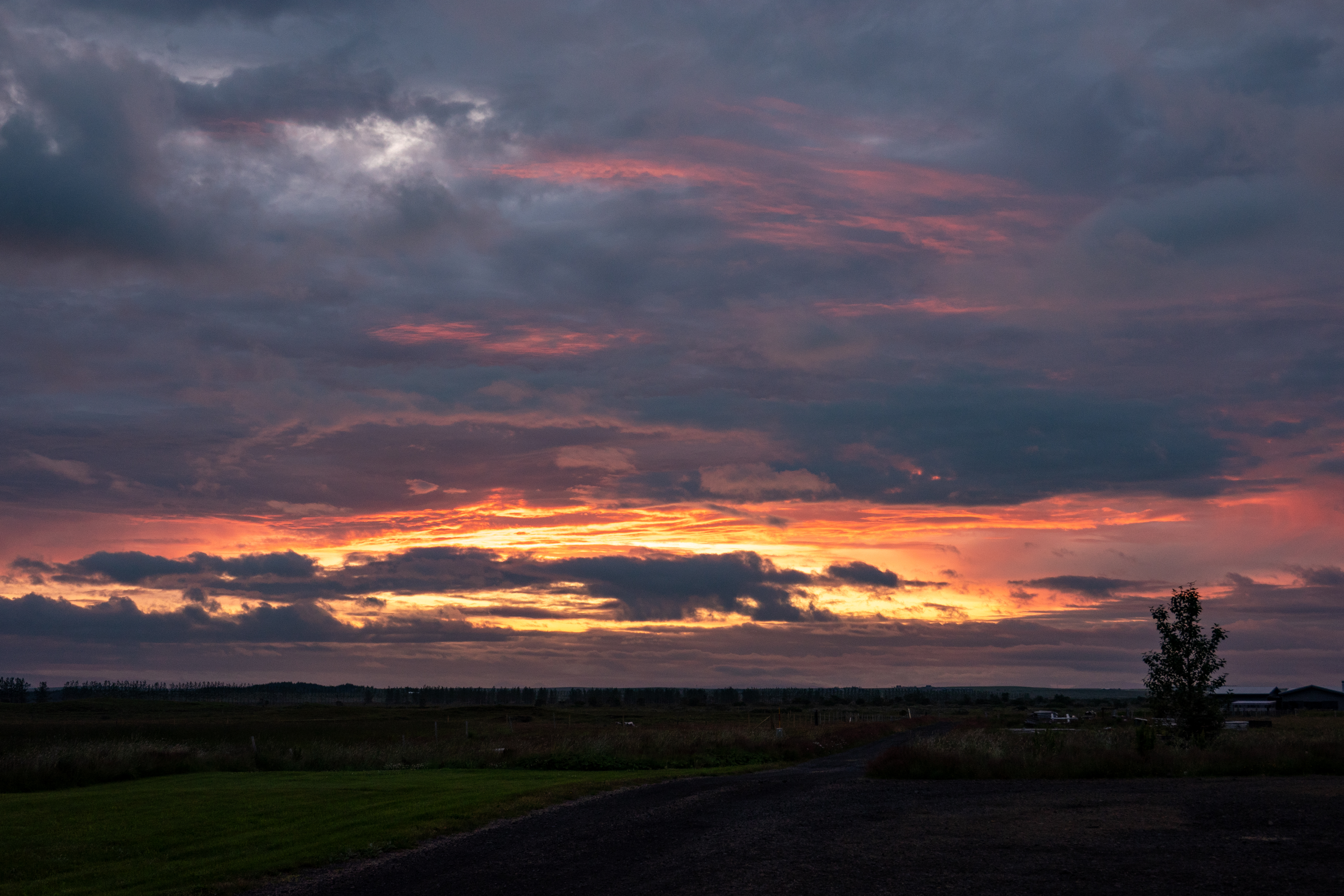 |
We got to the hotel, Loa's Nest, just after 23:00, fairly exhausted. There was a nice sunset, or whatever it’s called when the sun doesn’t actually set. It was a long day, longer than we’d expected, but we aren’t sure what we would’ve cut to keep it shorter. Our reward for our long day was doing our stupid Duolingo. There were some birds outside, and Crystal thought it might be a special one. We couldn’t get a photo of the correct bird through the window, however. We went to bed just after midnight.
| Previous Entry |