

The days in late April were good and bad, and seemed to oscillate. When we actually did stuff, everything was great. But when nothing was going on, we'd get stressed about the visa application taking so long, and what might happen if our worst fears came to light. On 21 April, in a particularly low moment, I texted Carlos: "We flew our dogs halfway around the world, at great expense and at risk to their health. We were assured that once we got here, everything else would be EASY. It has been anything but. If Spain wants us...great. If they don’t, say so. But keeping us constantly worried about our future is beyond unacceptable- it is cruel. Every day I wake up not knowing where I’ll be in 3 days, 3 weeks, 3 months. Every day I look away when a police vehicle goes by. Every day I worry what happens if Spain tells me I have to leave but I find out no airline is willing to fly my animals home with me. Retirement should be stress free. Instead this has been the most stressful time of my life. And all because a bunch of people in an office don’t want to do their job. It’s infuriating."
On the other end of the spectrum, on 22 April, we decided to take another hike, on the west side of the island again. Before going back to the US to get my shot, I wanted to make sure I got a chance to see Masca. I had read about Masca in preparing for our 2019 cruise, and it was one of the things I asked our potential tour guides about before we chose to go with Alicia. All of them, including Alicia, mentioned that if we went to Masca, we wouldn’t have time for much of anything else, and that the famous Masca hike was closed in any event because of a rockslide or something like that. So we skipped Masca then.
We hadn’t visited since moving to Tenerife for a variety of reasons. First and foremost, on days where we were at Spanish class, we wouldn’t be able to go since there wouldn’t be enough time. Second, Masca is renowned for its greenery, but that greenery comes from rain, fog, etc., so I wanted to ensure we’d go on a sunny day. Third, hiking in the Masca area is a lot of difficult trails, so not only did we have to find a sunny day where we didn’t have class, but also one where the day or two we decided we were up for a long hike. We were now done with school, so all we needed was to find a day that was supposed to be clear, on which we wanted to hike.
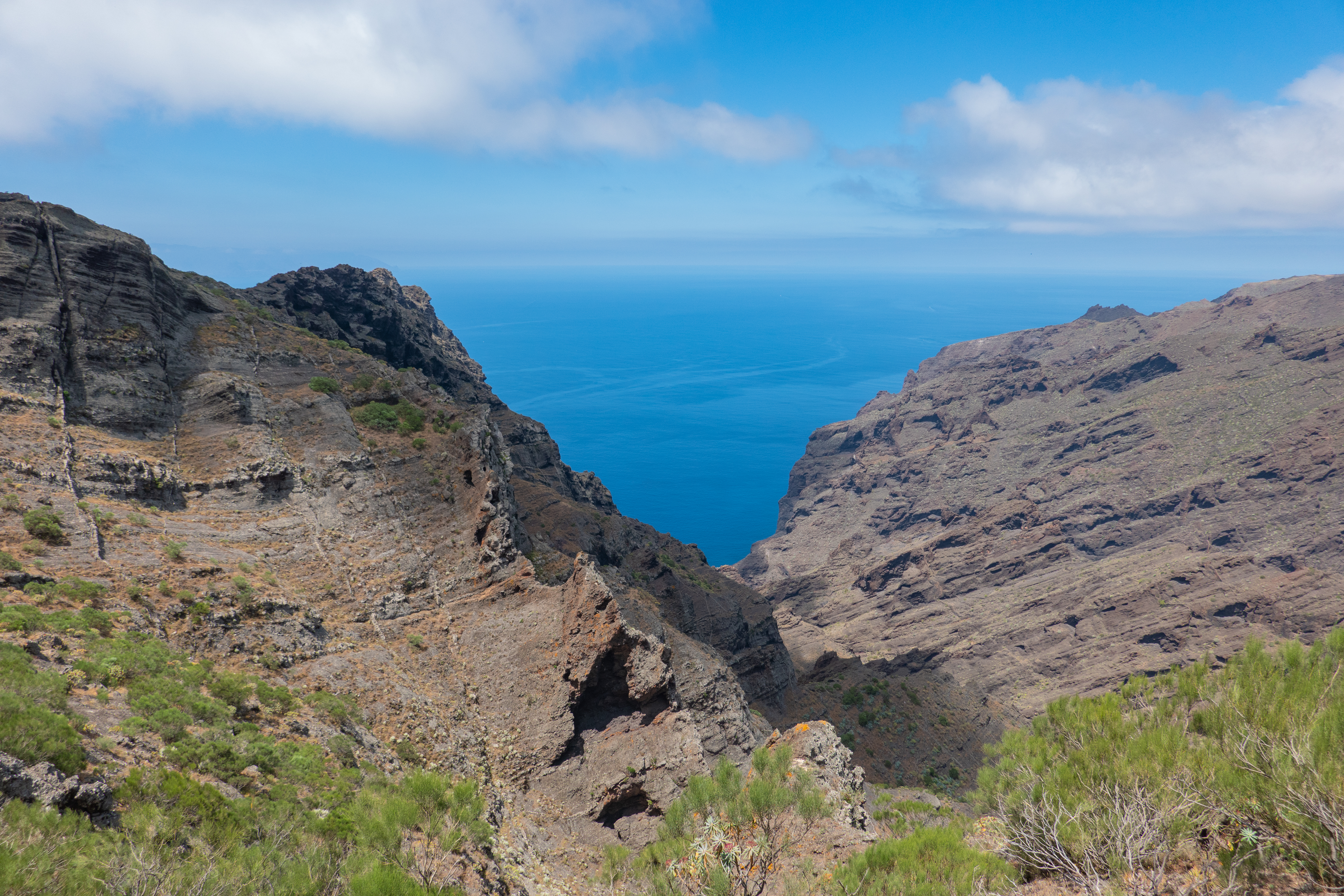
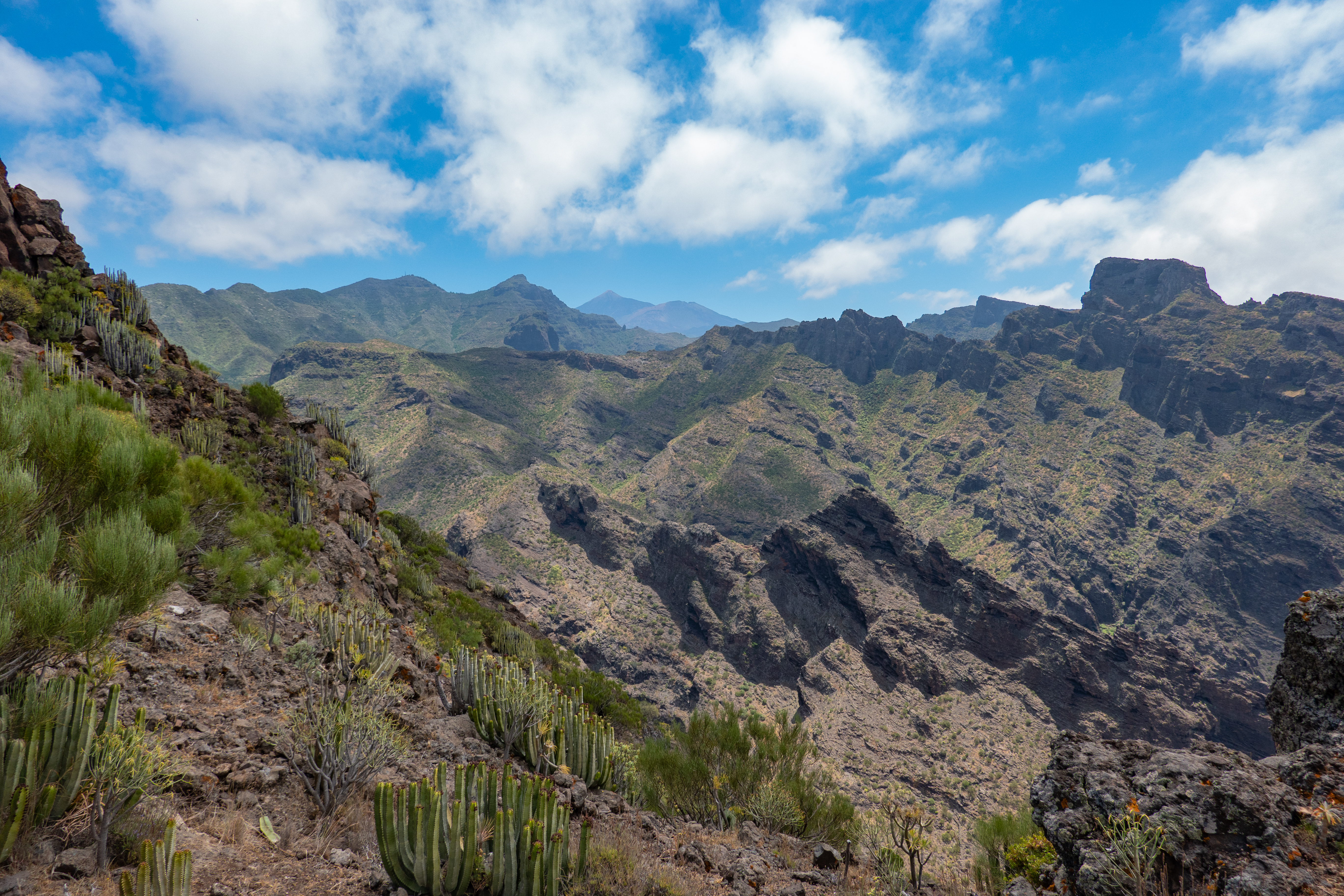
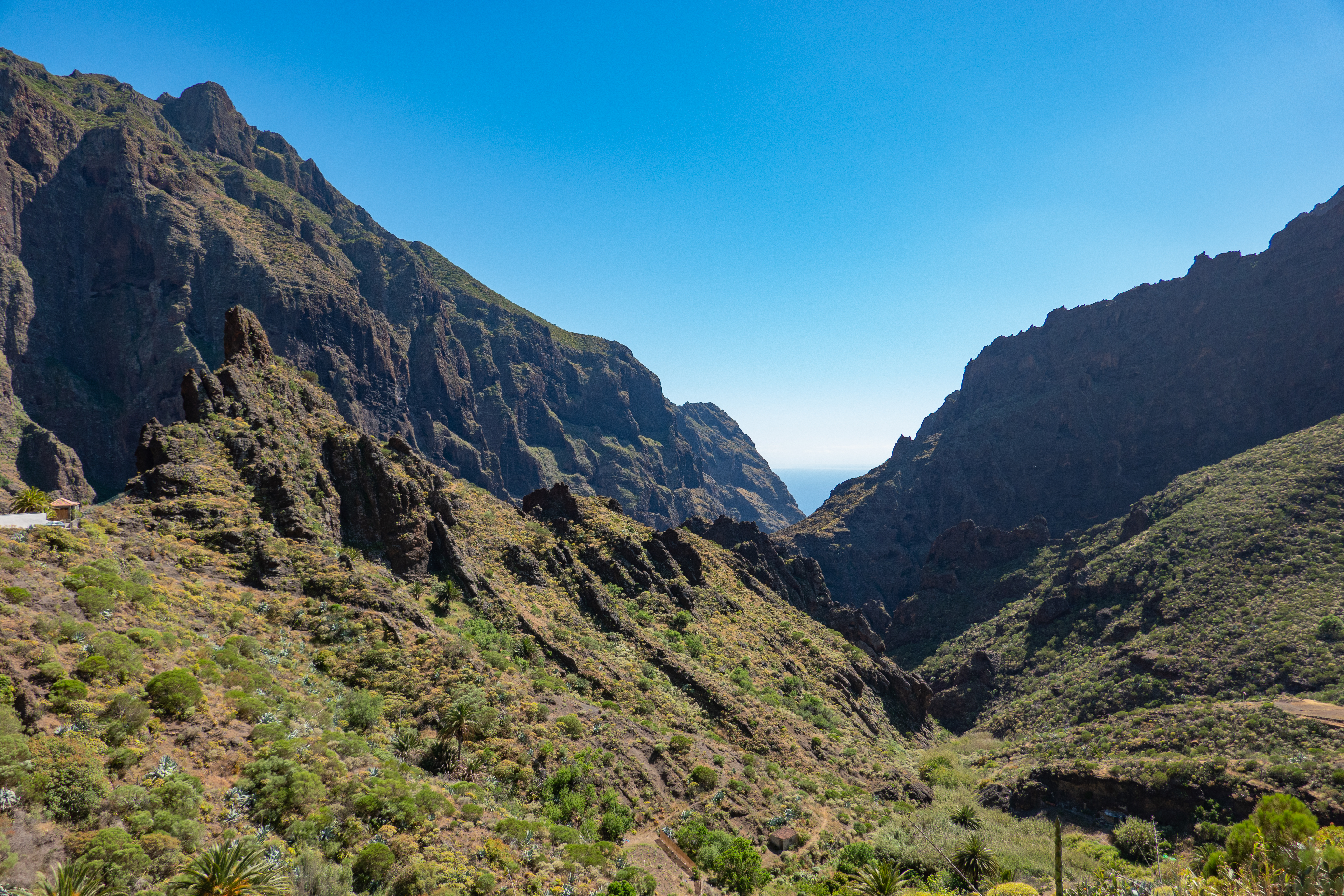
The hike today was sort of a cheat. I’d found a shorter trail, not in Masca itself, but a little to the north. The “famous” Masca trail had just re-opened, but instead of walking all the way down to the ocean and taking a boat back to civilization, the trail was now down and back up the same way, and didn’t sound very easy at all. It was also requiring reservations, on certain days only, and required hiking with a safety helmet. For all these reasons, I felt this wasn’t going to be one Crystal enjoyed. So I found the Cerro Carrizales trail, one or two valleys to the north of Masca. From what I read at Alltrails, it sounded like some of the hikes in Koke`e State Park on the northwest part of Kauai. The trail basically went right along the top of a ridge, back and forth, with not a ton of elevation change, and views in front (water) and on the sides (valleys and ridges in either direction).
The other advantage of today’s hike was that it started from right next to a bus stop on the 355 line, the aptly named El Carrizal. [“Carrizal” means reedbed, by the way.] After almost missing the connection from 363 to 355 when we went to Teno Alto, I suggested that we take an earlier 363 bus so that instead of having a 5-10 minute supposed connection, we’d have a 35-40 minute supposed connection. So we took the 363 bus that left a little after 10:00, and got to Buenavista del Norte around 11:30 for a noon connection to the 355 bus. This proved to be very prescient, as the 363 bus that was supposed to arrive just before noon was not there in time, and the 355 bus didn’t wait.
|
|
|
|
 |
Since coming this way the last time, I’d purchased some motion sickness medication, such that we wouldn’t get upset stomachs on the windy roads. The ride up to El Carrizal wasn’t too bad, just a couple more stops than when we’d gotten off in El Plamar. I guess the part between El Palmar and Masca is the “straight” and “flat” part of TF-436, with the windiest parts and steepest parts being between Buenavista del Norte and El Palmar on the north and Masca and Santiago del Teide on the south. We got off the bus just a little before 12:30, and it was pretty sunny and clear, with some sparse white clouds here and there, but nothing to impede our view. We could see La Gomera fairly clearly to the west, much more clear than when we went to Teno Alto.
 |
 |
 |
 |
The hike was pretty well established, although on this day there were hardly any hikers at all. [I don’t remember any, Crystal thinks there were a couple here and there.] There weren’t any trees, but low scrub, agaves, wildflowers, and the like. The red poppies were in bloom and were striking. Also striking were the views to the valleys to the north and the south. There were some terraced, populated, areas near the road, but for the most part the valleys were untouched down to the water. The hike was in fact a lot like the Awa’awapuhi and Honopu trails on Kauai, and was mostly a light stroll instead of a hike. Unlike the Kauai hikes, there weren’t any helicopters out today, however.
 |
 |
|
 |
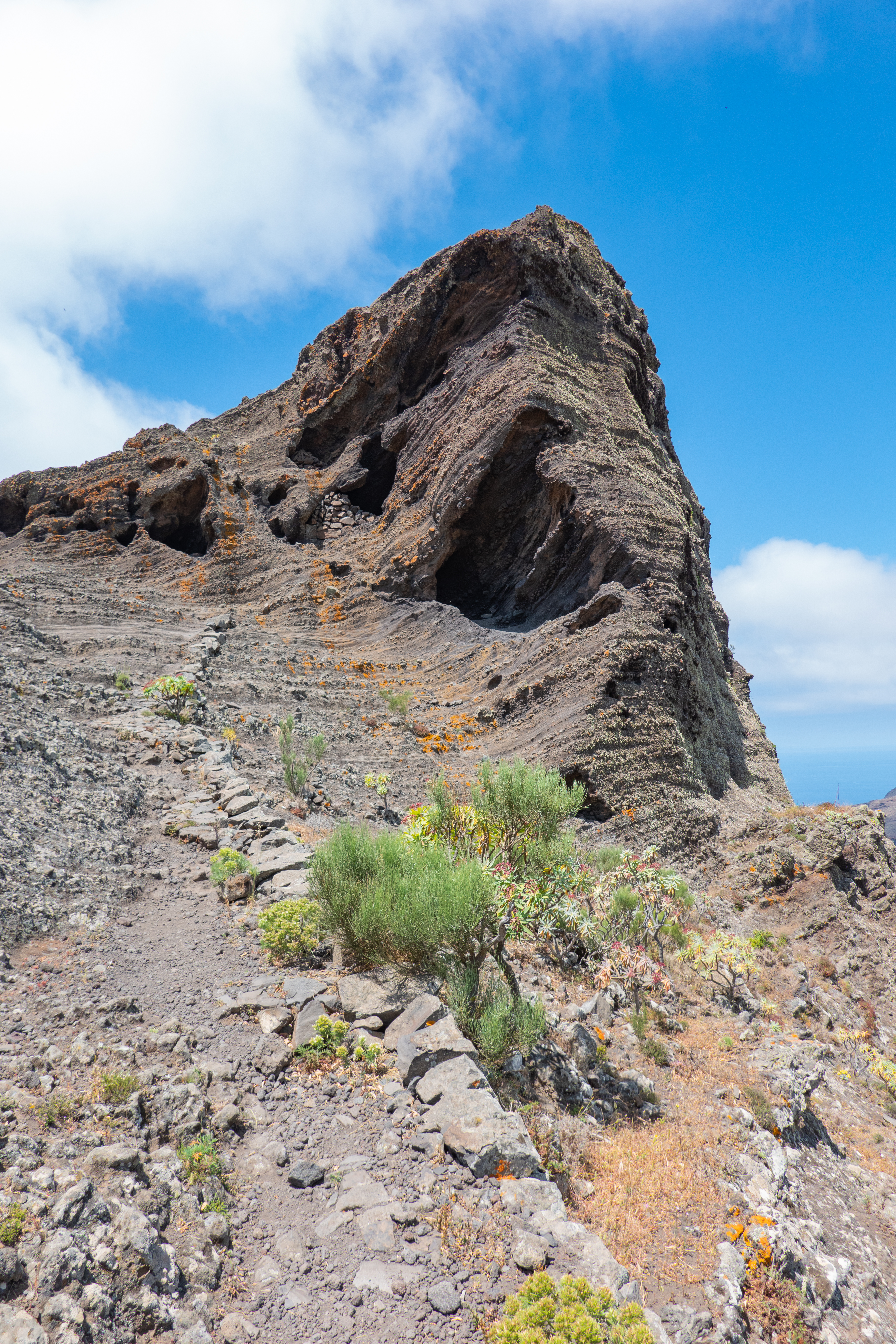
The last 10% of the hike was slightly more difficult, as there was an area where rocks marked the trail on an exposed rocky area that looked like the remains of an old lava pathway. One part had a very clearly demarcated “fault” between two almost mirrored sides of the rock formation, and once we passed by this, the end of the hike wasn’t too far off. At the end there was an abandoned building, which we assumed was used for housing goats or other livestock back in the day, but we really had no clue. I’d read on the reviews that although this was the “official” end, like the Kauai hikes, there was a little more walking that was possible to get even better views before the footing got too dicey.
 |
 |
 |
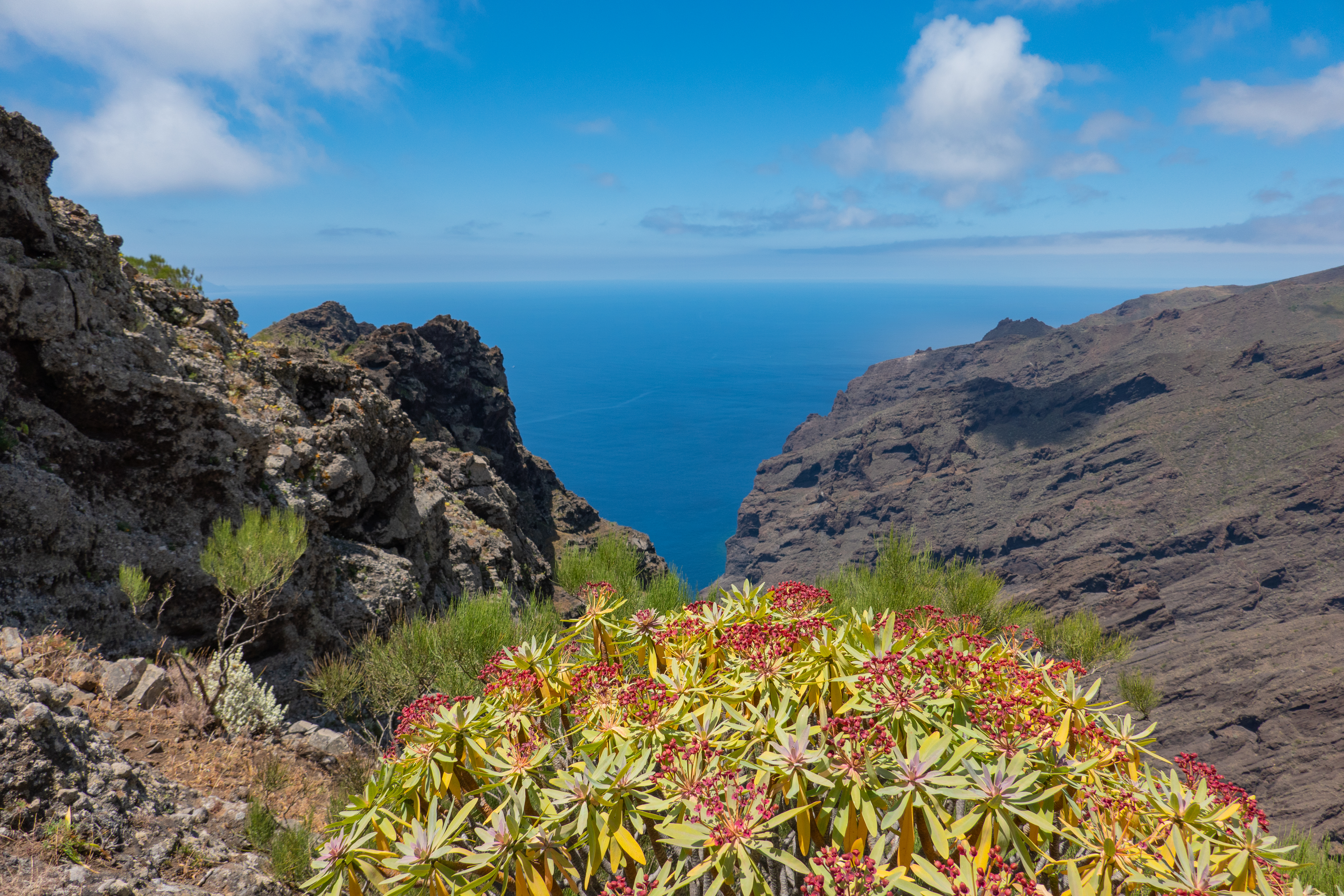 |
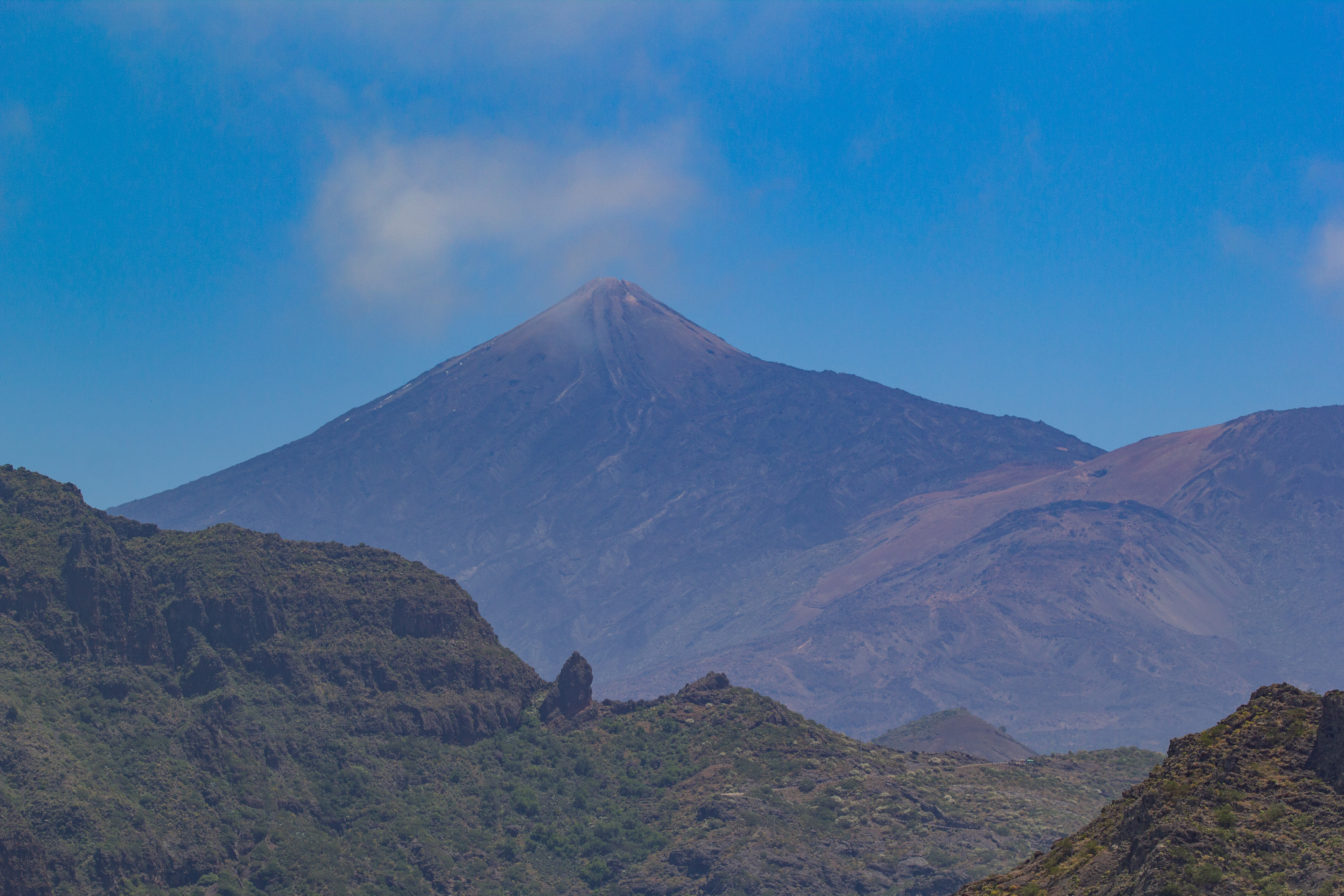
Crystal wasn’t interested, but I veered a little to the south, and from the very end there were good views all the way down to the rocky coastline that was maybe 2-3 kilometers to the southwest and about 650 meters (2000 feet) down the cliffs. My big Canon camera, with its telephoto lens, was able to get some pretty good photos of the beach, and also of La Gomera, right across the ocean. After taking some photos and eating some snacks, we started back the way we came and noticed that Teide was actually clearly visible off in the distance – we hadn’t noticed it on the walk towards the water, probably because it was behind us for almost the entirety of the way and we were focused on the ocean and the valleys anyway. From this vantage point, Teide had basically no snow, just some tiny streams on the north side.
 |
 |
 |
The hike back was uphill for the first little bit, but then mostly downhill all the way back to the road. But the total elevation change, from the highest point to the lowest point on the trail, was less than 100m. On the walk back there were some more clouds than on the first half, but they were all to our east and the sun was now behind us as it was mid-afternoon. We got back to the highway a little before 14:45. Our plan was to walk along the road to the south, down into Masca valley, eat a late lunch or early dinner, then catch the 355 bus back from Masca to Buenavista del Norte. I’d double- and triple-checked the schedule, so that we wouldn’t have the same issue we had getting a bus going back north to Buenavista del Norte. What I hadn’t checked, or even considered frankly, was whether there was a bus going south that we could take into Masca instead of walking. Crystal and I just sort of stared at each other when a bus passed us maybe 10 minutes after we started our walk; then we shrugged and kept walking.
 |
 |
In my (sort of) defense, it was a really nice walk. From certain spots we could see not only La Gomera, but also La Palma, to the northeast. La Palma almost looked like two islands, because it has two peaks and a low valley in the middle, and from as far away as we were, we really only saw the peaks. The road was pretty empty, with vehicles going by every couple minutes. The first 20 minutes or so of the walk was uphill, but the last 30 minutes was downhill as the road zig-zagged down into Masca Valley. Since we were walking, we could enjoy all the scenic spots with the road and the valley, which we would’ve missed on the bus. That’s at least what I told myself to justify another 50 minutes of walking.
 |
 |
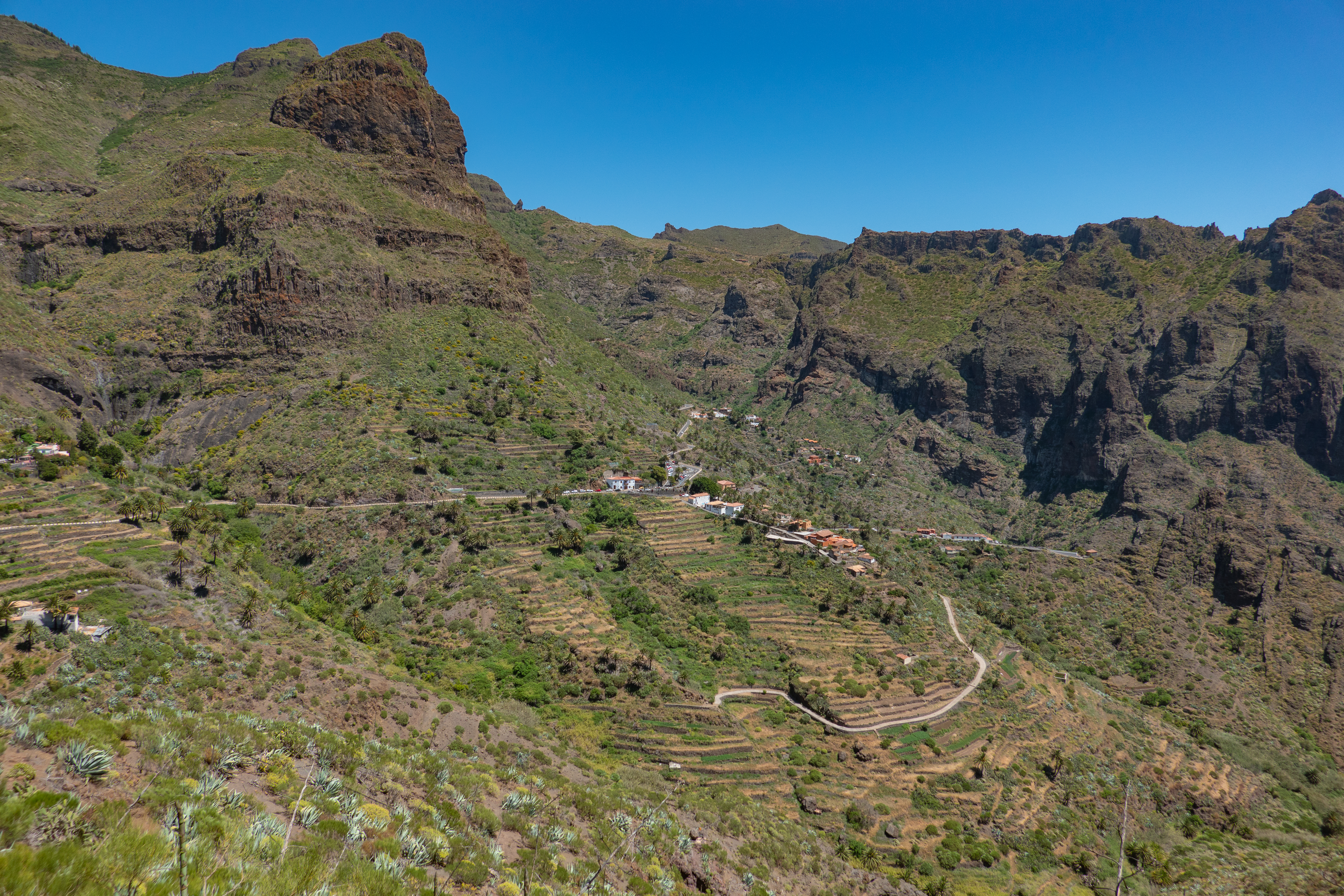
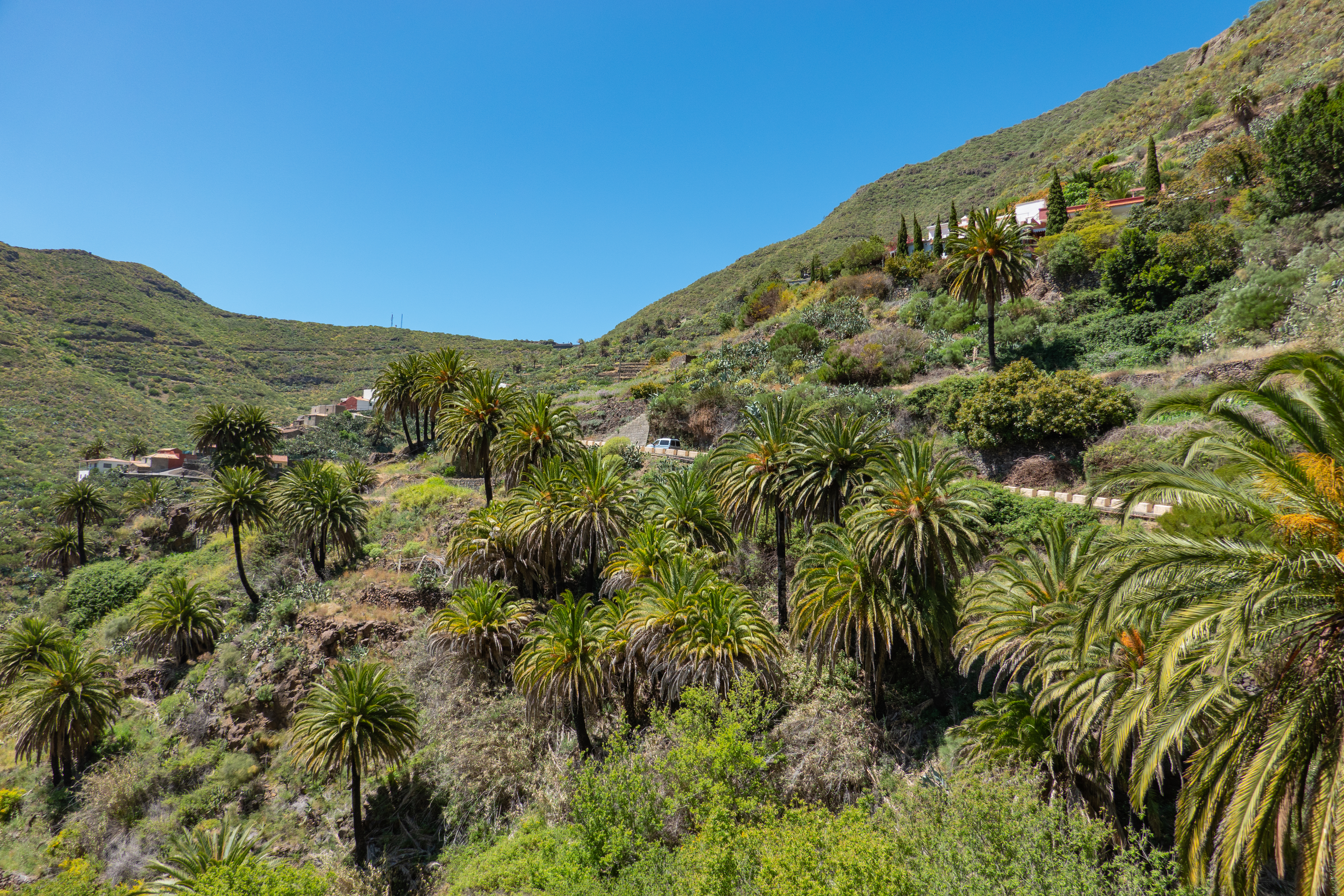
Arriving in the valley, there were buildings here and there, but most notably a bunch of Canary Island Date Palms that I assume were planted, as opposed to being native, as we hadn’t seen any palms anywhere else along our walk today. As we got into the “heart” of town the view of the ocean to the southwest got bigger and bigger as the valley opened up. This is the valley that has the famous hike, and the hike descends all the way to the ocean, where in the past a boat would pick you up and take you past Los Gigantes (famous sea cliffs) and drop you off in the touristy area at the south of the island. If and when they bring back that version of the hike, I will definitely try it out. Descending into the valley, only to have to walk right back up, doesn’t sound as enticing.
 |
 |
“Downtown” Masca looked to be just a couple square blocks, with walkways and paths connecting different roads. Restaurant choices were therefore limited, and exacerbated by the fact we were trying to eat during siesta time (it was around 15:30) and it was the middle of a pandemic. We chose to eat at Restauante “El Guanche” Alte Schule. They were open only until 17:00 (with last orders by 16:30), but that was fine with us since we needed to leave by then to catch the bus back to Buenavista del Norte. There was a shaded terrace on the east side of the restaurant that had a bunch of tourists wrapping up a meal, and then a sunny terrace on the southwest side of the restaurant that had incredible views of the valley and the ocean. We got a seat on the southwest terrace, with one of the best views we’ve had at any restaurant. The food and drink were “eh” but given the context of where (and when) we were, plus the view, we didn’t really care.
 |
 |
When the tables in the corner emptied out, I went over there and took some unobstructed photos from the very corner. On a clear day, this would be a great spot for a brunch, but I’m not sure if they even offer this. A little before 17:00 we left and walked back up to TF-436 to get to the bus stop. After all the walking, followed by the sitting, our legs didn’t want to walk up the path to the road. We found the bus stop easily, and hung out for maybe 15 minutes before it arrived. The bus was largely empty, and we took seats on the left side so we’d have views to the west out the window. La Palma was now even easier to see, with the two peaks sticking up above the clouds. One of these peaks, I assume, is the peak with all the telescopes, and where the TMT will go if Hawaii keeps insisting on shooting itself in the foot. [This was before the eruption started on La Palma, in case you're wondering.]
 |
 |
 |
 |
The views coming down into Buenavista were quite nice, as were the views of Teide on the way back from Buenavista del Norte to Puerto. The last little remnants of snow were visible, and we guessed they’d be gone by the end of April. It was a great day, and it was very nice to check something off the "to-do" list that we had. While things were very stressful in one sense, they were very relaxed in other senses, and I tried to maintain some semblance of balance so as to not go crazy.
| Previous Entry |